Spray House Wood - Broadleaved woodland
24 ha
🐶Dogs🦅Birds🦉Wildlife
Public accessFree entryDogs welcome24 ha
Getting here
53.39207, -1.94604
Open directionsv
Visiting this summer
Seasonal nature notes and what to look for now
- 🌞Midsummer — early morning visits most comfortable; look for deer fawns in quieter clearings
- 🐕Early mornings are best for dog walks in summer — visit before 9am to avoid the heat and find quieter trails
- 🅿️Parking 202m away — 2 car parks within reach
🌤️ Visiting this summer
- 🌞Midsummer — early morning visits most comfortable; look for deer fawns in quieter clearings
- 🐕Early mornings are best for dog walks in summer — visit before 9am to avoid the heat and find quieter trails
- 🅿️Parking 202m away — 2 car parks within reach
- £Free to visit — no entry charge
- 🐕Dogs welcome
Dogs allowed — public woodland
Free
🦅Bird watching
Strong match
Upland heathland — red grouse, merlin and short-eared owl
Free
Deciduous woodland priority habitat
Free
Deciduous woodland — fungi, berries and wild garlic
Varies
🍂Seasonal nature
Good match
Broadleaved woodland — spring blossom and autumn colour
Free
Trails nearby
Within roughly 5 km16 signed routes nearby · 17 public paths nearby
Signed route nearbyPublic paths
Midshires WayWalking route370 km▾
Multi-use trail links the Ridgeway National Trail with the Trans Pennine Trail
Named routeLength 370 kmRegional walking route
GM Ringway Stage 6Walking route13.4 km▾
GM Ringway Stage 6 - Strines to Marple
Named routeLength 13.4 kmRegional walking route
Lantern Pike Circular (Ethel), High PeakWalking route7.4 km▾
Named routeLength 7.4 kmDuration 02:30Round tripLocal walking route
Mount Famine, South Head and Brown Knoll (Ethels), High PeakWalking route10.9 km▾
Named routeLength 10.9 kmDuration 03:00Round tripLocal walking route
Peak District Boundary Walk Stage 2Walking route15.6 km▾
Named routeLength 15.6 kmRegional walking route
Park Lanepublic footpath · 426 m▾
Public pathpublic footpathLength 426 mPath type: service
Primrose Lanepublic footpath · 157 m▾
Public pathpublic footpathLength 157 mSurface dirtPath type: footway
Middle Fieldspublic footpath · 636 m▾
Public pathpublic footpathLength 636 mSurface gravelPath type: footway
5 signed routes nearby
Signed route nearby
Trans-Pennine TrailCycling route▾
Named routeRef TPTRegional cycle route
Trans Pennine TrailCycling route▾
Named routeRef 62National Cycle Network
Sett Valley TrailCycling route▾
Named routeLocal cycle route
Peak Forest CanalCycling route▾
Named routeLocal cycle route
Pennine CyclewayCycling route▾
Named routeRef 68National Cycle Network
1 signed route nearby
Signed route nearby
Great North Trail (Peak District and South Pennines)Mountain bike route130.4 km▾
Named routeLength 130.4 kmNational Cycle Network
3 public paths nearby
Public paths
Primrose Lanebridleway · 171 m▾
Public pathbridlewayLength 171 mSurface dirtPath type: bridleway
Photos
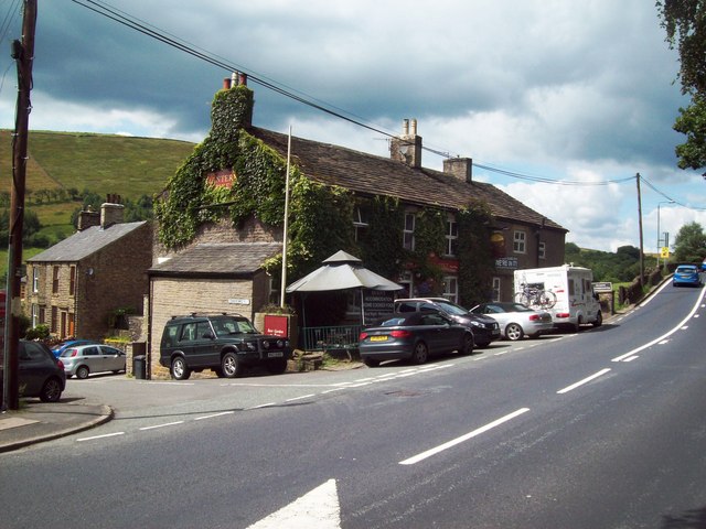
The Lantern Pike Public House
Weather for this location
Next 14 daysNearby places
Useful places within 5 km
Own or manage this place?
Claim this listing to keep details accurate, add photos, and highlight what makes it special — free.
Claim this page→How useful was the information on this page?
id: 43c6be39-5db0-45e6-8032-41f533115fb3
Wildlife to spot
12,606 records · National Biodiversity Network
Wildlife to spot
12,606 records · National Biodiversity Network🐦Birds39 species
springsummer
2026▾
Jackdaw · Wren · Woodpigeon · Chaffinch · Swallow +34
- JackdawColoeus monedula
- WrenTroglodytes troglodytes
- WoodpigeonColumba palumbus2025
- ChaffinchFringilla coelebs2025
- SwallowHirundo rustica2025
- NuthatchSitta europaea
- RobinErithacus rubecula
- Carrion CrowCorvus corone2025
- GoldfinchCarduelis carduelis2025
- BlackbirdTurdus merula2025
- Grey HeronArdea cinerea
- ChiffchaffPhylloscopus collybita2025
- BlackcapSylvia atricapilla2025
- KestrelFalco tinnunculus
- DunnockPrunella modularis
- Barn OwlTyto alba
- MagpiePica pica2025
- Blue TitCyanistes caeruleus2025
- Canada GooseBranta canadensis2025
- Willow WarblerPhylloscopus trochilus2025
- Meadow PipitAnthus pratensis2025
- CurlewNumenius arquata2025
- GoldcrestRegulus regulus
- Black-headed GullChroicocephalus ridibundus2025
- Pied WagtailMotacilla alba yarrellii2025
- Great Spotted WoodpeckerDendrocopos major2025
- Long-tailed TitAegithalos caudatus2025
- MallardAnas platyrhynchos2025
- Great TitParus major2025
- PheasantPhasianus colchicus2025
- Coal TitPeriparus ater2025
- CuckooCuculus canorus2025
- OystercatcherHaematopus ostralegus2025
- RedstartPhoenicurus phoenicurus2025
- SkylarkAlauda arvensis2025
- StonechatSaxicola rubicola2025
- Lesser RedpollAcanthis flammea cabaret2025
- GreenfinchChloris chloris2025
- LinnetLinaria cannabina2025
Brown Hare · Mountain Hare · Mole · Roe Deer · Whiskered Bat +1
- Brown HareLepus europaeus
- Mountain HareLepus timidus
- MoleTalpa europaea
- Roe DeerCapreolus capreolus
- Whiskered BatMyotis mystacinus
- HedgehogErinaceus europaeus
🐸Amphibians1 species
spring
2026▾
Common Toad
Bibio pomonae · Red-legged Shieldbug · Harlequin Ladybird · Birch Shieldbug · Orange Ladybird +13
- Bibio pomonaeBibio pomonae2025
- Red-legged ShieldbugPentatoma rufipes2025
- Harlequin LadybirdHarmonia axyridis2025
- Birch ShieldbugElasmostethus interstinctus2025
- Orange LadybirdHalyzia sedecimguttata2025
- Green Tiger Beetle
🌿Plants53 species
springsummer
2025▾
Welsh Poppy · Common Knapweed · Foxglove · Harebell · Green Alkanet +48
- Welsh PoppyPapaver cambricum
- Common KnapweedCentaurea nigra
- FoxgloveDigitalis purpurea
- HarebellCampanula rotundifolia
- Green AlkanetPentaglottis sempervirens
- Red CampionSilene dioica
Species observations from the last 10 years via NBN Atlas
Cicindela campestris
Cicindela campestris
Four-barred MajorOxycera rara2025Four-barred MajorOxycera rara2025Common CockchaferMelolontha melolontha2025Common CockchaferMelolontha melolontha2025Athripsodes bilineatusAthripsodes bilineatus2025Athripsodes bilineatusAthripsodes bilineatus2025Lagria hirtaLagria hirta2025Lagria hirtaLagria hirta2025Marmalade HoverflyEpisyrphus balteatus2025Marmalade HoverflyEpisyrphus balteatus2025Corizus hyoscyamiCorizus hyoscyami2025Corizus hyoscyamiCorizus hyoscyami2025Stag KnucklehornCladius pectinicornis2025Stag KnucklehornCladius pectinicornis2025Broad CenturionChloromyia formosa2025Broad CenturionChloromyia formosa2025Eristalis pertinaxEristalis pertinax2025Eristalis pertinaxEristalis pertinax2025SyrphusSyrphus2025SyrphusSyrphus2025Batman HoverflyMyathropa florea2025Batman HoverflyMyathropa florea2025Harpocera thoracicaHarpocera thoracica2025Harpocera thoracicaHarpocera thoracica2025Hawthorn
Hawthorn
Crataegus monogyna
Crataegus monogyna
RhododendronRhododendron ponticumRhododendronRhododendron ponticumHazelCorylus avellanaHazelCorylus avellanaMarsh WoundwortStachys palustrisMarsh WoundwortStachys palustrisGreat WillowherbEpilobium hirsutumGreat WillowherbEpilobium hirsutumWild AngelicaAngelica sylvestrisWild AngelicaAngelica sylvestrisTufted VetchVicia craccaTufted VetchVicia craccaField ScabiousKnautia arvensisField ScabiousKnautia arvensisMeadowsweetFilipendula ulmariaMeadowsweetFilipendula ulmariaFox-and-cubsPilosella aurantiacaFox-and-cubsPilosella aurantiacaMusk-mallowMalva moschataMusk-mallowMalva moschataWild CarrotDaucus carotaWild CarrotDaucus carotaRed CloverTrifolium pratenseRed CloverTrifolium pratenseHimalayan BalsamImpatiens glanduliferaHimalayan BalsamImpatiens glanduliferaTutsanHypericum androsaemumTutsanHypericum androsaemumRagged-RobinSilene flos-cuculiRagged-RobinSilene flos-cuculiNipplewortLapsana communisNipplewortLapsana communisThale CressArabidopsis thalianaThale CressArabidopsis thalianaFrench Crane's-billGeranium endressiiFrench Crane's-billGeranium endressiiPurple Crane's-billGeranium ibericum x platypetalum = G. x magnificumPurple Crane's-billGeranium ibericum x platypetalum = G. x magnificumMeadow ButtercupRanunculus acrisMeadow ButtercupRanunculus acrisCreeping ThistleCirsium arvenseCreeping ThistleCirsium arvenseSycamoreAcer pseudoplatanusSycamoreAcer pseudoplatanusRowanSorbus aucupariaRowanSorbus aucupariaBeechFagus sylvaticaBeechFagus sylvaticaPink PurslaneClaytonia sibiricaPink PurslaneClaytonia sibiricaJapanese RoseRosa rugosaJapanese RoseRosa rugosaElderSambucus nigraElderSambucus nigraCorncockleAgrostemma githagoCorncockleAgrostemma githagoHogweedHeracleum sphondyliumHogweedHeracleum sphondyliumWhite CloverTrifolium repensWhite CloverTrifolium repensRibwort PlantainPlantago lanceolataRibwort PlantainPlantago lanceolataPick-a-back-plantTolmiea menziesiiPick-a-back-plantTolmiea menziesiiMeadow FoxtailAlopecurus pratensisMeadow FoxtailAlopecurus pratensisCommon BistortBistorta officinalisCommon BistortBistorta officinalisBittersweetSolanum dulcamaraBittersweetSolanum dulcamaraPerennial CornflowerCentaurea montanaPerennial CornflowerCentaurea montanaGuelder-roseViburnum opulusGuelder-roseViburnum opulusDame's-violetHesperis matronalisDame's-violetHesperis matronalisCarnation SedgeCarex paniceaCarnation SedgeCarex paniceaYellow-rattleRhinanthus minorYellow-rattleRhinanthus minorGermander SpeedwellVeronica chamaedrysGermander SpeedwellVeronica chamaedrysBush VetchVicia sepiumBush VetchVicia sepiumGarlic MustardAlliaria petiolataGarlic MustardAlliaria petiolataWood AvensGeum urbanumWood AvensGeum urbanumLesser TrefoilTrifolium dubiumLesser TrefoilTrifolium dubiumCuckooflowerCardamine pratensisCuckooflowerCardamine pratensisEvents & activities nearby
Switch provider to compare local events, tours and bookable activities.