Bellhagg Wood - Broadleaved woodland ✦ Ancient woodland 18 ha
Plan your visit
🦉 Wildlife🐶 Dogs🍂 Seasonal
Public access Free entry Dogs welcome 18 ha
Places › England › East Midlands › High Peak Getting here
53.39438, -1.76365
Open directionsv Visiting this summer
Seasonal nature notes and what to look for now
▾ 🌞 Midsummer — early morning visits most comfortable; look for deer fawns in quieter clearings 🐕 Early mornings are best for dog walks in summer — visit before 9am to avoid the heat and find quieter trails 🅿️ Parking 61m away — 4 car parks within reach 🌤️ Visiting this summer
🌞 Midsummer — early morning visits most comfortable; look for deer fawns in quieter clearings 🐕 Early mornings are best for dog walks in summer — visit before 9am to avoid the heat and find quieter trails 🅿️ Parking 61m away — 4 car parks within reach £ Free to visit — no entry charge🐕 Dogs welcome🌿 Ancient woodland — rare wildlife habitatDeciduous woodland priority habitat; Ancient woodland
Free
Dogs allowed — public woodland
Free
🍂 Seasonal nature
Strong match
Ancient woodland — bluebells, fungi and autumn colour
Free
🦅 Bird watching
Strong match
Deciduous woodland — woodpeckers, warblers and woodland birds
Free
Deciduous woodland — fungi, berries and wild garlic
Varies
Trails nearby Within roughly 5 km 14 signed routes nearby · 1 public path nearby
Signed route nearby Public paths
Derwent Valley Heritage Way Walking route 89 km ▾
Named route Length 89 km Regional walking route
Show on map Derwent Valley and Reservoir Walk, Walking route 7.4 km ▾
Ladybower Reservoir, farmland and wooded cloughs. Views of Derwent Valley and High Peak area. Rough walking through fields, woodland paths, roads and open moorland. Dogs must be on leads.
Named route Length 7.4 km Duration 02:30 Round trip Local walking route
Show on map Edale Circular Walk, High Peak Walking route 5.4 km ▾
Low level circular walk which includes part of the Pennine Way, following streams and stone-flagged paths. Dogs must be kept on leads.
Named route Length 5.4 km Duration 02:00 Round trip Local walking route
Show on map Crook Hill Circular (Ethel), High Peak Walking route 11.5 km ▾
Named route Length 11.5 km Duration 03:30 Round trip Local walking route
Show on map Lost Lad and Back Tor (Ethels), High Peak Walking route 12.1 km ▾
Named route Length 12.1 km Duration 04:00 Round trip Local walking route
Show on map 8 signed routes nearby
Signed route nearby
Thornhill Trail Cycling route ▾
Named route Local cycle route
Show on map Route 6 Cycling route ▾
Named route Ref 6 National Cycle Network
Show on map Main Route Cycling route 252 m ▾
Named route Ref 6 Length 252 m National Cycle Network Traffic-free Surface asphalt
Show on map Main Route Cycling route 347 m ▾
Named route Ref 6 Length 347 m National Cycle Network Traffic-free Surface unsealedfirm
Show on map Main Route Cycling route 11 km ▾
Named route Ref 6 Length 11 km National Cycle Network On-road Surface asphalt
Show on map Main Route Cycling route 27 m ▾
Named route Ref 6 Length 27 m National Cycle Network Traffic-free Surface pavementslabs
Show on map 1 signed route nearby
Signed route nearby
Great North Trail (Peak District and South Pennines) Mountain bike route 130.4 km ▾
Named route Length 130.4 km National Cycle Network
Show on map 23 public paths nearby
Public paths
Rowlee Bridge bridleway · 19 m ▾
Public path bridleway Length 19 m Surface asphalt Path type: service
Show on map ✦ Ancient woodland — continuously wooded since at least 1600 AD. A rare and irreplaceable habitat, rich in biodiversity and historical character.
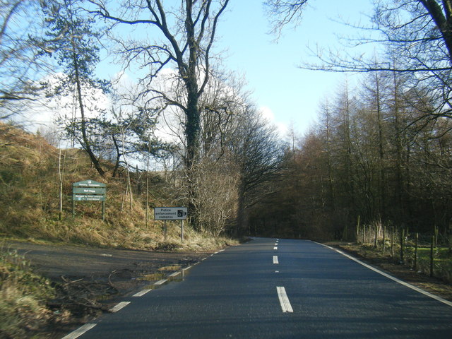
Photos A57 eastbound at Bellhag Wood
‹ ›
Weather for this location Next 14 days Nearby places Useful places within 5 km
All Historic
Own or manage this place?
Claim this listing to keep details accurate, add photos, and highlight what makes it special — free.
Claim this page→ How useful was the information on this page?
id: 573cbc90-b1d8-4996-9d82-fb1fad2400b0
UK green spaces mapped from open public data — so anyone can find the woodland, trail, or nature reserve closest to them.
© 2026 Glade · Made with care for UK green spaces
Wildlife to spot
6,112 records · National Biodiversity Network
▾
Wildlife to spot 6,112 records · National Biodiversity Network 🐦 Birds 3 species
winter autumn
2026 ▾
Robin · Kestrel · Blackbird
Robin Erithacus rubecula Kestrel Falco tinnunculus2025 Blackbird Turdus merula2025 Common Lizard
Common Lizard Zootoca vivipara Larch Ladybird · 10-spot Ladybird · Orange Ladybird · Poecilus versicolor · Cheilosia albipila +4
Larch Ladybird Aphidecta obliterata 10-spot Ladybird Adalia decempunctata Orange Ladybird Halyzia sedecimguttata Poecilus versicolor Poecilus versicolor Cheilosia albipila Cheilosia albipila Helina evecta Helina evecta Bembidion properans Foxglove · Autumn Hawkbit · Tutsan · Bog Stitchwort · Coltsfoot +143
Foxglove Digitalis purpurea Autumn Hawkbit Scorzoneroides autumnalis2025 Tutsan Hypericum androsaemum2025 Bog Stitchwort Stellaria alsine2025 Coltsfoot Tussilago farfara2025 Greater Plantain Plantago major Species observations from the last 10 years via NBN Atlas
Bembidion properans
Bembidion properans
Drymus (Sylvadrymus) sylvaticus Drymus (Sylvadrymus) sylvaticus
Drymus (Sylvadrymus) sylvaticus Drymus (Sylvadrymus) sylvaticus
Dicyphus (Idolocoris) pallicornis Dicyphus (Idolocoris) pallicornis
Dicyphus (Idolocoris) pallicornis Dicyphus (Idolocoris) pallicornis 2025
2025
Bluebell Hyacinthoides non-scripta2025
Bluebell Hyacinthoides non-scripta2025
Broad-leaved Dock Rumex obtusifolius2025
Broad-leaved Dock Rumex obtusifolius2025
Yellow Pimpernel Lysimachia nemorum2025
Yellow Pimpernel Lysimachia nemorum2025
Opposite-leaved Golden-saxifrage Chrysosplenium oppositifolium2025
Opposite-leaved Golden-saxifrage Chrysosplenium oppositifolium2025
Lady-fern Athyrium filix-femina2025
Lady-fern Athyrium filix-femina2025
Bulbous Rush Juncus bulbosus2025
Bulbous Rush Juncus bulbosus2025
Sycamore Acer pseudoplatanus2025
Sycamore Acer pseudoplatanus2025
Japanese Larch Larix kaempferi2025
Japanese Larch Larix kaempferi2025
Smooth Sow-thistle Sonchus oleraceus2025
Smooth Sow-thistle Sonchus oleraceus2025
Common Dog-violet Viola riviniana2025
Common Dog-violet Viola riviniana2025
Bugle Ajuga reptans2025
Bugle Ajuga reptans2025
Hybrid Larch Larix decidua x kaempferi = L. x marschlinsii2025
Hybrid Larch Larix decidua x kaempferi = L. x marschlinsii2025
Meadow Buttercup Ranunculus acris2025
Meadow Buttercup Ranunculus acris2025
Broad-leaved Willowherb Epilobium montanum2025
Broad-leaved Willowherb Epilobium montanum2025
Beech Fagus sylvatica2025
Beech Fagus sylvatica2025
Rosebay Willowherb Chamaenerion angustifolium2025
Rosebay Willowherb Chamaenerion angustifolium2025
Hazel Corylus avellana2025
Hazel Corylus avellana2025
Upright Hedge-parsley Torilis japonica2025
Upright Hedge-parsley Torilis japonica2025
Male-fern Dryopteris filix-mas2025
Male-fern Dryopteris filix-mas2025
Mouse-ear-hawkweed Pilosella officinarum2025
Mouse-ear-hawkweed Pilosella officinarum2025
Snowberry Symphoricarpos albus2025
Snowberry Symphoricarpos albus2025
Barren Strawberry Potentilla sterilis2025
Barren Strawberry Potentilla sterilis2025
Common Bird's-foot-trefoil Lotus corniculatus2025
Common Bird's-foot-trefoil Lotus corniculatus2025
Bush Vetch Vicia sepium2025
Bush Vetch Vicia sepium2025
Creeping Bent Agrostis stolonifera2025
Creeping Bent Agrostis stolonifera2025
Bracken Pteridium aquilinum2025
Bracken Pteridium aquilinum2025
Spear Thistle Cirsium vulgare2025
Spear Thistle Cirsium vulgare2025
Dryopteris affinis Dryopteris affinis2025
Dryopteris affinis Dryopteris affinis2025
Festuca rubra Festuca rubra2025
Festuca rubra Festuca rubra2025
Remote Sedge Carex remota2025
Remote Sedge Carex remota2025
Rhododendron Rhododendron ponticum2025
Rhododendron Rhododendron ponticum2025
Lesser Burdock Arctium minus2025
Lesser Burdock Arctium minus2025
Silver Birch Betula pendula2025
Silver Birch Betula pendula2025
Curled Dock Rumex crispus2025
Curled Dock Rumex crispus2025
Winter-cress Barbarea vulgaris2025
Winter-cress Barbarea vulgaris2025
Common Mallow Malva sylvestris2025
Common Mallow Malva sylvestris2025
Rowan Sorbus aucuparia2025
Rowan Sorbus aucuparia2025
Selfheal Prunella vulgaris2025
Selfheal Prunella vulgaris2025
Water-Starwort Callitriche2025
Water-Starwort Callitriche2025
Ribwort Plantain Plantago lanceolata2025
Ribwort Plantain Plantago lanceolata2025
Garlic Mustard Alliaria petiolata2025
Garlic Mustard Alliaria petiolata2025
Hedera hibernica 'Hibernica' Hedera hibernica 'Hibernica'2025
Hedera hibernica 'Hibernica' Hedera hibernica 'Hibernica'2025
Shoreweed Littorella uniflora2025
Shoreweed Littorella uniflora2025
Short-fruited Willowherb Epilobium obscurum2025
Short-fruited Willowherb Epilobium obscurum2025
Broad Buckler-fern Dryopteris dilatata2025
Broad Buckler-fern Dryopteris dilatata2025
Annual Meadow-grass Poa annua2025
Annual Meadow-grass Poa annua2025
Canadian Fleabane Erigeron canadensis2025
Canadian Fleabane Erigeron canadensis2025
Ash Fraxinus excelsior2025
Ash Fraxinus excelsior2025
Large Bitter-cress Cardamine amara2025
Large Bitter-cress Cardamine amara2025
Tormentil Potentilla erecta2025
Tormentil Potentilla erecta2025
Marsh Thistle Cirsium palustre2025
Marsh Thistle Cirsium palustre2025
Common Chickweed Stellaria media2025
Common Chickweed Stellaria media2025
Lawson Cypress Cupressus lawsoniana2025
Lawson Cypress Cupressus lawsoniana2025
Downy Birch Betula pubescens2025
Downy Birch Betula pubescens2025
Sessile Oak Quercus petraea2025
Sessile Oak Quercus petraea2025
Marsh Pennywort Hydrocotyle vulgaris2025
Marsh Pennywort Hydrocotyle vulgaris2025
Daisy Bellis perennis2025
Daisy Bellis perennis2025
Common Mouse-ear Cerastium fontanum2025
Common Mouse-ear Cerastium fontanum2025
Hedge Woundwort Stachys sylvatica2025
Hedge Woundwort Stachys sylvatica2025
Euphrasia officinalis Euphrasia officinalis2025
Euphrasia officinalis Euphrasia officinalis2025
Knotgrass Polygonum aviculare2025
Knotgrass Polygonum aviculare2025
Harebell Campanula rotundifolia2025
Harebell Campanula rotundifolia2025
Norway Maple Acer platanoides2025
Norway Maple Acer platanoides2025
Wild Cherry Prunus avium2025
Wild Cherry Prunus avium2025
Yellow Dodder Cuscuta campestris2025
Yellow Dodder Cuscuta campestris2025
Common Sorrel Rumex acetosa2025
Common Sorrel Rumex acetosa2025
Heath Rush Juncus squarrosus2025
Heath Rush Juncus squarrosus2025
Elder Sambucus nigra2025
Elder Sambucus nigra2025
Water-pepper Persicaria hydropiper2025
Water-pepper Persicaria hydropiper2025
Wood-sedge Carex sylvatica2025
Wood-sedge Carex sylvatica2025
Hawkweed Hieracium2025
Hawkweed Hieracium2025
Goat Willow Salix caprea2025
Goat Willow Salix caprea2025
Wood-sorrel Oxalis acetosella2025
Wood-sorrel Oxalis acetosella2025
Polypodium vulgare Polypodium vulgare2025
Polypodium vulgare Polypodium vulgare2025
Greater Stitchwort Stellaria holostea2025
Greater Stitchwort Stellaria holostea2025
Heath Bedstraw Galium saxatile2025
Heath Bedstraw Galium saxatile2025
Smooth-stalked Sedge Carex laevigata2025
Smooth-stalked Sedge Carex laevigata2025
White Clover Trifolium repens2025
White Clover Trifolium repens2025
Mugwort Artemisia vulgaris2025
Mugwort Artemisia vulgaris2025
Tufted Hair-grass Deschampsia cespitosa2025
Tufted Hair-grass Deschampsia cespitosa2025
Rosa canina Rosa canina2025
Rosa canina Rosa canina2025
Black Nightshade Solanum nigrum2025
Black Nightshade Solanum nigrum2025
Perennial Rye-grass Lolium perenne2025
Perennial Rye-grass Lolium perenne2025
Thyme-leaved Speedwell Veronica serpyllifolia2025
Thyme-leaved Speedwell Veronica serpyllifolia2025
Common Bent Agrostis capillaris2025
Common Bent Agrostis capillaris2025
Yarrow Achillea millefolium2025
Yarrow Achillea millefolium2025
Scots Pine Pinus sylvestris2025
Scots Pine Pinus sylvestris2025
Toad Rush Juncus bufonius2025
Toad Rush Juncus bufonius2025
Salix caprea x cinerea = S. x reichardtii Salix caprea x cinerea = S. x reichardtii2025
Salix caprea x cinerea = S. x reichardtii Salix caprea x cinerea = S. x reichardtii2025
Lesser Spearwort Ranunculus flammula2025
Lesser Spearwort Ranunculus flammula2025
Greater Bird's-foot-trefoil Lotus pedunculatus2025
Greater Bird's-foot-trefoil Lotus pedunculatus2025
Creeping Thistle Cirsium arvense2025
Creeping Thistle Cirsium arvense2025
New Zealand Pigmyweed Crassula helmsii2025
New Zealand Pigmyweed Crassula helmsii2025
Wood Forget-me-not Myosotis sylvatica2025
Wood Forget-me-not Myosotis sylvatica2025
Wood Dock Rumex sanguineus2025
Wood Dock Rumex sanguineus2025
Marsh Cudweed Gnaphalium uliginosum2025
Marsh Cudweed Gnaphalium uliginosum2025
Fairy Flax Linum catharticum2025
Fairy Flax Linum catharticum2025
Great Willowherb Epilobium hirsutum2025
Great Willowherb Epilobium hirsutum2025
Common Ragwort Jacobaea vulgaris2025
Common Ragwort Jacobaea vulgaris2025
Germander Speedwell Veronica chamaedrys2025
Germander Speedwell Veronica chamaedrys2025
Guelder-rose Viburnum opulus2025
Guelder-rose Viburnum opulus2025
Hairy Wood-rush Luzula pilosa2025
Hairy Wood-rush Luzula pilosa2025
Soft-rush Juncus effusus2025
Soft-rush Juncus effusus2025
Field Wood-rush Luzula campestris2025
Field Wood-rush Luzula campestris2025
Callitriche stagnalis Callitriche stagnalis2025
Callitriche stagnalis Callitriche stagnalis2025
Shepherd's-purse Capsella bursa-pastoris2025
Shepherd's-purse Capsella bursa-pastoris2025
Ground-elder Aegopodium podagraria2025
Ground-elder Aegopodium podagraria2025
Red Goosefoot Oxybasis rubra2025
Red Goosefoot Oxybasis rubra2025
Cleavers Galium aparine2025
Cleavers Galium aparine2025
Bilberry Vaccinium myrtillus2025
Bilberry Vaccinium myrtillus2025
Three-nerved Sandwort Moehringia trinervia2025
Three-nerved Sandwort Moehringia trinervia2025
Procumbent Pearlwort Sagina procumbens2025
Procumbent Pearlwort Sagina procumbens2025
Green-ribbed Sedge Carex binervis2025
Green-ribbed Sedge Carex binervis2025
Marsh Yellow-cress Rorippa palustris2025
Marsh Yellow-cress Rorippa palustris2025
Heath Speedwell Veronica officinalis2025
Heath Speedwell Veronica officinalis2025
Wood Speedwell Veronica montana2025
Wood Speedwell Veronica montana2025
Marsh-bedstraw Galium palustre2025
Marsh-bedstraw Galium palustre2025
Lesser Celandine Ficaria verna2025
Lesser Celandine Ficaria verna2025
Prickly Sow-thistle Sonchus asper2025
Prickly Sow-thistle Sonchus asper2025
Nipplewort Lapsana communis2025
Nipplewort Lapsana communis2025
Wood Meadow-grass Poa nemoralis2025
Wood Meadow-grass Poa nemoralis2025
Hybrid Woundwort Stachys palustris x sylvatica = S. x ambigua2025
Hybrid Woundwort Stachys palustris x sylvatica = S. x ambigua2025
Bristly Oxtongue Helminthotheca echioides2025
Bristly Oxtongue Helminthotheca echioides2025
Crested Dog's-tail Cynosurus cristatus2025
Crested Dog's-tail Cynosurus cristatus2025
Trailing Tormentil Potentilla anglica2025
Trailing Tormentil Potentilla anglica2025
Hoary Willowherb Epilobium parviflorum2025
Hoary Willowherb Epilobium parviflorum2025
Ground-ivy Glechoma hederacea2025
Ground-ivy Glechoma hederacea2025
Common Ivy Hedera helix subsp. helix2025
Common Ivy Hedera helix subsp. helix2025
Hard-fern Blechnum spicant2025
Hard-fern Blechnum spicant2025
Raspberry Rubus idaeus2025
Raspberry Rubus idaeus2025
Wild Marjoram Origanum vulgare2025
Wild Marjoram Origanum vulgare2025
Osier Salix viminalis2025
Osier Salix viminalis2025
Wood Avens Geum urbanum2025
Wood Avens Geum urbanum2025
Trailing St John's-wort Hypericum humifusum2025
Trailing St John's-wort Hypericum humifusum2025
Wavy Bitter-cress Cardamine flexuosa2025
Wavy Bitter-cress Cardamine flexuosa2025
Dandelion Taraxacum2025
Dandelion Taraxacum2025
Smooth Meadow-grass Poa pratensis2025
Smooth Meadow-grass Poa pratensis2025
Meadow Vetchling Lathyrus pratensis2025
Meadow Vetchling Lathyrus pratensis2025
Sheep's Sorrel Rumex acetosella2025
Sheep's Sorrel Rumex acetosella2025
Wood Sage Teucrium scorodonia2025
Wood Sage Teucrium scorodonia2025
Rusty Willow Salix cinerea subsp. oleifolia2025
Rusty Willow Salix cinerea subsp. oleifolia2025
Welsh Poppy Papaver cambricum2025
Welsh Poppy Papaver cambricum2025 Events & activities nearby Switch provider to compare local events, tours and bookable activities.
Bookable tours GetYourGuide Promote here