Robin Wood - Broadleaved woodland
1 ha
🐶Dogs🦉Wildlife🦅Birds
Public accessFree entryDogs welcome1 ha
Getting here
53.44461, -2.00557
Open directionsv
Visiting this summer
Seasonal nature notes and what to look for now
- 🌞Midsummer — early morning visits most comfortable; look for deer fawns in quieter clearings
- 🐕Early mornings are best for dog walks in summer — visit before 9am to avoid the heat and find quieter trails
- 🅿️Parking 488m away — 2 car parks within reach
🌤️ Visiting this summer
- 🌞Midsummer — early morning visits most comfortable; look for deer fawns in quieter clearings
- 🐕Early mornings are best for dog walks in summer — visit before 9am to avoid the heat and find quieter trails
- 🅿️Parking 488m away — 2 car parks within reach
- £Free to visit — no entry charge
- 🐕Dogs welcome
Dogs allowed — public woodland
Free
Deciduous woodland priority habitat
Free
🦅Bird watching
Strong match
Deciduous woodland — woodpeckers, warblers and woodland birds
Free
Named hiking route nearby: Pennine Bridleway Interim Route for Walkers
Free
Named cycling route nearby: Trans Pennine Trail
Varies
Deciduous woodland — fungi, berries and wild garlic
Varies
Trails nearby
Within roughly 5 km15 signed routes nearby · 5 public paths nearby
Signed route nearbyPublic paths
Midshires WayWalking route370 km▾
Multi-use trail links the Ridgeway National Trail with the Trans Pennine Trail
Named routeLength 370 kmRegional walking route
GM Ringway Stage 6Walking route13.4 km▾
GM Ringway Stage 6 - Strines to Marple
Named routeLength 13.4 kmRegional walking route
Tameside Trail (West - Broadbottom to Mossley)Walking route▾
Named routeLocal walking route
Tameside Trail (East - Broadbottom to Mossley)Walking route▾
Named routeLocal walking route
Trans-Pennine Trail (Charlesworth alternative route)Walking route▾
Named routeRegional walking route
53 signed routes nearby
Signed route nearby
Trans Pennine TrailCycling route▾
Named routeRef 62National Cycle Network
Stalybridge & Diggle Loop LineCycling route▾
Named routeLocal cycle route
Trans-Pennine TrailCycling route▾
Named routeRef TPTRegional cycle route
Trans Pennine TrailCycling route▾
Named routeRef 62National Cycle Network
Trans Pennine TrailCycling route▾
Named routeRef 62National Cycle Network
Longdendale TrailCycling route▾
2 signed routes nearby
Signed route nearby
Great North Trail (Peak District and South Pennines)Mountain bike route130.4 km▾
Named routeLength 130.4 kmNational Cycle Network
Tame Valley LoopMountain bike route29 km▾
Named routeRef AdvancedLength 29 kmLocal cycle route
11 public paths nearby
Public paths
Botany Lanebridleway · 131 m▾
Public pathbridlewayLength 131 mSurface gravelPath type: track
Botany Lanebridleway · 315 m▾
Public pathbridlewayLength 315 mPath type: track
Photos
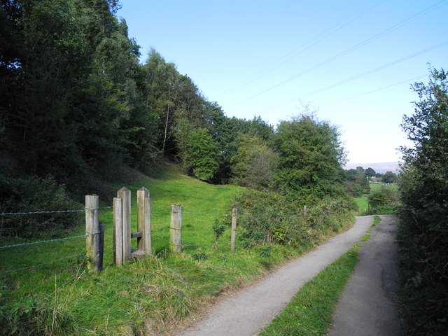
Pingot Lane footpath and Hague Road
Weather for this location
Next 14 daysNearby places
Useful places within 5 km
Own or manage this place?
Claim this listing to keep details accurate, add photos, and highlight what makes it special — free.
Claim this page→How useful was the information on this page?
id: 2994b7d2-e31e-42f5-8af9-b6cfe317e12c
Stachys sylvatica
Stachys sylvatica
Wayfaring-treeViburnum lantanaWayfaring-treeViburnum lantanaWintergreenPyrola rotundifoliaWintergreenPyrola rotundifoliaTufted VetchVicia craccaTufted VetchVicia craccaTutsanHypericum androsaemumTutsanHypericum androsaemumGreat HorsetailEquisetum telmateiaGreat HorsetailEquisetum telmateiaBush VetchVicia sepiumBush VetchVicia sepiumHogweedHeracleum sphondyliumHogweedHeracleum sphondyliumOpposite-leaved Golden-saxifrageChrysosplenium oppositifoliumOpposite-leaved Golden-saxifrageChrysosplenium oppositifoliumWood AnemoneAnemone nemorosaWood AnemoneAnemone nemorosaSpear MintMentha spicataSpear MintMentha spicataCommon SallowSalix cinereaCommon SallowSalix cinereaMeadowsweetFilipendula ulmariaMeadowsweetFilipendula ulmariaCommon Hemp-nettleGaleopsis tetrahitCommon Hemp-nettleGaleopsis tetrahitBetonyBetonica officinalisBetonyBetonica officinalisBrackenPteridium aquilinum subsp. aquilinumBrackenPteridium aquilinum subsp. aquilinumHard Shield-fernPolystichum aculeatumHard Shield-fernPolystichum aculeatumCreeping ThistleCirsium arvenseCreeping ThistleCirsium arvenseWall LettuceMycelis muralisWall LettuceMycelis muralisLady-fernAthyrium filix-feminaLady-fernAthyrium filix-feminaHollyIlex aquifoliumHollyIlex aquifoliumWild AngelicaAngelica sylvestrisWild AngelicaAngelica sylvestrisHay-scented Buckler-fernDryopteris aemulaHay-scented Buckler-fernDryopteris aemulaWych ElmUlmus glabraWych ElmUlmus glabraHeatherCalluna vulgarisHeatherCalluna vulgarisBroad Buckler-fernDryopteris dilatataBroad Buckler-fernDryopteris dilatataBilberryVaccinium myrtillusBilberryVaccinium myrtillusFalse Fox-sedgeCarex otrubaeFalse Fox-sedgeCarex otrubaeGoldenrodSolidago virgaureaGoldenrodSolidago virgaureaHard RushJuncus inflexusHard RushJuncus inflexusWavy Bitter-cressCardamine flexuosaWavy Bitter-cressCardamine flexuosaGrey PoplarPopulus alba x tremula = P. x canescensGrey PoplarPopulus alba x tremula = P. x canescensBroad-leaved BambooSasa palmataBroad-leaved BambooSasa palmataWood AvensGeum urbanumWood AvensGeum urbanumLamiastrum galeobdolon subsp. argentatumLamiastrum galeobdolon subsp. argentatumLamiastrum galeobdolon subsp. argentatumLamiastrum galeobdolon subsp. argentatumEnchanter's-nightshadeCircaea lutetianaEnchanter's-nightshadeCircaea lutetianaCommon Field-speedwellVeronica persicaCommon Field-speedwellVeronica persicaSoft-rushJuncus effususSoft-rushJuncus effususWall-rueAsplenium ruta-murariaWall-rueAsplenium ruta-murariaHazelCorylus avellanaHazelCorylus avellanaRed CampionSilene dioicaRed CampionSilene dioicaCurled DockRumex crispusCurled DockRumex crispusCanadian WaterweedElodea canadensisCanadian WaterweedElodea canadensisFringed Water-lilyNymphoides peltataFringed Water-lilyNymphoides peltataWood HorsetailEquisetum sylvaticumWood HorsetailEquisetum sylvaticumJapanese RoseRosa rugosaJapanese RoseRosa rugosaElderSambucus nigraElderSambucus nigraGarlic MustardAlliaria petiolataGarlic MustardAlliaria petiolataFringecupsTellima grandifloraFringecupsTellima grandifloraYarrowAchillea millefoliumYarrowAchillea millefoliumBluebellHyacinthoides non-scripta x hispanica = H. x massartianaBluebellHyacinthoides non-scripta x hispanica = H. x massartianaYellow ArchangelLamiastrum galeobdolonYellow ArchangelLamiastrum galeobdolonEvents & activities nearby
Switch provider to compare local events, tours and bookable activities.