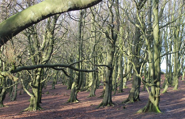
Crawshaw Wood - Broadleaved woodland
10 ha
Plan your visit
🐶Dogs🦉Wildlife🦅Birds
Public accessFree entryDogs welcome10 ha
Getting here
53.47513, -1.63207
Open directionsv
Visiting this summer
Seasonal nature notes and what to look for now
- 🌞Midsummer — early morning visits most comfortable; look for deer fawns in quieter clearings
- 🐕Early mornings are best for dog walks in summer — visit before 9am to avoid the heat and find quieter trails
- 🅿️Parking on site — 6 car parks within reach
🌤️ Visiting this summer
- 🌞Midsummer — early morning visits most comfortable; look for deer fawns in quieter clearings
- 🐕Early mornings are best for dog walks in summer — visit before 9am to avoid the heat and find quieter trails
- 🅿️Parking on site — 6 car parks within reach
- £Free to visit — no entry charge
- 🐕Dogs welcome
Dogs allowed — public woodland
Free
Deciduous woodland priority habitat
Free
🦅Bird watching
Strong match
Upland heathland — red grouse, merlin and short-eared owl
Free
Deciduous woodland — fungi, berries and wild garlic
Varies
🍂Seasonal nature
Good match
Broadleaved woodland — spring blossom and autumn colour
Free
Trails nearby
Within roughly 5 km6 signed routes nearby · 13 public paths nearby
Signed route nearbyPublic paths
Barnsley Boundary WalkWalking route▾
Named routeRegional walking route
Trans-Pennine Trail (Stockport to Silkstone Common)Walking route▾
Named routeRegional walking route
Penistone Boundary WalkWalking route▾
Named routeLocal walking route
Old Salt RoadWalking route▾
Peak District Boundary Walk Stage 8Walking route16.9 km▾
Named routeLength 16.9 kmRegional walking route
21 signed routes nearby
Signed route nearby
Route 627Cycling route▾
Named routeRef 627National Cycle Network
Sheffield Local Cycle NetworkCycling route▾
Sheffield Local Cycle Network
Named routeLocal cycle route
Trans Pennine TrailCycling route▾
Named routeRef 62National Cycle Network
Main RouteCycling route31 m▾
Named routeRef 62Length 31 mNational Cycle NetworkTraffic-freeSurface asphalt
Main RouteCycling route762 m▾
Named routeRef 627Length 762 mNational Cycle NetworkTraffic-freeSurface asphalt
Main RouteCycling route6.1 km▾
Named routeRef 627Length 6.1 kmNational Cycle NetworkTraffic-freeSurface unsealedfirm
1 public path nearby
Public paths
Peg Follyrestricted byway · 611 m▾
Public pathrestricted bywayLength 611 mSurface gravelPath type: track
Photos
'Spooky Wood,' Stocksbridge
Weather for this location
Next 14 daysNearby places
Useful places within 5 km
Own or manage this place?
Claim this listing to keep details accurate, add photos, and highlight what makes it special — free.
Claim this page→How useful was the information on this page?
id: 0a3e3a42-16da-416f-9410-5a20eb11bc85
Wildlife to spot
7,089 records · National Biodiversity Network
Wildlife to spot
7,089 records · National Biodiversity Network🐦Birds49 species
springautumn
2026▾
Lapwing · Kestrel · Chaffinch · Red Grouse (scotica) · Robin +44
- LapwingVanellus vanellus
- KestrelFalco tinnunculus
- ChaffinchFringilla coelebs2025
- Red Grouse (scotica)Lagopus scotica2025
- RobinErithacus rubecula2025
- GoldcrestRegulus regulus2025
- WrenTroglodytes troglodytes2025
- PheasantPhasianus colchicus2025
- BlackbirdTurdus merula2025
- WoodpigeonColumba palumbus2025
- StonechatSaxicola rubicola2025
- Mistle ThrushTurdus viscivorus2025
- ChiffchaffPhylloscopus collybita2025
- JackdawColoeus monedula2025
- CurlewNumenius arquata2025
- GreenfinchChloris chloris2025
- Coal TitPeriparus ater2025
- Blue TitCyanistes caeruleus2024
- FieldfareTurdus pilaris
- Barn OwlTyto alba2025
- DunnockPrunella modularis2025
- Willow WarblerPhylloscopus trochilus2025
- StarlingSturnus vulgaris2025
- SiskinSpinus spinus2025
- Great Crested GrebePodiceps cristatus2025
- GoldfinchCarduelis carduelis2025
- Tufted DuckAythya fuligula2025
- RedwingTurdus iliacus2024
- TreecreeperCerthia familiaris2024
- Long-tailed TitAegithalos caudatus2024
- CrossbillLoxia curvirostra2025
- Spotted FlycatcherMuscicapa striata2025
- JayGarrulus glandarius2025
- Song ThrushTurdus philomelos2025
- Great Spotted WoodpeckerDendrocopos major2025
- CuckooCuculus canorus2025
- BlackcapSylvia atricapilla2025
- Stock DoveColumba oenas2025
- House SparrowPasser domesticus2025
- WheatearOenanthe oenanthe2025
- SwallowHirundo rustica2025
- Carrion CrowCorvus corone2025
- Pied WagtailMotacilla alba yarrellii2025
- Meadow PipitAnthus pratensis2025
- SkylarkAlauda arvensis2025
- Canada GooseBranta canadensis2025
- OystercatcherHaematopus ostralegus2025
- MallardAnas platyrhynchos2025
- NuthatchSitta europaea2024
🦌Mammals2 species
springautumn
2025▾
Brown Hare · Roe Deer
- Brown HareLepus europaeus
- Roe DeerCapreolus capreolus
🐸Amphibians1 species
winter
2025▾
Common Frog
- Common FrogRana temporaria
Dark-edged Bee-fly · Cantharis fusca
- Dark-edged Bee-flyBombylius major
- Cantharis fuscaCantharis fusca
🌿Plants46 species
summerautumn
2025▾
Sneezewort · Amphibious Bistort · Purple-loosestrife · Trifid Bur-marigold · Wild Angelica +41
- SneezewortAchillea ptarmica
- Amphibious BistortPersicaria amphibia
- Purple-loosestrifeLythrum salicaria
- Trifid Bur-marigoldBidens tripartita
- Wild AngelicaAngelica sylvestris
- Hard Shield-fernPolystichum aculeatum
Species observations from the last 10 years via NBN Atlas
Hart's-Tongue
Hart's-Tongue
Asplenium scolopendrium
Asplenium scolopendrium
Soft Shield-fernPolystichum setiferumSoft Shield-fernPolystichum setiferumPolypodiumPolypodiumPolypodiumPolypodiumGoldenrodSolidago virgaureaGoldenrodSolidago virgaureaBroad-leaved HelleborineEpipactis helleborineBroad-leaved HelleborineEpipactis helleborineMarsh PennywortHydrocotyle vulgarisMarsh PennywortHydrocotyle vulgarisCorn SpurreySpergula arvensisCorn SpurreySpergula arvensisWater MintMentha aquaticaWater MintMentha aquaticaClimbing CorydalisCeratocapnos claviculataClimbing CorydalisCeratocapnos claviculataViper's-buglossEchium vulgareViper's-buglossEchium vulgareSkullcapScutellaria galericulataSkullcapScutellaria galericulataCommon ValerianValeriana officinalisCommon ValerianValeriana officinalisPick-a-back-plantTolmiea menziesiiPick-a-back-plantTolmiea menziesiiHoneysuckleLonicera periclymenumHoneysuckleLonicera periclymenumCrab AppleMalus sylvestris2024Crab AppleMalus sylvestris2024Silver BirchBetula pendula2024Silver BirchBetula pendula2024Creeping ButtercupRanunculus repens2024Creeping ButtercupRanunculus repens2024Cock's-footDactylis glomerata2024Cock's-footDactylis glomerata2024BroomCytisus scoparius2024BroomCytisus scoparius2024Common RagwortJacobaea vulgaris2024Common RagwortJacobaea vulgaris2024HogweedHeracleum sphondylium2024HogweedHeracleum sphondylium2024Sessile OakQuercus petraea2024Sessile OakQuercus petraea2024Marsh ThistleCirsium palustre2024Marsh ThistleCirsium palustre2024RowanSorbus aucuparia2024RowanSorbus aucuparia2024SycamoreAcer pseudoplatanus2024SycamoreAcer pseudoplatanus2024Spear ThistleCirsium vulgare2024Spear ThistleCirsium vulgare2024Pedunculate OakQuercus robur2024Pedunculate OakQuercus robur2024Oxeye DaisyLeucanthemum vulgare2024Oxeye DaisyLeucanthemum vulgare2024DandelionTaraxacum2024DandelionTaraxacum2024HazelCorylus avellana2024HazelCorylus avellana2024Creeping ThistleCirsium arvense2024Creeping ThistleCirsium arvense2024Soft-rushJuncus effusus2024Soft-rushJuncus effusus2024Tufted Hair-grassDeschampsia cespitosa2024Tufted Hair-grassDeschampsia cespitosa2024AlderAlnus glutinosa2024AlderAlnus glutinosa2024Common KnapweedCentaurea nigra2024Common KnapweedCentaurea nigra2024ElderSambucus nigra2024ElderSambucus nigra2024Common NettleUrtica dioica2024Common NettleUrtica dioica2024Broad-leaved DockRumex obtusifolius2024Broad-leaved DockRumex obtusifolius2024HollyIlex aquifolium2024HollyIlex aquifolium2024Yorkshire-fogHolcus lanatus2024Yorkshire-fogHolcus lanatus2024Events & activities nearby
Switch provider to compare local events, tours and bookable activities.