Getting here
53.08141, -0.94368
Visiting this summer
Seasonal nature notes and what to look for now
Visiting this summer
Seasonal nature notes and what to look for now
- 🌞Midsummer — early morning visits most comfortable; look for deer fawns in quieter clearings
- 🐕Early mornings are best for dog walks in summer — visit before 9am to avoid the heat and find quieter trails
- 🅿️Parking on site — 20 car parks within reach, toilets nearby
🌤️ Visiting this summer
- 🌞Midsummer — early morning visits most comfortable; look for deer fawns in quieter clearings
- 🐕Early mornings are best for dog walks in summer — visit before 9am to avoid the heat and find quieter trails
- 🅿️Parking on site — 20 car parks within reach, toilets nearby
Good to know
- £Free to visit — no entry charge
- 🐕Dogs welcome
Best for
Dog walks
Strong match
Dogs allowed — public woodland
Foraging
Strong match
Traditional orchard — seasonal fruit, fungi and wild plants
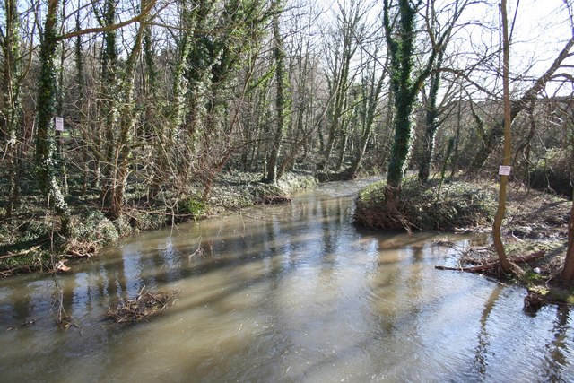
Wildlife
Strong match
Deciduous woodland priority habitat
Bird watching
Strong match
Deciduous woodland — woodpeckers, warblers and woodland birds
Family friendly
Good match
toilets
Insect spotting
Good match
Traditional orchard — specialist orchard insects and lichens
Trails nearby
Within roughly 5 km🚶Walking
5 signed routes nearby · 25 public paths nearby
Signed route nearbyPublic paths
Walking
Southwell TrailWalking route
Southwell Heritage TrailWalking route
Trent Valley WayWalking route304 km
Robin Hood WayWalking route
Stoke Field TrailWalking route
Shady Lanepublic footpath · 4 m
Shady Lanepublic footpath · 10 m
Shady Lanepublic footpath · 119 m
🚴Cycling
7 signed routes nearby
Signed route nearby
Cycling
Route 645Cycling route
Fosse2Cycling route
National Byway (Southwell Loop)Cycling route
Main RouteCycling route3.4 km
Main RouteCycling route104 m
Main RouteCycling route2.8 km
🐴Horse riding
5 public paths nearby
Public paths
Horse riding
Southwell Trailbridleway · 1.3 km
Wildlife to spot
Photos
Weather for this location
Loading local forecast…
Nearby places
Useful places within 5 km
Own or manage this place?
Claim this listing to keep details accurate, add photos, and highlight what makes it special — free.
Claim this pageHow was your visit?
How useful was the information on this page?
id: b0d8ba6a-d3ae-4b20-a3da-fde563caf33f