Getting here
51.30281, -2.79919
Visiting this summer
Seasonal nature notes and what to look for now
Visiting this summer
Seasonal nature notes and what to look for now
- 🌞Midsummer — early morning visits most comfortable; look for deer fawns in quieter clearings
- 🐕Early mornings are best for dog walks in summer — visit before 9am to avoid the heat and find quieter trails
- 🅿️Parking 254m away — 2 car parks within reach
🌤️ Visiting this summer
- 🌞Midsummer — early morning visits most comfortable; look for deer fawns in quieter clearings
- 🐕Early mornings are best for dog walks in summer — visit before 9am to avoid the heat and find quieter trails
- 🅿️Parking 254m away — 2 car parks within reach
Good to know
- £Free to visit — no entry charge
- 🐕Dogs welcome
Best for
Dog walks
Strong match
Dogs allowed — public woodland
Insect spotting
Strong match
Chalk and limestone grassland — chalkhill blue, adonis blue and rare moths
Wildlife
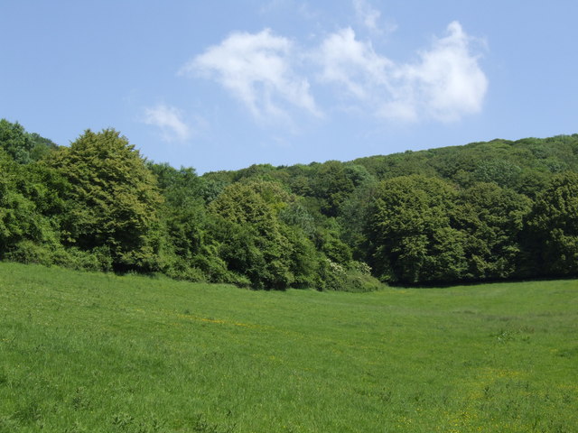
Strong match
Deciduous woodland priority habitat
Bird watching
Strong match
Deciduous woodland — woodpeckers, warblers and woodland birds
Foraging
Good match
Deciduous woodland — fungi, berries and wild garlic
Forest walks
Good match
Public woodland
Trails nearby
Within roughly 5 km🚶Walking
5 signed routes nearby · 13 public paths nearby
Signed route nearbyPublic paths
Walking
Samaritans Way South WestWalking route166 km
West Mendip WayWalking route48 km
The Butcombe TrailWalking route74 km
The Mendip TrailWalking route
Limestone LinkWalking route58 km
Callow Drovepublic footpath · 795 m
Callow Drovepublic footpath · 1.3 km
🚴Cycling
38 signed routes nearby
Signed route nearby
Cycling
National Cycle Network Route 26 (Proposed)Cycling route
Strawberry LineCycling route
Route 26Cycling route
Main RouteCycling route66 m
Main RouteCycling route113 m
Main RouteCycling route115 m
🐴Horse riding
4 public paths nearby
Public paths
Horse riding
Winscombe Drovebridleway · 804 m
Winscombe Drovebridleway · 12 m
Winscombe Drovebridleway · 157 m
Winscombe Drovebridleway · 113 m
Wildlife to spot
Photos
Weather for this location
Loading local forecast…
Nearby places
Useful places within 5 km
Own or manage this place?
Claim this listing to keep details accurate, add photos, and highlight what makes it special — free.
Claim this pageHow was your visit?
How useful was the information on this page?
id: fed8e4d5-5203-45b8-b050-df7a2529bdff