🌞Midsummer — early morning visits most comfortable; look for deer fawns in quieter clearings
🐕Early mornings are best for dog walks in summer — visit before 9am to avoid the heat and find quieter trails
🅿️Parking on site — 14 car parks within reach
🌤️ Visiting this summer
🌞Midsummer — early morning visits most comfortable; look for deer fawns in quieter clearings
🐕Early mornings are best for dog walks in summer — visit before 9am to avoid the heat and find quieter trails
🅿️Parking on site — 14 car parks within reach
Good to know
£Free to visit — no entry charge
🐕Dogs welcome
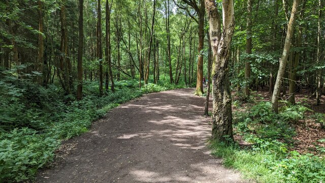
🌿Ancient woodland — rare wildlife habitat
🚲Bike parking🅿️Parking
Best for
9 activities
🍂
Seasonal nature
Strong match
Ancient woodland — bluebells, fungi and autumn colour
Free
🦉
Wildlife
Strong match
Lowland heathland priority habitat; Ancient woodland
Free
🦅
Bird watching
Strong match
Lowland heathland — Dartford warblers, nightjars and stonechats
Free
🐶
Dog walks
Strong match
Dogs allowed — public woodland
Free
🦋
Insect spotting
Strong match
Lowland heathland — silver-studded blue and heath fritillary butterflies
Free
🌿
Foraging
Good match
Deciduous woodland — fungi, berries and wild garlic
Varies
Trails nearby
Within roughly 5 km
🚶
Walking
▾
20 signed routes nearby · 19 public paths nearby
Signed route nearbyPublic paths
Shropshire Way - stage 01Walking route24.1 km▾
Named routeRef ShW01Length 24.1 kmLocal walking route
Shropshire Way - stage 10Walking route18.1 km▾
Named routeRef ShW10Length 18.1 kmLocal walking route
River Reflections Walk, Attingham ParkWalking route1.6 km▾
River Tern, Water Meadow, Man-Made Lake, Two Bridges. Dogs leashed for majority of the walk, with a section for off lead walking in the north: https://nt.global.ssl.fastly.net/binaries/content/assets/website/national/regions/shropshire-staffordshire/place
Named routeLength 1.6 kmDuration 01:00-01:30Round tripLocal walking route
Food and Fungi Walk, Attingham ParkWalking route1.6 km▾
Walled Garden, Apple Orchard, Woodland, Fungi, Exotic Fruit
Named routeLength 1.6 kmDuration 00:30-01:00Round tripLocal walking route
Repton Ramble, Attingham ParkWalking route4 km▾
Deer, WW2 Remians, The Ha-Ha, Mainsion Views, River Tern. Dogs leashed for parts of this walk: https://nt.global.ssl.fastly.net/binaries/content/assets/website/natio
Named routeLength 4 kmDuration 01:00-01:30Round tripLocal walking route
Mill Lanepublic footpath · 99 m▾
Public pathpublic footpathLength 99 mSurface asphaltPath type: unclassified
Tower Farmpublic footpath · 65 m▾
Public pathpublic footpathLength 65 mSurface pavedPath type: residential
🚴
Cycling
▾
55 signed routes nearby
Signed route nearby
Mercian WayCycling route▾
Named routeRef 45National Cycle Network
National Byway (Shropshire)Cycling route▾
National Byway route in Shropshire
Named routeRef NBRegional cycle route
Route 81Cycling route▾
Named routeRef 81National Cycle Network
Main RouteCycling route22 m▾
Named routeRef 45Length 22 mNational Cycle NetworkOn-roadSurface asphalt
Main RouteCycling route14 m▾
Named routeRef 45Length 14 mNational Cycle NetworkOn-roadSurface asphalt
Main RouteCycling route231 m▾
Named routeRef 81Length 231 mNational Cycle NetworkTraffic-freeSurface asphalt
🐴
Horse riding
▾
6 public paths nearby
Public paths
Shropshire Union Canal Shrewsbury Branch pathbridleway · 529 m▾
Public pathbridlewayLength 529 mSurface pavedPath type: cycleway
Shropshire Union Canal Shrewsbury Branch pathbridleway · 186 m▾
Public pathbridlewayLength 186 mSurface pavedPath type: cycleway