🌞Midsummer — early morning visits most comfortable; look for deer fawns in quieter clearings
🐕Early mornings are best for dog walks in summer — visit before 9am to avoid the heat and find quieter trails
🅿️Parking nearby — easy to reach by car
🌤️ Visiting this summer
🌞Midsummer — early morning visits most comfortable; look for deer fawns in quieter clearings
🐕Early mornings are best for dog walks in summer — visit before 9am to avoid the heat and find quieter trails
🅿️Parking nearby — easy to reach by car
Good to know
£Free to visit — no entry charge
🐕Dogs welcome
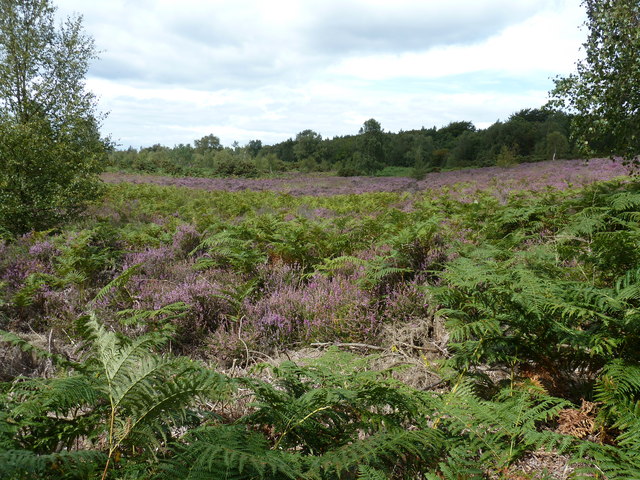
🌿Ancient woodland — rare wildlife habitat
🅿️Parking
Best for
9 activities
🦉
Wildlife
Strong match
Deciduous woodland priority habitat; Ancient woodland
Free
🍂
Seasonal nature
Strong match
Ancient woodland — bluebells, fungi and autumn colour
Free
🦅
Bird watching
Strong match
Lowland heathland — Dartford warblers, nightjars and stonechats
Free
🐶
Dog walks
Strong match
Dogs allowed — public woodland
Free
🦋
Insect spotting
Strong match
Lowland heathland — silver-studded blue and heath fritillary butterflies
Free
🌿
Foraging
Good match
Deciduous woodland — fungi, berries and wild garlic
Varies
Trails nearby
Within roughly 5 km
🚶
Walking
▾
8 signed routes nearby · 51 public paths nearby
Signed route nearbyPublic paths
Sussex Diamond WayWalking route97 km▾
Named routeLength 97 kmRegional walking route
New Lipchis WayWalking route▾
Named routeRegional walking route
Sussex Border PathWalking route220 km▾
Named routeLength 220 kmRegional walking route
Stargazing Circular Walk at Black DownWalking route2.4 km▾
At the highest point in Surrey, away from light pollution, Black Down is ideal for stargazing. On a clear night, there are ~4,000 stars visible, including the Milky Way. This leisurely walk offers viewpoints & a chance to encounter night-time wildlife.
Named routeLength 2.4 kmDuration 00:30Round tripLocal walking route
Woolbeding, River Rother and Midhurst Walk, South Downs WestWalking route4.8 km▾
Woolbeding Estate is a countryside gem, near Midhurst. Take in the beauty of the parkland. Follow the River Rother, edged with ancient trees. Pass a poplar plantation & hear the sounds of the weir before returning to the main street for its cafe's & pubs.
Named routeLength 4.8 kmDuration 01:30Round tripLocal walking route
Older Hill Lanepublic footpath · 204 m▾
Public pathpublic footpathLength 204 mSurface asphaltPath type: unclassified
Dene House access track and TRAIL bridlewaypublic footpath · 324 m▾
Public pathpublic footpathLength 324 mSurface compactedPath type: track
TRAIL Dene to Eastshaw Bridlewaypublic footpath · 449 m▾
Braided path.
Public pathpublic footpathLength 449 mSurface grassPath type: track
🚴
Cycling
▾
4 signed routes nearby
Signed route nearby
National Cycle Route 228 Pulborough to Petersfield (proposed)Cycling route▾
Named routeRef 228National Cycle Network
Bepton to MidhurstCycling route▾
Named routeLocal cycle route
Stedham to MidhurstCycling route▾
Named routeLocal cycle route
National Cycle Route 288 Cocking to Midhurst (Proposed)Cycling route▾