Getting here
51.23460, -0.42531
Visiting this summer
Seasonal nature notes and what to look for now
Visiting this summer
Seasonal nature notes and what to look for now
- 🌞Midsummer — early morning visits most comfortable; look for deer fawns in quieter clearings
- 🐕Early mornings are best for dog walks in summer — visit before 9am to avoid the heat and find quieter trails
- 📍Open access throughout summer — no booking required
🌤️ Visiting this summer
- 🌞Midsummer — early morning visits most comfortable; look for deer fawns in quieter clearings
- 🐕Early mornings are best for dog walks in summer — visit before 9am to avoid the heat and find quieter trails
- 📍Open access throughout summer — no booking required
Good to know
- £Free to visit — no entry charge
- 🐕Dogs welcome
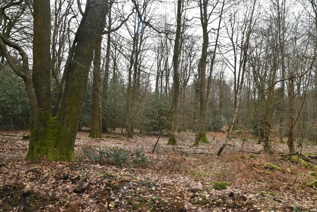
- 🌿Ancient woodland — rare wildlife habitat
Best for
Wildlife
Strong match
Deciduous woodland priority habitat; Ancient woodland
Dog walks
Strong match
Dogs allowed — public woodland
Seasonal nature
Strong match
Ancient woodland — bluebells, fungi and autumn colour
Bird watching
Strong match
Deciduous woodland — woodpeckers, warblers and woodland birds
Foraging
Good match
Deciduous woodland — fungi, berries and wild garlic
Forest walks
Good match
Public woodland
Trails nearby
Within roughly 5 km🚶Walking
27 signed routes nearby · 1 public path nearby
Signed route nearbyPublic paths
Walking
Shere Parish Millennium TrailWalking route
Prospects of Polesden (SCC)Walking route
Ranmore Circular (SCC)Walking route9.5 km
The Fox WayWalking route
Tillingbourne at work (long) (SCC)Walking route
🚴Cycling
38 signed routes nearby
Signed route nearby
Cycling
Wookies HoleCycling route
Surrey CyclewayCycling route
Woking and Egham link
Im Still StandingCycling route
Surrey CyclewayCycling route
Leigh Hill link
Route 22Cycling route
Surrey CyclewayCycling route
Cranleigh link
🚵Mountain biking
12 signed routes nearby
Signed route nearby
Mountain biking
Son of CocoMountain bike route
DeleriumMountain bike route
Lower Treaders TrailMountain bike route
Windy WillowsMountain bike route
Logans RunMountain bike route
Van Gogh's Missing EarMountain bike route
🐴Horse riding
7 public paths nearby
Public paths
Horse riding
Beggars Lane (BY 515)byway open to all traffic · 466 m
Byway 515 (Beggars Lane) is a Byway Open to All Traffic (BOAT) but has a TRO in place: "No person shall use, cause or permit any motor vehicles or any horse drawn vehicle with four or more wheels over 1500mm (4ft 11in) width"
Sheepwalk Lane (BY 104)byway open to all traffic · 1.6 km
BW 3bridleway · 1 km
BW 133bridleway · 786 m
Drove Roadbyway open to all traffic · 1.2 km
Wildlife to spot
Photos
Weather for this location
Loading local forecast…
Nearby places
Useful places within 5 km
Own or manage this place?
Claim this listing to keep details accurate, add photos, and highlight what makes it special — free.
Claim this pageHow was your visit?
How useful was the information on this page?
id: cb37a806-3a03-4ebc-b537-43a8f0a99a48