Plan your visit
Getting here
51.32043, -0.46765
Visiting this summer
Seasonal nature notes and what to look for now
Visiting this summer
Seasonal nature notes and what to look for now
- 🌞Midsummer — early morning visits most comfortable; look for deer fawns in quieter clearings
- 🐕Early mornings are best for dog walks in summer — visit before 9am to avoid the heat and find quieter trails
- ⛺Camping available here — summer nights at this site are worth planning around
🌤️ Visiting this summer
- 🌞Midsummer — early morning visits most comfortable; look for deer fawns in quieter clearings
- 🐕Early mornings are best for dog walks in summer — visit before 9am to avoid the heat and find quieter trails
- ⛺Camping available here — summer nights at this site are worth planning around
Good to know
- £Free to visit — no entry charge
- 🐕Dogs welcome
Best for
Insect spotting
Strong match
Lowland heathland — silver-studded blue and heath fritillary butterflies
Bird watching
Strong match
Lowland heathland — Dartford warblers, nightjars and stonechats
Dog walks
Strong match
Dogs allowed — public woodland
Wildlife
Strong match
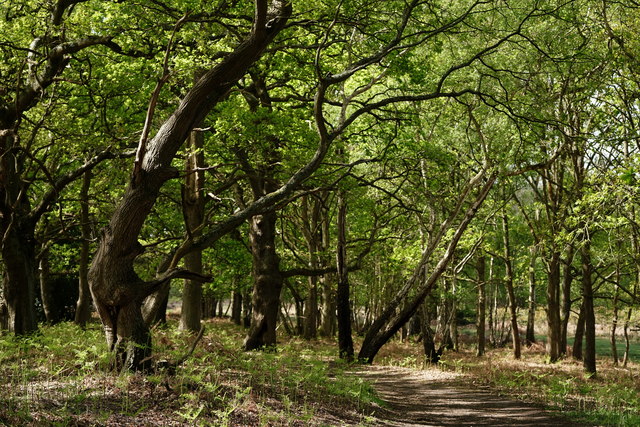
Deciduous woodland priority habitat
Foraging
Good match
Deciduous woodland — fungi, berries and wild garlic
Forest walks
Good match
Public woodland
Trails nearby
Within roughly 5 km🚶Walking
11 signed routes nearby · 29 public paths nearby
Signed route nearbyPublic paths
Walking
Effingham walk (SCC)Walking route
Locks and Levels (SCC)Walking route
The Fox WayWalking route
Canons and CornmillsWalking route
Papercourt Lock to Triggs Lock Walk, River Wey NavigationsWalking route9.6 km
Starting from Papercourt, this walk is based in Send, where the River Wey Navigations has its navigation workshops. On this flat route you'll find locks from the 1760s and ponds and meadows that are important for the local wildlife. Flat & easy walking.
FP 6public footpath · 93 m
FP 7public footpath · 590 m
FP 7public footpath · 114 m
🚴Cycling
30 signed routes nearby
Signed route nearby
Cycling
Mimas TrailCycling route
A3 Cycle Route (alternative)Cycling route
Route 223Cycling route
Ceres TrailCycling route
Deimos TrailCycling route
Surrey CyclewayCycling route
Woking and Egham link
🚵Mountain biking
1 signed route nearby
Signed route nearby
Mountain biking
Basingstoke Canal TowpathMountain bike route
🐴Horse riding
18 public paths nearby
Public paths
Horse riding
BW 8bridleway · 1.3 km
Clearmount Bridgebridleway · 65 m
BW 8bridleway · 17 m
Cockcrow Bridgebridleway · 70 m
Wildlife to spot
Photos
Weather for this location
Loading local forecast…
Nearby places
Useful places within 5 km
Own or manage this place?
Claim this listing to keep details accurate, add photos, and highlight what makes it special — free.
Claim this pageHow was your visit?
How useful was the information on this page?
id: 9e9fb5a0-abb8-4bf5-aff2-f370d8e3a4a5