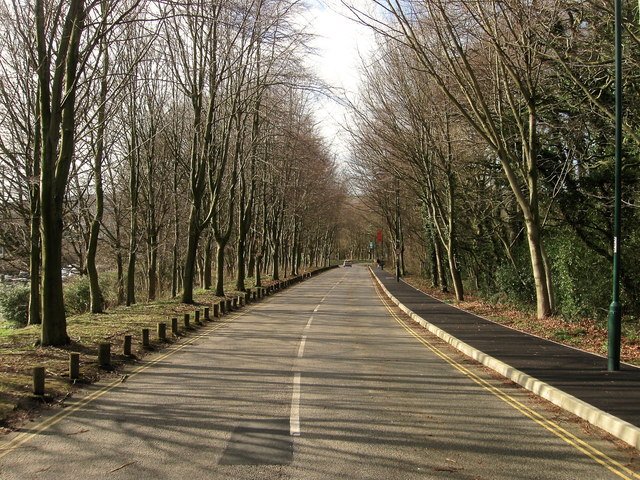
Tenantlain Belt - Broadleaved woodland 2 ha
Plan your visit
🦉 Wildlife🦅 Birds🌿 Foraging
Free entry Dogs welcome 2 ha
Places › England › South East › Brighton and Hove Getting here
50.86349, -0.08582
Open directionsv Visiting this summer
Seasonal nature notes and what to look for now
▾ 🌞 Midsummer — early morning visits most comfortable; look for deer fawns in quieter clearings 🌿 Foraging is at its best in summer here ☕ Doctor's Orders — a good base for a longer summer day out 🌤️ Visiting this summer
🌞 Midsummer — early morning visits most comfortable; look for deer fawns in quieter clearings 🌿 Foraging is at its best in summer here ☕ Doctor's Orders — a good base for a longer summer day out £ Free to visit — no entry charge🐕 Dogs welcome🚲 Bike parking☕ Café🅿️ Parking· Paid 🧺 Picnic spot🚻 Toilets
Deciduous woodland priority habitat
Free
🦅 Bird watching
Strong match
Deciduous woodland — woodpeckers, warblers and woodland birds
Free
Deciduous woodland — fungi, berries and wild garlic
Varies
🌲 Forest walks
Moderate match
Public woodland
Free
Trails nearby Within roughly 5 km 9 signed routes nearby · 3 public paths nearby
Signed route nearby Public paths
Monarch's Way Walking route 990 km ▾
approximate route of Charles II's escape
Named route Ref MW Length 990 km Regional walking route
Show on map South Downs Way Walking route 160 km ▾
Named route Length 160 km National walking route
Show on map Ditchling Beacon to Devil's Dyke, South Downs walk, Sussex East Walking route 11.2 km ▾
This walk takes in one of the most stunning sections of the South Downs Way. Spring & Summer bring rich plant life thanks to the chalk soil, forming unique grassland habitat. Great bus links from Brighton. Mostly flat until Pyecombe where it gets steep.
Named route Length 11.2 km Duration 03:00 Point-to-point Regional walking route
Show on map Newhaven-Brighton Clifftop Path Walking route ▾
Named route Local walking route
Show on map Greenwich Meridian Trail Walking route 440 km ▾
A long-distance walk that follows the line of the Prime Meridian. Inaugurated in 2009, to coincide with the 125th anniversary of the Greenwich Meridian.
Named route Ref GMT Length 440 km Regional walking route
Show on map Village Way public footpath · 40 m ▾
Public path public footpath Length 40 m Surface asphalt Path type: tertiary
Show on map Village Way public footpath · 41 m ▾
Public path public footpath Length 41 m Surface asphalt Path type: tertiary
Show on map 86 signed routes nearby
Signed route nearby
The Level Cycling route ▾
Named route Local cycle route
Show on map Preston Street contraflow lane Cycling route ▾
Named route Local cycle route
Show on map Church Road cycle contraflow/cut-throughs Cycling route ▾
Named route Local cycle route
Show on map National Cycle Route 20 Pyecombe to Brighton Cycling route ▾
Named route Ref 20 National Cycle Network
Show on map National Cycle Route 2 Brighton to Worthing Cycling route ▾
Named route Ref 2 National Cycle Network
Show on map East Brighton (Sheepcote ring) Cycling route ▾
Named route Local cycle route
Show on map 1 signed route nearby
Signed route nearby
South Downs Way Mountain bike route ▾
Named route Ref 89 National Cycle Network
Show on map Photos Southern Ring Road, University of Sussex
‹ ›
Weather for this location Next 14 days Nearby places Useful places within 5 km
All Historic
Own or manage this place?
Claim this listing to keep details accurate, add photos, and highlight what makes it special — free.
Claim this page→ How useful was the information on this page?
id: 2cd4742b-6c21-4952-a0fe-cd71733bc487
UK green spaces mapped from open public data — so anyone can find the woodland, trail, or nature reserve closest to them.
© 2026 Glade · Made with care for UK green spaces
Events & activities nearby Switch provider to compare local events, tours and bookable activities.
Bookable tours GetYourGuide Promote here
Wildlife to spot
22,417 records · National Biodiversity Network
▾
Wildlife to spot 22,417 records · National Biodiversity Network 🐦 Birds 18 species
spring winter
2026 ▾
Robin · Jackdaw · Goldfinch · Magpie · Herring Gull +13
Robin Erithacus rubecula Jackdaw Coloeus monedula Goldfinch Carduelis carduelis Magpie Pica pica Herring Gull Larus argentatus Woodpigeon Columba palumbus2025 Blackcap Sylvia atricapilla Blue Tit Cyanistes caeruleus Carrion Crow Corvus corone Blackbird Turdus merula Green Woodpecker Picus viridis Great Tit Parus major2025 Black-headed Gull Chroicocephalus ridibundus2025 Rook Corvus frugilegus2025 Song Thrush Turdus philomelos2025 Common Gull Larus canus2025 Raven Corvus corax Stock Dove Columba oenas Common Lizard
Common Lizard Zootoca vivipara 🐸 Amphibians 2 species
winter spring
2026 ▾
Common Frog · Smooth Newt
Common Frog Rana temporaria Smooth Newt Lissotriton vulgaris 🐝 Insects 16 species
winter spring
2026 ▾
Orange Ladybird · 7-spot Ladybird · Scathophaga stercoraria · Syrphus · Dark-edged Bee-fly +11
Orange Ladybird Halyzia sedecimguttata 7-spot Ladybird Coccinella septempunctata Scathophaga stercoraria Scathophaga stercoraria Syrphus Syrphus Dark-edged Bee-fly Bombylius major Black Clock Pterostichus madidus Lords-and-Ladies · Early Meadow-grass · Lesser Celandine · Yew · Garden Grape-hyacinth +76
Lords-and-Ladies Arum maculatum Early Meadow-grass Poa infirma Lesser Celandine Ficaria verna Yew Taxus baccata Garden Grape-hyacinth Muscari armeniacum Cock's-foot Dactylis glomerata Common Striated Feather-moss Eurhynchium striatum Species observations from the last 10 years via NBN Atlas
Snail Hunter
Snail Hunter
Cychrus caraboides
Cychrus caraboides
Eristalis tenax Eristalis tenax
Eristalis tenax Eristalis tenax
Meliscaeva auricollis Meliscaeva auricollis
Meliscaeva auricollis Meliscaeva auricollis
Cream-spot Ladybird Calvia quattuordecimguttata
Cream-spot Ladybird Calvia quattuordecimguttata
14-spot Ladybird Propylea quattuordecimpunctata
14-spot Ladybird Propylea quattuordecimpunctata
Phloiophilus edwardsii Phloiophilus edwardsii
Phloiophilus edwardsii Phloiophilus edwardsii
Brown Tree Ant Lasius brunneus2025
Brown Tree Ant Lasius brunneus2025
Acericerus heydenii Acericerus heydenii2025
Acericerus heydenii Acericerus heydenii2025
Harlequin Ladybird Harmonia axyridis2025
Harlequin Ladybird Harmonia axyridis2025
Oxystoma pomonae Oxystoma pomonae2025
Oxystoma pomonae Oxystoma pomonae2025
Even Scalewort Radula complanata
Even Scalewort Radula complanata
Forked Veilwort Metzgeria furcata
Forked Veilwort Metzgeria furcata
Foxglove Digitalis purpurea
Foxglove Digitalis purpurea
Cherry Laurel Prunus laurocerasus
Cherry Laurel Prunus laurocerasus
Creeping Comfrey Symphytum grandiflorum
Creeping Comfrey Symphytum grandiflorum
Marjoram Origanum
Marjoram Origanum
Purple Toadflax Linaria purpurea
Purple Toadflax Linaria purpurea
Japanese Cherry Prunus serrulata
Japanese Cherry Prunus serrulata
Common Sorrel Rumex acetosa
Common Sorrel Rumex acetosa
Lawson Cypress Cupressus lawsoniana
Lawson Cypress Cupressus lawsoniana
Gorse Ulex europaeus
Gorse Ulex europaeus
Crown Vetch Securigera varia
Crown Vetch Securigera varia
Horse-chestnut Aesculus hippocastanum
Horse-chestnut Aesculus hippocastanum
Greater Celandine Chelidonium majus
Greater Celandine Chelidonium majus
Knapweed Centaurea
Knapweed Centaurea
Red Fescue Festuca rubra
Red Fescue Festuca rubra
Slender Speedwell Veronica filiformis
Slender Speedwell Veronica filiformis
Aspen Populus tremula
Aspen Populus tremula
Scarlet Pimpernel Lysimachia arvensis
Scarlet Pimpernel Lysimachia arvensis
Ground-elder Aegopodium podagraria
Ground-elder Aegopodium podagraria
Primrose Primula vulgaris
Primrose Primula vulgaris
Hedge Bedstraw Galium album
Hedge Bedstraw Galium album
Fennel Foeniculum vulgare
Fennel Foeniculum vulgare
Alder Alnus glutinosa
Alder Alnus glutinosa
Pink Shepherd's-purse Capsella rubella
Pink Shepherd's-purse Capsella rubella
Lesser Trefoil Trifolium dubium
Lesser Trefoil Trifolium dubium
Cowslip Primula veris
Cowslip Primula veris
Alexanders Smyrnium olusatrum
Alexanders Smyrnium olusatrum
Yarrow Achillea millefolium
Yarrow Achillea millefolium
Flat Neckera Neckera complanata
Flat Neckera Neckera complanata
Black Medick Medicago lupulina
Black Medick Medicago lupulina
Blackthorn Prunus spinosa
Blackthorn Prunus spinosa
Daisy Bellis perennis
Daisy Bellis perennis
Coltsfoot Tussilago farfara
Coltsfoot Tussilago farfara
Wavy Beard-moss Didymodon sinuosus
Wavy Beard-moss Didymodon sinuosus
Borage Borago officinalis
Borage Borago officinalis
Wood Forget-me-not Myosotis sylvatica
Wood Forget-me-not Myosotis sylvatica
Butterfly-bush Buddleja davidii
Butterfly-bush Buddleja davidii
Early Dog-violet Viola reichenbachiana
Early Dog-violet Viola reichenbachiana
Creeping Buttercup Ranunculus repens
Creeping Buttercup Ranunculus repens
Larger Mouse-tail Moss Isothecium alopecuroides
Larger Mouse-tail Moss Isothecium alopecuroides
Cherry Prunus
Cherry Prunus
Broad-leaved Dock Rumex obtusifolius
Broad-leaved Dock Rumex obtusifolius
Wood Spurge Euphorbia amygdaloides
Wood Spurge Euphorbia amygdaloides
Cut-leaved Crane's-bill Geranium dissectum
Cut-leaved Crane's-bill Geranium dissectum
Ribwort Plantain Plantago lanceolata
Ribwort Plantain Plantago lanceolata
Spurge-laurel Daphne laureola
Spurge-laurel Daphne laureola
Creeping Cinquefoil Potentilla reptans
Creeping Cinquefoil Potentilla reptans
White Clover Trifolium repens
White Clover Trifolium repens
Cow Parsley Anthriscus sylvestris
Cow Parsley Anthriscus sylvestris
Rue-leaved Saxifrage Saxifraga tridactylites
Rue-leaved Saxifrage Saxifraga tridactylites
Herb-Robert Geranium robertianum
Herb-Robert Geranium robertianum
Cherry Plum Prunus cerasifera
Cherry Plum Prunus cerasifera
Grey-cushioned Grimmia Grimmia pulvinata
Grey-cushioned Grimmia Grimmia pulvinata
Snowdrop Galanthus nivalis
Snowdrop Galanthus nivalis
Ivy-leaved Toadflax Cymbalaria muralis
Ivy-leaved Toadflax Cymbalaria muralis
Minute Pouncewort Myriocoleopsis minutissima
Minute Pouncewort Myriocoleopsis minutissima
Silver-moss Bryum argenteum
Silver-moss Bryum argenteum
Redshank Ceratodon purpureus
Redshank Ceratodon purpureus
Common Cord-moss Funaria hygrometrica
Common Cord-moss Funaria hygrometrica
Golden Thread-moss Leptobryum pyriforme
Golden Thread-moss Leptobryum pyriforme
Dilated Scalewort Frullania dilatata
Dilated Scalewort Frullania dilatata
Lateral Cryphaea Cryphaea heteromalla
Lateral Cryphaea Cryphaea heteromalla
White Dead-nettle Lamium album
White Dead-nettle Lamium album
Common Field-speedwell Veronica persica
Common Field-speedwell Veronica persica
Shepherd's-purse Capsella bursa-pastoris
Shepherd's-purse Capsella bursa-pastoris
Field Madder Sherardia arvensis
Field Madder Sherardia arvensis
Annual Mercury Mercurialis annua
Annual Mercury Mercurialis annua
Petty Spurge Euphorbia peplus
Petty Spurge Euphorbia peplus
Scentless Mayweed Tripleurospermum inodorum
Scentless Mayweed Tripleurospermum inodorum
Dandelion Taraxacum
Dandelion Taraxacum
Common Pocket-moss Fissidens taxifolius2025
Common Pocket-moss Fissidens taxifolius2025
Fox-tail Feather-moss Thamnobryum alopecurum2025
Fox-tail Feather-moss Thamnobryum alopecurum2025
Beech Fagus sylvatica2025
Beech Fagus sylvatica2025