Dogkennel Wood - Broadleaved woodland
3 ha
Plan your visit
🎠Play🐶Dogs🦉Wildlife
Public accessFree entryDogs welcome3 ha
Getting here
50.85935, 0.53863
Open directionsv
Visiting this summer
Seasonal nature notes and what to look for now
- ☀️June — canopy now fully closed, creating cool dappled shade even on warm days
- ☀️Summer family visits work well here — arrive early and plan for a longer stay
- 🛝Playground 275m away — built-in entertainment for younger visitors alongside the wider site
🌤️ Visiting this summer
- ☀️June — canopy now fully closed, creating cool dappled shade even on warm days
- ☀️Summer family visits work well here — arrive early and plan for a longer stay
- 🛝Playground 275m away — built-in entertainment for younger visitors alongside the wider site
- £Free to visit — no entry charge
- 🐕Dogs welcome
🅿️Parking· Paid🛝Playground
Dogs allowed — public woodland
Free
Deciduous woodland priority habitat
Free
🛝Family friendly
Strong match
playground
Free
🦅Bird watching
Strong match
Deciduous woodland — woodpeckers, warblers and woodland birds
Free
Deciduous woodland — fungi, berries and wild garlic
Varies
Trails nearby
Within roughly 5 km5 signed routes nearby · 1 public path nearby
Signed route nearbyPublic paths
Saxon Shore WayWalking route262 km▾
Named routeLength 262 kmRegional walking route
1066 Country Walk - Hastings LinkWalking route▾
Named routeRegional walking route
Combe Valley GreenwayWalking route4.5 km▾
The Greenway runs alongside the Combe Valley Way, providing access for walkers and cyclists between Bexhill and Hastings.
Named routeLength 4.5 kmPoint-to-pointLocal walking route
1066 Country Walk - Bexhill LinkWalking route10 km▾
Named routeLength 10 kmRegional walking route
Motoring Heritage TrailWalking route▾
Named routeLocal walking route
39 signed routes nearby
Signed route nearby
National Cycle Route 2 Dover to HastingsCycling route▾
Named routeRef 2National Cycle Network
National Cycle Route 2 Hastings to BrightonCycling route▾
Named routeRef 2National Cycle Network
Alternative RouteCycling route598 m▾
Named routeRef 2Length 598 mNational Cycle NetworkOn-roadSurface asphalt
Alternative RouteCycling route30 m▾
Named routeRef 2Length 30 mNational Cycle NetworkOn-roadSurface asphalt
Main RouteCycling route443 m▾
Named routeRef 2Length 443 mNational Cycle NetworkOn-roadSurface asphalt
Main RouteCycling route44 m▾
Named routeRef 2Length 44 mNational Cycle NetworkOn-roadSurface asphalt
Photos
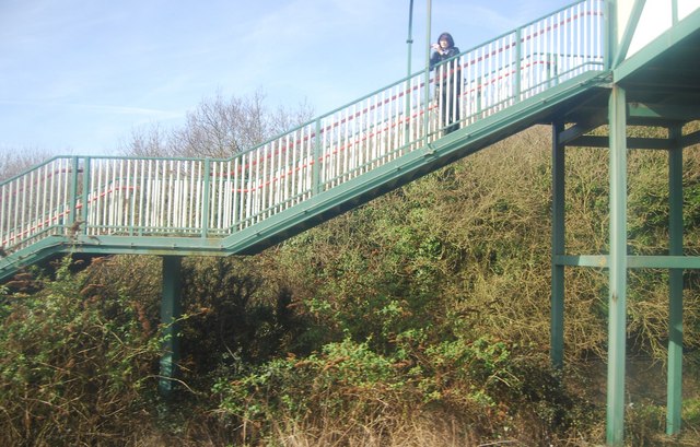
Photographing trains from the footbridge!
Weather for this location
Next 14 daysNearby places
Useful places within 5 km
Own or manage this place?
Claim this listing to keep details accurate, add photos, and highlight what makes it special — free.
Claim this page→How useful was the information on this page?
id: 986f02f2-b1d8-48fb-9d15-6a09240a035d
2025
2025
Trichocera rufescensTrichocera rufescens2025Trichocera rufescensTrichocera rufescens2025Dixa submaculataDixa submaculata2025Dixa submaculataDixa submaculata2025Common ReedPhragmites australisCommon ReedPhragmites australisOxeye DaisyLeucanthemum vulgareOxeye DaisyLeucanthemum vulgareHawthornCrataegus monogyna2025HawthornCrataegus monogyna2025YewTaxus baccata2025YewTaxus baccata2025Wych ElmUlmus glabra2025Wych ElmUlmus glabra2025Common ChickweedStellaria media2025Common ChickweedStellaria media2025Evergreen OakQuercus ilex2025Evergreen OakQuercus ilex2025HazelCorylus avellana2025HazelCorylus avellana2025Horse-chestnutAesculus hippocastanum2025Horse-chestnutAesculus hippocastanum2025Pendulous SedgeCarex pendula2025Pendulous SedgeCarex pendula2025Spear ThistleCirsium vulgare2025Spear ThistleCirsium vulgare2025IvyHedera helix2025IvyHedera helix2025Common RagwortJacobaea vulgaris2025Common RagwortJacobaea vulgaris2025DandelionTaraxacum2025DandelionTaraxacum2025Garlic MustardAlliaria petiolata2025Garlic MustardAlliaria petiolata2025Common Dog-violetViola riviniana2025Common Dog-violetViola riviniana2025Hart's-TongueAsplenium scolopendrium2025Hart's-TongueAsplenium scolopendrium2025Sweet ChestnutCastanea sativa2025Sweet ChestnutCastanea sativa2025Field MapleAcer campestre2025Field MapleAcer campestre2025Winter HeliotropePetasites pyrenaicus2025Winter HeliotropePetasites pyrenaicus2025SycamoreAcer pseudoplatanus2025SycamoreAcer pseudoplatanus2025Common FleabanePulicaria dysenterica2025Common FleabanePulicaria dysenterica2025ElderSambucus nigra2025ElderSambucus nigra2025Soft Shield-fernPolystichum setiferum2025Soft Shield-fernPolystichum setiferum2025Bilbao FleabaneErigeron floribundus2025Bilbao FleabaneErigeron floribundus2025Greater PlantainPlantago major2025Greater PlantainPlantago major2025Common NettleUrtica dioica2025Common NettleUrtica dioica2025Common KnapweedCentaurea nigra2025Common KnapweedCentaurea nigra2025Pedunculate OakQuercus robur2025Pedunculate OakQuercus robur2025BurdockArctium2025BurdockArctium2025CleaversGalium aparine2025CleaversGalium aparine2025AgrimonyAgrimonia eupatoria2025AgrimonyAgrimonia eupatoria2025GroundselSenecio vulgaris2025GroundselSenecio vulgaris2025BrambleRubus fruticosus2025BrambleRubus fruticosus2025Silver BirchBetula pendula2025Silver BirchBetula pendula2025Cow ParsleyAnthriscus sylvestris2025Cow ParsleyAnthriscus sylvestris2025Wood AvensGeum urbanum2025Wood AvensGeum urbanum2025DaisyBellis perennis2025DaisyBellis perennis2025Scots PinePinus sylvestris2025Scots PinePinus sylvestris2025Barren StrawberryPotentilla sterilis2025Barren StrawberryPotentilla sterilis2025Lady-fernAthyrium filix-femina2025Lady-fernAthyrium filix-femina2025SelfhealPrunella vulgaris2025SelfhealPrunella vulgaris2025BindweedCalystegia2025BindweedCalystegia2025Events & activities nearby
Switch provider to compare local events, tours and bookable activities.