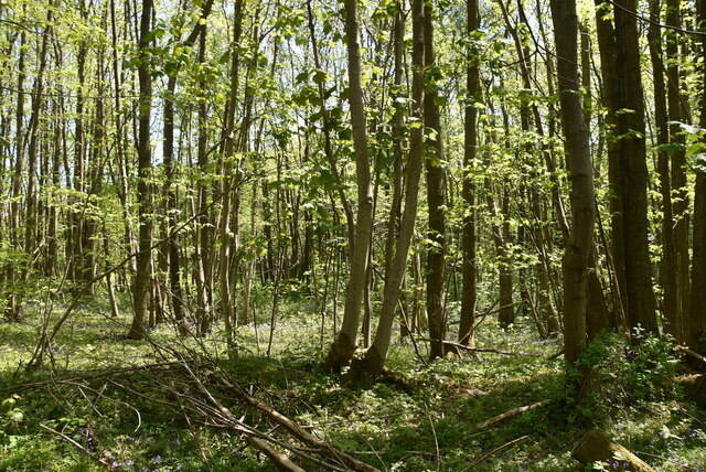
Marshall Wood - Broadleaved woodland
✦ Ancient woodland18 ha
Plan your visit
🦉Wildlife🐶Dogs🍂Seasonal
Public accessFree entryDogs welcome18 ha
Getting here
51.22778, 0.65083
Open directionsv
Visiting this summer
Seasonal nature notes and what to look for now
- 🌞Midsummer — early morning visits most comfortable; look for deer fawns in quieter clearings
- 🐕Early mornings are best for dog walks in summer — visit before 9am to avoid the heat and find quieter trails
- 📍Open access throughout summer — no booking required
🌤️ Visiting this summer
- 🌞Midsummer — early morning visits most comfortable; look for deer fawns in quieter clearings
- 🐕Early mornings are best for dog walks in summer — visit before 9am to avoid the heat and find quieter trails
- 📍Open access throughout summer — no booking required
- £Free to visit — no entry charge
- 🐕Dogs welcome
- 🌿Ancient woodland — rare wildlife habitat
Deciduous woodland priority habitat; Ancient woodland
Free
Dogs allowed — public woodland
Free
🍂Seasonal nature
Strong match
Ancient woodland — bluebells, fungi and autumn colour
Free
🦅Bird watching
Strong match
Deciduous woodland — woodpeckers, warblers and woodland birds
Free
Named cycling route nearby: NCN National Route 177 (Proposed)
Varies
Deciduous woodland — fungi, berries and wild garlic
Varies
Trails nearby
Within roughly 5 km7 signed routes nearby · 2 public paths nearby
Signed route nearbyPublic paths
Stour Valley WalkWalking route▾
Named routeListed length 82.9 kmRegional walking route
Oftord to Canterbury CathedralWalking route▾
follows North Downs Way from Otford to Broughton Lees
Named routeRegional walking route
Scenic Green Trail Section 7Walking route13.6 km▾
Named routeRef SGT7Length 13.6 kmLocal walking route
North Downs Way (Eastern)Walking route▾
Named routeNational walking route
Greensand WayWalking route▾
Named routeRef GWRegional walking route
10 signed routes nearby
Signed route nearby
NCN National Route 177 (Proposed)Cycling route▾
Named routeRef 177National Cycle Network
NCN National Route 17Cycling route▾
Named routeRef 17National Cycle Network
Main RouteCycling route321 m▾
Named routeRef 17Length 321 mNational Cycle NetworkTraffic-freeSurface asphalt
Main RouteCycling route2.8 km▾
Named routeRef 17Length 2.8 kmNational Cycle NetworkTraffic-freeSurface unsealedfirm
Main RouteCycling route5 m▾
Named routeRef 17Length 5 mNational Cycle NetworkTraffic-freeSurface asphalt
Main RouteCycling route682 m▾
Named routeRef 17Length 682 mNational Cycle NetworkTraffic-freeSurface unsealedfirm
3 public paths nearby
Public paths
Water Lanebyway open to all traffic · 441 m▾
Public pathbyway open to all trafficLength 441 mPath type: track
Weather for this location
Next 14 daysNearby places
Useful places within 5 km
Own or manage this place?
Claim this listing to keep details accurate, add photos, and highlight what makes it special — free.
Claim this page→How useful was the information on this page?
id: 075e5dfd-6345-407e-a0ea-d71cdc076697
Wildlife to spot
4,785 records · National Biodiversity Network
Wildlife to spot
4,785 records · National Biodiversity Network🐦Birds10 species
winterspringsummer
2025▾
Little Egret · Little Owl · Blackcap · Redwing · Robin +5
- Little EgretEgretta garzetta2023
- Little OwlAthene noctua
- BlackcapSylvia atricapilla
- RedwingTurdus iliacus
- RobinErithacus rubecula2023
- SwiftApus apus2023
- StarlingSturnus vulgaris2023
- MagpiePica pica2023
- PheasantPhasianus colchicus2023
- SwallowHirundo rustica2023
🦌Mammals15 species
springsummerautumnwinter
2026▾
Grey Squirrel · Rabbit · Brown Rat · Hedgehog · Badger +10
- Grey SquirrelSciurus carolinensis
- RabbitOryctolagus cuniculus2025
- Brown RatRattus norvegicus
- HedgehogErinaceus europaeus
- BadgerMeles meles2025
Golden-ringed Dragonfly · Emperor Dragonfly · Graphopsocus cruciatus · Lesser Stag Beetle · Rosemary Beetle
- Golden-ringed DragonflyCordulegaster boltonii
- Emperor DragonflyAnax imperator
- Graphopsocus cruciatusGraphopsocus cruciatus2023
- Lesser Stag BeetleDorcus parallelipipedus2022
- Rosemary BeetleChrysolina americana2021
Capillary Thread-moss · Flat Neckera · Green Yoke-moss · Grey-cushioned Grimmia · Common Feather-moss +22
- Capillary Thread-mossBryum capillare
- Flat NeckeraNeckera complanata
- Green Yoke-mossZygodon viridissimus
- Grey-cushioned GrimmiaGrimmia pulvinata
- Common Feather-mossKindbergia praelonga
- Silky Wall Feather-mossHomalothecium sericeum
- Fox-tail Feather-moss
Species observations from the last 10 years via NBN Atlas
Thamnobryum alopecurum
Thamnobryum alopecurum
Streblotrichum convolutumStreblotrichum convolutumStreblotrichum convolutumStreblotrichum convolutumForked VeilwortMetzgeria furcataForked VeilwortMetzgeria furcataGreat Hairy Screw-mossSyntrichia ruralisGreat Hairy Screw-mossSyntrichia ruralisWood Bristle-mossLewinskya affinisWood Bristle-mossLewinskya affinisCommon Striated Feather-mossEurhynchium striatumCommon Striated Feather-mossEurhynchium striatumTender Feather-mossRhynchostegiella tenellaTender Feather-mossRhynchostegiella tenellaHart's-tongue Thyme-mossPlagiomnium undulatumHart's-tongue Thyme-mossPlagiomnium undulatumRough-stalked Feather-mossBrachythecium rutabulumRough-stalked Feather-mossBrachythecium rutabulumCylindric Beard-mossDidymodon insulanusCylindric Beard-mossDidymodon insulanusWavy Beard-mossDidymodon sinuosusWavy Beard-mossDidymodon sinuosusBird's-claw Beard-mossBarbula unguiculataBird's-claw Beard-mossBarbula unguiculataLateral CryphaeaCryphaea heteromallaLateral CryphaeaCryphaea heteromallaLyell's Bristle-mossPulvigera lyelliiLyell's Bristle-mossPulvigera lyelliiClustered Feather-mossRhynchostegium confertumClustered Feather-mossRhynchostegium confertumCypress-leaved Plait-mossHypnum cupressiformeCypress-leaved Plait-mossHypnum cupressiformeSoft-tufted Beard-mossDidymodon vinealisSoft-tufted Beard-mossDidymodon vinealisWall Screw-mossTortula muralisWall Screw-mossTortula muralisLong-beaked Water Feather-mossRhynchostegium riparioidesLong-beaked Water Feather-mossRhynchostegium riparioidesWall ScalewortPorella platyphyllaWall ScalewortPorella platyphyllaIntermediate Screw-mossSyntrichia montanaIntermediate Screw-mossSyntrichia montanaEvents & activities nearby
Switch provider to compare local events, tours and bookable activities.