Plan your visit
🦉 Wildlife🦅 Birds🌿 Foraging
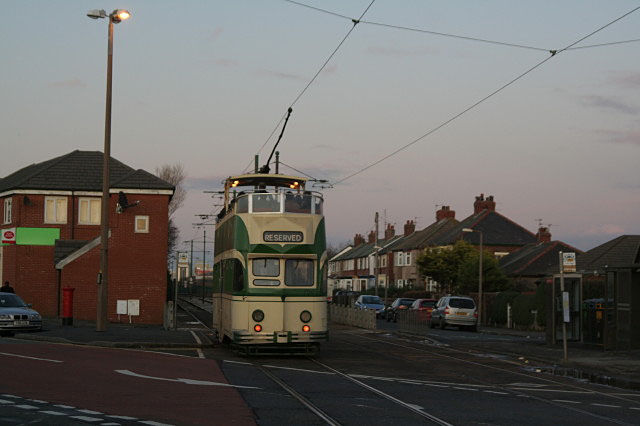
Public access Free entry Dogs welcome 4 ha
Places › England › North West › Wyre Getting here
53.90334, -3.02897
Open directionsv Visiting this summer
Seasonal nature notes and what to look for now
▾ 🌞 Midsummer — early morning visits most comfortable; look for deer fawns in quieter clearings 🌿 Foraging is at its best in summer here 🐕 Dogs welcome — bring water in summer; the site has enough space to find shade on hot days 🌤️ Visiting this summer
🌞 Midsummer — early morning visits most comfortable; look for deer fawns in quieter clearings 🌿 Foraging is at its best in summer here 🐕 Dogs welcome — bring water in summer; the site has enough space to find shade on hot days £ Free to visit — no entry charge🐕 Dogs welcome🦉 Wildlife
Very strong match
Multi-group wildlife — Amphibians, Birds, Mammals; Multi-group wildlife — Amphibians, Birds, Mammals
Free
🦅 Bird watching
Very strong match
Birds — Woodpigeon, Magpie, Goldfinch +85 more · last seen 2026; Birds — Woodpigeon, Magpie, Goldfinch +85 more · last seen 2026
Free
Plants — Hogweed, Elder, Blackthorn +16 more foraging species; Deciduous woodland — fungi, berries and wild garlic
Varies
🍂 Seasonal nature
Strong match
Plants — Creeping Thistle, Common Bird's-foot-trefoil, Yarrow +182 more · last seen 2026; Plants — Creeping Thistle, Common Bird's-foot-trefoil, Yarrow +182 more · last seen 2026
Free
Dogs allowed — public woodland
Free
🦋 Insect spotting
Strong match
Insects — Buff-tailed Bumblebee, Red-tailed Bumblebee, Hornet Hoverfly +24 more · last seen 2025; Insects — Buff-tailed Bumblebee, Red-tailed Bumblebee, Hornet Hoverfly +24 more · last seen 2025
Free
Trails nearby Within roughly 5 km 3 signed routes nearby
Signed route nearby
Lancashire Coastal Way Walking route ▾
Named route Listed length 220km Regional walking route
Show on map Wyre Way (Fleetwood Peninsula Loop) Walking route ▾
Named route Round trip Regional walking route
Show on map Wyre Way (Shard Bridge to Garstang) Walking route ▾
Named route Point-to-point Regional walking route
Show on map 22 signed routes nearby
Signed route nearby
Knott End Cycling route ▾
Named route Ref 5 Local cycle route
Show on map Seashell Way Cycling route ▾
Named route Local cycle route
Show on map Route 62 Cycling route ▾
Named route Ref 62 National Cycle Network
Show on map Temporary Diversion Cycling route 721 m ▾
Named route Ref 62 Length 721 m National Cycle Network On-road Surface asphalt
Show on map Main Route Cycling route 1.7 km ▾
Named route Ref 62 Length 1.7 km National Cycle Network Traffic-free Surface asphalt
Show on map Main Route Cycling route 401 m ▾
Named route Ref 62 Length 401 m National Cycle Network Traffic-free Surface concrete
Show on map 1 public path nearby
Public paths
No named routes yet. Public paths are shown on the map.
Weather for this location Next 14 days Nearby places Useful places within 5 km
All Historic
Own or manage this place?
Claim this listing to keep details accurate, add photos, and highlight what makes it special — free.
Claim this page→ How useful was the information on this page?
id: 2e773ed6-7bf5-4989-ae09-db31b714a7ab
UK green spaces mapped from open public data — so anyone can find the woodland, trail, or nature reserve closest to them.
© 2026 Glade · Made with care for UK green spaces
Events & activities nearby Switch provider to compare local events, tours and bookable activities.
Bookable tours GetYourGuide Promote here
Wildlife to spot
27,061 records · National Biodiversity Network
▾
Wildlife to spot 27,061 records · National Biodiversity Network 🐦 Birds 20 species
summer autumn winter
2026 ▾
Mallard · Herring Gull · Turnstone · Coot · Tufted Duck +15
Mallard Anas platyrhynchos Herring Gull Larus argentatus2025 Turnstone Arenaria interpres2025 Coot Fulica atra2025 Tufted Duck Aythya fuligula2025 Magpie Pica pica Barnacle Goose Branta leucopsis Pied Wagtail Motacilla alba yarrellii2025 Cormorant Phalacrocorax carbo2025 Moorhen Gallinula chloropus2025 Black-headed Gull Chroicocephalus ridibundus2025 Long-tailed Tit Aegithalos caudatus2025 Blue Tit Cyanistes caeruleus2025 Grey Heron Ardea cinerea2025 Jackdaw Coloeus monedula2025 Robin Erithacus rubecula2025 Cetti's Warbler Cettia cetti2025 Eider Somateria mollissima2025 Starling Sturnus vulgaris2025 Lapwing Vanellus vanellus2025 Grey Squirrel
Grey Squirrel Sciurus carolinensis 🐸 Amphibians 1 species
winter
2026 ▾
Common Frog
Common Frog Rana temporaria Bronze Shieldbug · Buff-tailed Bumblebee
Bronze Shieldbug Troilus luridus Buff-tailed Bumblebee Bombus terrestris 🌿 Plants 106 species
autumn winter
2026 ▾
Yarrow · Creeping Thistle · Butterfly-bush · Hogweed · Centaurea nigra +101
Yarrow Achillea millefolium2025 Creeping Thistle Cirsium arvense2025 Butterfly-bush Buddleja davidii2025 Hogweed Heracleum sphondylium2025 Centaurea nigra Centaurea nigra2025 Species observations from the last 10 years via NBN Atlas
Annual Meadow-grass
Annual Meadow-grass
Poa annua
Poa annua
Lesser Celandine Ficaria verna
Lesser Celandine Ficaria verna
Blackthorn Prunus spinosa
Blackthorn Prunus spinosa
Hart's-Tongue Asplenium scolopendrium
Hart's-Tongue Asplenium scolopendrium
Daisy Bellis perennis
Daisy Bellis perennis
Wild Carrot Daucus carota2025
Wild Carrot Daucus carota2025
Viper's-bugloss Echium vulgare2025
Viper's-bugloss Echium vulgare2025
Elder Sambucus nigra2025
Elder Sambucus nigra2025
Cat's-ear Hypochaeris radicata2025
Cat's-ear Hypochaeris radicata2025
Mugwort Artemisia vulgaris2025
Mugwort Artemisia vulgaris2025
Common Ragwort Jacobaea vulgaris2025
Common Ragwort Jacobaea vulgaris2025
Sea Campion Silene uniflora2025
Sea Campion Silene uniflora2025
Lady's Bedstraw Galium verum2025
Lady's Bedstraw Galium verum2025
Coltsfoot Tussilago farfara
Coltsfoot Tussilago farfara
Curled Dock Rumex crispus
Curled Dock Rumex crispus
Senecio vulgaris subsp. vulgaris Senecio vulgaris subsp. vulgaris
Senecio vulgaris subsp. vulgaris Senecio vulgaris subsp. vulgaris
Ivy Hedera helix
Ivy Hedera helix
Broad-leaved Dock Rumex obtusifolius
Broad-leaved Dock Rumex obtusifolius
Common Nettle Urtica dioica
Common Nettle Urtica dioica
Italian Lords-and-Ladies Arum italicum
Italian Lords-and-Ladies Arum italicum
Gorse Ulex europaeus2025
Gorse Ulex europaeus2025
Perennial Rye-grass Lolium perenne2025
Perennial Rye-grass Lolium perenne2025
Hedge Mustard Sisymbrium officinale2025
Hedge Mustard Sisymbrium officinale2025
Sea Radish Raphanus raphanistrum subsp. maritimus2025
Sea Radish Raphanus raphanistrum subsp. maritimus2025
Cock's-foot Dactylis glomerata2025
Cock's-foot Dactylis glomerata2025
Sea Beet Beta vulgaris subsp. maritima2025
Sea Beet Beta vulgaris subsp. maritima2025
Wild Teasel Dipsacus fullonum2025
Wild Teasel Dipsacus fullonum2025
Ash Fraxinus excelsior2025
Ash Fraxinus excelsior2025
Perennial Sow-thistle Sonchus arvensis2025
Perennial Sow-thistle Sonchus arvensis2025
Common Fleabane Pulicaria dysenterica2025
Common Fleabane Pulicaria dysenterica2025
Flowering Currant Ribes sanguineum2025
Flowering Currant Ribes sanguineum2025
Hemp-agrimony Eupatorium cannabinum2025
Hemp-agrimony Eupatorium cannabinum2025
Tansy Tanacetum vulgare
Tansy Tanacetum vulgare
Petty Spurge Euphorbia peplus
Petty Spurge Euphorbia peplus
Cleavers Galium aparine
Cleavers Galium aparine
Sowbread Cyclamen hederifolium
Sowbread Cyclamen hederifolium
Holly Ilex aquifolium
Holly Ilex aquifolium
Snowdrop Galanthus nivalis
Snowdrop Galanthus nivalis
Evergreen Spindle Euonymus japonicus
Evergreen Spindle Euonymus japonicus
Beech Fagus sylvatica
Beech Fagus sylvatica
Spotted-laurel Aucuba japonica
Spotted-laurel Aucuba japonica
Arrow Bamboo Pseudosasa japonica
Arrow Bamboo Pseudosasa japonica
Cowslip Primula veris
Cowslip Primula veris
Yew Taxus baccata
Yew Taxus baccata
Prunus cerasifera var. cerasifera Prunus cerasifera var. cerasifera
Prunus cerasifera var. cerasifera Prunus cerasifera var. cerasifera
Horse-chestnut Aesculus hippocastanum
Horse-chestnut Aesculus hippocastanum
Sea-purslane Atriplex portulacoides2025
Sea-purslane Atriplex portulacoides2025
Biting Stonecrop Sedum acre2025
Biting Stonecrop Sedum acre2025
Laurustinus Viburnum tinus2025
Laurustinus Viburnum tinus2025
Red Dead-nettle Lamium purpureum2025
Red Dead-nettle Lamium purpureum2025
Wall Cotoneaster Cotoneaster horizontalis2025
Wall Cotoneaster Cotoneaster horizontalis2025
Japanese Rose Rosa rugosa2025
Japanese Rose Rosa rugosa2025
Cow Parsley Anthriscus sylvestris2025
Cow Parsley Anthriscus sylvestris2025
Sea Club-rush Bolboschoenus maritimus2025
Sea Club-rush Bolboschoenus maritimus2025
Sycamore Acer pseudoplatanus2025
Sycamore Acer pseudoplatanus2025
Scots Pine Pinus sylvestris2025
Scots Pine Pinus sylvestris2025
Honeysuckle Lonicera periclymenum2025
Honeysuckle Lonicera periclymenum2025
Rosa canina Rosa canina2025
Rosa canina Rosa canina2025
Taxus baccata f. baccata Taxus baccata f. baccata2025
Taxus baccata f. baccata Taxus baccata f. baccata2025
Bristly Oxtongue Helminthotheca echioides2025
Bristly Oxtongue Helminthotheca echioides2025
Garden Privet Ligustrum ovalifolium2025
Garden Privet Ligustrum ovalifolium2025
Soft Shield-fern Polystichum setiferum2025
Soft Shield-fern Polystichum setiferum2025
New Zealand Broadleaf Griselinia littoralis2025
New Zealand Broadleaf Griselinia littoralis2025
Spear Thistle Cirsium vulgare2025
Spear Thistle Cirsium vulgare2025
Sticky Mouse-ear Cerastium glomeratum2025
Sticky Mouse-ear Cerastium glomeratum2025
Pendulous Sedge Carex pendula2025
Pendulous Sedge Carex pendula2025
Apple Malus domestica2025
Apple Malus domestica2025
Purple-loosestrife Lythrum salicaria2025
Purple-loosestrife Lythrum salicaria2025
Common Toadflax Linaria vulgaris2025
Common Toadflax Linaria vulgaris2025
Bramble Rubus fruticosus2025
Bramble Rubus fruticosus2025
Sea-Milkwort Lysimachia maritima2025
Sea-Milkwort Lysimachia maritima2025
Sea Mayweed Tripleurospermum maritimum2025
Sea Mayweed Tripleurospermum maritimum2025
Aster agg. Aster agg.2025
Aster agg. Aster agg.2025
Nipplewort Lapsana communis2025
Nipplewort Lapsana communis2025
Red Campion Silene dioica2025
Red Campion Silene dioica2025
Goat Willow Salix caprea2025
Goat Willow Salix caprea2025
False Oat-grass Arrhenatherum elatius2025
False Oat-grass Arrhenatherum elatius2025
Tall Fescue Schedonorus arundinaceus2025
Tall Fescue Schedonorus arundinaceus2025
Annual Sea-blite Suaeda maritima2025
Annual Sea-blite Suaeda maritima2025
Sea Arrowgrass Triglochin maritima2025
Sea Arrowgrass Triglochin maritima2025
Kidney Vetch Anthyllis vulneraria2025
Kidney Vetch Anthyllis vulneraria2025
Hare's-foot Clover Trifolium arvense2025
Hare's-foot Clover Trifolium arvense2025
Common Stork's-bill Erodium cicutarium2025
Common Stork's-bill Erodium cicutarium2025
Blue Fleabane Erigeron acris2025
Blue Fleabane Erigeron acris2025
Amphibious Bistort Persicaria amphibia2025
Amphibious Bistort Persicaria amphibia2025
Ribwort Plantain Plantago lanceolata2025
Ribwort Plantain Plantago lanceolata2025
Lyme-grass Leymus arenarius2025
Lyme-grass Leymus arenarius2025
Austrian Pine Pinus nigra2025
Austrian Pine Pinus nigra2025
Musk-mallow Malva moschata2025
Musk-mallow Malva moschata2025
White Campion Silene latifolia2025
White Campion Silene latifolia2025
Hedge Bedstraw Galium album2025
Hedge Bedstraw Galium album2025
Red Clover Trifolium pratense2025
Red Clover Trifolium pratense2025
Procumbent Pearlwort Sagina procumbens2025
Procumbent Pearlwort Sagina procumbens2025
Wild Mignonette Reseda lutea2025
Wild Mignonette Reseda lutea2025
White Poplar Populus alba2025
White Poplar Populus alba2025
Knotgrass Polygonum aviculare2025
Knotgrass Polygonum aviculare2025
Bloody Crane's-bill Geranium sanguineum2025
Bloody Crane's-bill Geranium sanguineum2025
Smooth Sow-thistle Sonchus oleraceus2025
Smooth Sow-thistle Sonchus oleraceus2025
Scentless Mayweed Tripleurospermum inodorum2025
Scentless Mayweed Tripleurospermum inodorum2025
Common Bird's-foot-trefoil Lotus corniculatus2025
Common Bird's-foot-trefoil Lotus corniculatus2025
Russian-vine Fallopia baldschuanica2025
Russian-vine Fallopia baldschuanica2025