🦉 Wildlife🦅 Birds🍄 Fungi
↑ Share
Public access Free entry Dogs welcome 23 ha
Places › England › South West › East Devon Getting here
50.71391, -3.20936
Open directionsv Visiting this summer
Seasonal nature notes and what to look for now
▾ 🌞 Midsummer — early morning visits most comfortable; look for deer fawns in quieter clearings 🍄 Mushroom foraging is at its best in summer here 🐕 Dogs welcome — bring water in summer; the site has enough space to find shade on hot days 🌤️ Visiting this summer
🌞 Midsummer — early morning visits most comfortable; look for deer fawns in quieter clearings 🍄 Mushroom foraging is at its best in summer here 🐕 Dogs welcome — bring water in summer; the site has enough space to find shade on hot days £ Free to visit — no entry charge🐕 Dogs welcome🦉 Wildlife
Very strong match
Multi-group wildlife — Amphibians, Birds, Mammals, Reptiles; Multi-group wildlife — Amphibians, Birds, Mammals, Reptiles
Free
🦅 Bird watching
Very strong match
Birds — Robin, Blackbird, Woodpigeon +62 more · last seen 2025; Birds — Robin, Blackbird, Woodpigeon +62 more · last seen 2025
Free
🍄 Mushroom foraging
Strong match
Fungi — Hairy Curtain Crust, Turkeytail, Ochre Brittlegill +134 more · last seen 2025; Fungi — Hairy Curtain Crust, Turkeytail, Ochre Brittlegill +134 more · last seen 2025
Varies
Fungi — False Chanterelle, Beech Milkcap, Beechwood Sickener +16 more foraging species; Deciduous woodland — fungi, berries and wild garlic
Varies
🍂 Seasonal nature
Strong match
Plants — Ivy, Common Nettle, Creeping Buttercup +30 more · last seen 2025; Plants — Ivy, Common Nettle, Creeping Buttercup +30 more · last seen 2025
Free
Dogs allowed — public woodland
Free
Trails nearby Within roughly 5 km 6 signed routes nearby · 7 public paths nearby
Signed route nearby Public paths
East Devon Way Walking route ▾
Named route Ref EDW Listed length 61km Regional walking route
Show on map Coleridge Link Walking route 14.5 km ▾
A circular route in the Otter Valley.
Named route Ref COL Length 14.5 km Local walking route
Show on map South West Coast Path (Section 44: Exmouth to Sidmouth) Walking route ▾
Named route Ref SWCP National walking route
Show on map South West Coast Path (Section 45: Sidmouth to Seaton) Walking route ▾
Named route Ref SWCP National walking route
Show on map Orange Way Walking route 560 km ▾
Named route Ref ORW Length 560 km Regional walking route
Show on map 22 signed routes nearby
Signed route nearby
Route 248 Cycling route ▾
Named route Ref 248 National Cycle Network
Show on map National Cycle Route 2 Axminster to Dawlish Cycling route ▾
Named route Ref 2 National Cycle Network
Show on map N/A Cycling route 481 m ▾
Named route Length 481 m National Cycle Network On-road Surface asphalt
Show on map Main Route Cycling route 436 m ▾
Named route Ref 2 Length 436 m National Cycle Network On-road Surface asphalt
Show on map Main Route Cycling route 202 m ▾
Named route Ref 2 Length 202 m National Cycle Network On-road Surface asphalt
Show on map Main Route Cycling route 314 m ▾
Named route Ref 2 Length 314 m National Cycle Network On-road Surface asphalt
Show on map 8 public paths nearby
Public paths
No named routes yet. Public paths are shown on the map.
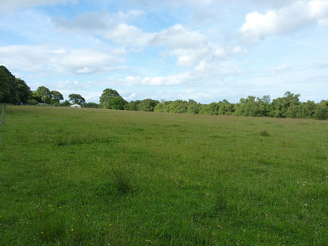
Photos Open field on Buckley Plain
‹ ›
Weather for this location Next 14 days Nearby places Useful places within 5 km
All Historic
Own or manage this place?
Claim this listing to keep details accurate, add photos, and highlight what makes it special — free.
Claim this page→ How useful was the information on this page?
Something wrong on this page?
id: dbaeb704-1232-4479-9332-ac1fcd6a8f01
UK green spaces mapped from open public data — so anyone can find the woodland, trail, or nature reserve closest to them.
© 2026 Glade · Made with care for UK green spaces
Events & activities nearby Switch provider to compare local events, tours and bookable activities.
Bookable tours GetYourGuide Promote here
Wildlife to spot
8,333 records · National Biodiversity Network
▾
Wildlife to spot 8,333 records · National Biodiversity Network Blackbird · Robin · Woodpigeon · Carrion Crow · Great Tit +30
Blackbird Turdus merula Robin Erithacus rubecula Woodpigeon Columba palumbus Carrion Crow Corvus corone Great Tit Parus major Wren Troglodytes troglodytes Magpie Pica pica Herring Gull Larus argentatus Chaffinch Fringilla coelebs Dunnock Prunella modularis Rook Corvus frugilegus Pheasant Phasianus colchicus House Sparrow Passer domesticus Blue Tit Cyanistes caeruleus Collared Dove Streptopelia decaocto Stock Dove Columba oenas Greenfinch Chloris chloris Linnet Linaria cannabina Long-tailed Tit Aegithalos caudatus Song Thrush Turdus philomelos Goldfinch Carduelis carduelis Starling Sturnus vulgaris Kestrel Falco tinnunculus Rock Dove Columba livia Green Woodpecker Picus viridis Fieldfare Turdus pilaris Mallard Anas platyrhynchos Yellowhammer Emberiza citrinella Great Spotted Woodpecker Dendrocopos major Turnstone Arenaria interpres Pied Wagtail Motacilla alba Mistle Thrush Turdus viscivorus Yellow Wagtail Motacilla flava Blackcap Sylvia atricapilla Chiffchaff Phylloscopus collybita Grey Squirrel
Grey Squirrel Sciurus carolinensis 🐸 Amphibians 1 species
winter summer
2026 ▾
Common Frog
Common Frog Rana temporaria Green Shieldbug · 7-spot Ladybird · Muscina prolapsa · Vagrant Emperor · River Skater +5
Green Shieldbug Palomena prasina2025 7-spot Ladybird Coccinella septempunctata Muscina prolapsa Muscina prolapsa Vagrant Emperor Anax ephippiger2025 River Skater Aquarius najas2025 Harlequin Ladybird Harmonia axyridis2025 Deceiver · White Saddle · Wood Blewits · Oak Toothcrust · Liver Milkcap +43
Deceiver Laccaria laccata White Saddle Helvella crispa Wood Blewits Lepista nuda Oak Toothcrust Radulomyces molaris Liver Milkcap Lactarius hepaticus Violet Bramble Rust Phragmidium violaceum Candlesnuff Fungus Xylaria hypoxylon 🌿 Plants 28 species
spring summer
2025 ▾
Ivy · Common Nettle · Bugle · Marsh Woundwort · Bramble +23
Ivy Hedera helix Common Nettle Urtica dioica Bugle Ajuga reptans Marsh Woundwort Stachys palustris Bramble Rubus fruticosus Wood Avens Geum urbanum Marsh Violet Species observations from the last 10 years via NBN Atlas
Melanostoma scalare Melanostoma scalare2025
Melanostoma scalare Melanostoma scalare2025
Common Red Soldier Beetle Rhagonycha fulva2025
Common Red Soldier Beetle Rhagonycha fulva2025
Meadow Grasshopper Pseudochorthippus parallelus2025
Meadow Grasshopper Pseudochorthippus parallelus2025
Eristalis nemorum Eristalis nemorum2025
Eristalis nemorum Eristalis nemorum2025
Brown Birch Bolete Leccinum scabrum
Brown Birch Bolete Leccinum scabrum
Purple Brittlegill Russula atropurpurea
Purple Brittlegill Russula atropurpurea
Bay Bolete Imleria badia
Bay Bolete Imleria badia
Rooting Shank Hymenopellis radicata
Rooting Shank Hymenopellis radicata
Collybia dorotheae Collybia dorotheae
Collybia dorotheae Collybia dorotheae
Beech Milkcap Lactarius blennius
Beech Milkcap Lactarius blennius
Amanita'r Gwybed Amanita muscaria
Amanita'r Gwybed Amanita muscaria
False Chanterelle Hygrophoropsis aurantiaca
False Chanterelle Hygrophoropsis aurantiaca
Bovine Bolete Suillus bovinus
Bovine Bolete Suillus bovinus
Beech Tarcrust Biscogniauxia nummularia
Beech Tarcrust Biscogniauxia nummularia
Red Cracking Bolete Xerocomellus chrysenteron
Red Cracking Bolete Xerocomellus chrysenteron
Sepia Bolete Xerocomellus porosporus
Sepia Bolete Xerocomellus porosporus
Dwarf Shield Pluteus nanus
Dwarf Shield Pluteus nanus
Powdery Brittlegill Russula parazurea
Powdery Brittlegill Russula parazurea
Common Bonnet Mycena galericulata
Common Bonnet Mycena galericulata
Grey Spotted Amanita Amanita excelsa var. spissa
Grey Spotted Amanita Amanita excelsa var. spissa
False Deathcap Amanita citrina var. citrina
False Deathcap Amanita citrina var. citrina
Turkeytail Trametes versicolor
Turkeytail Trametes versicolor
Smoky Bracket Bjerkandera adusta
Smoky Bracket Bjerkandera adusta
Hairy Curtain Crust Stereum hirsutum
Hairy Curtain Crust Stereum hirsutum
Snapping Bonnet Mycena vitilis
Snapping Bonnet Mycena vitilis
Hazel Bracket Skeletocutis semipileata
Hazel Bracket Skeletocutis semipileata
Primrose Brittlegill Russula sardonia
Primrose Brittlegill Russula sardonia
Spectacular Rustgill Gymnopilus junonius
Spectacular Rustgill Gymnopilus junonius
Snakeskin Grisette Amanita ceciliae
Snakeskin Grisette Amanita ceciliae
Porcelain Fungus Mucidula mucida
Porcelain Fungus Mucidula mucida
Amanita Wridog Amanita rubescens
Amanita Wridog Amanita rubescens
Deer Shield Pluteus cervinus
Deer Shield Pluteus cervinus
Honey Fungus Armillaria mellea
Honey Fungus Armillaria mellea
Wrinkled Crust Phlebia radiata
Wrinkled Crust Phlebia radiata
Trooping Funnel Infundibulicybe geotropa
Trooping Funnel Infundibulicybe geotropa
Penny Bun Boletus edulis
Penny Bun Boletus edulis
Ganoderma adspersum Ganoderma adspersum
Ganoderma adspersum Ganoderma adspersum
Razor Strop Fungus Fomitopsis betulina
Razor Strop Fungus Fomitopsis betulina
Dryad's Saddle Polyporus squamosus
Dryad's Saddle Polyporus squamosus
Grooved Bonnet Mycena polygramma
Grooved Bonnet Mycena polygramma
Ochre Brittlegill Russula ochroleuca
Ochre Brittlegill Russula ochroleuca
Brown Rollrim Paxillus involutus
Brown Rollrim Paxillus involutus
Beechwood Sickener Russula nobilis
Beechwood Sickener Russula nobilis
Split Porecrust Schizopora paradoxa
Split Porecrust Schizopora paradoxa
Mild Milkcap Lactarius subdulcis
Mild Milkcap Lactarius subdulcis Viola palustris
Viola palustris
Bittersweet Solanum dulcamara
Bittersweet Solanum dulcamara
Common Sorrel Rumex acetosa
Common Sorrel Rumex acetosa
Water Mint Mentha aquatica
Water Mint Mentha aquatica
Hawthorn Crataegus monogyna
Hawthorn Crataegus monogyna
Holly Ilex aquifolium
Holly Ilex aquifolium
Hogweed Heracleum sphondylium
Hogweed Heracleum sphondylium
Hart's-Tongue Asplenium scolopendrium
Hart's-Tongue Asplenium scolopendrium
Hard Rush / Soft Rush / Compact Rush Juncus inflexus/effusus/conglomeratus
Hard Rush / Soft Rush / Compact Rush Juncus inflexus/effusus/conglomeratus
Wood Speedwell Veronica montana
Wood Speedwell Veronica montana
Blackthorn Prunus spinosa
Blackthorn Prunus spinosa
Hazel Corylus avellana
Hazel Corylus avellana
Cleavers Galium aparine
Cleavers Galium aparine
Rough Chervil Chaerophyllum temulum
Rough Chervil Chaerophyllum temulum
Creeping Buttercup Ranunculus repens
Creeping Buttercup Ranunculus repens
Dog's Mercury Mercurialis perennis
Dog's Mercury Mercurialis perennis
Fool's Water-Cress Helosciadium nodiflorum
Fool's Water-Cress Helosciadium nodiflorum
Pignut Conopodium majus
Pignut Conopodium majus
Yorkshire-fog Holcus lanatus
Yorkshire-fog Holcus lanatus
Water Cress Nasturtium officinale
Water Cress Nasturtium officinale
Cow Parsley Anthriscus sylvestris
Cow Parsley Anthriscus sylvestris
Bluebell Hyacinthoides non-scripta
Bluebell Hyacinthoides non-scripta