Buckworth Wood ✦ Ancient woodland 9 ha
🦉 Wildlife🍄 Fungi🍂 Seasonal
↑ Share
Public access Free entry Dogs welcome 9 ha
Places › England › Eastern › Huntingdonshire Getting here
52.37624, -0.33032
Open directionsv Visiting this summer
Seasonal nature notes and what to look for now
▾ 🌞 Midsummer — early morning visits most comfortable; look for deer fawns in quieter clearings 🍄 Mushroom foraging is at its best in summer here 🐕 Dogs welcome — bring water in summer; the site has enough space to find shade on hot days 🌤️ Visiting this summer
🌞 Midsummer — early morning visits most comfortable; look for deer fawns in quieter clearings 🍄 Mushroom foraging is at its best in summer here 🐕 Dogs welcome — bring water in summer; the site has enough space to find shade on hot days £ Free to visit — no entry charge🐕 Dogs welcome🌿 Ancient woodland — rare wildlife habitat🦉 Wildlife
Very strong match
Multi-group wildlife — Amphibians, Birds, Mammals; Multi-group wildlife — Amphibians, Birds, Mammals
Free
🍄 Mushroom foraging
Strong match
Fungi — Flavoplaca oasis, Verrucaria, Polycauliona ucrainica +86 more · last seen 2015; Fungi — Flavoplaca oasis, Verrucaria, Polycauliona ucrainica +86 more · last seen 2015
Varies
🍂 Seasonal nature
Strong match
Ancient woodland — bluebells, fungi and autumn colour; Plants — Forked Veilwort, Even Scalewort, Dilated Scalewort +69 more · last seen 2022
Free
🦅 Bird watching
Strong match
Birds — Spotted Flycatcher, Goldfinch, Blackbird +17 more · last seen 2018; Birds — Spotted Flycatcher, Goldfinch, Blackbird +17 more · last seen 2018
Free
🦋 Insect spotting
Strong match
Insects — Setaceous Hebrew Character, Flounced Rustic, Snout +175 more · last seen 2025; Insects — Setaceous Hebrew Character, Flounced Rustic, Snout +175 more · last seen 2025
Free
Dogs allowed — public woodland
Free
Trails nearby Within roughly 5 km 1 signed route nearby · 1 public path nearby
Signed route nearby Public paths
Three Shires Way Walking route 79 km ▾
49 mile route liking the Swan's Way to the Grafham Water circular walk, which it now incorporates, made up largely of bridleways.
Named route Length 79 km Regional walking route
Show on map 8 signed routes nearby
Signed route nearby
National Byway (through Ely) Cycling route ▾
Named route Ref NB Regional cycle route
Show on map Route 12 Cycling route ▾
Named route Ref 12 National Cycle Network
Show on map Main Route Cycling route 163 m ▾
Named route Ref 12 Length 163 m National Cycle Network On-road Surface asphalt
Show on map Main Route Cycling route 378 m ▾
Named route Ref 12 Length 378 m National Cycle Network Traffic-free Surface asphalt
Show on map Main Route Cycling route 9.3 km ▾
Named route Ref 12 Length 9.3 km National Cycle Network On-road Surface asphalt
Show on map Main Route Cycling route 302 m ▾
Named route Ref 12 Length 302 m National Cycle Network On-road Surface asphalt
Show on map 6 public paths nearby
Public paths
No named routes yet. Public paths are shown on the map.
✦ Ancient woodland — continuously wooded since at least 1600 AD. A rare and irreplaceable habitat, rich in biodiversity and historical character.
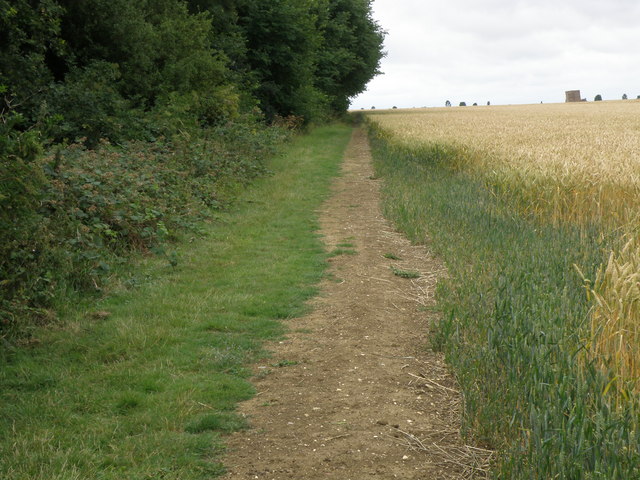
Photos Path beside Buckworth wood
‹ ›
Weather for this location Next 14 days Nearby places Useful places within 5 km
All Historic
Own or manage this place?
Claim this listing to keep details accurate, add photos, and highlight what makes it special — free.
Claim this page→ How useful was the information on this page?
Something wrong on this page?
id: 808a2182-6536-40d9-999e-d75960d2088f
UK green spaces mapped from open public data — so anyone can find the woodland, trail, or nature reserve closest to them.
© 2026 Glade · Made with care for UK green spaces
Wildlife to spot
1,413 records · National Biodiversity Network
▾
Wildlife to spot 1,413 records · National Biodiversity Network Willow Warbler
Willow Warbler Phylloscopus trochilus 🦌 Mammals 7 species
spring summer
2024 ▾
Hedgehog · Common Pipistrelle · Common Shrew · Brown Hare · Muntjac +2
Hedgehog Erinaceus europaeus2020 Common Pipistrelle Pipistrellus pipistrellus Common Shrew Sorex araneus2022 Brown Hare Lepus europaeus2021 Muntjac Muntiacus reevesi2018 Rabbit Oryctolagus cuniculus2018 Badger Meles meles2018 🐸 Amphibians 1 species
spring
2021 ▾
Great Crested Newt
Great Crested Newt Triturus cristatus Lesser-spotted Pinion · Lesser Broad-bordered Yellow Underwing · Common Carpet · Straw Dot · White-spotted Pinion +43
Lesser-spotted Pinion Cosmia affinis2019 Lesser Broad-bordered Yellow Underwing Noctua janthe2019 Common Carpet Epirrhoe alternata2019 Straw Dot Rivula sericealis2019 White-spotted Pinion Cosmia diffinis2019 Dingy Footman Dilated Scalewort · Forked Veilwort · Even Scalewort · White-tipped Bristle-moss · Variable-leaved Crestwort +67
Dilated Scalewort Frullania dilatata2020 Forked Veilwort Metzgeria furcata2020 Even Scalewort Radula complanata2020 White-tipped Bristle-moss Orthotrichum diaphanum2020 Variable-leaved Crestwort Lophocolea heterophylla2020 Wood Bristle-moss Species observations from the last 10 years via NBN Atlas
Eilema griseola2019
Eilema griseola2019
Streamer Anticlea derivata2019
Streamer Anticlea derivata2019
Ringlet Aphantopus hyperantus2018
Ringlet Aphantopus hyperantus2018
Purple Hairstreak Favonius quercus2018
Purple Hairstreak Favonius quercus2018
Large White Pieris brassicae2018
Large White Pieris brassicae2018
Pea-leaf Weevil Sitona lineatus
Pea-leaf Weevil Sitona lineatus
Eristalis tenax Eristalis tenax2024
Eristalis tenax Eristalis tenax2024
Cantharis livida Cantharis livida2024
Cantharis livida Cantharis livida2024
Nicrophorus vespilloides Nicrophorus vespilloides2020
Nicrophorus vespilloides Nicrophorus vespilloides2020
Marsh Snipefly Rhagio tringarius2020
Marsh Snipefly Rhagio tringarius2020
Sprawler Asteroscopus sphinx2019
Sprawler Asteroscopus sphinx2019
November Moth agg. Epirrita dilutata agg.2019
November Moth agg. Epirrita dilutata agg.2019
Green-brindled Crescent Allophyes oxyacanthae2019
Green-brindled Crescent Allophyes oxyacanthae2019
Dusky Sallow Eremobia ochroleuca2019
Dusky Sallow Eremobia ochroleuca2019
Smoky Wainscot Mythimna impura2019
Smoky Wainscot Mythimna impura2019
Orange Swift Triodia sylvina2019
Orange Swift Triodia sylvina2019
Clay Mythimna ferrago2019
Clay Mythimna ferrago2019
Large Twin-spot Carpet Xanthorhoe quadrifasiata2019
Large Twin-spot Carpet Xanthorhoe quadrifasiata2019
Scorched Carpet Ligdia adustata2019
Scorched Carpet Ligdia adustata2019
Black Arches Lymantria monacha2019
Black Arches Lymantria monacha2019
Least Carpet Idaea rusticata2019
Least Carpet Idaea rusticata2019
Single-dotted Wave Idaea dimidiata2019
Single-dotted Wave Idaea dimidiata2019
Riband Wave Idaea aversata2019
Riband Wave Idaea aversata2019
Large Yellow Underwing Noctua pronuba2019
Large Yellow Underwing Noctua pronuba2019
Turnip Moth Agrotis segetum2019
Turnip Moth Agrotis segetum2019
Flame Shoulder Ochropleura plecta2019
Flame Shoulder Ochropleura plecta2019
Willow Beauty Peribatodes rhomboidaria2019
Willow Beauty Peribatodes rhomboidaria2019
Shoulder Stripe Earophila badiata2019
Shoulder Stripe Earophila badiata2019
Limnephilus marmoratus Limnephilus marmoratus2018
Limnephilus marmoratus Limnephilus marmoratus2018
Limnephilus flavicornis Limnephilus flavicornis2018
Limnephilus flavicornis Limnephilus flavicornis2018
Oecetis ochracea Oecetis ochracea2018
Oecetis ochracea Oecetis ochracea2018
Limnephilus lunatus Limnephilus lunatus2018
Limnephilus lunatus Limnephilus lunatus2018
Small Skipper Thymelicus sylvestris2018
Small Skipper Thymelicus sylvestris2018
Green-veined White Pieris napi2018
Green-veined White Pieris napi2018
Gatekeeper Pyronia tithonus2018
Gatekeeper Pyronia tithonus2018
Small White Pieris rapae2018
Small White Pieris rapae2018
Peacock Aglais io2018
Peacock Aglais io2018
Meadow Brown Maniola jurtina2018
Meadow Brown Maniola jurtina2018
Winter Moth Operophtera brumata2017
Winter Moth Operophtera brumata2017
Flounced Rustic Luperina testacea2017
Flounced Rustic Luperina testacea2017
Water Carpet Lampropteryx suffumata2017
Water Carpet Lampropteryx suffumata2017
Hebrew Character Orthosia gothica2017
Hebrew Character Orthosia gothica2017
Dotted Border Agriopis marginaria2017
Dotted Border Agriopis marginaria2017 Lewinskya affinis2020
Lewinskya affinis2020
Creeping Feather-moss Amblystegium serpens2020
Creeping Feather-moss Amblystegium serpens2020
Rough-stalked Feather-moss Brachythecium rutabulum2020
Rough-stalked Feather-moss Brachythecium rutabulum2020
Hart's-tongue Thyme-moss Plagiomnium undulatum2020
Hart's-tongue Thyme-moss Plagiomnium undulatum2020
Common Pocket-moss Fissidens taxifolius2020
Common Pocket-moss Fissidens taxifolius2020
Clustered Feather-moss Rhynchostegium confertum2020
Clustered Feather-moss Rhynchostegium confertum2020
Common Feather-moss Kindbergia praelonga2020
Common Feather-moss Kindbergia praelonga2020
Minute Pouncewort Myriocoleopsis minutissima2020
Minute Pouncewort Myriocoleopsis minutissima2020
Bluebell Hyacinthoides non-scripta2017
Bluebell Hyacinthoides non-scripta2017
Lateral Cryphaea Cryphaea heteromalla2020
Lateral Cryphaea Cryphaea heteromalla2020
Short-leaved Pocket-moss Fissidens incurvus2020
Short-leaved Pocket-moss Fissidens incurvus2020
Cape Thread-moss Orthodontium lineare2020
Cape Thread-moss Orthodontium lineare2020
Hair-pointed Feather-moss Cirriphyllum piliferum2020
Hair-pointed Feather-moss Cirriphyllum piliferum2020
Swartz's Feather-moss Oxyrrhynchium hians2020
Swartz's Feather-moss Oxyrrhynchium hians2020
Crimson-tuber Thread-moss Bryum rubens2020
Crimson-tuber Thread-moss Bryum rubens2020
Cylindric Beard-moss Didymodon insulanus2020
Cylindric Beard-moss Didymodon insulanus2020
Fox-tail Feather-moss Thamnobryum alopecurum2020
Fox-tail Feather-moss Thamnobryum alopecurum2020
Capillary Thread-moss Bryum capillare2020
Capillary Thread-moss Bryum capillare2020
Blueish Veilwort Metzgeria violacea2020
Blueish Veilwort Metzgeria violacea2020
Common Pincushion Dicranoweisia cirrata2020
Common Pincushion Dicranoweisia cirrata2020
Hypnum cupressiforme var. cupressiforme Hypnum cupressiforme var. cupressiforme2020
Hypnum cupressiforme var. cupressiforme Hypnum cupressiforme var. cupressiforme2020
Little Shaggy-moss Rhytidiadelphus loreus2020
Little Shaggy-moss Rhytidiadelphus loreus2020
Woodsy Silk-moss Plagiothecium nemorale2020
Woodsy Silk-moss Plagiothecium nemorale2020
Bruch's Pincushion Ulota bruchii2020
Bruch's Pincushion Ulota bruchii2020
Whitish Feather-moss Brachythecium albicans2020
Whitish Feather-moss Brachythecium albicans2020
Pointed Spear-moss Calliergonella cuspidata2020
Pointed Spear-moss Calliergonella cuspidata2020
Common Striated Feather-moss Eurhynchium striatum2020
Common Striated Feather-moss Eurhynchium striatum2020
Hyacinthoides Hyacinthoides2018
Hyacinthoides Hyacinthoides2018
Japanese Knotweed Reynoutria japonica
Japanese Knotweed Reynoutria japonica
Anomalous Bristle-moss Orthotrichum anomalum2020
Anomalous Bristle-moss Orthotrichum anomalum2020
Silky Wall Feather-moss Homalothecium sericeum2020
Silky Wall Feather-moss Homalothecium sericeum2020
Atrichum undulatum Atrichum undulatum2020
Atrichum undulatum Atrichum undulatum2020
Schreberian Earth-moss Tortula acaulon var. acaulon2020
Schreberian Earth-moss Tortula acaulon var. acaulon2020
Soft-tufted Beard-moss Didymodon vinealis2020
Soft-tufted Beard-moss Didymodon vinealis2020
Syntrichia ruralis var. ruralis Syntrichia ruralis var. ruralis2020
Syntrichia ruralis var. ruralis Syntrichia ruralis var. ruralis2020
Hooded Bristle-moss Orthotrichum cupulatum2020
Hooded Bristle-moss Orthotrichum cupulatum2020
Green Pocket-moss Fissidens viridulus2020
Green Pocket-moss Fissidens viridulus2020
Marchantia polymorpha subsp. ruderalis Marchantia polymorpha subsp. ruderalis2020
Marchantia polymorpha subsp. ruderalis Marchantia polymorpha subsp. ruderalis2020
Larger Mouse-tail Moss Isothecium alopecuroides2020
Larger Mouse-tail Moss Isothecium alopecuroides2020
Common Tamarisk-moss Thuidium tamariscinum2020
Common Tamarisk-moss Thuidium tamariscinum2020
Silver-moss Bryum argenteum2020
Silver-moss Bryum argenteum2020
Flat Neckera Neckera complanata2020
Flat Neckera Neckera complanata2020
Wall Screw-moss Tortula muralis2020
Wall Screw-moss Tortula muralis2020
Dune Thread-moss Bryum dichotomum2020
Dune Thread-moss Bryum dichotomum2020
Zygodon conoideus var. conoideus Zygodon conoideus var. conoideus2020
Zygodon conoideus var. conoideus Zygodon conoideus var. conoideus2020
Many-fruited Leskea Leskea polycarpa2020
Many-fruited Leskea Leskea polycarpa2020
Straw Bristle-moss Orthotrichum stramineum2020
Straw Bristle-moss Orthotrichum stramineum2020
Tender Feather-moss Rhynchostegiella tenella2020
Tender Feather-moss Rhynchostegiella tenella2020
Green Yoke-moss Zygodon viridissimus2020
Green Yoke-moss Zygodon viridissimus2020
Frizzled Pincushion Plenogemma phyllantha2020
Frizzled Pincushion Plenogemma phyllantha2020
Wall Feather-moss Rhynchostegium murale2020
Wall Feather-moss Rhynchostegium murale2020
Springy Turf-moss Rhytidiadelphus squarrosus2020
Springy Turf-moss Rhytidiadelphus squarrosus2020
Elegant Bristle-moss Orthotrichum pulchellum2020
Elegant Bristle-moss Orthotrichum pulchellum2020
Neat Feather-moss Pseudoscleropodium purum2020
Neat Feather-moss Pseudoscleropodium purum2020
Swan's-neck Thyme-moss Mnium hornum2020
Swan's-neck Thyme-moss Mnium hornum2020
Perthshire Beard-moss Didymodon rigidulus2020
Perthshire Beard-moss Didymodon rigidulus2020
Grey-cushioned Grimmia Grimmia pulvinata2020
Grey-cushioned Grimmia Grimmia pulvinata2020
Curved Silk-moss Plagiothecium curvifolium2020
Curved Silk-moss Plagiothecium curvifolium2020
Lyell's Bristle-moss Pulvigera lyellii2020
Lyell's Bristle-moss Pulvigera lyellii2020
Isothecium myosuroides Isothecium myosuroides2020
Isothecium myosuroides Isothecium myosuroides2020
Bifid Crestwort Lophocolea bidentata2020
Bifid Crestwort Lophocolea bidentata2020
Silesian Feather-moss Herzogiella seligeri2020
Silesian Feather-moss Herzogiella seligeri2020
Bird's-claw Beard-moss Barbula unguiculata2020
Bird's-claw Beard-moss Barbula unguiculata2020
Marble Screw-moss Syntrichia papillosa2020
Marble Screw-moss Syntrichia papillosa2020
Wall Thread-moss Bryum radiculosum2020
Wall Thread-moss Bryum radiculosum2020
Common Cord-moss Funaria hygrometrica2020
Common Cord-moss Funaria hygrometrica2020
Intermediate Screw-moss Syntrichia montana2020
Intermediate Screw-moss Syntrichia montana2020 Events & activities nearby Switch provider to compare local events, tours and bookable activities.
Bookable tours GetYourGuide Promote here