Plan your visit
🦅Birds🦉Wildlife🦋Insects
Public accessFree entryDogs welcome
Getting here
51.21237, -3.71642
Open directionsv
Visiting this summer
Seasonal nature notes and what to look for now
- 🐦69+ species recorded in this area — summer evenings are best for activity; watch for Chaffinch and Robin
- 🐕Early mornings are best for dog walks in summer — visit before 9am to avoid the heat and find quieter trails
- ☕Lorna Doone Farm Cafe & B&B — makes this an easy full-day family visit without needing to pack food
🌤️ Visiting this summer
- 🐦69+ species recorded in this area — summer evenings are best for activity; watch for Chaffinch and Robin
- 🐕Early mornings are best for dog walks in summer — visit before 9am to avoid the heat and find quieter trails
- ☕Lorna Doone Farm Cafe & B&B — makes this an easy full-day family visit without needing to pack food
Best for
10 activities🦅Bird watching
Very strong match
Birds — Chaffinch, Robin, Carrion Crow +66 more · last seen 2025
Birds — Chaffinch, Robin, Carrion Crow +66 more · last seen 2025
🦋Insect spotting
Strong match
Insects — Meadow Brown, Gatekeeper, Ringlet +34 more · last seen 2025
Dogs allowed with public access
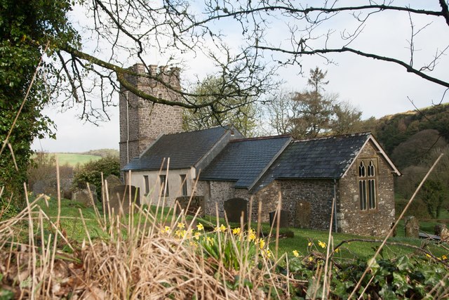
⛪Churchyard walks
Good match
Churchyard or religious grounds — wildlife sanctuary and quiet reflection
🛝Family friendly
Good match
café
Trails nearby
Within roughly 5 km5 signed routes nearby · 6 public paths nearby
Signed route nearbyPublic paths
Watersmeet to Ash Bridge circular walkWalking route3.5 km▾
Named routeRef WACLength 3.5 kmRound tripLocal walking route
South West Coast Path (Section 2: Porlock Weir to Lynmouth / Lynton)Walking route▾
Named routeRef SWCPNational walking route
Coleridge WayWalking route82 km▾
Named routeRef CWLength 82 kmRegional walking route
King Charles III England Coast Path: Minehead to Combe MartinWalking route▾
Named routeRef ECPNational walking route
Macmillan Way WestWalking route▾
Named routeRef MWWRegional walking route
8 signed routes nearby
Signed route nearby
Regional Route 51Cycling route▾
Named routeRef 51Regional cycle route
NCN 3 to NCN 51 LinkCycling route▾
Named routeRegional cycle route
N/ACycling route10.7 km▾
Named routeRef 51Length 10.7 kmNational Cycle NetworkOn-roadSurface asphalt
N/ACycling route1.4 km▾
Named routeRef 51Length 1.4 kmNational Cycle NetworkTraffic-freeSurface unsealedloose
N/ACycling route131 m▾
Named routeRef 51Length 131 mNational Cycle NetworkTraffic-freeSurface bareearth
N/ACycling route2.1 km▾
Named routeRef 51Length 2.1 kmNational Cycle NetworkOn-roadSurface asphalt
4 public paths nearby
Public paths
No named routes yet. Public paths are shown on the map.
Photos
21 photos from nearby open sources
Facilities
☕Café
Lorna Doone Farm Cafe & B&B · 58m
✓ Public accessFree entry🐶 Dogs
Good to know
- £Free to visit — no entry charge
- 🐕Dogs welcome
Weather for this location
Next 14 daysNearby places
Useful places within 5 km
Red Fox
Red Fox
Vulpes vulpes
Vulpes vulpes
Red DeerCervus elaphusRed DeerCervus elaphusBank VoleMyodes glareolus2024Bank VoleMyodes glareolus2024OtterLutra lutra2022OtterLutra lutra2022Small Skipper
Small Skipper
Thymelicus sylvestris2023
Thymelicus sylvestris2023
Red AdmiralVanessa atalanta2023Red AdmiralVanessa atalanta2023Common BluePolyommatus icarus2023Common BluePolyommatus icarus2023Small TortoiseshellAglais urticae2024Small TortoiseshellAglais urticae2024Silver-washed FritillaryArgynnis paphia2024Silver-washed FritillaryArgynnis paphia2024Holly BlueCelastrina argiolus2023Holly BlueCelastrina argiolus2023Anoplotrupes stercorosusAnoplotrupes stercorosus2024Anoplotrupes stercorosusAnoplotrupes stercorosus2024Green-veined WhitePieris napi2023Green-veined WhitePieris napi2023Bloody-nosed BeetleTimarcha tenebricosa2022Bloody-nosed BeetleTimarcha tenebricosa2022Oil BeetleMeloe2022Oil BeetleMeloe2022Garden ChaferPhyllopertha horticola2024Garden ChaferPhyllopertha horticola2024Small CopperLycaena phlaeas2023Small CopperLycaena phlaeas2023Speckled WoodPararge aegeria2023Speckled WoodPararge aegeria2023Large SkipperOchlodes sylvanus2022Large SkipperOchlodes sylvanus2022RhyacophilaRhyacophilaRhyacophilaRhyacophila7-spot LadybirdCoccinella septempunctata7-spot LadybirdCoccinella septempunctataSylvicola punctatusSylvicola punctatusSylvicola punctatusSylvicola punctatusHeather BeetleLochmaea suturalisHeather BeetleLochmaea suturalisRiver SkaterAquarius najas2024River SkaterAquarius najas2024Cicadella viridisCicadella viridis2024Cicadella viridisCicadella viridis2024Dark Green FritillarySpeyeria aglaja2024Dark Green FritillarySpeyeria aglaja2024Philopotamus montanusPhilopotamus montanus2024Philopotamus montanusPhilopotamus montanus2024Western Conifer Seed BugLeptoglossus occidentalis2023Western Conifer Seed BugLeptoglossus occidentalis2023PeacockAglais io2023PeacockAglais io2023Green HairstreakCallophrys rubi2023Green HairstreakCallophrys rubi2023Carabus problematicusCarabus problematicus2022Carabus problematicusCarabus problematicus2022Painted LadyVanessa cardui2022Painted LadyVanessa cardui2022Violet Oil-beetleMeloe violaceus2022Violet Oil-beetleMeloe violaceus2022Green Tiger BeetleCicindela campestris2022Green Tiger BeetleCicindela campestris2022Rhagium bifasciatumRhagium bifasciatum2022Rhagium bifasciatumRhagium bifasciatum2022Small HeathCoenonympha pamphilus2021Small HeathCoenonympha pamphilus2021CommaPolygonia c-album2021CommaPolygonia c-album2021Events & activities nearby
Switch provider to compare local events, tours and bookable activities.