Caddick Copse ✦ Ancient woodland 70 ha
Plan your visit
🦉 Wildlife🦅 Birds🍂 Seasonal
Public access Free entry Dogs welcome 70 ha
Places › England › South East › Chichester Getting here
51.08218, -0.50113
Open directionsv Visiting this summer
Seasonal nature notes and what to look for now
▾ 🌞 Midsummer — early morning visits most comfortable; look for deer fawns in quieter clearings 🌿 Foraging is at its best in summer here 🐕 Dogs welcome — bring water in summer; the site has enough space to find shade on hot days 🌤️ Visiting this summer
🌞 Midsummer — early morning visits most comfortable; look for deer fawns in quieter clearings 🌿 Foraging is at its best in summer here 🐕 Dogs welcome — bring water in summer; the site has enough space to find shade on hot days £ Free to visit — no entry charge🐕 Dogs welcome🌿 Ancient woodland — rare wildlife habitat🦉 Wildlife
Very strong match
Multi-group wildlife — Amphibians, Birds, Mammals, Reptiles; Multi-group wildlife — Amphibians, Birds, Mammals, Reptiles
Free
🦅 Bird watching
Very strong match
Birds — Blackcap, Blue Tit, Great Spotted Woodpecker +60 more · last seen 2026; Birds — Blackcap, Blue Tit, Great Spotted Woodpecker +60 more · last seen 2026
Free
🍂 Seasonal nature
Strong match
Ancient woodland — bluebells, fungi and autumn colour; Plants — Bluebell, Primrose, Early-purple Orchid +195 more · last seen 2025
Free
Plants — Hogweed, Hazel, Hawthorn +24 more foraging species; Deciduous woodland — fungi, berries and wild garlic
Varies
🦋 Insect spotting
Strong match
Insects — Stag Beetle, Scarce Chaser, Azure Damselfly +49 more · last seen 2026; Insects — Stag Beetle, Scarce Chaser, Azure Damselfly +49 more · last seen 2026
Free
Dogs allowed — public woodland
Free
Trails nearby Within roughly 5 km 3 signed routes nearby · 6 public paths nearby
Signed route nearby Public paths
Wey-South Path Walking route ▾
follows the river Wey and the (partly disused) Wey & Arun canal
Named route Regional walking route
Show on map Sussex Border Path Walking route 220 km ▾
Named route Length 220 km Regional walking route
Show on map Downs Link Walking route 59 km ▾
A 37 mile shared route for walkers, horse riders and cyclists linking the North Downs Way with the South Downs Way
Named route Length 59 km Regional walking route
Show on map 7 signed routes nearby
Signed route nearby
Route 223 Cycling route ▾
Named route Ref 223 National Cycle Network
Show on map Surrey Cycleway Cycling route ▾
Cranleigh link
Named route Regional cycle route
Show on map Surrey Cycleway Cycling route ▾
Cycle route consisting of main loop plus link routes
Named route Round trip Regional cycle route
Show on map Main Route Cycling route 4.2 km ▾
Named route Ref 223 Length 4.2 km National Cycle Network Traffic-free Surface unsealedfirm
Show on map Main Route Cycling route 80 m ▾
Named route Ref 223 Length 80 m National Cycle Network On-road Surface asphalt
Show on map Main Route Cycling route 220 m ▾
Named route Ref 223 Length 220 m National Cycle Network On-road Surface asphalt
Show on map 10 public paths nearby
Public paths
BW 793 bridleway · 651 m ▾
Public path bridleway Length 651 m Surface dirt Path type: track
Show on map BW 801 bridleway · 148 m ▾
Public path bridleway Length 148 m Path type: bridleway
Show on map Brewhurst Lane bridleway · 309 m ▾
Public path bridleway Length 309 m Path type: track
Show on map Pigbush Lane bridleway · 980 m ▾
Public path bridleway Length 980 m Path type: unclassified
Show on map BW 801 bridleway · 402 m ▾
Public path bridleway Length 402 m Path type: bridleway
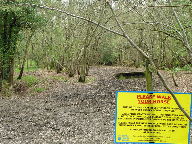
Show on map ✦ Ancient woodland — continuously wooded since at least 1600 AD. A rare and irreplaceable habitat, rich in biodiversity and historical character.
Weather for this location Next 14 days Nearby places Useful places within 5 km
All Historic
Own or manage this place?
Claim this listing to keep details accurate, add photos, and highlight what makes it special — free.
Claim this page→ How useful was the information on this page?
id: a6723378-8814-40c1-acd7-85e85eda4a0a
UK green spaces mapped from open public data — so anyone can find the woodland, trail, or nature reserve closest to them.
© 2026 Glade · Made with care for UK green spaces
Wildlife to spot
5,144 records · National Biodiversity Network
▾
Wildlife to spot 5,144 records · National Biodiversity Network 🐦 Birds 3 species
spring autumn
2026 ▾
Blackcap · Kingfisher · Nuthatch
Blackcap Sylvia atricapilla Kingfisher Alcedo atthis2025 Nuthatch Sitta europaea2025 Glow-worm
Glow-worm Lampyris noctiluca Reed Canary-grass · Cut-leaved Crane's-bill · False Oat-grass · Herb-Robert · Stone Parsley +136
Reed Canary-grass Phalaris arundinacea Cut-leaved Crane's-bill Geranium dissectum False Oat-grass Arrhenatherum elatius Herb-Robert Geranium robertianum Stone Parsley Sison amomum Pendulous Sedge Carex pendula Holly Ilex aquifolium Species observations from the last 10 years via NBN Atlas
Bracken Pteridium aquilinum
Bracken Pteridium aquilinum
False-brome Brachypodium sylvaticum
False-brome Brachypodium sylvaticum
Hawthorn Crataegus monogyna
Hawthorn Crataegus monogyna
Hazel Corylus avellana
Hazel Corylus avellana
Knotgrass Polygonum aviculare
Knotgrass Polygonum aviculare
Ground-ivy Glechoma hederacea
Ground-ivy Glechoma hederacea
Cow Parsley Anthriscus sylvestris
Cow Parsley Anthriscus sylvestris
White Clover Trifolium repens
White Clover Trifolium repens
Sycamore Acer pseudoplatanus
Sycamore Acer pseudoplatanus
Taraxacum agg. Taraxacum agg.
Taraxacum agg. Taraxacum agg.
Hedge Woundwort Stachys sylvatica
Hedge Woundwort Stachys sylvatica
Red Clover Trifolium pratense
Red Clover Trifolium pratense
Garlic Mustard Alliaria petiolata
Garlic Mustard Alliaria petiolata
Cock's-foot Dactylis glomerata
Cock's-foot Dactylis glomerata
Yarrow Achillea millefolium
Yarrow Achillea millefolium
Stinking Iris Iris foetidissima
Stinking Iris Iris foetidissima
Bush Vetch Vicia sepium
Bush Vetch Vicia sepium
English Elm Ulmus procera
English Elm Ulmus procera
Pedunculate Oak Quercus robur
Pedunculate Oak Quercus robur
Petty Spurge Euphorbia peplus
Petty Spurge Euphorbia peplus
Common Mouse-ear Cerastium fontanum
Common Mouse-ear Cerastium fontanum
Tufted Hair-grass Deschampsia cespitosa
Tufted Hair-grass Deschampsia cespitosa
Timothy Phleum pratense
Timothy Phleum pratense
Creeping Thistle Cirsium arvense
Creeping Thistle Cirsium arvense
Broad-leaved Dock Rumex obtusifolius
Broad-leaved Dock Rumex obtusifolius
Meadow Buttercup Ranunculus acris
Meadow Buttercup Ranunculus acris
Ash Fraxinus excelsior
Ash Fraxinus excelsior
Creeping Buttercup Ranunculus repens
Creeping Buttercup Ranunculus repens
Field Maple Acer campestre
Field Maple Acer campestre
Blackthorn Prunus spinosa
Blackthorn Prunus spinosa
Common Fleabane Pulicaria dysenterica
Common Fleabane Pulicaria dysenterica
Selfheal Prunella vulgaris
Selfheal Prunella vulgaris
Red Fescue Festuca rubra
Red Fescue Festuca rubra
Common Nettle Urtica dioica
Common Nettle Urtica dioica
Cat's-ear Hypochaeris radicata
Cat's-ear Hypochaeris radicata
Yorkshire-fog Holcus lanatus
Yorkshire-fog Holcus lanatus
Hogweed Heracleum sphondylium
Hogweed Heracleum sphondylium
Ivy Hedera helix
Ivy Hedera helix
Prickly Sow-thistle Sonchus asper
Prickly Sow-thistle Sonchus asper
Redshank Persicaria maculosa
Redshank Persicaria maculosa
Hedge Bindweed Calystegia sepium
Hedge Bindweed Calystegia sepium
Spear Thistle Cirsium vulgare
Spear Thistle Cirsium vulgare
Smooth Sow-thistle Sonchus oleraceus
Smooth Sow-thistle Sonchus oleraceus
Soft-rush Juncus effusus
Soft-rush Juncus effusus
Agrimony Agrimonia eupatoria
Agrimony Agrimonia eupatoria
Oxeye Daisy Leucanthemum vulgare
Oxeye Daisy Leucanthemum vulgare
Intermediate Polypody Polypodium interjectum
Intermediate Polypody Polypodium interjectum
Common Knapweed Centaurea nigra
Common Knapweed Centaurea nigra
Daisy Bellis perennis
Daisy Bellis perennis
Marsh Woundwort Stachys palustris
Marsh Woundwort Stachys palustris
Hard Rush Juncus inflexus
Hard Rush Juncus inflexus
Autumn Hawkbit Scorzoneroides autumnalis
Autumn Hawkbit Scorzoneroides autumnalis
Wood Dock Rumex sanguineus
Wood Dock Rumex sanguineus
Hairy Bitter-cress Cardamine hirsuta
Hairy Bitter-cress Cardamine hirsuta
Turkey Oak Quercus cerris
Turkey Oak Quercus cerris
Scentless Mayweed Tripleurospermum inodorum
Scentless Mayweed Tripleurospermum inodorum
Greater Plantain Plantago major
Greater Plantain Plantago major
Prickly Lettuce Lactuca serriola
Prickly Lettuce Lactuca serriola
Great Willowherb Epilobium hirsutum
Great Willowherb Epilobium hirsutum
Ribwort Plantain Plantago lanceolata
Ribwort Plantain Plantago lanceolata
Spotted Medick Medicago arabica
Spotted Medick Medicago arabica
Square-stalked St John's-wort Hypericum tetrapterum
Square-stalked St John's-wort Hypericum tetrapterum
Bristly Oxtongue Helminthotheca echioides
Bristly Oxtongue Helminthotheca echioides
Slender Speedwell Veronica filiformis
Slender Speedwell Veronica filiformis
Remote Sedge Carex remota
Remote Sedge Carex remota
Curled Dock Rumex crispus
Curled Dock Rumex crispus
Butterfly-bush Buddleja davidii
Butterfly-bush Buddleja davidii
Common Bent Agrostis capillaris
Common Bent Agrostis capillaris
Dog's Mercury Mercurialis perennis
Dog's Mercury Mercurialis perennis
Wood Avens Geum urbanum
Wood Avens Geum urbanum
Hairy Sedge Carex hirta
Hairy Sedge Carex hirta
Common Ragwort Jacobaea vulgaris
Common Ragwort Jacobaea vulgaris
Silverweed Potentilla anserina
Silverweed Potentilla anserina
Black Bryony Tamus communis
Black Bryony Tamus communis
Creeping Cinquefoil Potentilla reptans
Creeping Cinquefoil Potentilla reptans
Mugwort Artemisia vulgaris
Mugwort Artemisia vulgaris
Wild Carrot Daucus carota
Wild Carrot Daucus carota
Gooseberry Ribes uva-crispa
Gooseberry Ribes uva-crispa
Common Sorrel Rumex acetosa
Common Sorrel Rumex acetosa
White Dead-nettle Lamium album
White Dead-nettle Lamium album
Primrose Primula vulgaris
Primrose Primula vulgaris
Nipplewort Lapsana communis
Nipplewort Lapsana communis
Wild Cherry Prunus avium
Wild Cherry Prunus avium
Foxglove Digitalis purpurea
Foxglove Digitalis purpurea
Wood-sedge Carex sylvatica
Wood-sedge Carex sylvatica
Cleavers Galium aparine
Cleavers Galium aparine
Gypsywort Lycopus europaeus
Gypsywort Lycopus europaeus
Annual Meadow-grass Poa annua
Annual Meadow-grass Poa annua
Common Bird's-foot-trefoil Lotus corniculatus
Common Bird's-foot-trefoil Lotus corniculatus
Sowbread Cyclamen hederifolium
Sowbread Cyclamen hederifolium
Upright Hedge Bedstraw Galium album subsp. erectum
Upright Hedge Bedstraw Galium album subsp. erectum
Male-fern Dryopteris filix-mas
Male-fern Dryopteris filix-mas
Common Field-speedwell Veronica persica
Common Field-speedwell Veronica persica
Field Bindweed Convolvulus arvensis
Field Bindweed Convolvulus arvensis
Sweet Chestnut Castanea sativa
Sweet Chestnut Castanea sativa
Smooth Hawk's-beard Crepis capillaris
Smooth Hawk's-beard Crepis capillaris
Common Orache Atriplex patula
Common Orache Atriplex patula
Silver Birch Betula pendula
Silver Birch Betula pendula
Field-rose Rosa arvensis
Field-rose Rosa arvensis
Ground-elder Aegopodium podagraria
Ground-elder Aegopodium podagraria
Water Mint Mentha aquatica
Water Mint Mentha aquatica
Marsh Thistle Cirsium palustre
Marsh Thistle Cirsium palustre
Wood Sage Teucrium scorodonia
Wood Sage Teucrium scorodonia
Purple Toadflax Linaria purpurea
Purple Toadflax Linaria purpurea
Common Figwort Scrophularia nodosa
Common Figwort Scrophularia nodosa
Lesser Stitchwort Stellaria graminea
Lesser Stitchwort Stellaria graminea
Short-fruited Willowherb Epilobium obscurum
Short-fruited Willowherb Epilobium obscurum
Thyme-leaved Speedwell Veronica serpyllifolia
Thyme-leaved Speedwell Veronica serpyllifolia
Sweet Vernal-grass Anthoxanthum odoratum
Sweet Vernal-grass Anthoxanthum odoratum
Perforate St John's-wort Hypericum perforatum
Perforate St John's-wort Hypericum perforatum
Common Mallow Malva sylvestris
Common Mallow Malva sylvestris
Lesser Burdock Arctium minus
Lesser Burdock Arctium minus
Tall Fescue Schedonorus arundinaceus
Tall Fescue Schedonorus arundinaceus
Groundsel Senecio vulgaris
Groundsel Senecio vulgaris
Grey Sedge Carex divulsa subsp. divulsa
Grey Sedge Carex divulsa subsp. divulsa
Common Dog-violet Viola riviniana
Common Dog-violet Viola riviniana
Equal-leaved Knotgrass Polygonum arenastrum
Equal-leaved Knotgrass Polygonum arenastrum
Wood Melick Melica uniflora
Wood Melick Melica uniflora
Red Campion Silene dioica
Red Campion Silene dioica
Fat-hen Chenopodium album
Fat-hen Chenopodium album
Bluebell Hyacinthoides non-scripta
Bluebell Hyacinthoides non-scripta
Spear-leaved Orache Atriplex prostrata
Spear-leaved Orache Atriplex prostrata
Elder Sambucus nigra
Elder Sambucus nigra
Crested Dog's-tail Cynosurus cristatus
Crested Dog's-tail Cynosurus cristatus
Common Sallow Salix cinerea
Common Sallow Salix cinerea
Meadow Barley Hordeum secalinum
Meadow Barley Hordeum secalinum
Water-pepper Persicaria hydropiper
Water-pepper Persicaria hydropiper
Hornbeam Carpinus betulus
Hornbeam Carpinus betulus
Bittersweet Solanum dulcamara
Bittersweet Solanum dulcamara
Bramble Rubus fruticosus
Bramble Rubus fruticosus
Bugle Ajuga reptans
Bugle Ajuga reptans
Wood-sorrel Oxalis acetosella
Wood-sorrel Oxalis acetosella
Greater Stitchwort Stellaria holostea
Greater Stitchwort Stellaria holostea
Black Nightshade Solanum nigrum
Black Nightshade Solanum nigrum Events & activities nearby Switch provider to compare local events, tours and bookable activities.
Bookable tours GetYourGuide Promote here