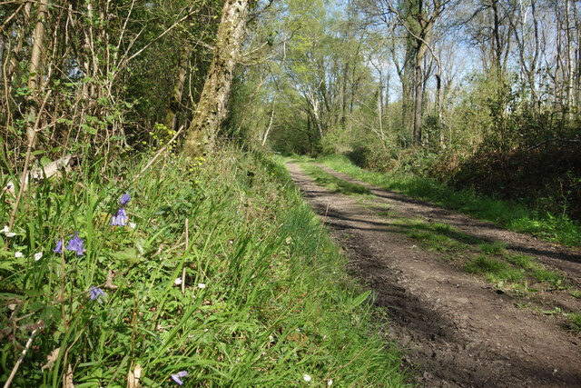
Caesar's Copse ✦ Ancient woodland 12 ha
Plan your visit
🦅 Birds🦉 Wildlife🍂 Seasonal
Public access Free entry Dogs welcome 12 ha
Places › England › South East › Hart Getting here
51.32057, -0.97973
Open directionsv Visiting this summer
Seasonal nature notes and what to look for now
▾ 🐦 68+ species recorded in this area — summer evenings are best for activity; watch for Tawny Owl and Blackbird 🐕 Early mornings are best for dog walks in summer — visit before 9am to avoid the heat and find quieter trails 📍 Open access throughout summer — no booking required 🌤️ Visiting this summer
🐦 68+ species recorded in this area — summer evenings are best for activity; watch for Tawny Owl and Blackbird 🐕 Early mornings are best for dog walks in summer — visit before 9am to avoid the heat and find quieter trails 📍 Open access throughout summer — no booking required £ Free to visit — no entry charge🐕 Dogs welcome🌿 Ancient woodland — rare wildlife habitat🦅 Bird watching
Very strong match
Birds — Tawny Owl, Blackbird, Carrion Crow +65 more · last seen 2026; Birds — Tawny Owl, Blackbird, Carrion Crow +65 more · last seen 2026
Free
🦉 Wildlife
Very strong match
Multi-group wildlife — Birds, Mammals; Multi-group wildlife — Birds, Mammals
Free
🍂 Seasonal nature
Strong match
Ancient woodland — bluebells, fungi and autumn colour; Plants — Bluebell · last seen 2017
Free
🦋 Insect spotting
Strong match
Insects — Gatekeeper, Large White, Small White +48 more · last seen 2023; Insects — Gatekeeper, Large White, Small White +48 more · last seen 2023
Free
Dogs allowed — public woodland
Free
Deciduous woodland — fungi, berries and wild garlic
Varies
Trails nearby Within roughly 5 km 2 signed routes nearby · 8 public paths nearby
Signed route nearby Public paths
Blackwater Valley Path Walking route ▾
Named route Regional walking route
Show on map The Wokingham Way Walking route ▾
Named route Regional walking route
Show on map Rickett Lane public footpath · 448 m ▾
Public path public footpath Length 448 m Surface unpaved Path type: footway
Show on map 11 signed routes nearby
Signed route nearby
National Cycle Route 23 Cycling route ▾
Named route Ref 23 National Cycle Network
Show on map Calleva Trail Cycling route ▾
Named route Ref Calleva Trail Regional cycle route
Show on map Hook LCN Cycling route ▾
Named route Local cycle route
Show on map N/A Cycling route 2.5 km ▾
Named route Length 2.5 km National Cycle Network Traffic-free Surface bareearth
Show on map Main Route Cycling route 110 m ▾
Named route Ref 23 Length 110 m National Cycle Network On-road Surface asphalt
Show on map Main Route Cycling route 6.2 km ▾
Named route Ref 23 Length 6.2 km National Cycle Network On-road Surface asphalt
Show on map 1 signed route nearby
Signed route nearby
King Alfred's Way Mountain bike route ▾
King Alfreds Way is 350km (220 miles) off road route designed to be ridden clockwise. It starts & ends in Winchester. It is suitable for gravel or cross-country bikes.
Named route Regional cycle route
Show on map 1 public path nearby
Public paths
Hall's Lane bridleway · 768 m ▾
Public path bridleway Length 768 m Surface dirt Path type: track
Show on map ✦ Ancient woodland — continuously wooded since at least 1600 AD. A rare and irreplaceable habitat, rich in biodiversity and historical character.
Weather for this location Next 14 days Nearby places Useful places within 5 km
All Historic
Own or manage this place?
Claim this listing to keep details accurate, add photos, and highlight what makes it special — free.
Claim this page→ How useful was the information on this page?
id: e9a39b60-4ec6-4beb-8ace-e0137a02a725
UK green spaces mapped from open public data — so anyone can find the woodland, trail, or nature reserve closest to them.
© 2026 Glade · Made with care for UK green spaces
Wildlife to spot
1,503 records · National Biodiversity Network
▾
Wildlife to spot 1,503 records · National Biodiversity Network 🐦 Birds 32 species
spring autumn
2026 ▾
Tawny Owl · Cuckoo · Blackbird · Carrion Crow · Blue Tit +27
Tawny Owl Strix aluco2019 Cuckoo Cuculus canorus2019 Blackbird Turdus merula2023 Carrion Crow Corvus corone2018 Blue Tit Cyanistes caeruleus2018 Pheasant Phasianus colchicus2018 Mallard Anas platyrhynchos2016 Song Thrush Turdus philomelos2016 Red-legged Partridge Alectoris rufa House Martin Delichon urbicum2025 Woodpigeon Columba palumbus2018 Magpie Pica pica2018 Jackdaw Coloeus monedula2018 Robin Erithacus rubecula2018 Grey Heron Ardea cinerea2016 Goldfinch Carduelis carduelis2016 Great Tit Parus major2016 Chaffinch Fringilla coelebs2016 Moorhen Gallinula chloropus2016 Grey Wagtail Motacilla cinerea2015 Wren Troglodytes troglodytes Green Woodpecker Picus viridis2025 White Stork Ciconia ciconia2020 Yellowhammer Emberiza citrinella2018 Swift Apus apus2018 Mandarin Duck Aix galericulata2016 Bullfinch Pyrrhula pyrrhula2016 Chiffchaff Phylloscopus collybita2016 Pied Wagtail Motacilla alba2015 Long-tailed Tit Aegithalos caudatus2015 Redwing Turdus iliacus2015 Kingfisher Alcedo atthis2015 🦌 Mammals 6 species
winter spring autumn
2025 ▾
Hedgehog · Roe Deer · Badger · Rabbit · Grey Squirrel +1
Hedgehog Erinaceus europaeus2022 Roe Deer Capreolus capreolus Badger Meles meles2022 Rabbit Oryctolagus cuniculus2019 Grey Squirrel Sciurus carolinensis2018 Gatekeeper · Large White · Peacock · Small White · Meadow Brown +36
Gatekeeper Pyronia tithonus2019 Large White Pieris brassicae2019 Peacock Aglais io2019 Small White Pieris rapae2019 Meadow Brown Maniola jurtina2019 Red Admiral Vanessa atalanta Bluebell
Bluebell Hyacinthoides non-scripta Species observations from the last 10 years via NBN Atlas
Red Fox Vulpes vulpes2016
Red Fox Vulpes vulpes2016 2019
2019
Comma Polygonia c-album2019
Comma Polygonia c-album2019
Small Tortoiseshell Aglais urticae2015
Small Tortoiseshell Aglais urticae2015
Baetis rhodani Baetis rhodani2019
Baetis rhodani Baetis rhodani2019
Brimstone Gonepteryx rhamni2019
Brimstone Gonepteryx rhamni2019
Speckled Wood Pararge aegeria2014
Speckled Wood Pararge aegeria2014
Tree Bumblebee Bombus hypnorum2021
Tree Bumblebee Bombus hypnorum2021
Speckled Bush-cricket Leptophyes punctatissima2021
Speckled Bush-cricket Leptophyes punctatissima2021
Small Copper Lycaena phlaeas2019
Small Copper Lycaena phlaeas2019
Ringlet Aphantopus hyperantus2019
Ringlet Aphantopus hyperantus2019
Marmalade Hoverfly Episyrphus balteatus2019
Marmalade Hoverfly Episyrphus balteatus2019
Holly Blue Celastrina argiolus2019
Holly Blue Celastrina argiolus2019
Painted Lady Vanessa cardui2017
Painted Lady Vanessa cardui2017
Marbled White Melanargia galathea2015
Marbled White Melanargia galathea2015
Broad-bodied Chaser Libellula depressa
Broad-bodied Chaser Libellula depressa
St Marks Fly Bibio marci
St Marks Fly Bibio marci
Red-headed Cardinal Beetle Pyrochroa serraticornis
Red-headed Cardinal Beetle Pyrochroa serraticornis
Red Mason Bee Osmia bicornis
Red Mason Bee Osmia bicornis
Dark-edged Bee-fly Bombylius major
Dark-edged Bee-fly Bombylius major
Banded Demoiselle Calopteryx splendens
Banded Demoiselle Calopteryx splendens
Beautiful Demoiselle Calopteryx virgo
Beautiful Demoiselle Calopteryx virgo
Endomychus coccineus Endomychus coccineus
Endomychus coccineus Endomychus coccineus
Helophilus pendulus Helophilus pendulus2021
Helophilus pendulus Helophilus pendulus2021
Orange-bearded Bluebottle Calliphora vomitoria2021
Orange-bearded Bluebottle Calliphora vomitoria2021
Common Carder Bee Bombus pascuorum2021
Common Carder Bee Bombus pascuorum2021
7-spot Ladybird Coccinella septempunctata2021
7-spot Ladybird Coccinella septempunctata2021
Yellow May Dun Heptagenia sulphurea2020
Yellow May Dun Heptagenia sulphurea2020
Stag Beetle Lucanus cervus2020
Stag Beetle Lucanus cervus2020
Corizus hyoscyami Corizus hyoscyami2019
Corizus hyoscyami Corizus hyoscyami2019
Common Red Soldier Beetle Rhagonycha fulva2019
Common Red Soldier Beetle Rhagonycha fulva2019
Rutpela maculata Rutpela maculata2019
Rutpela maculata Rutpela maculata2019
Orange-tip Anthocharis cardamines2019
Orange-tip Anthocharis cardamines2019
Volucella inanis Volucella inanis2017
Volucella inanis Volucella inanis2017
Leptura quadrifasciata Leptura quadrifasciata2017
Leptura quadrifasciata Leptura quadrifasciata2017
Common Cockchafer Melolontha melolontha2016
Common Cockchafer Melolontha melolontha2016
Large Skipper Ochlodes sylvanus2014
Large Skipper Ochlodes sylvanus2014 Events & activities nearby Switch provider to compare local events, tours and bookable activities.
Bookable tours GetYourGuide Promote here