Getting here
53.71687, -2.10638
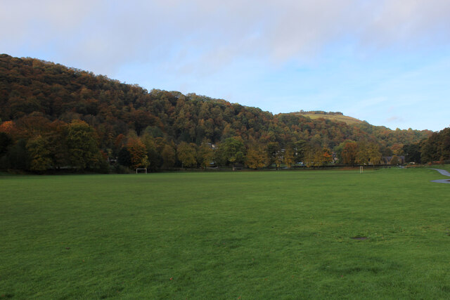
Visiting this summer
Seasonal nature notes and what to look for now
Visiting this summer
Seasonal nature notes and what to look for now
- 🌞Midsummer — early morning visits most comfortable; look for deer fawns in quieter clearings
- 🧺Good picnic destination in summer — open space and facilities for a relaxed day out
- 🐕Dogs welcome — bring water in summer; the site has enough space to find shade on hot days
🌤️ Visiting this summer
- 🌞Midsummer — early morning visits most comfortable; look for deer fawns in quieter clearings
- 🧺Good picnic destination in summer — open space and facilities for a relaxed day out
- 🐕Dogs welcome — bring water in summer; the site has enough space to find shade on hot days
Good to know
- £Free to visit — no entry charge
- 🐕Dogs welcome
Best for
Wildlife
Very strong match
Multi-group wildlife — Amphibians, Birds, Mammals, Reptiles; Multi-group wildlife — Amphibians, Birds, Mammals, Reptiles
Bird watching
Very strong match
Birds — Jackdaw, Carrion Crow, Woodpigeon +75 more · last seen 2026; Birds — Jackdaw, Carrion Crow, Woodpigeon +75 more · last seen 2026
Picnic day out
Strong match
picnic area, car park
Foraging
Strong match
Plants — Elder, Common Bistort, Blackthorn +18 more foraging species; Deciduous woodland — fungi, berries and wild garlic
Seasonal nature
Strong match
Plants — Japanese Knotweed, Himalayan Balsam, Sycamore +149 more · last seen 2026; Plants — Japanese Knotweed, Himalayan Balsam, Sycamore +149 more · last seen 2026
Dog walks
Strong match
Dogs allowed — public woodland
Trails nearby
Within roughly 5 km🚶Walking
16 signed routes nearby · 34 public paths nearby
Signed route nearbyPublic paths
Walking
Mary Towneley LoopWalking route
Forms part of Pennine Bridleway National Trail
Rochdale WayWalking route
Rossendale WayWalking route
A high-level route around Bacup, Rawtenstall, Haslingden and Whitworth in the Rossendale Valley, crossing the open moors and farmland of the South Pennines which roughly follows the Rossendale Borough boundary.
Todmorden Centenary WayWalking route
Pennine Way (Warland Reservoir to Calder Valley)Walking route
Sunnysidepublic footpath · 97 m
Sunnysidepublic footpath · 33 m
🚴Cycling
80 signed routes nearby
Signed route nearby
Cycling
Pennine CyclewayCycling route
Route 66Cycling route
Todmorden High School Safe Route to SchoolCycling route
Route 68Cycling route
Route 92Cycling route
Britannia GreenwayCycling route
🚵Mountain biking
2 signed routes nearby
Signed route nearby
Mountain biking
Great North Trail (Yorkshire Dales)Mountain bike route172.2 km
Great North Trail (Peak District and South Pennines)Mountain bike route130.4 km
Wildlife to spot
Photos
Weather for this location
Loading local forecast…
Nearby places
Useful places within 5 km
Own or manage this place?
Claim this listing to keep details accurate, add photos, and highlight what makes it special — free.
Claim this pageHow was your visit?
How useful was the information on this page?
id: afd98c54-dc3b-45c6-ad9f-440763d184ee