🦉 Wildlife🌿 Foraging🦅 Birds
↑ Share
Public access Free entry Dogs welcome 34 ha
Places › England › South West › East Devon Getting here
50.72315, -3.12134
Open directionsv Visiting this summer
Seasonal nature notes and what to look for now
▾ 🌞 Midsummer — early morning visits most comfortable; look for deer fawns in quieter clearings 🌿 Foraging is at its best in summer here 🐕 Dogs welcome — bring water in summer; the site has enough space to find shade on hot days 🌤️ Visiting this summer
🌞 Midsummer — early morning visits most comfortable; look for deer fawns in quieter clearings 🌿 Foraging is at its best in summer here 🐕 Dogs welcome — bring water in summer; the site has enough space to find shade on hot days £ Free to visit — no entry charge🐕 Dogs welcome🦉 Wildlife
Very strong match
Multi-group wildlife — Amphibians, Birds, Mammals; Multi-group wildlife — Amphibians, Birds, Mammals
Free
Plants — Blackthorn, Meadowsweet, Beech +31 more foraging species; Deciduous woodland — fungi, berries and wild garlic
Varies
🦅 Bird watching
Strong match
Birds — Robin, Chaffinch, Blackbird +41 more · last seen 2025; Birds — Robin, Chaffinch, Blackbird +41 more · last seen 2025
Free
🦋 Insect spotting
Strong match
Insects — Meadow Brown, Gatekeeper, Small White +80 more · last seen 2024; Insects — Meadow Brown, Gatekeeper, Small White +80 more · last seen 2024
Free
🍂 Seasonal nature
Strong match
Plants — Bluebell, Hedge Woundwort, Enchanter's-nightshade +243 more · last seen 2017; Plants — Bluebell, Hedge Woundwort, Enchanter's-nightshade +243 more · last seen 2017
Free
Dogs allowed — public woodland
Free
Trails nearby Within roughly 5 km 7 signed routes nearby · 5 public paths nearby
Signed route nearby Public paths
East Devon Way Walking route ▾
Named route Ref EDW Listed length 61km Regional walking route
Show on map South West Coast Path (Section 45: Sidmouth to Seaton) Walking route ▾
Named route Ref SWCP National walking route
Show on map South West Coast Path (Section 46: Seaton to Seatown) Walking route ▾
Named route Ref SWCP National walking route
Show on map Monmouth Rebellion Walk Walking route ▾
Named route Ref MRW Regional walking route
Show on map Channel to Channel Walking route ▾
Named route Ref CC Regional walking route
Show on map 45 signed routes nearby
Signed route nearby
National Cycle Route 2 Axminster to Dawlish Cycling route ▾
Named route Ref 2 National Cycle Network
Show on map Main Route Cycling route 212 m ▾
Named route Ref 2 Length 212 m National Cycle Network On-road Surface asphalt
Show on map Main Route Cycling route 172 m ▾
Named route Ref 2 Length 172 m National Cycle Network On-road Surface asphalt
Show on map Main Route Cycling route 2 km ▾
Named route Ref 2 Length 2 km National Cycle Network On-road Surface asphalt
Show on map Main Route Cycling route 57 m ▾
Named route Ref 2 Length 57 m National Cycle Network On-road Surface asphalt
Show on map Main Route Cycling route 236 m ▾
Named route Ref 2 Length 236 m National Cycle Network Traffic-free Surface asphalt
Show on map 1 public path nearby
Public paths
No named routes yet. Public paths are shown on the map.
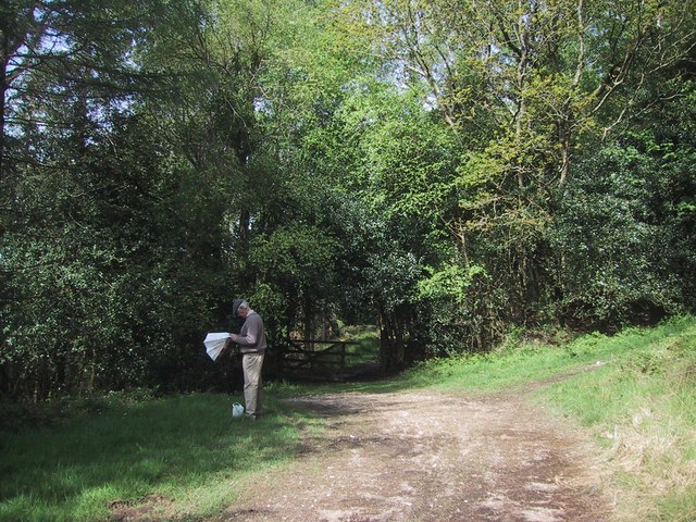
Photos Paths cross in the woods on Bovey Down
‹ ›
Weather for this location Next 14 days Nearby places Useful places within 5 km
All Historic
Own or manage this place?
Claim this listing to keep details accurate, add photos, and highlight what makes it special — free.
Claim this page→ How useful was the information on this page?
Something wrong on this page?
id: 89f75b12-2637-475e-b68d-92395119eb60
UK green spaces mapped from open public data — so anyone can find the woodland, trail, or nature reserve closest to them.
© 2026 Glade · Made with care for UK green spaces
Wildlife to spot
1,840 records · National Biodiversity Network
▾
Wildlife to spot 1,840 records · National Biodiversity Network Swallow · Goldfinch · Tawny Owl · Chaffinch · Great Spotted Woodpecker +24
Swallow Hirundo rustica2023 Goldfinch Carduelis carduelis2019 Tawny Owl Strix aluco2023 Chaffinch Fringilla coelebs2016 Great Spotted Woodpecker Dendrocopos major2015 Pied Wagtail Motacilla alba2023 Raven Corvus corax2019 Robin Erithacus rubecula2016 Pheasant Phasianus colchicus2016 Great Tit Parus major2014 Greenfinch Chloris chloris2014 Nuthatch Sitta europaea2014 Blue Tit Cyanistes caeruleus2014 Siskin Spinus spinus2014 Barn Owl Tyto alba Woodpigeon Columba palumbus Golden Plover Pluvialis apricaria Jackdaw Coloeus monedula2021 Lapwing Vanellus vanellus2020 Wheatear Oenanthe oenanthe2019 Stock Dove Columba oenas2019 Carrion Crow Corvus corone2016 Blackbird Turdus merula2016 Coal Tit Periparus ater2014 Crossbill Loxia curvirostra2013 Wren Troglodytes troglodytes2013 Blackcap Sylvia atricapilla2013 House Martin Delichon urbicum2013 House Sparrow Passer domesticus2013 🦌 Mammals 4 species
spring summer autumn
2023 ▾
Polecat · Hedgehog · Mustelidae · Polecat-Ferret
Polecat Mustela putorius Hedgehog Erinaceus europaeus2021 Mustelidae Mustelidae2014 Polecat-Ferret Mustela furo x putorius2014 🐸 Amphibians 1 species
spring
2019 ▾
Common Frog
Common Frog Rana temporaria Emperor Dragonfly · Black-tailed Skimmer · Small White · Meadow Brown · Blue-tailed Damselfly +25
Emperor Dragonfly Anax imperator2014 Black-tailed Skimmer Orthetrum cancellatum2014 Small White Pieris rapae2019 Meadow Brown Maniola jurtina2018 Blue-tailed Damselfly Ischnura elegans2014 Green-veined White Pieris napi Bluebell · Hyacinthoides · Ivy · Bracken · Ash +48
Bluebell Hyacinthoides non-scripta2017 Hyacinthoides Hyacinthoides2017 Ivy Hedera helix2015 Bracken Pteridium aquilinum2015 Ash Fraxinus excelsior2015 Scaly Male-fern Dryopteris affinis Species observations from the last 10 years via NBN Atlas
2018
2018
Harlequin Ladybird Harmonia axyridis2022
Harlequin Ladybird Harmonia axyridis2022
Painted Lady Vanessa cardui2019
Painted Lady Vanessa cardui2019
Red Admiral Vanessa atalanta2019
Red Admiral Vanessa atalanta2019
Small Tortoiseshell Aglais urticae2019
Small Tortoiseshell Aglais urticae2019
Brimstone Gonepteryx rhamni2019
Brimstone Gonepteryx rhamni2019
Gatekeeper Pyronia tithonus2018
Gatekeeper Pyronia tithonus2018
Peacock Aglais io2018
Peacock Aglais io2018
Four-spotted Chaser Libellula quadrimaculata2014
Four-spotted Chaser Libellula quadrimaculata2014
Scarce Chaser Libellula fulva2014
Scarce Chaser Libellula fulva2014
Brown Argus Aricia agestis2014
Brown Argus Aricia agestis2014
Common Blue Polyommatus icarus2014
Common Blue Polyommatus icarus2014
Anoplotrupes stercorosus Anoplotrupes stercorosus
Anoplotrupes stercorosus Anoplotrupes stercorosus
Buff-tip Phalera bucephala2017
Buff-tip Phalera bucephala2017
Early Bumblebee Bombus pratorum2017
Early Bumblebee Bombus pratorum2017
Small Garden Bumblebee Bombus hortorum2017
Small Garden Bumblebee Bombus hortorum2017
Gypsy Cuckoo Bee Bombus bohemicus2017
Gypsy Cuckoo Bee Bombus bohemicus2017
Tree Bumblebee Bombus hypnorum2017
Tree Bumblebee Bombus hypnorum2017
Red-tailed Bumblebee Bombus lapidarius2017
Red-tailed Bumblebee Bombus lapidarius2017
Common Carder Bee Bombus pascuorum2017
Common Carder Bee Bombus pascuorum2017
Field Cuckoo Bee Bombus campestris2017
Field Cuckoo Bee Bombus campestris2017
Buff-tailed Bumblebee Bombus terrestris2016
Buff-tailed Bumblebee Bombus terrestris2016
Orange-tip Anthocharis cardamines2014
Orange-tip Anthocharis cardamines2014
Silver-washed Fritillary Argynnis paphia2013
Silver-washed Fritillary Argynnis paphia2013
Ringlet Aphantopus hyperantus2013
Ringlet Aphantopus hyperantus2013 2015
2015
Enchanter's-nightshade Circaea lutetiana2015
Enchanter's-nightshade Circaea lutetiana2015
Hedge Woundwort Stachys sylvatica2015
Hedge Woundwort Stachys sylvatica2015
Bramble Rubus fruticosus2015
Bramble Rubus fruticosus2015
Lady-fern Athyrium filix-femina2015
Lady-fern Athyrium filix-femina2015
Holly Ilex aquifolium2015
Holly Ilex aquifolium2015
Snowdrop Galanthus nivalis
Snowdrop Galanthus nivalis
Spanish Bluebell Hyacinthoides hispanica2017
Spanish Bluebell Hyacinthoides hispanica2017
Musk-mallow Malva moschata2016
Musk-mallow Malva moschata2016
Common Centaury Centaurium erythraea2016
Common Centaury Centaurium erythraea2016
Male-fern Dryopteris filix-mas2015
Male-fern Dryopteris filix-mas2015
Honeysuckle Lonicera periclymenum2015
Honeysuckle Lonicera periclymenum2015
Wood-sedge Carex sylvatica2015
Wood-sedge Carex sylvatica2015
Hard-fern Blechnum spicant2015
Hard-fern Blechnum spicant2015
Water-pepper Persicaria hydropiper2015
Water-pepper Persicaria hydropiper2015
False-brome Brachypodium sylvaticum2015
False-brome Brachypodium sylvaticum2015
Common Dog-violet Viola riviniana2015
Common Dog-violet Viola riviniana2015
Rowan Sorbus aucuparia2015
Rowan Sorbus aucuparia2015
Bugle Ajuga reptans2015
Bugle Ajuga reptans2015
Tufted Hair-grass Deschampsia cespitosa2015
Tufted Hair-grass Deschampsia cespitosa2015
Hybrid Oak Quercus petraea x robur = Q. x rosacea2015
Hybrid Oak Quercus petraea x robur = Q. x rosacea2015
Blackthorn Prunus spinosa2015
Blackthorn Prunus spinosa2015
Hazel Corylus avellana2015
Hazel Corylus avellana2015
Opposite-leaved Golden-saxifrage Chrysosplenium oppositifolium2015
Opposite-leaved Golden-saxifrage Chrysosplenium oppositifolium2015
Creeping Buttercup Ranunculus repens2015
Creeping Buttercup Ranunculus repens2015
Brooklime Veronica beccabunga2015
Brooklime Veronica beccabunga2015
Downy Birch Betula pubescens2015
Downy Birch Betula pubescens2015
Soft-rush Juncus effusus2015
Soft-rush Juncus effusus2015
Greater Stitchwort Stellaria holostea2015
Greater Stitchwort Stellaria holostea2015
Alder Alnus glutinosa2015
Alder Alnus glutinosa2015
Meadowsweet Filipendula ulmaria2015
Meadowsweet Filipendula ulmaria2015
Wood Dock Rumex sanguineus2015
Wood Dock Rumex sanguineus2015
Wood Avens Geum urbanum2015
Wood Avens Geum urbanum2015
Hawthorn Crataegus monogyna2015
Hawthorn Crataegus monogyna2015
Broad Buckler-fern Dryopteris dilatata2015
Broad Buckler-fern Dryopteris dilatata2015
Common Sallow Salix cinerea2015
Common Sallow Salix cinerea2015
Wood Speedwell Veronica montana2015
Wood Speedwell Veronica montana2015
Primrose Primula vulgaris2015
Primrose Primula vulgaris2015
Water Mint Mentha aquatica2015
Water Mint Mentha aquatica2015
Himalayan Balsam Impatiens glandulifera2015
Himalayan Balsam Impatiens glandulifera2015
Herb-Robert Geranium robertianum2015
Herb-Robert Geranium robertianum2015
Yellow Pimpernel Lysimachia nemorum2015
Yellow Pimpernel Lysimachia nemorum2015
Remote Sedge Carex remota2015
Remote Sedge Carex remota2015
Foxglove Digitalis purpurea2015
Foxglove Digitalis purpurea2015
Cock's-foot Dactylis glomerata2015
Cock's-foot Dactylis glomerata2015
Marsh-bedstraw Galium palustre2015
Marsh-bedstraw Galium palustre2015
Selfheal Prunella vulgaris2015
Selfheal Prunella vulgaris2015
Common Nettle Urtica dioica2015
Common Nettle Urtica dioica2015 Events & activities nearby Switch provider to compare local events, tours and bookable activities.
Bookable tours GetYourGuide Promote here