Chrishall Methodist Church
Plan your visit
🦅Birds🦉Wildlife🦋Insects
Public accessFree entryDogs welcome
Getting here
52.03812, 0.10636
Open directionsv
Visiting this summer
Seasonal nature notes and what to look for now
- 🐦73+ species recorded in this area — summer evenings are best for activity; watch for Woodpigeon and Blackbird
- 🐕Early mornings are best for dog walks in summer — visit before 9am to avoid the heat and find quieter trails
- 🅿️Parking on site — 2 car parks within reach
🌤️ Visiting this summer
- 🐦73+ species recorded in this area — summer evenings are best for activity; watch for Woodpigeon and Blackbird
- 🐕Early mornings are best for dog walks in summer — visit before 9am to avoid the heat and find quieter trails
- 🅿️Parking on site — 2 car parks within reach
- £Free to visit — no entry charge
- 🐕Dogs welcome
🦅Bird watching
Very strong match
Birds — Woodpigeon, Blackbird, Great Tit +70 more · last seen 2025
Free
Birds — Woodpigeon, Blackbird, Great Tit +70 more · last seen 2025
Free
🦋Insect spotting
Strong match
Insects — Meadow Brown, Small Heath, Green-veined White +74 more · last seen 2026
Free
Dogs allowed with public access
Free
⛪Churchyard walks
Good match
Churchyard or religious grounds — wildlife sanctuary and quiet reflection
Free
Named hiking route nearby: Harcamlow Way; Named hiking route nearby: Harcamlow Way
Free
Trails nearby
Within roughly 5 km3 signed routes nearby · 15 public paths nearby
Signed route nearbyPublic paths
Icknield Way PathWalking route169 km▾
long distance footpath 169 km
Named routeLength 169 kmRegional walking route
Harcamlow WayWalking route▾
Named routeRef HARRegional walking route
Hertfordshire WayWalking route267 km▾
Long distance path
Named routeLength 267 kmRegional walking route
Loveday Closepublic footpath · 68 m▾
Public pathpublic footpathLength 68 mPath type: service
15 signed routes nearby
Signed route nearby
National Byway (Cambridgeshire)Cycling route▾
National Byway route through Cambridgeshire
Named routeRef NBRegional cycle route
NCN National Route 11Cycling route▾
Named routeRef 11National Cycle Network
Main RouteCycling route2.9 km▾
Named routeRef 11Length 2.9 kmNational Cycle NetworkOn-roadSurface asphalt
Main RouteCycling route40 m▾
Named routeRef 11Length 40 mNational Cycle NetworkOn-roadSurface asphalt
Main RouteCycling route789 m▾
Named routeRef 11Length 789 mNational Cycle NetworkOn-roadSurface asphalt
Main RouteCycling route24 m▾
Named routeRef 11Length 24 mNational Cycle NetworkOn-roadSurface asphalt
1 signed route nearby
Signed route nearby
Icknield Way Cycle TrailMountain bike route226 km▾
This is the off-road or mountain cycling route of the Icknield Way Trail.
Named routeLength 226 kmRegional cycle route
1 public path nearby
Public paths
Dark Lanebyway open to all traffic · 780 m▾
Public pathbyway open to all trafficLength 780 mSurface dirtPath type: track
Photos
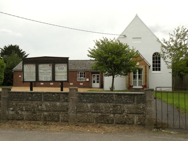
Chrishall Methodist Church
Weather for this location
Next 14 daysNearby places
Useful places within 5 km
Wildlife to spot
4,372 records · National Biodiversity Network
Wildlife to spot
4,372 records · National Biodiversity Network🐦Birds54 species
springsummerautumn
2025▾
Woodpigeon · Magpie · Blue Tit · Blackbird · Skylark +49
- WoodpigeonColumba palumbus
- MagpiePica pica
- Blue TitCyanistes caeruleus
- BlackbirdTurdus merula
- SkylarkAlauda arvensis
- Great TitParus major
- JackdawColoeus monedula
- Carrion CrowCorvus corone
- Great Spotted WoodpeckerDendrocopos major
- RavenCorvus corax
- RobinErithacus rubecula
- GoldfinchCarduelis carduelis
- WrenTroglodytes troglodytes
- RookCorvus frugilegus
- Corn BuntingEmberiza calandra
- BlackcapSylvia atricapilla2024
- PheasantPhasianus colchicus2024
- ChaffinchFringilla coelebs
- House SparrowPasser domesticus
- Coal TitPeriparus ater
- DunnockPrunella modularis
- NuthatchSitta europaea
- LinnetLinaria cannabina
- YellowhammerEmberiza citrinella
- Stock DoveColumba oenas
- MoorhenGallinula chloropus2024
- ChiffchaffPhylloscopus collybita2024
- JayGarrulus glandarius
- Meadow PipitAnthus pratensis
- Red-legged PartridgeAlectoris rufa
- SwallowHirundo rustica2024
- WhitethroatCurruca communis2024
- GreenfinchChloris chloris2024
- Green WoodpeckerPicus viridis2024
- Song ThrushTurdus philomelos2024
- Black-headed GullChroicocephalus ridibundus2024
- StarlingSturnus vulgaris2024
- KestrelFalco tinnunculus2024
- Lesser Black-backed GullLarus fuscus
- FieldfareTurdus pilaris
- Herring GullLarus argentatus
- StonechatSaxicola rubicola
- Long-tailed TitAegithalos caudatus
- House MartinDelichon urbicum
- SwiftApus apus
- RedwingTurdus iliacus
- Mute SwanCygnus olor
- CootFulica atra2024
- Greylag GooseAnser anser2024
- MallardAnas platyrhynchos2024
- GoldcrestRegulus regulus2023
- Rock DoveColumba livia2023
- Collared DoveStreptopelia decaocto2023
- Sylvia atricapilla atricapillaSylvia atricapilla atricapilla2022
🦌Mammals6 species
wintersummerautumn
2025▾
Fallow Deer · Badger · Grey Squirrel · Brown Hare · Water Shrew +1
- Fallow DeerDama dama
- BadgerMeles meles2024
- Grey SquirrelSciurus carolinensis
- Brown HareLepus europaeus
- Water ShrewNeomys fodiens
- RabbitOryctolagus cuniculus
🐸Amphibians1 species
winter
2022▾
Smooth Newt
- Smooth NewtLissotriton vulgaris
🐝Insects25 species
summerautumn
2026▾
7-spot Ladybird · Dark-edged Bee-fly · Pegomya flavifrons · Aphis (Aphis) jacobaeae · Anthomyia +20
- 7-spot LadybirdCoccinella septempunctata
- Dark-edged Bee-flyBombylius major
- Pegomya flavifronsPegomya flavifrons2025
- Aphis (Aphis) jacobaeaeAphis (Aphis) jacobaeae2025
- AnthomyiaAnthomyia2024
- Hydrotaea
Species observations from the last 10 years via NBN Atlas
2024
2024
Hydrotaea2025
Hydrotaea2025
AnoeciaAnoecia2025AnoeciaAnoecia2025PolietesPolietes2025PolietesPolietes2025Ectopsocus briggsi agg. (briggsi/petersi/meridionalis)Ectopsocus briggsi agg. (briggsi/petersi/meridionalis)2025Ectopsocus briggsi agg. (briggsi/petersi/meridionalis)Ectopsocus briggsi agg. (briggsi/petersi/meridionalis)2025Philotarsus picicornisPhilotarsus picicornis2025Philotarsus picicornisPhilotarsus picicornis2025Welsh ChaferHoplia philanthus2025Welsh ChaferHoplia philanthus2025Periphyllus testudinaceusPeriphyllus testudinaceus2025Periphyllus testudinaceusPeriphyllus testudinaceus2025Psyllopsis fraxini agg.Psyllopsis fraxini agg.2024Psyllopsis fraxini agg.Psyllopsis fraxini agg.2024Trioza urticaeTrioza urticae2024Trioza urticaeTrioza urticae2024Uroleucon (Uromelan) jaceaeUroleucon (Uromelan) jaceae2024Uroleucon (Uromelan) jaceaeUroleucon (Uromelan) jaceae2024Uroleucon (Uromelan) aeneumUroleucon (Uromelan) aeneum2024Uroleucon (Uromelan) aeneumUroleucon (Uromelan) aeneum2024Fine Streaked BugkinMiris striatus2024Fine Streaked BugkinMiris striatus2024Cantharis rusticaCantharis rustica2024Cantharis rusticaCantharis rustica2024Himacerus (Anaptus) majorHimacerus (Anaptus) major2023Himacerus (Anaptus) majorHimacerus (Anaptus) major2023Polyporivora pictaPolyporivora picta2023Polyporivora pictaPolyporivora picta2023Anoecia (Anoecia) corniAnoecia (Anoecia) corni2023Anoecia (Anoecia) corniAnoecia (Anoecia) corni2023Ivy BeeColletes hederae2023Ivy BeeColletes hederae2023Kite-tailed RobberflyMachimus atricapillus2023Kite-tailed RobberflyMachimus atricapillus2023Willow Emerald DamselflyChalcolestes viridis2023Willow Emerald DamselflyChalcolestes viridis2023Helina evectaHelina evecta2023Helina evectaHelina evecta2023Events & activities nearby
Switch provider to compare local events, tours and bookable activities.