Plan your visit
Getting here
51.45224, -2.77020
Visiting this summer
Seasonal nature notes and what to look for now
Visiting this summer
Seasonal nature notes and what to look for now
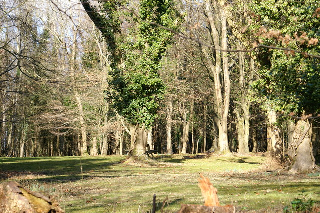
- ☀️June — canopy now fully closed, creating cool dappled shade even on warm days
- 🐕Early mornings are best for dog walks in summer — visit before 9am to avoid the heat and find quieter trails
- 🅿️Parking 423m away — 2 car parks within reach
🌤️ Visiting this summer
- ☀️June — canopy now fully closed, creating cool dappled shade even on warm days
- 🐕Early mornings are best for dog walks in summer — visit before 9am to avoid the heat and find quieter trails
- 🅿️Parking 423m away — 2 car parks within reach
Good to know
- £Free to visit — no entry charge
- 🐕Dogs welcome
- 🌿Ancient woodland — rare wildlife habitat
- 🌳Large woodland — room to roam
Best for
Wildlife
Very strong match
Multi-group wildlife — Amphibians, Birds, Mammals, Reptiles; Multi-group wildlife — Amphibians, Birds, Mammals, Reptiles
Bird watching
Very strong match
Birds — Woodpigeon, Carrion Crow, Magpie +65 more · last seen 2025; Birds — Woodpigeon, Carrion Crow, Magpie +65 more · last seen 2025
Seasonal nature
Strong match
Ancient woodland — bluebells, fungi and autumn colour
Insect spotting
Strong match
Chalk and limestone grassland — chalkhill blue, adonis blue and rare moths; Insects — Common Darter, Emperor Dragonfly, Blue-tailed Damselfly +11 more · last seen 2025
Dog walks
Strong match
Dogs allowed — public woodland
Foraging
Good match
Deciduous woodland — fungi, berries and wild garlic
Trails nearby
Within roughly 5 km🚶Walking
15 signed routes nearby · 72 public paths nearby
Signed route nearbyPublic paths
Walking
Watercatch Walk, TyntesfieldWalking route1.6 km
This circular walk is full of historical and natural interest. Watercatch walk takes you past an old single avenue of monkey puzzle trees, a summerhouse, Watercatch and old Second World War remains, before descending into a wooded combe and back along the
Cadbury Camp Ramble, Bristol CountrysideWalking route3.2 km
Walk through the Somerset countryside & spot wildlife like the silver-washed fritillary butterfly & six-spot burnet moth. Encounter Cadbury Camp Iron Age hillfort & views across the Severn Estuary & Mendips. Uneven surface, gates, stiles & steep gradients
Round Yatton WalkWalking route
Loop WalkWalking route
King Charles III England Coast Path: Aust to Brean DownWalking route
Stonehenge Lanepublic footpath · 204 m
Gordano Roundpublic footpath · 231 m
Causewaypublic footpath · 146 m
🚴Cycling
53 signed routes nearby
Signed route nearby
Cycling
Route 41Cycling route
National Cycle Network Route 26 (Proposed)Cycling route
Avon CyclewayCycling route
Route 26Cycling route
Festival WayCycling route
Northern PathCycling route
🐴Horse riding
39 public paths nearby
Public paths
Horse riding
Old Lanerestricted byway · 293 m
Cadbury Camp Lane Westbridleway · 38 m
Cadbury Camp Lane Westbridleway · 121 m
Cadbury Camp Lane Westbridleway · 539 m
Cadbury Camp Lane Westbridleway · 166 m
Wildlife to spot
Photos
Weather for this location
Loading local forecast…
Nearby places
Useful places within 5 km
How was your visit?
How useful was the information on this page?
id: 51a87f88-baf8-4030-b156-54d58e4f882e