Church of the Immaculate Conception 16 ha
🦉 Wildlife🦅 Birds🍂 Seasonal
↑ Share
Public access Free entry Dogs welcome 16 ha
Places › England › East Midlands › High Peak Getting here
53.44111, -1.99651
Open directionsv Visiting this summer
Seasonal nature notes and what to look for now
▾ 🌞 Midsummer — early morning visits most comfortable; look for deer fawns in quieter clearings 🐕 Early mornings are best for dog walks in summer — visit before 9am to avoid the heat and find quieter trails 🅿️ Parking on site — 6 car parks within reach 🌤️ Visiting this summer
🌞 Midsummer — early morning visits most comfortable; look for deer fawns in quieter clearings 🐕 Early mornings are best for dog walks in summer — visit before 9am to avoid the heat and find quieter trails 🅿️ Parking on site — 6 car parks within reach £ Free to visit — no entry charge🐕 Dogs welcome🦉 Wildlife
Very strong match
Multi-group wildlife — Amphibians, Birds, Mammals; Multi-group wildlife — Amphibians, Birds, Mammals
Free
🦅 Bird watching
Very strong match
Birds — Woodpigeon, Jackdaw, Magpie +64 more · last seen 2026; Birds — Woodpigeon, Jackdaw, Magpie +64 more · last seen 2026
Free
🍂 Seasonal nature
Strong match
Plants — Broad-leaved Helleborine, Great Horsetail, Sneezewort +82 more · last seen 2026; Plants — Broad-leaved Helleborine, Great Horsetail, Sneezewort +82 more · last seen 2026
Free
Dogs allowed — public woodland
Free
Plants — Hogweed, Raspberry, Hazel +9 more foraging species; Deciduous woodland — fungi, berries and wild garlic
Varies
🦋 Insect spotting
Strong match
Insects — Limnephilus lunatus, Acrossus rufipes, Eristalis tenax +32 more · last seen 2026; Insects — Limnephilus lunatus, Acrossus rufipes, Eristalis tenax +32 more · last seen 2026
Free
Trails nearby Within roughly 5 km 17 signed routes nearby · 26 public paths nearby
Signed route nearby Public paths
Midshires Way Walking route 370 km ▾
Multi-use trail links the Ridgeway National Trail with the Trans Pennine Trail
Named route Length 370 km Regional walking route
Show on map GM Ringway Stage 6 Walking route 13.4 km ▾
GM Ringway Stage 6 - Strines to Marple
Named route Length 13.4 km Regional walking route
Show on map Lantern Pike Circular (Ethel), High Peak Walking route 7.4 km ▾
Named route Length 7.4 km Duration 02:30 Round trip Local walking route
Show on map Tameside Trail (West - Broadbottom to Mossley) Walking route ▾
Named route Local walking route
Show on map Tameside Trail (East - Broadbottom to Mossley) Walking route ▾
Named route Local walking route
Show on map 47 signed routes nearby
Signed route nearby
Trans Pennine Trail Cycling route ▾
Named route Ref 62 National Cycle Network
Show on map Stalybridge & Diggle Loop Line Cycling route ▾
Named route Local cycle route
Show on map Trans-Pennine Trail Cycling route ▾
Named route Ref TPT Regional cycle route
Show on map Trans Pennine Trail Cycling route ▾
Named route Ref 62 National Cycle Network
Show on map Trans Pennine Trail Cycling route ▾
Named route Ref 62 National Cycle Network
Show on map Longdendale Trail Cycling route ▾
2 signed routes nearby
Signed route nearby
Great North Trail (Peak District and South Pennines) Mountain bike route 130.4 km ▾
Named route Length 130.4 km National Cycle Network
Show on map Tame Valley Loop Mountain bike route 29 km ▾
Named route Ref Advanced Length 29 km Local cycle route
Show on map 11 public paths nearby
Public paths
Botany Lane bridleway · 131 m ▾
Public path bridleway Length 131 m Surface gravel Path type: track
Show on map Botany Lane bridleway · 315 m ▾
Public path bridleway Length 315 m Path type: track
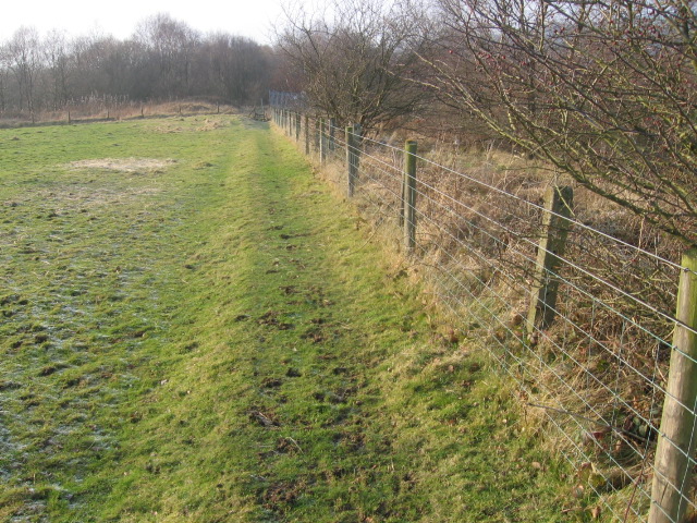
Show on map Photos Path near Gamesley Fold Farm
‹ ›
Weather for this location Next 14 days Nearby places Useful places within 5 km
Own or manage this place?
Claim this listing to keep details accurate, add photos, and highlight what makes it special — free.
Claim this page→ How useful was the information on this page?
Something wrong on this page?
id: cb431a5d-d159-4a96-9b1e-635b08f5855b
UK green spaces mapped from open public data — so anyone can find the woodland, trail, or nature reserve closest to them.
© 2026 Glade · Made with care for UK green spaces
Harlequin Ladybird Harmonia axyridis
Harlequin Ladybird Harmonia axyridis
Volucella inanis Volucella inanis2025
Volucella inanis Volucella inanis2025
Aphrophora alni Aphrophora alni2025
Aphrophora alni Aphrophora alni2025
Bibio pomonae Bibio pomonae2025
Bibio pomonae Bibio pomonae2025
Red-legged Shieldbug Pentatoma rufipes2025
Red-legged Shieldbug Pentatoma rufipes2025
Black-horned Gem Microchrysa polita2025
Black-horned Gem Microchrysa polita2025
Cicadella viridis Cicadella viridis2025
Cicadella viridis Cicadella viridis2025
Eristalis nemorum Eristalis nemorum2025
Eristalis nemorum Eristalis nemorum2025
Aphrophora major Aphrophora major2025
Aphrophora major Aphrophora major2025
Eupeodes luniger Eupeodes luniger2025
Eupeodes luniger Eupeodes luniger2025
Syritta pipiens Syritta pipiens2025
Syritta pipiens Syritta pipiens2025
House-fly Musca domestica2025
House-fly Musca domestica2025
Potato Capsid Closterotomus norwegicus2025
Potato Capsid Closterotomus norwegicus2025
Chrysotoxum festivum Chrysotoxum festivum2025
Chrysotoxum festivum Chrysotoxum festivum2025
Marmalade Hoverfly Episyrphus balteatus2025
Marmalade Hoverfly Episyrphus balteatus2025
Sphaerophoria scripta Sphaerophoria scripta2025
Sphaerophoria scripta Sphaerophoria scripta2025
Cuckoo-Spit Insect Philaenus spumarius2025
Cuckoo-Spit Insect Philaenus spumarius2025
Cheilosia illustrata Cheilosia illustrata2025
Cheilosia illustrata Cheilosia illustrata2025
Orange Ladybird Halyzia sedecimguttata2025
Orange Ladybird Halyzia sedecimguttata2025
Swollen-thighed Beetle Oedemera nobilis2025
Swollen-thighed Beetle Oedemera nobilis2025
Mystacides longicornis Mystacides longicornis2025
Mystacides longicornis Mystacides longicornis2025
Athripsodes albifrons Athripsodes albifrons2025
Athripsodes albifrons Athripsodes albifrons2025
Hawthorn Shieldbug Acanthosoma haemorrhoidale2025
Hawthorn Shieldbug Acanthosoma haemorrhoidale2025
Green Shieldbug Palomena prasina2025
Green Shieldbug Palomena prasina2025
Heteromyza Heteromyza2025
Heteromyza Heteromyza2025
Limnephilus sparsus Limnephilus sparsus2025
Limnephilus sparsus Limnephilus sparsus2025
Murky-legged Black Legionnaire Beris chalybata2025
Murky-legged Black Legionnaire Beris chalybata2025
Platycheirus albimanus Platycheirus albimanus2025
Platycheirus albimanus Platycheirus albimanus2025
Heteromyza commixta Heteromyza commixta2025
Heteromyza commixta Heteromyza commixta2025 Sanguisorba officinalis2025
Sanguisorba officinalis2025
Rosebay Willowherb Chamaenerion angustifolium2025
Rosebay Willowherb Chamaenerion angustifolium2025
Lesser Meadow-rue Thalictrum minus2025
Lesser Meadow-rue Thalictrum minus2025
Field Horsetail Equisetum arvense2025
Field Horsetail Equisetum arvense2025
Male-fern Dryopteris filix-mas2025
Male-fern Dryopteris filix-mas2025
Hedge Woundwort Stachys sylvatica2025
Hedge Woundwort Stachys sylvatica2025
Common Spotted-orchid Dactylorhiza fuchsii2025
Common Spotted-orchid Dactylorhiza fuchsii2025
Japanese Knotweed Reynoutria japonica2025
Japanese Knotweed Reynoutria japonica2025
Raspberry Rubus idaeus2025
Raspberry Rubus idaeus2025
Oval Sedge Carex leporina2025
Oval Sedge Carex leporina2025
Betony Betonica officinalis2025
Betony Betonica officinalis2025
Common Knapweed Centaurea nigra2025
Common Knapweed Centaurea nigra2025
Hazel Corylus avellana2025
Hazel Corylus avellana2025
Wild Angelica Angelica sylvestris2025
Wild Angelica Angelica sylvestris2025
Soft-rush Juncus effusus2025
Soft-rush Juncus effusus2025
Wood Horsetail Equisetum sylvaticum2025
Wood Horsetail Equisetum sylvaticum2025
Maidenhair Spleenwort Asplenium trichomanes2025
Maidenhair Spleenwort Asplenium trichomanes2025
Bracken Pteridium aquilinum subsp. aquilinum2025
Bracken Pteridium aquilinum subsp. aquilinum2025
Bilberry Vaccinium myrtillus2025
Bilberry Vaccinium myrtillus2025
Wayfaring-tree Viburnum lantana2025
Wayfaring-tree Viburnum lantana2025
Wintergreen Pyrola rotundifolia2025
Wintergreen Pyrola rotundifolia2025
Branched Bur-reed Sparganium erectum2025
Branched Bur-reed Sparganium erectum2025
Lesser Spearwort Ranunculus flammula2025
Lesser Spearwort Ranunculus flammula2025
Tufted Vetch Vicia cracca2025
Tufted Vetch Vicia cracca2025
Tutsan Hypericum androsaemum2025
Tutsan Hypericum androsaemum2025
Enchanter's-nightshade Circaea lutetiana2025
Enchanter's-nightshade Circaea lutetiana2025
Bush Vetch Vicia sepium2025
Bush Vetch Vicia sepium2025
Honeysuckle Lonicera periclymenum
Honeysuckle Lonicera periclymenum
Sycamore Acer pseudoplatanus
Sycamore Acer pseudoplatanus
Yellow Archangel Lamiastrum galeobdolon
Yellow Archangel Lamiastrum galeobdolon
Ivy-leaved Toadflax Cymbalaria muralis
Ivy-leaved Toadflax Cymbalaria muralis
Spear Mint Mentha spicata2025
Spear Mint Mentha spicata2025
Common Sallow Salix cinerea2025
Common Sallow Salix cinerea2025
Meadow Vetchling Lathyrus pratensis2025
Meadow Vetchling Lathyrus pratensis2025
Meadowsweet Filipendula ulmaria2025
Meadowsweet Filipendula ulmaria2025
Common Hemp-nettle Galeopsis tetrahit2025
Common Hemp-nettle Galeopsis tetrahit2025
Red Bartsia Odontites vernus2025
Red Bartsia Odontites vernus2025
Common Sorrel Rumex acetosa2025
Common Sorrel Rumex acetosa2025
Common Ragwort Jacobaea vulgaris2025
Common Ragwort Jacobaea vulgaris2025
Devil's-bit Scabious Succisa pratensis2025
Devil's-bit Scabious Succisa pratensis2025
Aspen Populus tremula2025
Aspen Populus tremula2025
Ash Fraxinus excelsior2025
Ash Fraxinus excelsior2025
Ground-elder Aegopodium podagraria2025
Ground-elder Aegopodium podagraria2025
Timothy Phleum pratense2025
Timothy Phleum pratense2025
Rowan Sorbus aucuparia2025
Rowan Sorbus aucuparia2025
Himalayan Balsam Impatiens glandulifera2025
Himalayan Balsam Impatiens glandulifera2025
Hard Shield-fern Polystichum aculeatum2025
Hard Shield-fern Polystichum aculeatum2025
Creeping Thistle Cirsium arvense2025
Creeping Thistle Cirsium arvense2025
Wall Lettuce Mycelis muralis2025
Wall Lettuce Mycelis muralis2025
Holly Ilex aquifolium2025
Holly Ilex aquifolium2025
Hay-scented Buckler-fern Dryopteris aemula2025
Hay-scented Buckler-fern Dryopteris aemula2025
Wych Elm Ulmus glabra2025
Wych Elm Ulmus glabra2025
Heather Calluna vulgaris2025
Heather Calluna vulgaris2025
Broad Buckler-fern Dryopteris dilatata2025
Broad Buckler-fern Dryopteris dilatata2025
Marsh-bedstraw Galium palustre2025
Marsh-bedstraw Galium palustre2025
Greater Bird's-foot-trefoil Lotus pedunculatus2025
Greater Bird's-foot-trefoil Lotus pedunculatus2025
False Fox-sedge Carex otrubae2025
False Fox-sedge Carex otrubae2025
Goldenrod Solidago virgaurea2025
Goldenrod Solidago virgaurea2025
Hard Rush Juncus inflexus2025
Hard Rush Juncus inflexus2025
Wavy Bitter-cress Cardamine flexuosa2025
Wavy Bitter-cress Cardamine flexuosa2025
Grey Poplar Populus alba x tremula = P. x canescens2025
Grey Poplar Populus alba x tremula = P. x canescens2025
Garden Lady's-mantle Alchemilla mollis2025
Garden Lady's-mantle Alchemilla mollis2025
Marsh Foxtail Alopecurus geniculatus2025
Marsh Foxtail Alopecurus geniculatus2025
White Clover Trifolium repens2025
White Clover Trifolium repens2025
Perennial Rye-grass Lolium perenne2025
Perennial Rye-grass Lolium perenne2025
Broad-leaved Bamboo Sasa palmata2025
Broad-leaved Bamboo Sasa palmata2025
Wood Avens Geum urbanum2025
Wood Avens Geum urbanum2025
Selfheal Prunella vulgaris2025
Selfheal Prunella vulgaris2025
Lamiastrum galeobdolon subsp. argentatum Lamiastrum galeobdolon subsp. argentatum2025
Lamiastrum galeobdolon subsp. argentatum Lamiastrum galeobdolon subsp. argentatum2025
Common Figwort Scrophularia nodosa2025
Common Figwort Scrophularia nodosa2025
Borage Borago officinalis2025
Borage Borago officinalis2025
Common Field-speedwell Veronica persica2025
Common Field-speedwell Veronica persica2025
Wall-rue Asplenium ruta-muraria2025
Wall-rue Asplenium ruta-muraria2025
Red Campion Silene dioica2025
Red Campion Silene dioica2025
Curled Dock Rumex crispus2025
Curled Dock Rumex crispus2025
Canadian Waterweed Elodea canadensis2025
Canadian Waterweed Elodea canadensis2025
Fringed Water-lily Nymphoides peltata2025
Fringed Water-lily Nymphoides peltata2025
Japanese Rose Rosa rugosa2025
Japanese Rose Rosa rugosa2025
Elder Sambucus nigra2025
Elder Sambucus nigra2025
Garlic Mustard Alliaria petiolata2025
Garlic Mustard Alliaria petiolata2025
Fringecups Tellima grandiflora2025
Fringecups Tellima grandiflora2025
Yarrow Achillea millefolium2025
Yarrow Achillea millefolium2025 Events & activities nearby Switch provider to compare local events, tours and bookable activities.
Bookable tours GetYourGuide Promote here