Plan your visit
Getting here
51.72398, -2.03047
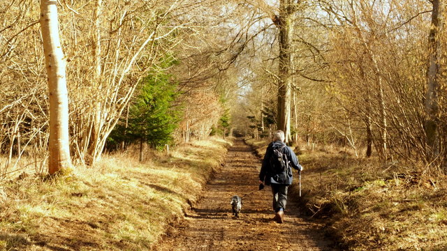
About CIRENCESTER PARK
Cirencester Park is a country house in the parish of Cirencester in Gloucestershire, England, and is the seat of the Bathurst family, Earls Bathurst. It is a Grade II* listed building. The gardens are Grade I listed on the Register of Historic Parks and Gardens.
Read more on Wikipedia →Visiting this summer
Seasonal nature notes and what to look for now
Visiting this summer
Seasonal nature notes and what to look for now
- 🐦70+ species recorded in this area — summer evenings are best for activity; watch for Nuthatch and Great Spotted Woodpecker
- ✦Historic character is a year-round quality here — summer brings its own atmosphere to the setting
- 🐕Dogs welcome — bring water in summer; the site has enough space to find shade on hot days
🌤️ Visiting this summer
- 🐦70+ species recorded in this area — summer evenings are best for activity; watch for Nuthatch and Great Spotted Woodpecker
- ✦Historic character is a year-round quality here — summer brings its own atmosphere to the setting
- 🐕Dogs welcome — bring water in summer; the site has enough space to find shade on hot days
Good to know
- 🐕Dogs welcome
Best for
Bird watching
Very strong match
Birds — Nuthatch, Great Spotted Woodpecker, Song Thrush +67 more · last seen 2025; Deciduous woodland — woodpeckers, warblers and woodland birds
Heritage
Strong match
Historic site with public access; Grade II* listed building: HEXAGON
Wildlife
Strong match
Birds — Nuthatch, Great Spotted Woodpecker, Song Thrush +67 more · last seen 2025; Deciduous woodland priority habitat
Insect spotting
Strong match
Chalk and limestone grassland — chalkhill blue, adonis blue and rare moths; Insects — Pearl-bordered Fritillary, Speckled Wood, Roesel's Bush-cricket +63 more · last seen 2025
Foraging
Strong match
Traditional orchard — seasonal fruit, fungi and wild plants
Dog walks
Good match
Dogs allowed with public access
Trails nearby
Within roughly 5 km🚶Walking
6 signed routes nearby · 59 public paths nearby
Signed route nearbyPublic paths
Walking
Monarch's WayWalking route990 km
approximate route of Charles II's escape
Macmillan WayWalking route290 km
The Roman WayWalking route274.5 km
Wysis WayWalking route88.5 km
Long distance footpath forming a link between the Thames and the Wye
Thames PathWalking route296 km
Riverside Walkpublic footpath · 15 m
Riverside Walkpublic footpath · 45 m
Riverside Walkpublic footpath · 273 m
🚴Cycling
26 signed routes nearby
Signed route nearby
Cycling
Mercian WayCycling route
National BywayCycling route
Fosse2Cycling route
Cotswold CyclewayCycling route
Main RouteCycling route592 m
Main RouteCycling route9.3 km
🐴Horse riding
11 public paths nearby
Public paths
Horse riding
The Broad Ridebridleway · 1.2 km
Wildlife to spot
Photos
Weather for this location
Loading local forecast…
Nearby places
Useful places within 5 km