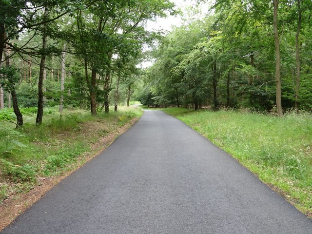
Coldwell Copse
✦ Ancient woodland55 ha
Plan your visit
🦉Wildlife🦅Birds🍂Seasonal
Public accessFree entryDogs welcome55 ha
Getting here
52.41532, -2.38261
Open directionsv
Visiting this summer
Seasonal nature notes and what to look for now
- 🌞Midsummer — early morning visits most comfortable; look for deer fawns in quieter clearings
- 🐕Early mornings are best for dog walks in summer — visit before 9am to avoid the heat and find quieter trails
- 📍Open access throughout summer — no booking required
🌤️ Visiting this summer
- 🌞Midsummer — early morning visits most comfortable; look for deer fawns in quieter clearings
- 🐕Early mornings are best for dog walks in summer — visit before 9am to avoid the heat and find quieter trails
- 📍Open access throughout summer — no booking required
- £Free to visit — no entry charge
- 🐕Dogs welcome
- 🌿Ancient woodland — rare wildlife habitat
🦉Wildlife
Very strong match
Multi-group wildlife — Amphibians, Birds, Mammals, Reptiles; Multi-group wildlife — Amphibians, Birds, Mammals, Reptiles
Free
🦅Bird watching
Very strong match
Birds — Coal Tit, Nuthatch, Goldcrest +65 more · last seen 2026; Birds — Coal Tit, Nuthatch, Goldcrest +65 more · last seen 2026
Free
🍂Seasonal nature
Strong match
Ancient woodland — bluebells, fungi and autumn colour; Plants — Butterbur, Early Dog-violet, Cuckooflower +20 more · last seen 2026
Free
🦋Insect spotting
Strong match
Insects — Red Wood Ant, Ringlet, Meadow Brown +114 more · last seen 2026; Insects — Red Wood Ant, Ringlet, Meadow Brown +114 more · last seen 2026
Free
Dogs allowed — public woodland
Free
Deciduous woodland — fungi, berries and wild garlic
Varies
Trails nearby
Within roughly 5 km7 signed routes nearby · 7 public paths nearby
Signed route nearbyPublic paths
North Worcestershire PathWalking route▾
Named routeRegional walking route
Worcestershire WayWalking route50 km▾
Walking route from Bewdley to Great Malvern
Named routeLength 50 kmRegional walking route
Geopark WayWalking route175 km▾
Named routeRef geoLength 175 kmRegional walking route
Ribbesford Circular TrailWalking route2 km▾
Named routeRef RCTLength 2 kmLocal walking route
Shropshire Way (Route 11, Link to Severn Way)Walking route14 km▾
Named routeLength 14 kmRegional walking route
41 signed routes nearby
Signed route nearby
Mercian WayCycling route▾
Named routeRef 45National Cycle Network
Main RouteCycling route129 m▾
Named routeRef 45Length 129 mNational Cycle NetworkTraffic-freeSurface unsealedfirm
Main RouteCycling route54 m▾
Named routeRef 45Length 54 mNational Cycle NetworkTraffic-freeSurface asphalt
Main RouteCycling route22 m▾
Named routeRef 45Length 22 mNational Cycle NetworkOn-roadSurface asphalt
Main RouteCycling route11 m▾
Named routeRef 45Length 11 mNational Cycle NetworkOn-roadSurface asphalt
Main RouteCycling route54 m▾
Named routeRef 45Length 54 mNational Cycle NetworkTraffic-freeSurface concrete
2 signed routes nearby
Signed route nearby
Wyre Forest Green RouteMountain bike route▾
Wyre Forest Blue RouteMountain bike route▾
1 public path nearby
Public paths
No named routes yet. Public paths are shown on the map.
Weather for this location
Next 14 daysNearby places
Useful places within 5 km
Own or manage this place?
Claim this listing to keep details accurate, add photos, and highlight what makes it special — free.
Claim this page→How useful was the information on this page?
id: 498d4ae5-cc52-4899-9ca7-fd37e98c34e9
Events & activities nearby
Switch provider to compare local events, tours and bookable activities.
Wildlife to spot
17,149 records · National Biodiversity Network
Wildlife to spot
17,149 records · National Biodiversity Network🐦Birds48 species
autumnwinter
2026▾
Raven · Goldcrest · Nuthatch · Coal Tit · Long-tailed Tit +43
- RavenCorvus corax2025
- GoldcrestRegulus regulus2025
- NuthatchSitta europaea
- Coal TitPeriparus ater2025
- Long-tailed TitAegithalos caudatus2025
- Blue TitCyanistes caeruleus2025
- CrossbillLoxia curvirostra2025
- RobinErithacus rubecula2025
- WoodpigeonColumba palumbus2025
- BlackbirdTurdus merula2025
- ChaffinchFringilla coelebs2025
- TreecreeperCerthia familiaris
- Green WoodpeckerPicus viridis
- JayGarrulus glandarius
- GoldfinchCarduelis carduelis2025
- Pied WagtailMotacilla alba yarrellii2025
- WrenTroglodytes troglodytes2025
- MoorhenGallinula chloropus2025
- MagpiePica pica2025
- Black-headed GullChroicocephalus ridibundus2025
- Lesser Black-backed GullLarus fuscus2025
- Carrion CrowCorvus corone2025
- GreenfinchChloris chloris2025
- StarlingSturnus vulgaris2025
- JackdawColoeus monedula2025
- House SparrowPasser domesticus2025
- Great Spotted WoodpeckerDendrocopos major2025
- Mistle ThrushTurdus viscivorus2025
- SiskinSpinus spinus2025
- SwallowHirundo rustica2025
- House MartinDelichon urbicum2025
- Greylag GooseAnser anser
- Sand MartinRiparia riparia
- CormorantPhalacrocorax carbo2025
- MallardAnas platyrhynchos2025
- RedwingTurdus iliacus2025
- Stock DoveColumba oenas2025
- Canada GooseBranta canadensis2025
- Song ThrushTurdus philomelos2025
- Great TitParus major2025
- Lesser RedpollAcanthis flammea cabaret2025
- BramblingFringilla montifringilla2025
- Lesser Spotted WoodpeckerDryobates minor2025
- KingfisherAlcedo atthis2025
- DipperCinclus cinclus2025
- ChiffchaffPhylloscopus collybita2025
- RookCorvus frugilegus2025
- StonechatSaxicola rubicola2025
🦌Mammals3 species
springsummerwinter
2026▾
Muntjac · Red Fox · Fallow Deer
- MuntjacMuntiacus reevesi2025
- Red FoxVulpes vulpes
- Fallow DeerDama dama2025
Slow-worm
🐝Insects28 species
winterspringautumn
2026▾
Red Wood Ant · Dark-edged Bee-fly · Anoplotrupes stercorosus · Eristalis pertinax · Bembidion biguttatum +23
- Red Wood AntFormica rufa
- Dark-edged Bee-flyBombylius major
- Anoplotrupes stercorosusAnoplotrupes stercorosus2025
- Eristalis pertinaxEristalis pertinax
- Bembidion biguttatumBembidion biguttatum
Butterbur · Early Dog-violet · Cuckooflower · Wall-rue · Green Hellebore +5
- ButterburPetasites hybridus
- Early Dog-violetViola reichenbachiana
- CuckooflowerCardamine pratensis
- Wall-rueAsplenium ruta-muraria
- Green HelleboreHelleborus viridis
- PolypodyPolypodium vulgare
- NavelwortUmbilicus rupestris
Species observations from the last 10 years via NBN Atlas
2-spot Ladybird
2-spot Ladybird
Adalia bipunctata
Adalia bipunctata
Melinopterus prodromusMelinopterus prodromusMelinopterus prodromusMelinopterus prodromusAgonum muelleriAgonum muelleriAgonum muelleriAgonum muelleriBembidion tetracolumBembidion tetracolumBembidion tetracolumBembidion tetracolumCarabus granulatusCarabus granulatusCarabus granulatusCarabus granulatusDusky AntFormica fuscaDusky AntFormica fuscaNotiophilus biguttatusNotiophilus biguttatusNotiophilus biguttatusNotiophilus biguttatusBembidion tibialeBembidion tibialeBembidion tibialeBembidion tibialeNalassus laevioctostriatusNalassus laevioctostriatusNalassus laevioctostriatusNalassus laevioctostriatusGreen ShieldbugPalomena prasinaGreen ShieldbugPalomena prasina7-spot LadybirdCoccinella septempunctata7-spot LadybirdCoccinella septempunctataDacne bipustulataDacne bipustulataDacne bipustulataDacne bipustulataMinotaur BeetleTyphaeus typhoeus2025Minotaur BeetleTyphaeus typhoeus2025Dock BugCoreus marginatus2025Dock BugCoreus marginatus2025Neottiglossa pusillaNeottiglossa pusilla2025Neottiglossa pusillaNeottiglossa pusilla2025Geomyza balachowskyiGeomyza balachowskyi2025Geomyza balachowskyiGeomyza balachowskyi2025Kite-tailed RobberflyMachimus atricapillus2025Kite-tailed RobberflyMachimus atricapillus2025Dark Bush-cricketPholidoptera griseoaptera2025Dark Bush-cricketPholidoptera griseoaptera2025Hydrotaea diabolusHydrotaea diabolus2025Hydrotaea diabolusHydrotaea diabolus2025Cymus melanocephalusCymus melanocephalus2025Cymus melanocephalusCymus melanocephalus2025Bishop's MitreAelia acuminata2025Bishop's MitreAelia acuminata2025HornetVespa crabro2025HornetVespa crabro2025Nut Leaf WeevilStrophosoma melanogrammum2025Nut Leaf WeevilStrophosoma melanogrammum2025Stinking IrisIris foetidissima2025Stinking IrisIris foetidissima2025Arum italicum subsp. italicumArum italicum subsp. italicum2025Arum italicum subsp. italicumArum italicum subsp. italicum2025MistletoeViscum album2025MistletoeViscum album2025