Redhill Copse - Conifer woodland 35 ha
Plan your visit
🐶 Dogs🦉 Wildlife🦅 Birds
Public access Free entry Dogs welcome 35 ha
Places › England › South East › Chichester Getting here
51.02740, -0.85268
Open directionsv Visiting this summer
Seasonal nature notes and what to look for now
▾ 🌞 Midsummer — early morning visits most comfortable; look for deer fawns in quieter clearings 🐕 Early mornings are best for dog walks in summer — visit before 9am to avoid the heat and find quieter trails 🅿️ Tullecombe 20m away — 4 car parks within reach 🌤️ Visiting this summer
🌞 Midsummer — early morning visits most comfortable; look for deer fawns in quieter clearings 🐕 Early mornings are best for dog walks in summer — visit before 9am to avoid the heat and find quieter trails 🅿️ Tullecombe 20m away — 4 car parks within reach £ Free to visit — no entry charge🐕 Dogs welcomeDogs allowed — public woodland
Free
Deciduous woodland priority habitat
Free
🦅 Bird watching
Strong match
Deciduous woodland — woodpeckers, warblers and woodland birds
Free
Deciduous woodland — fungi, berries and wild garlic
Varies
Named hiking route nearby: The Serpent Trail
Free
Trails nearby Within roughly 5 km 5 signed routes nearby · 8 public paths nearby
Signed route nearby Public paths
The Shipwrights Way Walking route ▾
A long distance route which links villages and towns in east Hampshire. The name reflects the use of oak grown at Alice Holt Forest for Tudor shipbuilding.
Named route Regional walking route
Show on map New Lipchis Way Walking route ▾
Named route Regional walking route
Show on map Sussex Border Path Walking route 220 km ▾
Named route Length 220 km Regional walking route
Show on map Liss Riverside Railway Wallk Walking route ▾
Named route Local walking route
Show on map The Serpent Trail Walking route ▾
Named route Regional walking route
Show on map Serpent Trail public footpath · 909 m ▾
Public path public footpath Length 909 m Surface dirt Path type: track
Show on map 39 signed routes nearby
Signed route nearby
National Cycle Route 228 Pulborough to Petersfield (proposed) Cycling route ▾
Named route Ref 228 National Cycle Network
Show on map A3 Cycle Route Cycling route ▾
Named route Ref A3 Local cycle route
Show on map Route 22 Cycling route ▾
Named route Ref 22 National Cycle Network
Show on map Discover the Hampshire South Downs by Bike Cycling route ▾
Named route Ref EH Regional cycle route
Show on map NCN 22 - Liphook Link Cycling route ▾
National Cycle Network link route
Named route Local cycle route
Show on map Main Route Cycling route 148 m ▾
Named route Ref 22 Length 148 m National Cycle Network On-road Surface asphalt
Show on map 3 signed routes nearby
Signed route nearby
King Alfred's Way Mountain bike route ▾
King Alfreds Way is 350km (220 miles) off road route designed to be ridden clockwise. It starts & ends in Winchester. It is suitable for gravel or cross-country bikes.
Named route Regional cycle route
Show on map Shipwright's Way Mountain bike route ▾
Shipwrights Way (Liphook Spur) Mountain bike route ▾
5 public paths nearby
Public paths
No named routes yet. Public paths are shown on the map.
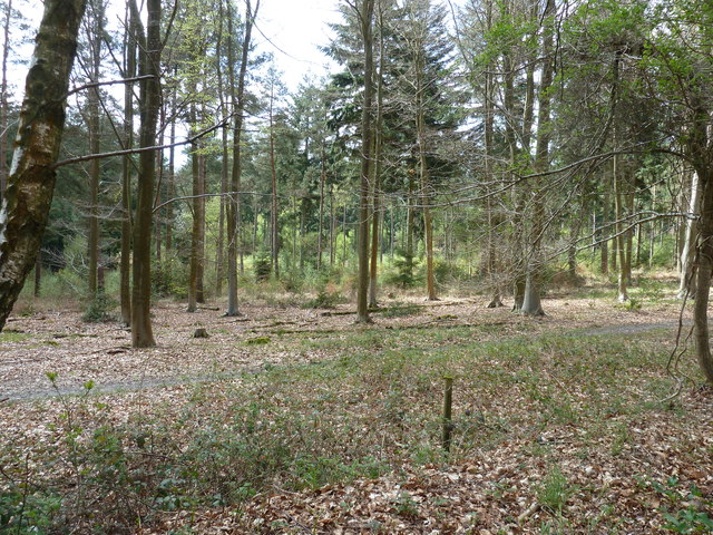
Photos Mixed woodland by the road to Milland
‹ ›
Weather for this location Next 14 days Nearby places Useful places within 5 km
All Historic
Own or manage this place?
Claim this listing to keep details accurate, add photos, and highlight what makes it special — free.
Claim this page→ How useful was the information on this page?
id: a2a52bf3-43ab-4707-95e4-8bfc2cc33d6e
UK green spaces mapped from open public data — so anyone can find the woodland, trail, or nature reserve closest to them.
© 2026 Glade · Made with care for UK green spaces
Events & activities nearby Switch provider to compare local events, tours and bookable activities.
Bookable tours GetYourGuide Promote here
Wildlife to spot
3,659 records · National Biodiversity Network
▾
Wildlife to spot 3,659 records · National Biodiversity Network Robin · Woodpigeon · Dunnock · Jay · Carrion Crow +20
Robin Erithacus rubecula Woodpigeon Columba palumbus Dunnock Prunella modularis Jay Garrulus glandarius Carrion Crow Corvus corone Redwing Turdus iliacus2024 Blackbird Turdus merula2024 Nuthatch Sitta europaea2024 Great Tit Parus major2024 Magpie Pica pica2024 Blue Tit Cyanistes caeruleus2024 Raven Corvus corax2024 Mistle Thrush Turdus viscivorus2024 Great Spotted Woodpecker Dendrocopos major2024 Treecreeper Certhia familiaris2024 Jackdaw Coloeus monedula2024 Stonechat Saxicola rubicola Linnet Linaria cannabina2024 Bullfinch Pyrrhula pyrrhula2024 Goldcrest Regulus regulus2024 Goldfinch Carduelis carduelis2024 Chaffinch Fringilla coelebs2024 Rook Corvus frugilegus2024 Long-tailed Tit Aegithalos caudatus2024 Egyptian Goose Alopochen aegyptiaca2024 🐝 Insects 3 species
winter summer
2026 ▾
16-spot Ladybird · Minotaur Beetle · Anoplotrupes stercorosus
16-spot Ladybird Tytthaspis sedecimpunctata Minotaur Beetle Typhaeus typhoeus2025 Anoplotrupes stercorosus Anoplotrupes stercorosus2024 Beech · Creeping Soft-grass · Hedge Woundwort · Wood Avens · Hawthorn +124
Beech Fagus sylvatica Creeping Soft-grass Holcus mollis Hedge Woundwort Stachys sylvatica Wood Avens Geum urbanum Hawthorn Crataegus monogyna Ash Fraxinus excelsior Rowan Sorbus aucuparia Species observations from the last 10 years via NBN Atlas
Alder Alnus glutinosa
Alder Alnus glutinosa
Enchanter's-nightshade Circaea lutetiana
Enchanter's-nightshade Circaea lutetiana
Bilberry Vaccinium myrtillus
Bilberry Vaccinium myrtillus
Scorpion Weed Phacelia tanacetifolia
Scorpion Weed Phacelia tanacetifolia
Honeysuckle Lonicera periclymenum
Honeysuckle Lonicera periclymenum
Red Clover Trifolium pratense
Red Clover Trifolium pratense
Green Alkanet Pentaglottis sempervirens
Green Alkanet Pentaglottis sempervirens
Greater Periwinkle Vinca major
Greater Periwinkle Vinca major
Dandelion Taraxacum
Dandelion Taraxacum
Hedge Bindweed Calystegia sepium
Hedge Bindweed Calystegia sepium
Soft-rush Juncus effusus
Soft-rush Juncus effusus
Male-fern Dryopteris filix-mas
Male-fern Dryopteris filix-mas
White Clover Trifolium repens
White Clover Trifolium repens
Ivy Hedera helix
Ivy Hedera helix
Yew Taxus baccata
Yew Taxus baccata
Mind-your-own-business Soleirolia soleirolii
Mind-your-own-business Soleirolia soleirolii
Blackthorn Prunus spinosa
Blackthorn Prunus spinosa
Ground-elder Aegopodium podagraria
Ground-elder Aegopodium podagraria
Wood-sorrel Oxalis acetosella
Wood-sorrel Oxalis acetosella
Groundsel Senecio vulgaris
Groundsel Senecio vulgaris
Hogweed Heracleum sphondylium
Hogweed Heracleum sphondylium
Greater Plantain Plantago major
Greater Plantain Plantago major
Sweet Chestnut Castanea sativa
Sweet Chestnut Castanea sativa
Square-stalked St John's-wort Hypericum tetrapterum
Square-stalked St John's-wort Hypericum tetrapterum
Western Red-cedar Thuja plicata
Western Red-cedar Thuja plicata
Bittersweet Solanum dulcamara
Bittersweet Solanum dulcamara
Wood Dock Rumex sanguineus
Wood Dock Rumex sanguineus
Meadow Buttercup Ranunculus acris
Meadow Buttercup Ranunculus acris
False-brome Brachypodium sylvaticum
False-brome Brachypodium sylvaticum
Montbretia Crocosmia aurea x pottsii = C. x crocosmiiflora
Montbretia Crocosmia aurea x pottsii = C. x crocosmiiflora
Bluebell Hyacinthoides non-scripta x hispanica = H. x massartiana
Bluebell Hyacinthoides non-scripta x hispanica = H. x massartiana
Cat's-ear Hypochaeris radicata
Cat's-ear Hypochaeris radicata
Ground-ivy Glechoma hederacea
Ground-ivy Glechoma hederacea
Remote Sedge Carex remota
Remote Sedge Carex remota
Lamiastrum galeobdolon subsp. argentatum Lamiastrum galeobdolon subsp. argentatum
Lamiastrum galeobdolon subsp. argentatum Lamiastrum galeobdolon subsp. argentatum
Creeping Cinquefoil Potentilla reptans
Creeping Cinquefoil Potentilla reptans
Common Nettle Urtica dioica
Common Nettle Urtica dioica
Foxglove Digitalis purpurea
Foxglove Digitalis purpurea
Garlic Mustard Alliaria petiolata
Garlic Mustard Alliaria petiolata
Wavy Bitter-cress Cardamine flexuosa
Wavy Bitter-cress Cardamine flexuosa
Ribwort Plantain Plantago lanceolata
Ribwort Plantain Plantago lanceolata
Gooseberry Ribes uva-crispa
Gooseberry Ribes uva-crispa
Mexican Fleabane Erigeron karvinskianus
Mexican Fleabane Erigeron karvinskianus
Common Chickweed Stellaria media
Common Chickweed Stellaria media
Common Knapweed Centaurea nigra
Common Knapweed Centaurea nigra
Phleum pratense Phleum pratense
Phleum pratense Phleum pratense
Common Sallow Salix cinerea
Common Sallow Salix cinerea
Bracken Pteridium aquilinum
Bracken Pteridium aquilinum
Germander Speedwell Veronica chamaedrys
Germander Speedwell Veronica chamaedrys
Trailing Bellflower Campanula poscharskyana
Trailing Bellflower Campanula poscharskyana
Rhododendron Rhododendron ponticum
Rhododendron Rhododendron ponticum
Wall Lettuce Mycelis muralis
Wall Lettuce Mycelis muralis
Dog's Mercury Mercurialis perennis
Dog's Mercury Mercurialis perennis
Lords-and-Ladies Arum maculatum
Lords-and-Ladies Arum maculatum
Goat Willow Salix caprea
Goat Willow Salix caprea
Common Bent Agrostis capillaris
Common Bent Agrostis capillaris
False Oat-grass Arrhenatherum elatius
False Oat-grass Arrhenatherum elatius
Pedunculate Oak Quercus robur
Pedunculate Oak Quercus robur
Black Bryony Tamus communis
Black Bryony Tamus communis
Elder Sambucus nigra
Elder Sambucus nigra
Broad-leaved Willowherb Epilobium montanum
Broad-leaved Willowherb Epilobium montanum
Pendulous Sedge Carex pendula
Pendulous Sedge Carex pendula
Polypody Polypodium vulgare
Polypody Polypodium vulgare
Holly Ilex aquifolium
Holly Ilex aquifolium
Hazel Corylus avellana
Hazel Corylus avellana
Yellow-flowered Strawberry Potentilla indica
Yellow-flowered Strawberry Potentilla indica
Red Currant Ribes rubrum
Red Currant Ribes rubrum
Wilson's Honeysuckle Lonicera nitida
Wilson's Honeysuckle Lonicera nitida
Greater Celandine Chelidonium majus
Greater Celandine Chelidonium majus
Greater Stitchwort Stellaria holostea
Greater Stitchwort Stellaria holostea
Wood-sedge Carex sylvatica
Wood-sedge Carex sylvatica
Common Sorrel Rumex acetosa
Common Sorrel Rumex acetosa
Broad-leaved Dock Rumex obtusifolius
Broad-leaved Dock Rumex obtusifolius
Field-rose Rosa arvensis
Field-rose Rosa arvensis
Fennel Foeniculum vulgare
Fennel Foeniculum vulgare
Common Ragwort Jacobaea vulgaris
Common Ragwort Jacobaea vulgaris
Sycamore Acer pseudoplatanus
Sycamore Acer pseudoplatanus
Cock's-foot Dactylis glomerata
Cock's-foot Dactylis glomerata
Cherry Laurel Prunus laurocerasus
Cherry Laurel Prunus laurocerasus
Apple Malus domestica
Apple Malus domestica
Creeping Bent Agrostis stolonifera
Creeping Bent Agrostis stolonifera
Hart's-Tongue Asplenium scolopendrium
Hart's-Tongue Asplenium scolopendrium
Barren Strawberry Potentilla sterilis
Barren Strawberry Potentilla sterilis
Short-fruited Willowherb Epilobium obscurum
Short-fruited Willowherb Epilobium obscurum
Arum italicum subsp. italicum Arum italicum subsp. italicum
Arum italicum subsp. italicum Arum italicum subsp. italicum
Purple Toadflax Linaria purpurea
Purple Toadflax Linaria purpurea
Greater Bird's-foot-trefoil Lotus pedunculatus
Greater Bird's-foot-trefoil Lotus pedunculatus
Downy Birch Betula pubescens
Downy Birch Betula pubescens
Common Figwort Scrophularia nodosa
Common Figwort Scrophularia nodosa
Creeping Thistle Cirsium arvense
Creeping Thistle Cirsium arvense
Tutsan Hypericum androsaemum
Tutsan Hypericum androsaemum
Butterfly-bush Buddleja davidii
Butterfly-bush Buddleja davidii
Nipplewort Lapsana communis
Nipplewort Lapsana communis
Marsh Thistle Cirsium palustre
Marsh Thistle Cirsium palustre
Dryopteris affinis Dryopteris affinis
Dryopteris affinis Dryopteris affinis
Sweet Vernal-grass Anthoxanthum odoratum
Sweet Vernal-grass Anthoxanthum odoratum
Creeping Buttercup Ranunculus repens
Creeping Buttercup Ranunculus repens
Fat-hen Chenopodium album
Fat-hen Chenopodium album
Arrow Bamboo Pseudosasa japonica
Arrow Bamboo Pseudosasa japonica
Cleavers Galium aparine
Cleavers Galium aparine
Smooth Sow-thistle Sonchus oleraceus
Smooth Sow-thistle Sonchus oleraceus
Raspberry Rubus idaeus
Raspberry Rubus idaeus
Lady-fern Athyrium filix-femina
Lady-fern Athyrium filix-femina
Selfheal Prunella vulgaris
Selfheal Prunella vulgaris
Herb-Robert Geranium robertianum
Herb-Robert Geranium robertianum
Cow Parsley Anthriscus sylvestris
Cow Parsley Anthriscus sylvestris
Yarrow Achillea millefolium
Yarrow Achillea millefolium
Lesser Burdock Arctium minus
Lesser Burdock Arctium minus
Broad Buckler-fern Dryopteris dilatata
Broad Buckler-fern Dryopteris dilatata
Bilbao Fleabane Erigeron floribundus
Bilbao Fleabane Erigeron floribundus
Opposite-leaved Golden-saxifrage Chrysosplenium oppositifolium
Opposite-leaved Golden-saxifrage Chrysosplenium oppositifolium
Fox-and-cubs Pilosella aurantiaca
Fox-and-cubs Pilosella aurantiaca
Hop Humulus lupulus
Hop Humulus lupulus
Great Horsetail Equisetum telmateia
Great Horsetail Equisetum telmateia
Waved Silk-moss Plagiothecium undulatum
Waved Silk-moss Plagiothecium undulatum
Dark Mullein Verbascum nigrum
Dark Mullein Verbascum nigrum
Musk Orchid Herminium monorchis
Musk Orchid Herminium monorchis
Shepherd's-purse Capsella bursa-pastoris
Shepherd's-purse Capsella bursa-pastoris
Red Dead-nettle Lamium purpureum
Red Dead-nettle Lamium purpureum
Wild Carrot Daucus carota2024
Wild Carrot Daucus carota2024
Black Nightshade Solanum nigrum2024
Black Nightshade Solanum nigrum2024
Forked Veilwort Metzgeria furcata2024
Forked Veilwort Metzgeria furcata2024