🌞Midsummer — early morning visits most comfortable; look for deer fawns in quieter clearings
🐕Early mornings are best for dog walks in summer — visit before 9am to avoid the heat and find quieter trails
📍Open access throughout summer — no booking required
🌤️ Visiting this summer
🌞Midsummer — early morning visits most comfortable; look for deer fawns in quieter clearings
🐕Early mornings are best for dog walks in summer — visit before 9am to avoid the heat and find quieter trails
📍Open access throughout summer — no booking required
Good to know
£Free to visit — no entry charge
🐕Dogs welcome
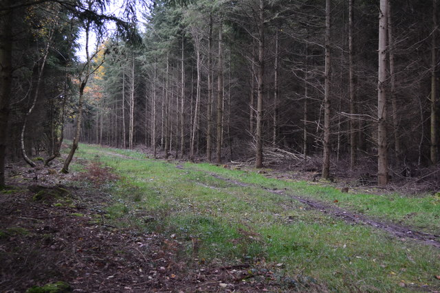
🌿Ancient woodland — rare wildlife habitat
Best for
9 activities
🦉
Wildlife
Strong match
Deciduous woodland priority habitat; Ancient woodland
Free
🍂
Seasonal nature
Strong match
Ancient woodland — bluebells, fungi and autumn colour
Free
🦋
Insect spotting
Strong match
Chalk and limestone grassland — chalkhill blue, adonis blue and rare moths
Free
🐶
Dog walks
Strong match
Dogs allowed — public woodland
Free
🦅
Bird watching
Strong match
Deciduous woodland — woodpeckers, warblers and woodland birds
Free
🌿
Foraging
Good match
Deciduous woodland — fungi, berries and wild garlic
Varies
Trails nearby
Within roughly 5 km
🚶
Walking
▾
5 signed routes nearby
Signed route nearby
Test WayWalking route▾
Named routeListed length 79Regional walking route
Monarch's WayWalking route990 km▾
approximate route of Charles II's escape
Named routeRef MWLength 990 kmRegional walking route
Clarendon WayWalking route▾
Winchester to Salisbury
Named routeRegional walking route
Stockbridge Common Marsh Wildlife Walk, SW HantsWalking route2.9 km▾
Enjoy the open space of Stockbridge Common, situated along the River Test. The marsh offers access to the river's edge, in a valley that has little / no river frontage. An ideal location for walking & picnicking. Grass paths can be muddy after wet weather
Named routeLength 2.9 kmDuration 00:45-01:00Round tripLocal walking route
Named routeRef 24Length 143 mNational Cycle NetworkOn-roadSurface asphalt
Main RouteCycling route19 m▾
Named routeRef 246Length 19 mNational Cycle NetworkTraffic-freeSurface other
🚵
Mountain biking
▾
6 signed routes nearby
Signed route nearby
Farley Mount Off Road Cycle TrailMountain bike route▾
Named routeHampshire off Road cycle trails
Farley Mount Off Road Cycle Trail (Shortcut)Mountain bike route▾
Named route
Danebury Off-Road Cycle TrailMountain bike route▾
A strenuous 24 miles that takes in some of Hampshire’s finest scenery. This cycle route joins easy sections of the Test Way with the steeper gradients of the Broughton Downs.
Named routeListed length 24 miHampshire off Road cycle trails
King Alfred's WayMountain bike route▾
King Alfreds Way is 350km (220 miles) off road route designed to be ridden clockwise. It starts & ends in Winchester. It is suitable for gravel or cross-country bikes.
Named routeRegional cycle route
Sparsholt Off Road Cycle TrailMountain bike route▾
Named routeHampshire off Road cycle trails
WestwoodMountain bike route▾
Named routeHampshire off Road cycle trails
🐴
Horse riding
▾
12 public paths nearby
Public paths
Parnholt Lanerestricted byway · 257 m▾
Public pathrestricted bywayLength 257 mSurface groundIncline 2%Path type: bridleway
Coombe Bottom Lanerestricted byway · 166 m▾
Public pathrestricted bywayLength 166 mSurface gravelPath type: track
Farley Lanerestricted byway · 475 m▾
Public pathrestricted bywayLength 475 mSurface gravelIncline 0%Path type: track
Coombe Bottom Lanebyway open to all traffic · 3.3 km▾
Public pathbyway open to all trafficLength 3.3 kmSurface gravelIncline 4%Path type: track
Parnholt Lanerestricted byway · 257 m▾
Public pathrestricted bywayLength 257 mSurface gravelIncline 10%Path type: track