Getting here
51.16219, -0.69110
Visiting this summer
Seasonal nature notes and what to look for now
Visiting this summer
Seasonal nature notes and what to look for now
- 🌞Midsummer — early morning visits most comfortable; look for deer fawns in quieter clearings
- 🐕Early mornings are best for dog walks in summer — visit before 9am to avoid the heat and find quieter trails
- 📍Open access throughout summer — no booking required
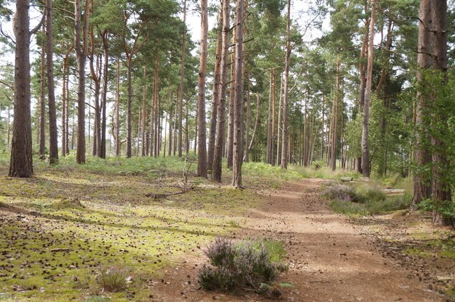
🌤️ Visiting this summer
- 🌞Midsummer — early morning visits most comfortable; look for deer fawns in quieter clearings
- 🐕Early mornings are best for dog walks in summer — visit before 9am to avoid the heat and find quieter trails
- 📍Open access throughout summer — no booking required
Good to know
- £Free to visit — no entry charge
- 🐕Dogs welcome
Best for
Dog walks
Strong match
Dogs allowed — public woodland
Bird watching
Strong match
Lowland heathland — Dartford warblers, nightjars and stonechats
Insect spotting
Strong match
Lowland heathland — silver-studded blue and heath fritillary butterflies
Wildlife
Strong match
Lowland fens priority habitat
Foraging
Good match
Deciduous woodland — fungi, berries and wild garlic
Forest walks
Good match
Public woodland
Trails nearby
Within roughly 5 km🚶Walking
11 signed routes nearby · 7 public paths nearby
Signed route nearbyPublic paths
Walking
Greensand WayWalking route
Highcombe Hike, HindheadWalking route5.1 km
Take a challenging walk through ancient woodland and open heath to find out how the Punch Bowl was formed. On the way learn about the people who lived in the old 'broom-squires' cottages and how they made their living here over the centuries.
Roam 639 Walk at Hindhead Commons and the Devil's Punch Bowl, HindheadWalking route10.2 km
A demanding walk taking in the Punchbowl, Gibbet Hill & Temple of the Four Winds. Named after Richard Overall, Alfie & Arthur Marchant; local men who died from muscular dystrophy. '639' represents the no. of muscles in the human body & length of the walk
Golden Valley Woodland Walk, HindheadWalking route4.8 km
A short woodland walk through the Golden Valley, which particularly lives up to its name in autumn when the beech, sycamores & oaks contrast beautifully with the dark green Scots pines. Rough tracks with a steep up & downhill sections & muddy patches.
Nature Trail, HindheadWalking route1.3 km
🚴Cycling
3 signed routes nearby
Signed route nearby
Cycling
A3 Cycle RouteCycling route
Surrey CyclewayCycling route
Cycle route consisting of main loop plus link routes
Surrey CyclewayCycling route
Farnham link
🚵Mountain biking
4 signed routes nearby
Signed route nearby
Mountain biking
King Alfred's WayMountain bike route
King Alfreds Way is 350km (220 miles) off road route designed to be ridden clockwise. It starts & ends in Winchester. It is suitable for gravel or cross-country bikes.
Cycle Surrey Hills - Elstead LoopMountain bike route
Cycle Surrey Hills - Puttenham LoopMountain bike route
Devils PunchBowl LoopMountain bike route
🐴Horse riding
52 public paths nearby
Public paths
Horse riding
No named routes yet. Public paths are shown on the map.
Wildlife to spot
Photos
Weather for this location
Loading local forecast…
Nearby places
Useful places within 5 km
Own or manage this place?
Claim this listing to keep details accurate, add photos, and highlight what makes it special — free.
Claim this pageHow was your visit?
How useful was the information on this page?
id: 54f91e78-086d-42d0-a30a-c6f2dad527b6