Longton Wood - Conifer woodland
✦ Ancient woodland14 ha
🦉Wildlife🐶Dogs🦅Birds
Public accessFree entryDogs welcome14 ha
Getting here
51.30814, 0.62377
Open directionsv
Visiting this summer
Seasonal nature notes and what to look for now
- 🌞Midsummer — early morning visits most comfortable; look for deer fawns in quieter clearings
- 🐕Early mornings are best for dog walks in summer — visit before 9am to avoid the heat and find quieter trails
- 🅿️Parking 139m away — 4 car parks within reach
🌤️ Visiting this summer
- 🌞Midsummer — early morning visits most comfortable; look for deer fawns in quieter clearings
- 🐕Early mornings are best for dog walks in summer — visit before 9am to avoid the heat and find quieter trails
- 🅿️Parking 139m away — 4 car parks within reach
- £Free to visit — no entry charge
- 🐕Dogs welcome
- 🌿Ancient woodland — rare wildlife habitat
Deciduous woodland priority habitat; Ancient woodland
Free
Dogs allowed — public woodland
Free
🦅Bird watching
Strong match
Lowland heathland — Dartford warblers, nightjars and stonechats
Free
🦋Insect spotting
Strong match
Lowland heathland — silver-studded blue and heath fritillary butterflies
Free
🍂Seasonal nature
Strong match
Ancient woodland — bluebells, fungi and autumn colour
Free
Deciduous woodland — fungi, berries and wild garlic
Varies
Trails nearby
Within roughly 5 km10 signed routes nearby · 2 public paths nearby
Signed route nearbyPublic paths
Augustine CaminoWalking route▾
Named routeRegional walking route
Oftord to Canterbury CathedralWalking route▾
follows North Downs Way from Otford to Broughton Lees
Named routeRegional walking route
Scenic Green Trail Stage 4Walking route12 km▾
Named routeRef SGT4Length 12 kmLocal walking route
North Downs Way (Eastern)Walking route▾
Named routeNational walking route
Len Valley WalkWalking route▾
Named routeLocal walking route
17 signed routes nearby
Signed route nearby
NCN National Route 177 (Proposed)Cycling route▾
Named routeRef 177National Cycle Network
NCN National Route 17Cycling route▾
Named routeRef 17National Cycle Network
Main RouteCycling route2.8 km▾
Named routeRef 17Length 2.8 kmNational Cycle NetworkTraffic-freeSurface unsealedfirm
Main RouteCycling route39 m▾
Named routeRef 17Length 39 mNational Cycle NetworkTraffic-freeSurface asphalt
Main RouteCycling route3.7 km▾
Named routeRef 17Length 3.7 kmNational Cycle NetworkOn-roadSurface asphalt
Main RouteCycling route541 m▾
Named routeRef 17Length 541 mNational Cycle NetworkTraffic-freeSurface asphalt
1 signed route nearby
Signed route nearby
Capstone Mountain bike trailMountain bike route▾
2 public paths nearby
Public paths
Steps Hill Roadbyway open to all traffic · 420 m▾
Public pathbyway open to all trafficLength 420 mSurface asphaltIncline downPath type: bridleway
Steps Hill Roadbyway open to all traffic · 15 m▾
Public pathbyway open to all trafficLength 15 mSurface asphaltIncline downPath type: unclassified
Photos
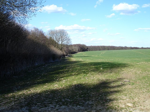
Eastern edge of Longton Wood
Weather for this location
Next 14 daysNearby places
Useful places within 5 km
Own or manage this place?
Claim this listing to keep details accurate, add photos, and highlight what makes it special — free.
Claim this page→How useful was the information on this page?
id: 7fc80721-9ee1-4d8a-a47d-a46718661e42
Events & activities nearby
Switch provider to compare local events, tours and bookable activities.
Wildlife to spot
4,319 records · National Biodiversity Network
Wildlife to spot
4,319 records · National Biodiversity NetworkMediterranean Gull · Robin · Yellow-legged Gull · Woodcock
- Mediterranean GullIchthyaetus melanocephalus2025
- RobinErithacus rubecula
- Yellow-legged GullLarus michahellis2025
- WoodcockScolopax rusticola2025
🦌Mammals3 species
winterspringsummerautumn
2025▾
Badger · Red Fox · Rabbit
- BadgerMeles meles
- Red FoxVulpes vulpes
- RabbitOryctolagus cuniculus
🐝Insects2 species
springsummer
2025▾
Swollen-thighed Beetle · Common Cockchafer
- Swollen-thighed BeetleOedemera nobilis
- Common CockchaferMelolontha melolontha
Lilac Bonnet · Amanita'r Gwybed · Torth Felen · Yellowing Knight · Rooting Shank +101
- Lilac BonnetMycena pura
- Amanita'r GwybedAmanita muscaria
- Torth FelenHypholoma fasciculare
- Yellowing KnightTricholoma scalpturatum
- Rooting ShankHymenopellis radicata
- White SaddleHelvella crispa
- Beefsteak FungusFistulina hepatica
Species observations from the last 10 years via NBN Atlas