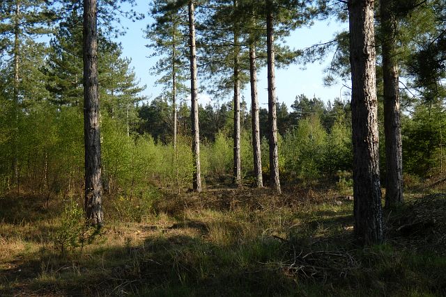
Bramshill Plantation - Conifer woodland 60 ha
Plan your visit
🐶 Dogs🦉 Wildlife🦅 Birds
Public access Free entry Dogs welcome 60 ha
Places › England › South East › Hart Getting here
51.35255, -0.91408
Open directionsv Visiting this summer
Seasonal nature notes and what to look for now
▾ ☀️ June — canopy now fully closed, creating cool dappled shade even on warm days 🐕 Early mornings are best for dog walks in summer — visit before 9am to avoid the heat and find quieter trails 🅿️ Parking 114m away — 4 car parks within reach 🌤️ Visiting this summer
☀️ June — canopy now fully closed, creating cool dappled shade even on warm days 🐕 Early mornings are best for dog walks in summer — visit before 9am to avoid the heat and find quieter trails 🅿️ Parking 114m away — 4 car parks within reach £ Free to visit — no entry charge🐕 Dogs welcomeDogs allowed — public woodland
Free
Deciduous woodland priority habitat
Free
🦅 Bird watching
Strong match
Deciduous woodland — woodpeckers, warblers and woodland birds
Free
🦋 Insect spotting
Good match
Acid grassland — heathland butterflies and rare invertebrates
Free
Deciduous woodland — fungi, berries and wild garlic
Varies
Trails nearby Within roughly 5 km 6 signed routes nearby · 28 public paths nearby
Signed route nearby Public paths
Three Castles Path Walking route ▾
Named route Regional walking route
Show on map Coombes Circular Walk Walking route ▾
Named route Round trip Local walking route
Show on map Finchampstead Ridges Ramble, Finchampstead Ridges Walking route 2.2 km ▾
A waymarked trail across Finchampstead Ridges, with views toward the Hog's Back ridge in Surrey. The route takes in two ponds, a woodland section, with slopes & opportunities to spot wildlife including birds of prey, deer and colourful dragonflies
Named route Length 2.2 km Duration 00:45 Round trip Local walking route
Show on map Blackwater Valley Path Walking route ▾
Named route Regional walking route
Show on map The Wokingham Way Walking route ▾
Named route Regional walking route
Show on map Plover Lane public footpath · 73 m ▾
Public path public footpath Length 73 m Surface gravel Path type: residential
Show on map 5 signed routes nearby
Signed route nearby
California Greenway Cycling route ▾
Named route Local cycle route
Show on map Round Berkshire Cycle Route Cycling route ▾
Named route Regional cycle route
Show on map Route 2 Cycling route ▾
Named route Ref 2 Local cycle route
Show on map Oakbank School LCN Cycling route ▾
Named route Local cycle route
Show on map Finchampstead Useful Cycle Routes Cycling route ▾
1 signed route nearby
Signed route nearby
King Alfred's Way Mountain bike route ▾
King Alfreds Way is 350km (220 miles) off road route designed to be ridden clockwise. It starts & ends in Winchester. It is suitable for gravel or cross-country bikes.
Named route Regional cycle route
Show on map 2 public paths nearby
Public paths
The Welsh Drive bridleway · 566 m ▾
Public path bridleway Length 566 m Surface mud Path type: bridleway
Show on map
Weather for this location Next 14 days Nearby places Useful places within 5 km
All Historic
How useful was the information on this page?
id: ef6db1a1-7301-472c-8758-79bc3e4c43a3
UK green spaces mapped from open public data — so anyone can find the woodland, trail, or nature reserve closest to them.
© 2026 Glade · Made with care for UK green spaces
Events & activities nearby Switch provider to compare local events, tours and bookable activities.
Bookable tours Wildlife to spot
17,261 records · National Biodiversity Network
▾
Wildlife to spot 17,261 records · National Biodiversity Network 🐦 Birds 31 species
autumn winter
2025 ▾
Jay · Long-tailed Tit · Goldcrest · Woodpigeon · Pheasant +26
Jay Garrulus glandarius Long-tailed Tit Aegithalos caudatus Goldcrest Regulus regulus Woodpigeon Columba palumbus Pheasant Phasianus colchicus Green Woodpecker Picus viridis Carrion Crow Corvus corone Chaffinch Fringilla coelebs Great Tit Parus major Blackbird Turdus merula Jackdaw Coloeus monedula Robin Erithacus rubecula Rook Corvus frugilegus Great Spotted Woodpecker Dendrocopos major Blue Tit Cyanistes caeruleus Treecreeper Certhia familiaris Egyptian Goose Alopochen aegyptiaca Redwing Turdus iliacus Goldfinch Carduelis carduelis Stock Dove Columba oenas Song Thrush Turdus philomelos Coot Fulica atra Moorhen Gallinula chloropus Wren Troglodytes troglodytes Greylag Goose Anser anser Coal Tit Periparus ater Magpie Pica pica Grey Wagtail Motacilla cinerea Rock Dove Columba livia Firecrest Regulus ignicapilla Raven Corvus corax 🦌 Mammals 3 species
winter autumn
2026 ▾
Grey Squirrel · Badger · Muntjac
Grey Squirrel Sciurus carolinensis2025 Badger Meles meles Muntjac Muntiacus reevesi2025 Ribwort Plantain · Common Fleabane · Creeping Thistle · Soft-rush · Tufted Hair-grass +78
Ribwort Plantain Plantago lanceolata Common Fleabane Pulicaria dysenterica Creeping Thistle Cirsium arvense Soft-rush Juncus effusus Tufted Hair-grass Deschampsia cespitosa Marsh Thistle Cirsium palustre Bramble Rubus fruticosus Species observations from the last 10 years via NBN Atlas
Common Bird's-foot-trefoil Lotus corniculatus
Common Bird's-foot-trefoil Lotus corniculatus
Hard Rush Juncus inflexus
Hard Rush Juncus inflexus
Common Bent Agrostis capillaris
Common Bent Agrostis capillaris
Gorse Ulex europaeus
Gorse Ulex europaeus
False Fox-sedge Carex otrubae
False Fox-sedge Carex otrubae
Selfheal Prunella vulgaris
Selfheal Prunella vulgaris
Cat's-ear Hypochaeris radicata
Cat's-ear Hypochaeris radicata
Scots Pine Pinus sylvestris
Scots Pine Pinus sylvestris
Creeping Bent Agrostis stolonifera
Creeping Bent Agrostis stolonifera
Yarrow Achillea millefolium
Yarrow Achillea millefolium
Common Vetch Vicia sativa
Common Vetch Vicia sativa
Compact Rush Juncus conglomeratus
Compact Rush Juncus conglomeratus
Grey Willow Salix cinerea subsp. cinerea
Grey Willow Salix cinerea subsp. cinerea
Red Fescue Festuca rubra
Red Fescue Festuca rubra
Wild Carrot Daucus carota
Wild Carrot Daucus carota
Cow Parsley Anthriscus sylvestris
Cow Parsley Anthriscus sylvestris
Red Clover Trifolium pratense
Red Clover Trifolium pratense
Creeping Buttercup Ranunculus repens
Creeping Buttercup Ranunculus repens
Bulbous Rush Juncus bulbosus
Bulbous Rush Juncus bulbosus
Hawthorn Crataegus monogyna
Hawthorn Crataegus monogyna
Gypsywort Lycopus europaeus
Gypsywort Lycopus europaeus
Oxeye Daisy Leucanthemum vulgare
Oxeye Daisy Leucanthemum vulgare
Perforate St John's-wort Hypericum perforatum
Perforate St John's-wort Hypericum perforatum
Pendulous Sedge Carex pendula
Pendulous Sedge Carex pendula
Annual Meadow-grass Poa annua
Annual Meadow-grass Poa annua
Purple Moor-grass Molinia caerulea
Purple Moor-grass Molinia caerulea
Silver Birch Betula pendula
Silver Birch Betula pendula
Heather Calluna vulgaris
Heather Calluna vulgaris
Crested Dog's-tail Cynosurus cristatus
Crested Dog's-tail Cynosurus cristatus
Cock's-foot Dactylis glomerata
Cock's-foot Dactylis glomerata
Blackthorn Prunus spinosa
Blackthorn Prunus spinosa
Yorkshire-fog Holcus lanatus
Yorkshire-fog Holcus lanatus
Tormentil Potentilla erecta
Tormentil Potentilla erecta
Meadow Buttercup Ranunculus acris
Meadow Buttercup Ranunculus acris
Upright Hedge-parsley Torilis japonica
Upright Hedge-parsley Torilis japonica
White Poplar Populus alba
White Poplar Populus alba
Sweet Vernal-grass Anthoxanthum odoratum
Sweet Vernal-grass Anthoxanthum odoratum
Floating Club-rush Eleogiton fluitans
Floating Club-rush Eleogiton fluitans
Tufted Vetch Vicia cracca
Tufted Vetch Vicia cracca
Common Reed Phragmites australis
Common Reed Phragmites australis
Hairy Bitter-cress Cardamine hirsuta
Hairy Bitter-cress Cardamine hirsuta
Coltsfoot Tussilago farfara
Coltsfoot Tussilago farfara
Bristle Club-rush Isolepis setacea
Bristle Club-rush Isolepis setacea
Common Club-rush Schoenoplectus lacustris
Common Club-rush Schoenoplectus lacustris
Honeysuckle Lonicera periclymenum
Honeysuckle Lonicera periclymenum
Meadow Vetchling Lathyrus pratensis
Meadow Vetchling Lathyrus pratensis
White Dead-nettle Lamium album
White Dead-nettle Lamium album
Creeping-Jenny Lysimachia nummularia
Creeping-Jenny Lysimachia nummularia
Perennial Rye-grass Lolium perenne
Perennial Rye-grass Lolium perenne
Yellow Loosestrife Lysimachia vulgaris
Yellow Loosestrife Lysimachia vulgaris
Grey Sedge Carex divulsa subsp. divulsa
Grey Sedge Carex divulsa subsp. divulsa
Rough Meadow-grass Poa trivialis
Rough Meadow-grass Poa trivialis
Common Sorrel Rumex acetosa
Common Sorrel Rumex acetosa
New Zealand Pigmyweed Crassula helmsii
New Zealand Pigmyweed Crassula helmsii
Broad-leaved Dock Rumex obtusifolius
Broad-leaved Dock Rumex obtusifolius
Green-ribbed Sedge Carex binervis
Green-ribbed Sedge Carex binervis
Field Horsetail Equisetum arvense
Field Horsetail Equisetum arvense
Curled Dock Rumex crispus
Curled Dock Rumex crispus
Lesser Spearwort Ranunculus flammula
Lesser Spearwort Ranunculus flammula
Smooth Sow-thistle Sonchus oleraceus
Smooth Sow-thistle Sonchus oleraceus
Common Centaury Centaurium erythraea
Common Centaury Centaurium erythraea
Square-stalked St John's-wort Hypericum tetrapterum
Square-stalked St John's-wort Hypericum tetrapterum
Alder Alnus glutinosa
Alder Alnus glutinosa
Common Ragwort Jacobaea vulgaris
Common Ragwort Jacobaea vulgaris
Cleavers Galium aparine
Cleavers Galium aparine
Foxglove Digitalis purpurea
Foxglove Digitalis purpurea
Marsh-bedstraw Galium palustre
Marsh-bedstraw Galium palustre
Rose Rosa
Rose Rosa
Creeping Cinquefoil Potentilla reptans
Creeping Cinquefoil Potentilla reptans
Holly Ilex aquifolium
Holly Ilex aquifolium
Water Mint Mentha aquatica
Water Mint Mentha aquatica
False Oat-grass Arrhenatherum elatius
False Oat-grass Arrhenatherum elatius
Water-plantain Alisma plantago-aquatica
Water-plantain Alisma plantago-aquatica
Broom Cytisus scoparius
Broom Cytisus scoparius
Slender Rush Juncus tenuis
Slender Rush Juncus tenuis
Jointed Rush Juncus articulatus
Jointed Rush Juncus articulatus