Down Wood - Conifer woodland
✦ Ancient woodland6 ha
🦉Wildlife🐶Dogs🍂Seasonal
Public accessFree entryDogs welcome6 ha
Getting here
51.77339, -2.15200
Open directionsv
Visiting this summer
Seasonal nature notes and what to look for now
- 🌞Midsummer — early morning visits most comfortable; look for deer fawns in quieter clearings
- 🐕Early mornings are best for dog walks in summer — visit before 9am to avoid the heat and find quieter trails
- 📍Open access throughout summer — no booking required
🌤️ Visiting this summer
- 🌞Midsummer — early morning visits most comfortable; look for deer fawns in quieter clearings
- 🐕Early mornings are best for dog walks in summer — visit before 9am to avoid the heat and find quieter trails
- 📍Open access throughout summer — no booking required
- £Free to visit — no entry charge
- 🐕Dogs welcome
- 🌿Ancient woodland — rare wildlife habitat
Deciduous woodland priority habitat; Ancient woodland
Free
Dogs allowed — public woodland
Free
🍂Seasonal nature
Strong match
Ancient woodland — bluebells, fungi and autumn colour
Free
🦅Bird watching
Strong match
Deciduous woodland — woodpeckers, warblers and woodland birds
Free
Deciduous woodland — fungi, berries and wild garlic
Varies
Ancient woodland — historic landscape
Free
Trails nearby
Within roughly 5 km7 signed routes nearby · 4 public paths nearby
Signed route nearbyPublic paths
Cotswold WayWalking route164 km▾
Named routeRef CWLength 164 kmNational walking route
Wysis WayWalking route88.5 km▾
Long distance footpath forming a link between the Thames and the Wye
Named routeRef WYSLength 88.5 kmRegional walking route
Walk Around Stroud (The WAS Way)Walking route▾
Named routeRef WASRound tripLocal walking route
Wheelchair Accessible (Thames & Severn Way)Walking route▾
Wheelchair accessible towpath diversion around steps at Bowbridge Lock, officially signposted
Named routeRef (T&S W)Point-to-pointRegional walking route
Gustav Holst Way (Cranham Church to Crickley Hill)Walking route5.7 km▾
Named routeLength 5.7 kmRegional walking route
4 signed routes nearby
Signed route nearby
Mercian Way (Stroud branch)Cycling route▾
Named routeRef (45)National Cycle Network
N/ACycling route68 m▾
Named routeLength 68 mNational Cycle NetworkTraffic-freeSurface asphalt
N/ACycling route192 m▾
Named routeLength 192 mNational Cycle NetworkTraffic-freeSurface asphalt
Alternative RouteCycling route311 m▾
Named routeRef 45Length 311 mNational Cycle NetworkTraffic-freeSurface asphalt
Photos
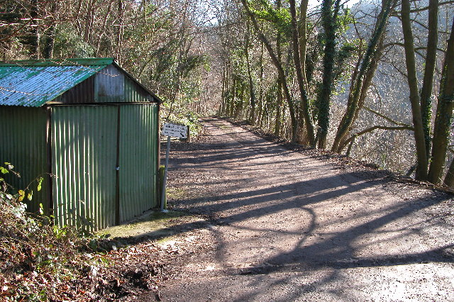
Woodland track through Piedmont
Weather for this location
Next 14 daysNearby places
Useful places within 5 km
Own or manage this place?
Claim this listing to keep details accurate, add photos, and highlight what makes it special — free.
Claim this page→How useful was the information on this page?
id: a1bac5a5-7c3b-4884-a7ec-fd477f35968b
Events & activities nearby
Switch provider to compare local events, tours and bookable activities.
24-spot Ladybird
24-spot Ladybird
Subcoccinella vigintiquattuorpunctata
Subcoccinella vigintiquattuorpunctata
Timothy GrassbugStenotus binotatusTimothy GrassbugStenotus binotatusNotostira elongataNotostira elongataNotostira elongataNotostira elongata16-spot LadybirdTytthaspis sedecimpunctata16-spot LadybirdTytthaspis sedecimpunctataSmall Green Nettle WeevilPhyllobius roboretanusSmall Green Nettle WeevilPhyllobius roboretanusRhyzobius lituraRhyzobius lituraRhyzobius lituraRhyzobius lituraEuscelisEuscelisEuscelisEuscelisStenodema (Stenodema) laevigataStenodema (Stenodema) laevigataStenodema (Stenodema) laevigataStenodema (Stenodema) laevigataCuckoo-Spit InsectPhilaenus spumariusCuckoo-Spit InsectPhilaenus spumariusPlagiognathus (Plagiognathus) arbustorumPlagiognathus (Plagiognathus) arbustorumPlagiognathus (Plagiognathus) arbustorumPlagiognathus (Plagiognathus) arbustorumDasysyrphus albostriatusDasysyrphus albostriatusDasysyrphus albostriatusDasysyrphus albostriatusCommon Blue DamselflyEnallagma cyathigerumCommon Blue DamselflyEnallagma cyathigerumLarge Red DamselflyPyrrhosoma nymphulaLarge Red DamselflyPyrrhosoma nymphulaSyrphus ribesiiSyrphus ribesiiSyrphus ribesiiSyrphus ribesii7-spot LadybirdCoccinella septempunctata7-spot LadybirdCoccinella septempunctataSplayed DeerflyChrysops caecutiensSplayed DeerflyChrysops caecutiensSwollen-thighed BeetleOedemera nobilisSwollen-thighed BeetleOedemera nobilisCinquefoil StriderMacrophya annulataCinquefoil StriderMacrophya annulata2025
2025
HazelCorylus avellana2025HazelCorylus avellana2025Wood AnemoneAnemone nemorosa2025Wood AnemoneAnemone nemorosa2025HollyIlex aquifolium2025HollyIlex aquifolium2025BluebellHyacinthoides non-scripta2025BluebellHyacinthoides non-scripta2025Salad BurnetPoterium sanguisorba2025Salad BurnetPoterium sanguisorba2025Common BentAgrostis capillaris2025Common BentAgrostis capillaris2025Curled Dock / Broad-leaved DockRumex crispus/obtusifolius2025Curled Dock / Broad-leaved DockRumex crispus/obtusifolius2025IvyHedera helix2025IvyHedera helix2025TormentilPotentilla erecta2025TormentilPotentilla erecta2025Upright BromeBromopsis erecta2025Upright BromeBromopsis erecta2025Traveller's-joyClematis vitalba2025Traveller's-joyClematis vitalba2025Dog's MercuryMercurialis perennis2025Dog's MercuryMercurialis perennis2025Common Bird's-foot-trefoilLotus corniculatus2025Common Bird's-foot-trefoilLotus corniculatus2025Spear ThistleCirsium vulgare2025Spear ThistleCirsium vulgare2025