Plan your visit
Getting here
51.83645, -2.12001
Visiting this summer
Seasonal nature notes and what to look for now
Visiting this summer
Seasonal nature notes and what to look for now
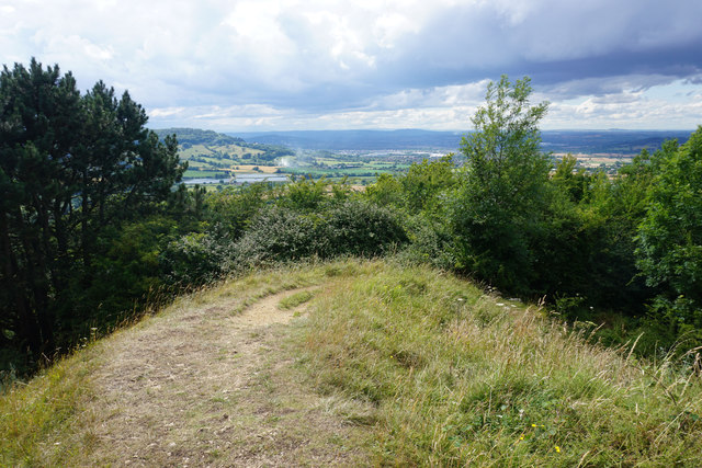
- ☀️June — canopy now fully closed, creating cool dappled shade even on warm days
- 🐕Early mornings are best for dog walks in summer — visit before 9am to avoid the heat and find quieter trails
- 🅿️417 Bike Park 306m away — 2 car parks within reach
🌤️ Visiting this summer
- ☀️June — canopy now fully closed, creating cool dappled shade even on warm days
- 🐕Early mornings are best for dog walks in summer — visit before 9am to avoid the heat and find quieter trails
- 🅿️417 Bike Park 306m away — 2 car parks within reach
Good to know
- £Free to visit — no entry charge
- 🐕Dogs welcome
Best for
Dog walks
Strong match
Dogs allowed — public woodland
Wildlife
Strong match
Deciduous woodland priority habitat
Bird watching
Strong match
Deciduous woodland — woodpeckers, warblers and woodland birds
Horse riding
Strong match
Horse riding listed as facility
Foraging
Good match
Deciduous woodland — fungi, berries and wild garlic
Forest walks
Good match
Public woodland
Trails nearby
Within roughly 5 km🚶Walking
7 signed routes nearby · 45 public paths nearby
Signed route nearbyPublic paths
Walking
Gloucestershire WayWalking route161 km
Cotswold WayWalking route164 km
Wysis WayWalking route88.5 km
Long distance footpath forming a link between the Thames and the Wye
Cheltenham Circular FootpathWalking route
Glevum WayWalking route42 km
A circular path around Gloucester passing through a varied landscape of river plain and limestone hillsides
Green Lanepublic footpath · 334 m
Upliftpublic footpath · 51 m
Upliftpublic footpath · 172 m
🚴Cycling
6 signed routes nearby
Signed route nearby
Cycling
National BywayCycling route
Cotswold CyclewayCycling route
Main RouteCycling route575 m
Main RouteCycling route954 m
Main RouteCycling route38 m
Main RouteCycling route452 m
🐴Horse riding
6 public paths nearby
Public paths
Horse riding
Push Up Pathbridleway · 106 m
Wildlife to spot
Photos
Weather for this location
Loading local forecast…
Nearby places
Useful places within 5 km
How was your visit?
How useful was the information on this page?
id: bbdb2584-6dac-409d-906d-2eeea4e16015