Waste Coppice - Conifer woodland
3 ha
🐶Dogs🌲Walks🦉Wildlife
Public accessFree entryDogs welcome3 ha
Getting here
52.32842, -2.30843
Open directionsv
Visiting this summer
Seasonal nature notes and what to look for now
- 🌞Midsummer — early morning visits most comfortable; look for deer fawns in quieter clearings
- 🐕Early mornings are best for dog walks in summer — visit before 9am to avoid the heat and find quieter trails
- ⛺Camping available here — summer nights at this site are worth planning around
🌤️ Visiting this summer
- 🌞Midsummer — early morning visits most comfortable; look for deer fawns in quieter clearings
- 🐕Early mornings are best for dog walks in summer — visit before 9am to avoid the heat and find quieter trails
- ⛺Camping available here — summer nights at this site are worth planning around
- £Free to visit — no entry charge
- 🐕Dogs welcome
Dogs allowed — public woodland
Free
Conifer plantation — limited but present wildlife
Free
Trails nearby
Within roughly 5 km6 signed routes nearby · 17 public paths nearby
Signed route nearbyPublic paths
Worcestershire WayWalking route50 km▾
Walking route from Bewdley to Great Malvern
Named routeLength 50 kmRegional walking route
Geopark WayWalking route175 km▾
Named routeRef geoLength 175 kmRegional walking route
Ribbesford Circular TrailWalking route2 km▾
Named routeRef RCTLength 2 kmLocal walking route
Abberley Circular WalkWalking route5 km▾
Named routeLength 5 kmLocal walking route
Stourport Circular WalkWalking route6.5 km▾
Named routeLength 6.5 kmLocal walking route
45 signed routes nearby
Signed route nearby
Mercian WayCycling route▾
Named routeRef 45National Cycle Network
Route 54Cycling route▾
Named routeRef 54National Cycle Network
Route 49Cycling route▾
Named routeRef 49Regional cycle route
Main RouteCycling route995 m▾
Named routeRef 45Length 995 mNational Cycle NetworkOn-roadSurface asphalt
Main RouteCycling route114 m▾
Named routeRef 54Length 114 mNational Cycle NetworkTraffic-freeSurface asphalt
Main RouteCycling route1.4 km▾
Named routeRef 54Length 1.4 kmNational Cycle NetworkTraffic-freeSurface unsealedfirm
2 signed routes nearby
Signed route nearby
Wyre Forest Green RouteMountain bike route▾
Wyre Forest Blue RouteMountain bike route▾
Photos
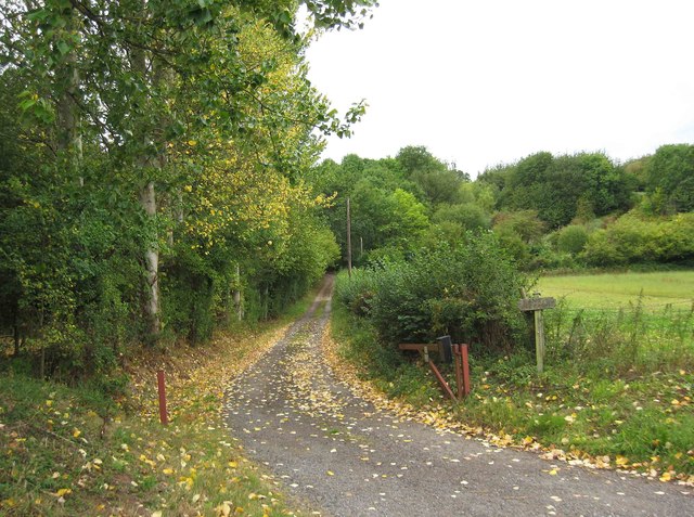
Public footpath and access road to Bank Farm, near Areley Kings
Weather for this location
Next 14 daysNearby places
Useful places within 5 km
Own or manage this place?
Claim this listing to keep details accurate, add photos, and highlight what makes it special — free.
Claim this page→How useful was the information on this page?
id: 20e3918b-dbaf-47a2-98bd-4bfd337419b5
Oryctolagus cuniculus2023
Oryctolagus cuniculus2023
BadgerMeles melesBadgerMeles melesFallow DeerDama dama2023Fallow DeerDama dama2023OtterLutra lutra2021OtterLutra lutra2021Red FoxVulpes vulpes2021Red FoxVulpes vulpes2021American MinkNeovison vison2018American MinkNeovison vison2018WeaselMustela nivalis2020WeaselMustela nivalis2020Soprano PipistrellePipistrellus pygmaeus2019Soprano PipistrellePipistrellus pygmaeus2019Common PipistrellePipistrellus pipistrellus2019Common PipistrellePipistrellus pipistrellus2019NoctuleNyctalus noctula2019NoctuleNyctalus noctula2019Field VoleMicrotus agrestis2019Field VoleMicrotus agrestis2019Brown HareLepus europaeus2019Brown HareLepus europaeus2019Hazel DormouseMuscardinus avellanarius2018Hazel DormouseMuscardinus avellanarius2018Light Emerald
Light Emerald
Campaea margaritaria2019
Campaea margaritaria2019
Common Marbled CarpetDysstroma truncata2019Common Marbled CarpetDysstroma truncata2019Blair's Shoulder-knotLithophane leautieri2017Blair's Shoulder-knotLithophane leautieri2017Lunar UnderwingAnchoscelis lunosa2017Lunar UnderwingAnchoscelis lunosa2017White-legged DamselflyPlatycnemis pennipes2019White-legged DamselflyPlatycnemis pennipes2019Setaceous Hebrew CharacterXestia c-nigrum2019Setaceous Hebrew CharacterXestia c-nigrum2019Green-brindled CrescentAllophyes oxyacanthae2017Green-brindled CrescentAllophyes oxyacanthae2017Brimstone MothOpisthograptis luteolata2019Brimstone MothOpisthograptis luteolata2019PeacockAglais io2019PeacockAglais io2019Small WhitePieris rapae2019Small WhitePieris rapae2019Beaded ChestnutAgrochola lychnidis2017Beaded ChestnutAgrochola lychnidis2017November Moth agg.Epirrita dilutata agg.2017November Moth agg.Epirrita dilutata agg.2017Banded DemoiselleCalopteryx splendens2023Banded DemoiselleCalopteryx splendens2023Harlequin LadybirdHarmonia axyridis2021Harlequin LadybirdHarmonia axyridis2021GatekeeperPyronia tithonus2019GatekeeperPyronia tithonus2019Roesel's Bush-cricketRoeseliana roeselii2019Roesel's Bush-cricketRoeseliana roeselii2019Garden CarpetXanthorhoe fluctuata2018Garden CarpetXanthorhoe fluctuata2018Feathered ThornColotois pennaria2017Feathered ThornColotois pennaria2017Merveille du JourGriposia aprilina2017Merveille du JourGriposia aprilina2017Lesser Yellow UnderwingNoctua comes2017Lesser Yellow UnderwingNoctua comes2017ChestnutConistra vaccinii2017ChestnutConistra vaccinii2017Pale Mottled WillowCaradrina clavipalpis2017Pale Mottled WillowCaradrina clavipalpis2017Western Conifer Seed BugLeptoglossus occidentalisWestern Conifer Seed BugLeptoglossus occidentalisIvy BeeColletes hederae2023Ivy BeeColletes hederae2023Speckled Bush-cricketLeptophyes punctatissima2023Speckled Bush-cricketLeptophyes punctatissima2023Common DarterSympetrum striolatum2023Common DarterSympetrum striolatum2023Hazel Leaf-rollerApoderus coryli2023Hazel Leaf-rollerApoderus coryli2023Green ShieldbugPalomena prasina2021Green ShieldbugPalomena prasina2021Lily BeetleLilioceris lilii2020Lily BeetleLilioceris lilii2020Hairy ShieldbugDolycoris baccarum2019Hairy ShieldbugDolycoris baccarum2019Dark Bush-cricketPholidoptera griseoaptera2019Dark Bush-cricketPholidoptera griseoaptera2019Tortoise BugEurygaster testudinaria2019Tortoise BugEurygaster testudinaria2019Buff FootmanEilema depressa2019Buff FootmanEilema depressa2019Tawny-barred AngleMacaria liturata2019Tawny-barred AngleMacaria liturata2019Green CarpetColostygia pectinataria2019Green CarpetColostygia pectinataria2019Lesser Broad-bordered Yellow UnderwingNoctua janthe2019Lesser Broad-bordered Yellow UnderwingNoctua janthe2019Flame CarpetXanthorhoe designata2019Flame CarpetXanthorhoe designata2019Black ArchesLymantria monacha2019Black ArchesLymantria monacha2019Straw DotRivula sericealis2019Straw DotRivula sericealis2019Lesser-spotted PinionCosmia affinis2019Lesser-spotted PinionCosmia affinis2019Small PhoenixEcliptopera silaceata2019Small PhoenixEcliptopera silaceata2019Copper Underwing agg.Amphipyra pyramidea agg.2019Copper Underwing agg.Amphipyra pyramidea agg.2019Dusky ThornEnnomos fuscantaria2019Dusky ThornEnnomos fuscantaria2019Common CarpetEpirrhoe alternata2019Common CarpetEpirrhoe alternata2019Willow BeautyPeribatodes rhomboidaria2019Willow BeautyPeribatodes rhomboidaria2019Double-striped PugGymnoscelis rufifasciata2019Double-striped PugGymnoscelis rufifasciata2019Common Rustic agg.Mesapamea secalis agg.2019Common Rustic agg.Mesapamea secalis agg.2019Holly BlueCelastrina argiolus2019Holly BlueCelastrina argiolus2019Green-veined WhitePieris napi2019Green-veined WhitePieris napi2019Large WhitePieris brassicae2019Large WhitePieris brassicae2019Neottiglossa pusillaNeottiglossa pusilla2019Neottiglossa pusillaNeottiglossa pusilla201924-spot LadybirdSubcoccinella vigintiquattuorpunctata201924-spot LadybirdSubcoccinella vigintiquattuorpunctata2019Corizus hyoscyamiCorizus hyoscyami2019Corizus hyoscyamiCorizus hyoscyami2019Cabbage BugEurydema (Eurydema) oleracea2019Cabbage BugEurydema (Eurydema) oleracea2019Large Red DamselflyPyrrhosoma nymphula2019Large Red DamselflyPyrrhosoma nymphula2019Common Club-tailGomphus vulgatissimus2018Common Club-tailGomphus vulgatissimus2018Silver YAutographa gamma2017Silver YAutographa gamma2017SatelliteEupsilia transversa2017SatelliteEupsilia transversa2017Common WainscotMythimna pallens2017Common WainscotMythimna pallens2017Alder Leaf BeetleAgelastica alniAlder Leaf BeetleAgelastica alniSlender Ground-hopperTetrix subulata2024Slender Ground-hopperTetrix subulata2024Pemphigus (Pemphigus) spyrothecaePemphigus (Pemphigus) spyrothecae2023Pemphigus (Pemphigus) spyrothecaePemphigus (Pemphigus) spyrothecae2023Northern CockchaferMelolontha hippocastani2022Northern CockchaferMelolontha hippocastani2022Dark-edged Bee-flyBombylius major2022Dark-edged Bee-flyBombylius major2022Lesser Stag BeetleDorcus parallelipipedus2021Lesser Stag BeetleDorcus parallelipipedus2021Helophilus trivittatusHelophilus trivittatus2021Helophilus trivittatusHelophilus trivittatus2021Hornet HoverflyVolucella zonaria2020Hornet HoverflyVolucella zonaria2020Southern HawkerAeshna cyanea2020Southern HawkerAeshna cyanea2020PondskaterGerris2020PondskaterGerris2020HornetVespa crabro2020HornetVespa crabro2020Bishop's MitreAelia acuminata2019Bishop's MitreAelia acuminata2019Geotrupes spinigerGeotrupes spiniger2019Geotrupes spinigerGeotrupes spiniger2019Demetrias atricapillusDemetrias atricapillus2019Demetrias atricapillusDemetrias atricapillus2019Common White WaveCabera pusaria2019Common White WaveCabera pusaria2019Odontocerum albicorneOdontocerum albicorne2019Odontocerum albicorneOdontocerum albicorne2019Vine's RusticHoplodrina ambigua2019Vine's RusticHoplodrina ambigua2019Potamophylax cingulatusPotamophylax cingulatus2019Potamophylax cingulatusPotamophylax cingulatus2019SpectacleAbrostola tripartita2019SpectacleAbrostola tripartita2019Triple-spotted PugEupithecia trisignaria2019Triple-spotted PugEupithecia trisignaria2019Dun-barCosmia trapezina2019Dun-barCosmia trapezina2019Square-spot RusticXestia xanthographa2019Square-spot RusticXestia xanthographa2019Orange SwiftTriodia sylvina2019Orange SwiftTriodia sylvina2019Drusus annulatusDrusus annulatus2019Drusus annulatusDrusus annulatus2019Anthracus consputusAnthracus consputus2019Anthracus consputusAnthracus consputus2019Broad-bordered Yellow UnderwingNoctua fimbriata2019Broad-bordered Yellow UnderwingNoctua fimbriata2019Euphylidorea lineolaEuphylidorea lineola2019Euphylidorea lineolaEuphylidorea lineola2019Pinion-streaked SnoutSchrankia costaestrigalis2019Pinion-streaked SnoutSchrankia costaestrigalis2019White ErmineSpilosoma lubricipeda2019White ErmineSpilosoma lubricipeda2019SnoutHypena proboscidalis2019SnoutHypena proboscidalis2019Painted LadyVanessa cardui2019Painted LadyVanessa cardui2019Meadow BrownManiola jurtina2019Meadow BrownManiola jurtina2019CommaPolygonia c-album2019CommaPolygonia c-album2019Red AdmiralVanessa atalanta2019Red AdmiralVanessa atalanta2019Small TortoiseshellAglais urticae2019Small TortoiseshellAglais urticae2019Rutpela maculataRutpela maculata2019Rutpela maculataRutpela maculata201916-spot LadybirdTytthaspis sedecimpunctata201916-spot LadybirdTytthaspis sedecimpunctata2019CinnabarTyria jacobaeae2019CinnabarTyria jacobaeae2019Tree BumblebeeBombus hypnorum2019Tree BumblebeeBombus hypnorum2019Cantharis nigricansCantharis nigricans2019Cantharis nigricansCantharis nigricans2019Rhopalus (Rhopalus) subrufusRhopalus (Rhopalus) subrufus2019Rhopalus (Rhopalus) subrufusRhopalus (Rhopalus) subrufus2019DrinkerEuthrix potatoria2019DrinkerEuthrix potatoria2019Dock BugCoreus marginatus2019Dock BugCoreus marginatus2019Agriotes obscurusAgriotes obscurus2019Agriotes obscurusAgriotes obscurus2019Dasysyrphus venustusDasysyrphus venustus2019Dasysyrphus venustusDasysyrphus venustus201922-spot LadybirdPsyllobora vigintiduopunctata201922-spot LadybirdPsyllobora vigintiduopunctata2019St Marks FlyBibio marci2019St Marks FlyBibio marci2019Orange SallowTiliacea citrago2019Orange SallowTiliacea citrago2019Helophilus pendulusHelophilus pendulus2019Helophilus pendulusHelophilus pendulus2019Small QuakerOrthosia cruda2019Small QuakerOrthosia cruda20197-spot LadybirdCoccinella septempunctata20197-spot LadybirdCoccinella septempunctata2019Grammoptera ruficornisGrammoptera ruficornis2019Grammoptera ruficornisGrammoptera ruficornis2019Red Mason BeeOsmia bicornis2019Red Mason BeeOsmia bicornis2019Metatropis rufescensMetatropis rufescens2019Metatropis rufescensMetatropis rufescens2019Syrphus ribesiiSyrphus ribesii2019Syrphus ribesiiSyrphus ribesii2019Liophloeus tessulatusLiophloeus tessulatus2019Liophloeus tessulatusLiophloeus tessulatus2019Stenocorus meridianusStenocorus meridianus2019Stenocorus meridianusStenocorus meridianus2019Blue ShieldbugZicrona caerulea2019Blue ShieldbugZicrona caerulea2019Red-headed Cardinal BeetlePyrochroa serraticornis2019Red-headed Cardinal BeetlePyrochroa serraticornis201914-spot LadybirdPropylea quattuordecimpunctata201914-spot LadybirdPropylea quattuordecimpunctata2019Eristalis tenaxEristalis tenax2019Eristalis tenaxEristalis tenax2019Euophryum confineEuophryum confine2019Euophryum confineEuophryum confine2019Rhagium mordaxRhagium mordax2019Rhagium mordaxRhagium mordax2019Flavous Nomad BeeNomada flava2019Flavous Nomad BeeNomada flava2019Malachite BeetleMalachius bipustulatus2019Malachite BeetleMalachius bipustulatus2019Xylota segnisXylota segnis2019Xylota segnisXylota segnis2019Green Dock BeetleGastrophysa viridula2019Green Dock BeetleGastrophysa viridula2019Kateretes pusillusKateretes pusillus2019Kateretes pusillusKateretes pusillus2019Hairy Spider WeevilExomias pellucidus2019Hairy Spider WeevilExomias pellucidus2019Common BluePolyommatus icarus2018Common BluePolyommatus icarus2018Bordered BeautyEpione repandaria2018Bordered BeautyEpione repandaria2018Small Fan-footed WaveIdaea biselata2018Small Fan-footed WaveIdaea biselata2018Single-dotted WaveIdaea dimidiata2018Single-dotted WaveIdaea dimidiata2018Common FootmanEilema lurideola2018Common FootmanEilema lurideola2018Sand Tailed Digger WaspCerceris arenaria2018Sand Tailed Digger WaspCerceris arenaria2018Bee WolfPhilanthus triangulum2018Bee WolfPhilanthus triangulum2018Leptura quadrifasciataLeptura quadrifasciata2018Leptura quadrifasciataLeptura quadrifasciata2018EupeodesEupeodes2018EupeodesEupeodes2018December MothPoecilocampa populi2017December MothPoecilocampa populi2017Pale November MothEpirrita christyi2017Pale November MothEpirrita christyi2017Autumnal MothEpirrita autumnata2017Autumnal MothEpirrita autumnata2017SprawlerAsteroscopus sphinx2017SprawlerAsteroscopus sphinx2017BrickSunira circellaris2017BrickSunira circellaris2017Grey Shoulder-knotLithophane ornitopus2017Grey Shoulder-knotLithophane ornitopus2017Cypress CarpetThera cupressata2017Cypress CarpetThera cupressata2017VestalRhodometra sacraria2017VestalRhodometra sacraria2017Turnip MothAgrotis segetum2017Turnip MothAgrotis segetum2017Yellow-Line QuakerLeptologia macilenta2017Yellow-Line QuakerLeptologia macilenta2017Barred SallowTiliacea aurago2017Barred SallowTiliacea aurago2017Rosy RusticHydraecia micacea2017Rosy RusticHydraecia micacea2017Deep-brown DartAporophyla lueneburgensis2017Deep-brown DartAporophyla lueneburgensis2017Angle ShadesPhlogophora meticulosa2017Angle ShadesPhlogophora meticulosa20172018
2018
Events & activities nearby
Switch provider to compare local events, tours and bookable activities.