Summer Sides Wood - Conifer woodland ✦ Ancient woodland 65 ha
🍂 Seasonal🦉 Wildlife🦅 Birds
↑ Share
Public access Free entry Dogs welcome 65 ha
Places › England › North West › Westmorland and Furness Getting here
54.28727, -2.98475
Open directionsv Visiting this summer
Seasonal nature notes and what to look for now
▾ 🌞 Midsummer — early morning visits most comfortable; look for deer fawns in quieter clearings 🐕 Early mornings are best for dog walks in summer — visit before 9am to avoid the heat and find quieter trails 🅿️ High Dam 426m away — 2 car parks within reach 🌤️ Visiting this summer
🌞 Midsummer — early morning visits most comfortable; look for deer fawns in quieter clearings 🐕 Early mornings are best for dog walks in summer — visit before 9am to avoid the heat and find quieter trails 🅿️ High Dam 426m away — 2 car parks within reach £ Free to visit — no entry charge🐕 Dogs welcome🌿 Ancient woodland — rare wildlife habitat🍂 Seasonal nature
Strong match
Ancient woodland — bluebells, fungi and autumn colour
Free
Lowland heathland priority habitat; Ancient woodland
Free
🦅 Bird watching
Strong match
Lowland heathland — Dartford warblers, nightjars and stonechats
Free
Dogs allowed — public woodland
Free
🦋 Insect spotting
Strong match
Lowland heathland — silver-studded blue and heath fritillary butterflies
Free
Deciduous woodland — fungi, berries and wild garlic
Varies
Trails nearby Within roughly 5 km 9 signed routes nearby · 26 public paths nearby
Signed route nearby Public paths
Cumbria Coastal Way Walking route 298 km ▾
Named route Length 298 km Regional walking route
Show on map Bogle Crag Trail (long) Walking route ▾
Named route Round trip Local walking route
Show on map Fell Foot Park Short Loop, Fell Foot Walking route 800 m ▾
An accessible, stile and step free circular route around the Fell Foot parkland, taking in Windermere lakeshore with views across the lake to Fairfield Horseshoe.
Named route Length 800 m Duration 00:30 Round trip Local walking route
Show on map Fell Foot circular heritage trail, Fell Foot Walking route 2.5 km ▾
Enjoy this circular Lake District walk exploring some of Fell Foot's heritage, including a complex of historic boathouses, a modern Active Base, and an 18th-century pleasure ground including a Pinetum. An easy walk on hard and grass paths.
Named route Length 2.5 km Duration 01:00 Round trip Local walking route
Show on map Silurian Way Walking route ▾
Named route Local walking route
Show on map Height Lane public footpath · 534 m ▾
Public path public footpath Length 534 m Surface gravel Path type: footway
Show on map Height Lane public footpath · 286 m ▾
Public path public footpath Length 286 m Path type: footway
Show on map 7 signed routes nearby
Signed route nearby
Walney to Wear Cycle Route Cycling route ▾
Named route Ref 70 National Cycle Network
Show on map Lakes & Dales Loop Cycling route ▾
Named route Ref LDL Regional cycle route
Show on map Regional Route 37 Cycling route ▾
Named route Ref 37 Regional cycle route
Show on map Bay Cycle Way Cycling route 132 km ▾
Named route Ref 700 Length 132 km National Cycle Network
Show on map West Windermere Way (Cycle Route) Cycling route ▾
Named route Lhn
Show on map Main Route Cycling route 7.5 km ▾
Named route Ref 70 Length 7.5 km National Cycle Network On-road Surface asphalt
Show on map 5 signed routes nearby
Signed route nearby
Silurian Way Mountain bike route ▾
Moor Top Trail Mountain bike route ▾
Hawkshead Moor Trail Mountain bike route ▾
The North Face Trail Mountain bike route ▾
Grizedale Tarn Trail Mountain bike route ▾
✦ Ancient woodland — continuously wooded since at least 1600 AD. A rare and irreplaceable habitat, rich in biodiversity and historical character.
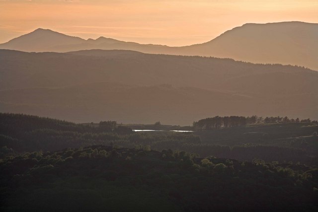
Photos Evening over Furness Fells
‹ ›
Weather for this location Next 14 days Nearby places Useful places within 5 km
All Historic
Own or manage this place?
Claim this listing to keep details accurate, add photos, and highlight what makes it special — free.
Claim this page→ How useful was the information on this page?
Something wrong on this page?
id: 09be8248-99cf-4e93-b4fb-cc91374efe49
UK green spaces mapped from open public data — so anyone can find the woodland, trail, or nature reserve closest to them.
© 2026 Glade · Made with care for UK green spaces
Events & activities nearby Switch provider to compare local events, tours and bookable activities.
Bookable tours GetYourGuide Promote here
Wildlife to spot
5,701 records · National Biodiversity Network
▾
Wildlife to spot 5,701 records · National Biodiversity Network Swallow · Woodpigeon · House Martin · Cormorant · Blackbird +22
Swallow Hirundo rustica Woodpigeon Columba palumbus House Martin Delichon urbicum Cormorant Phalacrocorax carbo Blackbird Turdus merula Blue Tit Cyanistes caeruleus Pied Wagtail Motacilla alba Carrion Crow Corvus corone Pheasant Phasianus colchicus Willow Warbler Phylloscopus trochilus Chaffinch Fringilla coelebs Goosander Mergus merganser Mallard Anas platyrhynchos Tawny Owl Strix aluco Whooper Swan Cygnus cygnus British Lesser Black-Backed Gull Larus fuscus graellsii Anas platyrhynchos platyrhynchos Anas platyrhynchos platyrhynchos Black-headed Gull Chroicocephalus ridibundus Jackdaw Coloeus monedula Goldfinch Carduelis carduelis Wren Troglodytes troglodytes Great Spotted Woodpecker Dendrocopos major Swift Apus apus House Sparrow Passer domesticus Greenfinch Chloris chloris Great Tit Parus major Song Thrush Turdus philomelos Wood Avens · Meadow Saffron · Herb-Robert · Ash · Enchanter's-nightshade +96
Wood Avens Geum urbanum Meadow Saffron Colchicum autumnale Herb-Robert Geranium robertianum Ash Fraxinus excelsior Enchanter's-nightshade Circaea lutetiana Common Ragwort Jacobaea vulgaris Bracken Pteridium aquilinum Species observations from the last 10 years via NBN Atlas
Rowan Sorbus aucuparia
Rowan Sorbus aucuparia
Meadowsweet Filipendula ulmaria
Meadowsweet Filipendula ulmaria
Hazel Corylus avellana
Hazel Corylus avellana
Sycamore Acer pseudoplatanus
Sycamore Acer pseudoplatanus
Common Nettle Urtica dioica
Common Nettle Urtica dioica
Elder Sambucus nigra
Elder Sambucus nigra
Silver Birch Betula pendula
Silver Birch Betula pendula
Tufted Hair-grass Deschampsia cespitosa
Tufted Hair-grass Deschampsia cespitosa
Dandelion Taraxacum
Dandelion Taraxacum
Holly Ilex aquifolium
Holly Ilex aquifolium
Pedunculate Oak Quercus robur
Pedunculate Oak Quercus robur
Creeping Thistle Cirsium arvense
Creeping Thistle Cirsium arvense
White Clover Trifolium repens
White Clover Trifolium repens
Garden Lady's-mantle Alchemilla mollis
Garden Lady's-mantle Alchemilla mollis
Broad-leaved Willowherb Epilobium montanum
Broad-leaved Willowherb Epilobium montanum
Alder Alnus glutinosa
Alder Alnus glutinosa
Bramble Rubus fruticosus
Bramble Rubus fruticosus
Creeping Buttercup Ranunculus repens
Creeping Buttercup Ranunculus repens
Cock's-foot Dactylis glomerata
Cock's-foot Dactylis glomerata
Selfheal Prunella vulgaris
Selfheal Prunella vulgaris
Garlic Mustard Alliaria petiolata
Garlic Mustard Alliaria petiolata
Greater Plantain Plantago major
Greater Plantain Plantago major
Dryopteris filix-mas Dryopteris filix-mas
Dryopteris filix-mas Dryopteris filix-mas
Hawthorn Crataegus monogyna
Hawthorn Crataegus monogyna
Ribwort Plantain Plantago lanceolata
Ribwort Plantain Plantago lanceolata
Bush Vetch Vicia sepium
Bush Vetch Vicia sepium
Slender Rush Juncus tenuis
Slender Rush Juncus tenuis
False-brome Brachypodium sylvaticum
False-brome Brachypodium sylvaticum
Wall Lettuce Mycelis muralis
Wall Lettuce Mycelis muralis
Great Mullein Verbascum thapsus
Great Mullein Verbascum thapsus
Common Bent Agrostis capillaris
Common Bent Agrostis capillaris
Foxglove Digitalis purpurea
Foxglove Digitalis purpurea
White Water-lily Nymphaea alba
White Water-lily Nymphaea alba
Lords-and-Ladies Arum maculatum
Lords-and-Ladies Arum maculatum
Hedera helix Hedera helix
Hedera helix Hedera helix
Hogweed Heracleum sphondylium
Hogweed Heracleum sphondylium
Wood Dock Rumex sanguineus
Wood Dock Rumex sanguineus
Maidenhair Spleenwort Asplenium trichomanes
Maidenhair Spleenwort Asplenium trichomanes
Meadow Buttercup Ranunculus acris
Meadow Buttercup Ranunculus acris
Spindle Euonymus europaeus
Spindle Euonymus europaeus
Ivy-leaved Toadflax Cymbalaria muralis
Ivy-leaved Toadflax Cymbalaria muralis
Common Cow-wheat Melampyrum pratense
Common Cow-wheat Melampyrum pratense
Common Knapweed Centaurea nigra
Common Knapweed Centaurea nigra
Lady-fern Athyrium filix-femina
Lady-fern Athyrium filix-femina
Wood-sorrel Oxalis acetosella
Wood-sorrel Oxalis acetosella
Rosebay Willowherb Chamaenerion angustifolium
Rosebay Willowherb Chamaenerion angustifolium
Common Figwort Scrophularia nodosa
Common Figwort Scrophularia nodosa
Crested Dog's-tail Cynosurus cristatus
Crested Dog's-tail Cynosurus cristatus
Hard-fern Blechnum spicant
Hard-fern Blechnum spicant
Devil's-bit Scabious Succisa pratensis
Devil's-bit Scabious Succisa pratensis
Great Wood-rush Luzula sylvatica
Great Wood-rush Luzula sylvatica
Marsh Thistle Cirsium palustre
Marsh Thistle Cirsium palustre
Redshank Persicaria maculosa
Redshank Persicaria maculosa
Common Sorrel Rumex acetosa
Common Sorrel Rumex acetosa
Gorse Ulex europaeus
Gorse Ulex europaeus
Sitka Spruce Picea sitchensis
Sitka Spruce Picea sitchensis
Rusty-Back Fern Asplenium ceterach
Rusty-Back Fern Asplenium ceterach
False Oat-grass Arrhenatherum elatius
False Oat-grass Arrhenatherum elatius
Wood Sage Teucrium scorodonia
Wood Sage Teucrium scorodonia
Tutsan Hypericum androsaemum
Tutsan Hypericum androsaemum
Daisy Bellis perennis
Daisy Bellis perennis
Water Mint Mentha aquatica
Water Mint Mentha aquatica
Wood Horsetail Equisetum sylvaticum
Wood Horsetail Equisetum sylvaticum
Wild Angelica Angelica sylvestris
Wild Angelica Angelica sylvestris
Polypodium vulgare Polypodium vulgare
Polypodium vulgare Polypodium vulgare
Prickly Sow-thistle Sonchus asper
Prickly Sow-thistle Sonchus asper
Dog's Mercury Mercurialis perennis
Dog's Mercury Mercurialis perennis
Ground-ivy Glechoma hederacea
Ground-ivy Glechoma hederacea
Thyme-leaved Speedwell Veronica serpyllifolia
Thyme-leaved Speedwell Veronica serpyllifolia
Bogbean Menyanthes trifoliata
Bogbean Menyanthes trifoliata
Bulrush Typha latifolia
Bulrush Typha latifolia
Wall-rue Asplenium ruta-muraria
Wall-rue Asplenium ruta-muraria
Lesser Burdock Arctium minus
Lesser Burdock Arctium minus
Hart's-Tongue Asplenium scolopendrium
Hart's-Tongue Asplenium scolopendrium
Yorkshire-fog Holcus lanatus
Yorkshire-fog Holcus lanatus
Mouse-ear-hawkweed Pilosella officinarum
Mouse-ear-hawkweed Pilosella officinarum
Bog Asphodel Narthecium ossifragum
Bog Asphodel Narthecium ossifragum
Rumex obtusifolius var. transiens Rumex obtusifolius var. transiens
Rumex obtusifolius var. transiens Rumex obtusifolius var. transiens
Lamiastrum galeobdolon subsp. argentatum Lamiastrum galeobdolon subsp. argentatum
Lamiastrum galeobdolon subsp. argentatum Lamiastrum galeobdolon subsp. argentatum
Tormentil Potentilla erecta
Tormentil Potentilla erecta
Festuca rubra Festuca rubra
Festuca rubra Festuca rubra
Perennial Rye-grass Lolium perenne
Perennial Rye-grass Lolium perenne
Hedge Bindweed Calystegia sepium
Hedge Bindweed Calystegia sepium
Cleavers Galium aparine
Cleavers Galium aparine
Common Bird's-foot-trefoil Lotus corniculatus
Common Bird's-foot-trefoil Lotus corniculatus
Broad-leaved Dock Rumex obtusifolius
Broad-leaved Dock Rumex obtusifolius
Hedge Woundwort Stachys sylvatica
Hedge Woundwort Stachys sylvatica
Honeysuckle Lonicera periclymenum
Honeysuckle Lonicera periclymenum
Heather Calluna vulgaris
Heather Calluna vulgaris
Yellow Pimpernel Lysimachia nemorum
Yellow Pimpernel Lysimachia nemorum
Annual Meadow-grass Poa annua
Annual Meadow-grass Poa annua
Procumbent Pearlwort Sagina procumbens
Procumbent Pearlwort Sagina procumbens
Biting Stonecrop Sedum acre
Biting Stonecrop Sedum acre
Raspberry Rubus idaeus
Raspberry Rubus idaeus