Deergarth Wood - Conifer woodland 76 ha
Plan your visit
🐶 Dogs🦉 Wildlife🦅 Birds
Public access Free entry Dogs welcome 76 ha
Places › England › North West › Cumberland Getting here
54.51689, -3.07028
Open directionsv Visiting this summer
Seasonal nature notes and what to look for now
▾ 🌞 Midsummer — early morning visits most comfortable; look for deer fawns in quieter clearings 🐕 Early mornings are best for dog walks in summer — visit before 9am to avoid the heat and find quieter trails 🅿️ Dobgill Car Park 168m away — 4 car parks within reach 🌤️ Visiting this summer
🌞 Midsummer — early morning visits most comfortable; look for deer fawns in quieter clearings 🐕 Early mornings are best for dog walks in summer — visit before 9am to avoid the heat and find quieter trails 🅿️ Dobgill Car Park 168m away — 4 car parks within reach £ Free to visit — no entry charge🐕 Dogs welcome🚲 Bike parking🅿️ Parking· Paid
Dogs allowed — public woodland
Free
Deciduous woodland priority habitat
Free
🦅 Bird watching
Strong match
Deciduous woodland — woodpeckers, warblers and woodland birds
Free
Deciduous woodland — fungi, berries and wild garlic
Varies
Trails nearby Within roughly 5 km 3 signed routes nearby · 1 public path nearby
Signed route nearby Public paths
Coast to Coast Walk (St Bees to Shap) Walking route ▾
Named route Ref C2C National walking route
Show on map Cumbria Way Walking route 118 km ▾
Named route Length 118 km Regional walking route
Show on map Rosthwaite Round, Fells, Tarn and Beck Walk, North Lakes Outdoors Walking route 8.4 km ▾
This favourite walk of National Trust rangers will take you to a Borrowdale gem, the hamlet of Watendlath. Along the way, you'll discover oak woodland, two tarns (mountain ponds) and stunning Lakeland views.
Named route Length 8.4 km Duration 03:15-04:40 Round trip Local walking route
Show on map 5 signed routes nearby
Signed route nearby
Route 6 Cycling route ▾
Named route Ref 6 National Cycle Network
Show on map Main Route Cycling route 1.3 km ▾
Named route Ref 6 Length 1.3 km National Cycle Network Traffic-free Surface asphalt
Show on map Main Route Cycling route 28 m ▾
Named route Ref 6 Length 28 m National Cycle Network Traffic-free Surface asphalt
Show on map Main Route Cycling route 5.8 km ▾
Named route Ref 6 Length 5.8 km National Cycle Network On-road Surface asphalt
Show on map Main Route Cycling route 2.8 km ▾
Named route Ref 6 Length 2.8 km National Cycle Network On-road Surface asphalt
Show on map 11 public paths nearby
Public paths
No named routes yet. Public paths are shown on the map.
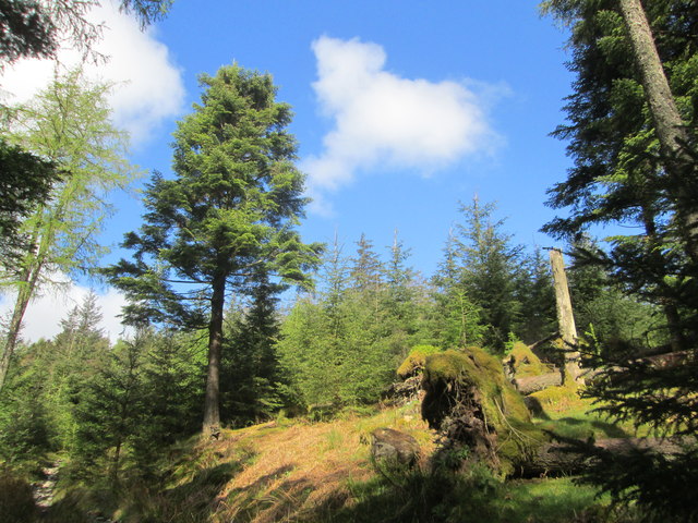
Photos Woodland above Harrop Tarn
‹ ›
Weather for this location Next 14 days Nearby places Useful places within 5 km
All Historic
Own or manage this place?
Claim this listing to keep details accurate, add photos, and highlight what makes it special — free.
Claim this page→ How useful was the information on this page?
id: e38ac631-1331-42cb-9211-5c6ce816ccdb
UK green spaces mapped from open public data — so anyone can find the woodland, trail, or nature reserve closest to them.
© 2026 Glade · Made with care for UK green spaces
Events & activities nearby Switch provider to compare local events, tours and bookable activities.
Bookable tours GetYourGuide Promote here
Wildlife to spot
3,384 records · National Biodiversity Network
▾
Wildlife to spot 3,384 records · National Biodiversity Network 🐦 Birds 27 species
spring autumn
2025 ▾
Mallard · Chaffinch · Goldcrest · Jackdaw · Robin +22
Mallard Anas platyrhynchos Chaffinch Fringilla coelebs Goldcrest Regulus regulus Jackdaw Coloeus monedula Robin Erithacus rubecula2023 Blue Tit Cyanistes caeruleus2023 Blackbird Turdus merula2023 Whooper Swan Cygnus cygnus Spotted Flycatcher Muscicapa striata Redstart Phoenicurus phoenicurus Willow Warbler Phylloscopus trochilus Tree Pipit Anthus trivialis Pheasant Phasianus colchicus Woodpigeon Columba palumbus Raven Corvus corax Canada Goose Branta canadensis Greylag Goose Anser anser Red-breasted Merganser Mergus serrator2024 Redpoll (cabaret/flammea) Acanthis flammea cabaret/flammea2023 Fieldfare Turdus pilaris2023 Linnet Linaria cannabina2023 Ring Ouzel Turdus torquatus2023 Carrion Crow Corvus corone2023 Siskin Spinus spinus2023 Wren Troglodytes troglodytes2023 Redwing Turdus iliacus2023 Long-tailed Tit Aegithalos caudatus2023 🦌 Mammals 3 species
winter summer
2023 ▾
Badger · Otter · Roe Deer
Badger Meles meles Otter Lutra lutra Roe Deer Capreolus capreolus2022 🐸 Amphibians 1 species
spring summer
2024 ▾
Common Frog
Common Frog Rana temporaria 🐝 Insects 9 species
spring summer
2025 ▾
Large Red Damselfly · Green Tiger Beetle · Small Black Ant · Birch Shieldbug · Anoplotrupes stercorosus +4
Large Red Damselfly Pyrrhosoma nymphula2023 Green Tiger Beetle Cicindela campestris Small Black Ant Lasius niger2024 Birch Shieldbug Elasmostethus interstinctus2024 Anoplotrupes stercorosus Anoplotrupes stercorosus2024 Bracken · Tormentil · Common Bent · Sneezewort · Marsh Thistle +102
Bracken Pteridium aquilinum2022 Tormentil Potentilla erecta2022 Common Bent Agrostis capillaris2022 Sneezewort Achillea ptarmica2022 Marsh Thistle Cirsium palustre2022 Lesser Spearwort Ranunculus flammula Species observations from the last 10 years via NBN Atlas
Leuctra
Leuctra
Leuctra2022
Leuctra2022
Bay Sucker Trioza alacris2022
Bay Sucker Trioza alacris2022
Blue-tailed Damselfly Ischnura elegans2022
Blue-tailed Damselfly Ischnura elegans2022
Common Hawker Aeshna juncea2022
Common Hawker Aeshna juncea2022 2022
2022
Devil's-bit Scabious Succisa pratensis2022
Devil's-bit Scabious Succisa pratensis2022
Hawkweed Hieracium2022
Hawkweed Hieracium2022
Viviparous Sheep's-fescue Festuca vivipara2022
Viviparous Sheep's-fescue Festuca vivipara2022
Broad Buckler-fern Dryopteris dilatata2022
Broad Buckler-fern Dryopteris dilatata2022
Bog Asphodel Narthecium ossifragum2022
Bog Asphodel Narthecium ossifragum2022
Sheep's Sorrel Rumex acetosella2022
Sheep's Sorrel Rumex acetosella2022
Rowan Sorbus aucuparia2022
Rowan Sorbus aucuparia2022
Marsh Violet Viola palustris2022
Marsh Violet Viola palustris2022
Lousewort Pedicularis sylvatica2022
Lousewort Pedicularis sylvatica2022
Soft-rush Juncus effusus2022
Soft-rush Juncus effusus2022
Alder Alnus glutinosa2022
Alder Alnus glutinosa2022
New Zealand Willowherb Epilobium brunnescens2022
New Zealand Willowherb Epilobium brunnescens2022
Sycamore Acer pseudoplatanus2022
Sycamore Acer pseudoplatanus2022
Heather Calluna vulgaris2022
Heather Calluna vulgaris2022
Foxglove Digitalis purpurea2022
Foxglove Digitalis purpurea2022
Bilberry Vaccinium myrtillus2022
Bilberry Vaccinium myrtillus2022
Creeping Soft-grass Holcus mollis2022
Creeping Soft-grass Holcus mollis2022
Common Sallow Salix cinerea2022
Common Sallow Salix cinerea2022
Round-leaved Sundew Drosera rotundifolia2022
Round-leaved Sundew Drosera rotundifolia2022
Sweet Vernal-grass Anthoxanthum odoratum2022
Sweet Vernal-grass Anthoxanthum odoratum2022
Heath Rush Juncus squarrosus2022
Heath Rush Juncus squarrosus2022
Sharp-flowered Rush Juncus acutiflorus2022
Sharp-flowered Rush Juncus acutiflorus2022
Purple Moor-grass Molinia caerulea2022
Purple Moor-grass Molinia caerulea2022
Beech Fagus sylvatica2022
Beech Fagus sylvatica2022
Marsh-bedstraw Galium palustre2022
Marsh-bedstraw Galium palustre2022
Thread Rush Juncus filiformis
Thread Rush Juncus filiformis
Girgensohn's Bog-moss Sphagnum girgensohnii2023
Girgensohn's Bog-moss Sphagnum girgensohnii2023
Fringed Bog-moss Sphagnum fimbriatum2023
Fringed Bog-moss Sphagnum fimbriatum2023
Trichophorum germanicum Trichophorum germanicum2022
Trichophorum germanicum Trichophorum germanicum2022
Common Butterwort Pinguicula vulgaris2022
Common Butterwort Pinguicula vulgaris2022
Lemon-scented Fern Oreopteris limbosperma2022
Lemon-scented Fern Oreopteris limbosperma2022
Common Sorrel Rumex acetosa2022
Common Sorrel Rumex acetosa2022
Wood Sage Teucrium scorodonia2022
Wood Sage Teucrium scorodonia2022
Marsh Hawk's-beard Crepis paludosa2022
Marsh Hawk's-beard Crepis paludosa2022
Holly Ilex aquifolium2022
Holly Ilex aquifolium2022
Wood Anemone Anemone nemorosa2022
Wood Anemone Anemone nemorosa2022
Wilson's Filmy-fern Hymenophyllum wilsonii2022
Wilson's Filmy-fern Hymenophyllum wilsonii2022
Parsley Fern Cryptogramma crispa2022
Parsley Fern Cryptogramma crispa2022
Little Kneeling Eyebright Euphrasia confusa2022
Little Kneeling Eyebright Euphrasia confusa2022
Jointed Rush Juncus articulatus2022
Jointed Rush Juncus articulatus2022
Harebell Campanula rotundifolia2022
Harebell Campanula rotundifolia2022
Wild Thyme Thymus drucei2022
Wild Thyme Thymus drucei2022
Star Sedge Carex echinata2022
Star Sedge Carex echinata2022
Mat-grass Nardus stricta2022
Mat-grass Nardus stricta2022
Festuca rubra Festuca rubra2022
Festuca rubra Festuca rubra2022
Smooth Lady's-mantle Alchemilla glabra2022
Smooth Lady's-mantle Alchemilla glabra2022
Dandelion Taraxacum2022
Dandelion Taraxacum2022
Bell Heather Erica cinerea2022
Bell Heather Erica cinerea2022
Heath Bedstraw Galium saxatile2022
Heath Bedstraw Galium saxatile2022
Sheep's Fescue agg. Festuca ovina2022
Sheep's Fescue agg. Festuca ovina2022
Juniper Juniperus communis2022
Juniper Juniperus communis2022
Carnation Sedge Carex panicea2022
Carnation Sedge Carex panicea2022
Wavy Hair-Grass Avenella flexuosa2022
Wavy Hair-Grass Avenella flexuosa2022
Tufted Hair-grass Deschampsia cespitosa2022
Tufted Hair-grass Deschampsia cespitosa2022
Creeping Bent Agrostis stolonifera2022
Creeping Bent Agrostis stolonifera2022
Autumn Hawkbit Scorzoneroides autumnalis2022
Autumn Hawkbit Scorzoneroides autumnalis2022
Sitka Spruce Picea sitchensis2022
Sitka Spruce Picea sitchensis2022
Hawthorn Crataegus monogyna2022
Hawthorn Crataegus monogyna2022
Early Hair-grass Aira praecox2022
Early Hair-grass Aira praecox2022
Downy Birch Betula pubescens2022
Downy Birch Betula pubescens2022
Common Cottongrass Eriophorum angustifolium2022
Common Cottongrass Eriophorum angustifolium2022
White Beak-sedge Rhynchospora alba2022
White Beak-sedge Rhynchospora alba2022
Bog Pondweed Potamogeton polygonifolius2022
Bog Pondweed Potamogeton polygonifolius2022
Heath Wood-rush Luzula multiflora2022
Heath Wood-rush Luzula multiflora2022
Green-ribbed Sedge Carex binervis2022
Green-ribbed Sedge Carex binervis2022
Hard-fern Blechnum spicant2022
Hard-fern Blechnum spicant2022
Yorkshire-fog Holcus lanatus2022
Yorkshire-fog Holcus lanatus2022
Dioecious Sedge Carex dioica2022
Dioecious Sedge Carex dioica2022
Male-fern Dryopteris filix-mas2022
Male-fern Dryopteris filix-mas2022
Common Dog-violet Viola riviniana2022
Common Dog-violet Viola riviniana2022
European Larch Larix decidua2022
European Larch Larix decidua2022
Field Wood-rush Luzula campestris2022
Field Wood-rush Luzula campestris2022
Slender St John's-wort Hypericum pulchrum2022
Slender St John's-wort Hypericum pulchrum2022
Ribwort Plantain Plantago lanceolata2022
Ribwort Plantain Plantago lanceolata2022
Goldenrod Solidago virgaurea2022
Goldenrod Solidago virgaurea2022
Round-leaved Crowfoot Ranunculus omiophyllus2022
Round-leaved Crowfoot Ranunculus omiophyllus2022
Lady-fern Athyrium filix-femina2022
Lady-fern Athyrium filix-femina2022
Heath Milkwort Polygala serpyllifolia2022
Heath Milkwort Polygala serpyllifolia2022
Common Yellow-sedge Carex demissa2022
Common Yellow-sedge Carex demissa2022
Reed Canary-grass Phalaris arundinacea2022
Reed Canary-grass Phalaris arundinacea2022
Corn Spurrey Spergula arvensis2022
Corn Spurrey Spergula arvensis2022
Marsh Speedwell Veronica scutellata2022
Marsh Speedwell Veronica scutellata2022
Common Hemp-nettle Galeopsis tetrahit2022
Common Hemp-nettle Galeopsis tetrahit2022
Knotweed Persicaria2022
Knotweed Persicaria2022
Sessile Oak Quercus petraea2022
Sessile Oak Quercus petraea2022
Whorled Mint Mentha aquatica x arvensis = M. x verticillata2022
Whorled Mint Mentha aquatica x arvensis = M. x verticillata2022
Goat Willow Salix caprea2022
Goat Willow Salix caprea2022
Curled Dock Rumex crispus2022
Curled Dock Rumex crispus2022
Selfheal Prunella vulgaris2022
Selfheal Prunella vulgaris2022
Broad-leaved Pondweed Potamogeton natans2022
Broad-leaved Pondweed Potamogeton natans2022
Bogbean Menyanthes trifoliata2022
Bogbean Menyanthes trifoliata2022
Yellow Water-lily Nuphar lutea2022
Yellow Water-lily Nuphar lutea2022
White Water-lily Nymphaea alba2022
White Water-lily Nymphaea alba2022
Greater Plantain Plantago major2022
Greater Plantain Plantago major2022
Heath Spotted-orchid Dactylorhiza maculata2022
Heath Spotted-orchid Dactylorhiza maculata2022
Water Horsetail Equisetum fluviatile2022
Water Horsetail Equisetum fluviatile2022
Mountain Male-fern Dryopteris oreades2022
Mountain Male-fern Dryopteris oreades2022
Cowberry Vaccinium vitis-idaea2022
Cowberry Vaccinium vitis-idaea2022
Slender Scottish Eyebright Euphrasia scottica2022
Slender Scottish Eyebright Euphrasia scottica2022
Heath-grass Danthonia decumbens2022
Heath-grass Danthonia decumbens2022
Pill Sedge Carex pilulifera2022
Pill Sedge Carex pilulifera2022