Strines Wood - Conifer woodland ✦ Ancient woodland 3 ha
🐶 Dogs🍂 Seasonal🦉 Wildlife
↑ Share
Public access Free entry Dogs welcome 3 ha
Places › England › Yorkshire and the Humber › Sheffield Getting here
53.41231, -1.66079
Open directionsv Visiting this summer
Seasonal nature notes and what to look for now
▾ 🌞 Midsummer — early morning visits most comfortable; look for deer fawns in quieter clearings 🐕 Early mornings are best for dog walks in summer — visit before 9am to avoid the heat and find quieter trails 🅿️ Parking 141m away — 4 car parks within reach 🌤️ Visiting this summer
🌞 Midsummer — early morning visits most comfortable; look for deer fawns in quieter clearings 🐕 Early mornings are best for dog walks in summer — visit before 9am to avoid the heat and find quieter trails 🅿️ Parking 141m away — 4 car parks within reach £ Free to visit — no entry charge🐕 Dogs welcome🌿 Ancient woodland — rare wildlife habitatDogs allowed — public woodland
Free
🍂 Seasonal nature
Strong match
Ancient woodland — bluebells, fungi and autumn colour
Free
Ancient woodland — owls, woodpeckers, warblers
Free
Ancient woodland — historic landscape
Free
Trails nearby Within roughly 5 km 9 signed routes nearby · 2 public paths nearby
Signed route nearby Public paths
Derwent Valley Heritage Way Walking route 89 km ▾
Named route Length 89 km Regional walking route
Show on map Derwent Valley and Reservoir Walk, Walking route 7.4 km ▾
Ladybower Reservoir, farmland and wooded cloughs. Views of Derwent Valley and High Peak area. Rough walking through fields, woodland paths, roads and open moorland. Dogs must be on leads.
Named route Length 7.4 km Duration 02:30 Round trip Local walking route
Show on map Crook Hill Circular (Ethel), High Peak Walking route 11.5 km ▾
Named route Length 11.5 km Duration 03:30 Round trip Local walking route
Show on map Lost Lad and Back Tor (Ethels), High Peak Walking route 12.1 km ▾
Named route Length 12.1 km Duration 04:00 Round trip Local walking route
Show on map Derwent Dam Green Route Walking route 4.5 km ▾
Named route Length 4.5 km Round trip Local walking route
Show on map 1 signed route nearby
Signed route nearby
Thornhill Trail Cycling route ▾
Named route Local cycle route
Show on map 3 public paths nearby
Public paths
Foulstone Road bridleway · 728 m ▾
Public path bridleway Length 728 m Surface asphalt Path type: service
Show on map ✦ Ancient woodland — continuously wooded since at least 1600 AD. A rare and irreplaceable habitat, rich in biodiversity and historical character.
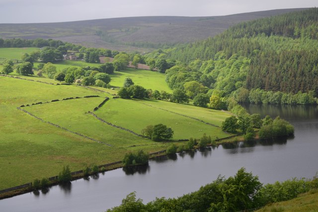
Photos View over Strines Reservoir to Brogging End
‹ ›
Weather for this location Next 14 days Nearby places Useful places within 5 km
All Historic
Own or manage this place?
Claim this listing to keep details accurate, add photos, and highlight what makes it special — free.
Claim this page→ How useful was the information on this page?
Something wrong on this page?
id: 71819097-4984-4d32-b3d4-471a4dbca343
UK green spaces mapped from open public data — so anyone can find the woodland, trail, or nature reserve closest to them.
© 2026 Glade · Made with care for UK green spaces
Wildlife to spot
12,237 records · National Biodiversity Network
▾
Wildlife to spot 12,237 records · National Biodiversity Network 🐦 Birds 45 species
autumn winter
2026 ▾
Meadow Pipit · Pheasant · Kestrel · Carrion Crow · Starling +40
Meadow Pipit Anthus pratensis2025 Pheasant Phasianus colchicus2025 Kestrel Falco tinnunculus Carrion Crow Corvus corone2025 Starling Sturnus vulgaris2025 Mistle Thrush Turdus viscivorus2025 Stonechat Saxicola rubicola2025 Magpie Pica pica2025 Blue Tit Cyanistes caeruleus2025 Raven Corvus corax2025 Goldfinch Carduelis carduelis2025 Woodpigeon Columba palumbus2025 Treecreeper Certhia familiaris2025 Skylark Alauda arvensis Reed Bunting Emberiza schoeniclus2025 Canada Goose Branta canadensis Mallard Anas platyrhynchos Grey Heron Ardea cinerea Wren Troglodytes troglodytes2025 Red Grouse (scotica) Lagopus scotica2025 Jay Garrulus glandarius2025 Woodcock Scolopax rusticola2025 Robin Erithacus rubecula2025 Chaffinch Fringilla coelebs2025 Goldcrest Regulus regulus2025 Barn Owl Tyto alba2025 Blackbird Turdus merula2025 Snipe Gallinago gallinago2025 Nuthatch Sitta europaea2025 Redstart Phoenicurus phoenicurus2025 Great Spotted Woodpecker Dendrocopos major Oystercatcher Haematopus ostralegus Golden Plover Pluvialis apricaria2025 Brambling Fringilla montifringilla2025 Greylag Goose Anser anser2025 Siskin Spinus spinus2025 Bullfinch Pyrrhula pyrrhula2025 Gannet Morus bassanus2025 Pied Wagtail Motacilla alba2025 Great Tit Parus major2025 Wheatear Oenanthe oenanthe2025 Linnet Linaria cannabina2025 Swallow Hirundo rustica2025 Willow Warbler Phylloscopus trochilus2025 Curlew Numenius arquata2025 🦌 Mammals 5 species
summer autumn
2025 ▾
Red Fox · Grey Squirrel · Badger · Weasel · Roe Deer
Red Fox Vulpes vulpes Grey Squirrel Sciurus carolinensis Badger Meles meles Weasel Mustela nivalis Roe Deer Capreolus capreolus Common Lizard
Common Lizard Zootoca vivipara 🐸 Amphibians 3 species
summer
2026 ▾
Common Frog · Common Toad · Palmate Newt
Common Frog Rana temporaria Common Toad Bufo bufo2025 Palmate Newt Lissotriton helveticus2025 Sericomyia silentis · Speckled Wood · Black Darter · Field Grasshopper · Mottled Grasshopper +11
Sericomyia silentis Sericomyia silentis Speckled Wood Pararge aegeria Black Darter Sympetrum danae Field Grasshopper Chorthippus brunneus Mottled Grasshopper Myrmeleotettix maculatus Roesel's Bush-cricket Roeseliana roeselii Frost Tortrix Soft-rush · Heather · Bilberry · Symphyotrichum novi-belgii · Shoreweed +9
Soft-rush Juncus effusus Heather Calluna vulgaris Bilberry Vaccinium myrtillus Symphyotrichum novi-belgii Symphyotrichum novi-belgii2025 Shoreweed Littorella uniflora2025 Pedunculate Oak Quercus robur Common Bent Species observations from the last 10 years via NBN Atlas
Exapate congelatella
Exapate congelatella
Phylidorea ferruginea Phylidorea ferruginea
Phylidorea ferruginea Phylidorea ferruginea
Limnephilus lunatus Limnephilus lunatus
Limnephilus lunatus Limnephilus lunatus
Tipula lateralis Tipula lateralis
Tipula lateralis Tipula lateralis
Ichneumonini Ichneumonini
Ichneumonini Ichneumonini
Red-tailed Bumblebee Bombus lapidarius
Red-tailed Bumblebee Bombus lapidarius
White-tailed Bumblebee Bombus lucorum/terrestris/magnus/cryptarum
White-tailed Bumblebee Bombus lucorum/terrestris/magnus/cryptarum
Southern Hawker Aeshna cyanea
Southern Hawker Aeshna cyanea
Common Blue Damselfly Enallagma cyathigerum
Common Blue Damselfly Enallagma cyathigerum
Mother Shipton Callistege mi
Mother Shipton Callistege mi Agrostis capillaris
Agrostis capillaris
Gymnocolea inflata Gymnocolea inflata2025
Gymnocolea inflata Gymnocolea inflata2025
Glittering Wood-moss Hylocomium splendens2025
Glittering Wood-moss Hylocomium splendens2025
Broom Fork-moss Dicranum scoparium2025
Broom Fork-moss Dicranum scoparium2025
Marsh Bryum Bryum pseudotriquetrum2025
Marsh Bryum Bryum pseudotriquetrum2025
Cowberry Vaccinium vitis-idaea2025
Cowberry Vaccinium vitis-idaea2025
Rowan Sorbus aucuparia2025
Rowan Sorbus aucuparia2025
Eared Willow Salix aurita2025
Eared Willow Salix aurita2025 Events & activities nearby Switch provider to compare local events, tours and bookable activities.
Bookable tours GetYourGuide Promote here