Back Wood - Conifer woodland
3 ha
Public accessFree entryDogs welcome3 ha
Getting here
53.64833, -1.87887
Open directionsv
Visiting this summer
Seasonal nature notes and what to look for now
- 🌞Midsummer — early morning visits most comfortable; look for deer fawns in quieter clearings
- 🐕Early mornings are best for dog walks in summer — visit before 9am to avoid the heat and find quieter trails
- 🅿️Parking 339m away — 2 car parks within reach
🌤️ Visiting this summer
- 🌞Midsummer — early morning visits most comfortable; look for deer fawns in quieter clearings
- 🐕Early mornings are best for dog walks in summer — visit before 9am to avoid the heat and find quieter trails
- 🅿️Parking 339m away — 2 car parks within reach
- £Free to visit — no entry charge
- 🐕Dogs welcome
Dogs allowed — public woodland
Free
Named hiking route nearby: Kirklees Way
Free
Conifer plantation — limited but present wildlife
Free
Trails nearby
Within roughly 5 km12 signed routes nearby · 5 public paths nearby
Signed route nearbyPublic paths
Kirklees WayWalking route116 km▾
Named routeLength 116 kmRound tripRegional walking route
Calderdale WayWalking route▾
Named routeRegional walking route
Brighouse Boundary WalkWalking route29 km▾
Named routeLength 29 kmRound tripLocal walking route
Standedge TrailWalking route▾
Named routeLocal walking route
Meltham WayWalking route▾
Named routeLocal walking route
39 signed routes nearby
Signed route nearby
Pennine CyclewayCycling route▾
Named routeRef 68National Cycle Network
Route 66Cycling route▾
Named routeRef 66National Cycle Network
Route 69Cycling route▾
Named routeRef 69National Cycle Network
West Yorkshire Cycle RouteCycling route▾
Named routeRef WYCRRegional cycle route
Main RouteCycling route964 m▾
Named routeRef 68Length 964 mNational Cycle NetworkOn-roadSurface asphalt
Main RouteCycling route771 m▾
Named routeRef 68Length 771 mNational Cycle NetworkOn-roadSurface asphalt
3 public paths nearby
Public paths
Hall Lanerestricted byway · 520 m▾
Public pathrestricted bywayLength 520 mSurface unpavedPath type: unclassified
Shaw Lanebridleway · 303 m▾
Public pathbridlewayLength 303 mSurface unpavedPath type: unclassified
New Lanerestricted byway · 156 m▾
Public pathrestricted bywayLength 156 mSurface gravelPath type: unclassified
Photos
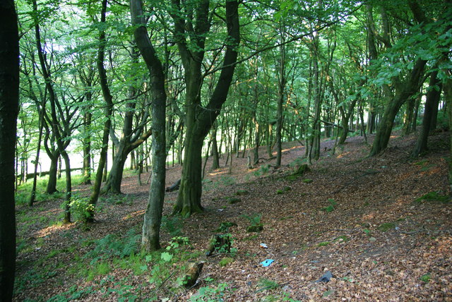
Woodland by the side of Round Ings Road
Weather for this location
Next 14 daysNearby places
Useful places within 5 km
Own or manage this place?
Claim this listing to keep details accurate, add photos, and highlight what makes it special — free.
Claim this page→How useful was the information on this page?
id: f9d1f769-fcc3-4da1-a1ad-909ee6769ba0
Wildlife to spot
651 records · National Biodiversity Network
Wildlife to spot
651 records · National Biodiversity NetworkKestrel · Carrion Crow · Woodpigeon · Magpie · Swift +24
- KestrelFalco tinnunculus
- Carrion CrowCorvus corone
- WoodpigeonColumba palumbus
- MagpiePica pica2024
- SwiftApus apus2023
- BlackbirdTurdus merula
- RobinErithacus rubecula2023
- JackdawColoeus monedula2023
- DunnockPrunella modularis
- Song ThrushTurdus philomelos2023
- Tawny OwlStrix aluco2023
- SwallowHirundo rustica2023
- GoldcrestRegulus regulus2023
- Barn OwlTyto alba
- WaxwingBombycilla garrulus2023
- ChiffchaffPhylloscopus collybita2023
- ChaffinchFringilla coelebs2023
- CootFulica atra2023
- Willow WarblerPhylloscopus trochilus2023
- Blue TitCyanistes caeruleus2023
- WrenTroglodytes troglodytes2023
- Great TitParus major2023
- Grey WagtailMotacilla cinerea2023
- Pied WagtailMotacilla alba2022
- Collared DoveStreptopelia decaocto2019
- PheasantPhasianus colchicus2018
- Jack SnipeLymnocryptes minimus2016
- SnipeGallinago gallinago2016
- Grey HeronArdea cinerea2015
🦌Mammals9 species
springsummerautumn
2025▾
Hedgehog · Grey Squirrel · Mole · Weasel · Rabbit +4
- HedgehogErinaceus europaeus2023
- Grey SquirrelSciurus carolinensis
- MoleTalpa europaea2022
- WeaselMustela nivalis2020
- RabbitOryctolagus cuniculus2014
🐸Amphibians1 species
spring
2023▾
Smooth Newt
- Smooth NewtLissotriton vulgaris
Stenophylax permistus · Cuckoo-Spit Insect · Meadow Brown · Lily Beetle · Limnephilus lunatus +22
- Stenophylax permistusStenophylax permistus2021
- Cuckoo-Spit InsectPhilaenus spumarius2019
- Meadow BrownManiola jurtina2017
- Lily BeetleLilioceris lilii2018
- Limnephilus lunatusLimnephilus lunatus2020
- Potamophylax latipennis
🌿Plants33 species
winterspringsummerautumn
2026▾
Red-osier Dogwood · Neat Feather-moss · Heath Plait-moss · Himalayan Balsam · Broom Fork-moss +28
- Red-osier DogwoodCornus sericea2016
- Neat Feather-mossPseudoscleropodium purum
- Heath Plait-mossHypnum jutlandicum
- Himalayan BalsamImpatiens glandulifera2025
- Broom Fork-moss
Species observations from the last 10 years via NBN Atlas
Muntjac
Muntjac
Muntiacus reevesi2023
Muntiacus reevesi2023
Roe DeerCapreolus capreolus2023Roe DeerCapreolus capreolus2023Pipistrelle Bat speciesPipistrellus2022Pipistrelle Bat speciesPipistrellus2022Fallow DeerDama dama2018Fallow DeerDama dama2018Potamophylax latipennis2017
Potamophylax latipennis2017
Small WhitePieris rapae2016Small WhitePieris rapae2016Common Carder BeeBombus pascuorumCommon Carder BeeBombus pascuorumHawthorn ShieldbugAcanthosoma haemorrhoidaleHawthorn ShieldbugAcanthosoma haemorrhoidaleHemerocallis Gall MidgeContarinia quinquenotata2021Hemerocallis Gall MidgeContarinia quinquenotata2021Drusus annulatusDrusus annulatus2020Drusus annulatusDrusus annulatus2020Mystacides longicornisMystacides longicornis2020Mystacides longicornisMystacides longicornis2020Cercopis vulnerataCercopis vulnerata2020Cercopis vulnerataCercopis vulnerata2020Hydropsyche pellucidulaHydropsyche pellucidula2019Hydropsyche pellucidulaHydropsyche pellucidula2019Ceraclea albimaculaCeraclea albimacula2019Ceraclea albimaculaCeraclea albimacula2019Stenophylax vibexStenophylax vibex2019Stenophylax vibexStenophylax vibex2019Bloody GrieverDolerus haematodes2019Bloody GrieverDolerus haematodes2019Harmonia axyridis form spectabilisHarmonia axyridis form spectabilis2018Harmonia axyridis form spectabilisHarmonia axyridis form spectabilis2018Humming-bird Hawk-mothMacroglossum stellatarum2018Humming-bird Hawk-mothMacroglossum stellatarum2018Limnephilus flavicornisLimnephilus flavicornis2017Limnephilus flavicornisLimnephilus flavicornis2017Common Sedge-sawflySelandria serva2017Common Sedge-sawflySelandria serva2017Red AdmiralVanessa atalanta2016Red AdmiralVanessa atalanta2016Harlequin LadybirdHarmonia axyridis2016Harlequin LadybirdHarmonia axyridis2016Kidney-spot LadybirdChilocorus renipustulatus2015Kidney-spot LadybirdChilocorus renipustulatus2015Potamophylax cingulatusPotamophylax cingulatus2015Potamophylax cingulatusPotamophylax cingulatus2015Common Red-legged RobberflyDioctria rufipes2014Common Red-legged RobberflyDioctria rufipes2014Livid SawflyTenthredo livida2014Livid SawflyTenthredo livida2014Dicranum scoparium
Dicranum scoparium
Glittering Wood-mossHylocomium splendensGlittering Wood-mossHylocomium splendensWaved Silk-mossPlagiothecium undulatumWaved Silk-mossPlagiothecium undulatumCommon Tamarisk-mossThuidium tamariscinumCommon Tamarisk-mossThuidium tamariscinumRed-stemmed Feather-mossPleurozium schreberiRed-stemmed Feather-mossPleurozium schreberiJuniper HaircapPolytrichum juniperinumJuniper HaircapPolytrichum juniperinumSpringy Turf-mossRhytidiadelphus squarrosusSpringy Turf-mossRhytidiadelphus squarrosusCommon Feather-mossKindbergia praelongaCommon Feather-mossKindbergia praelongaRosebay WillowherbChamaenerion angustifolium2025Rosebay WillowherbChamaenerion angustifolium2025FoxgloveDigitalis purpurea2025FoxgloveDigitalis purpurea2025Creeping ThistleCirsium arvense2025Creeping ThistleCirsium arvense2025CowslipPrimula veris2023CowslipPrimula veris2023BilberryVaccinium myrtillus2023BilberryVaccinium myrtillus2023Wood AnemoneAnemone nemorosa2023Wood AnemoneAnemone nemorosa2023Green AlkanetPentaglottis sempervirens2021Green AlkanetPentaglottis sempervirens2021Oval SedgeCarex leporina2021Oval SedgeCarex leporina2021Field Wood-rushLuzula campestris2021Field Wood-rushLuzula campestris2021Sheep's SorrelRumex acetosella2021Sheep's SorrelRumex acetosella2021Marsh ThistleCirsium palustre2021Marsh ThistleCirsium palustre2021Wild AngelicaAngelica sylvestris2021Wild AngelicaAngelica sylvestris2021Spring-sedgeCarex caryophyllea2021Spring-sedgeCarex caryophyllea2021BrooklimeVeronica beccabunga2021BrooklimeVeronica beccabunga2021LousewortPedicularis sylvatica2021LousewortPedicularis sylvatica2021ElderSambucus nigra2020ElderSambucus nigra2020Japanese RoseRosa rugosa2020Japanese RoseRosa rugosa2020HyacinthoidesHyacinthoides2017HyacinthoidesHyacinthoides2017BluebellHyacinthoides non-scripta2017BluebellHyacinthoides non-scripta2017False-acaciaRobinia pseudoacacia2016False-acaciaRobinia pseudoacacia2016Japanese KnotweedReynoutria japonica2016Japanese KnotweedReynoutria japonica2016Events & activities nearby
Switch provider to compare local events, tours and bookable activities.