Getting here
53.73920, -2.11453
Visiting this summer
Seasonal nature notes and what to look for now
Visiting this summer
Seasonal nature notes and what to look for now
- 🌞Midsummer — early morning visits most comfortable; look for deer fawns in quieter clearings
- 🐕Early mornings are best for dog walks in summer — visit before 9am to avoid the heat and find quieter trails
- 🅿️Parking 189m away — 2 car parks within reach
🌤️ Visiting this summer
- 🌞Midsummer — early morning visits most comfortable; look for deer fawns in quieter clearings
- 🐕Early mornings are best for dog walks in summer — visit before 9am to avoid the heat and find quieter trails
- 🅿️Parking 189m away — 2 car parks within reach
Good to know
- £Free to visit — no entry charge
- 🐕Dogs welcome
Best for
Dog walks
Strong match
Dogs allowed — public woodland
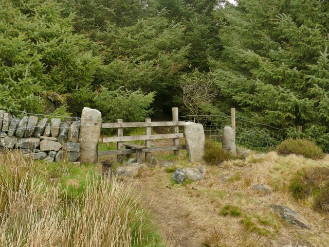
Forest walks
Good match
Public woodland
Hiking
Moderate match
Named hiking route nearby: Todmorden Centenary Way
Wildlife
Weak signal
Conifer plantation — limited but present wildlife
Trails nearby
Within roughly 5 km🚶Walking
18 signed routes nearby · 22 public paths nearby
Signed route nearbyPublic paths
Walking
Mary Towneley LoopWalking route
Forms part of Pennine Bridleway National Trail
Irwell Sculpture TrailWalking route
Rossendale WayWalking route
A high-level route around Bacup, Rawtenstall, Haslingden and Whitworth in the Rossendale Valley, crossing the open moors and farmland of the South Pennines which roughly follows the Rossendale Borough boundary.
Todmorden Centenary WayWalking route
Pennine Way (Warland Reservoir to Calder Valley)Walking route
🚴Cycling
54 signed routes nearby
Signed route nearby
Cycling
Route 66Cycling route
Todmorden High School Safe Route to SchoolCycling route
Route 68Cycling route
Main RouteCycling route65 m
Main RouteCycling route24 m
Main RouteCycling route42 m
🚵Mountain biking
3 signed routes nearby
Signed route nearby
Mountain biking
Calder Aire LinkMountain bike route
Great North Trail (Yorkshire Dales)Mountain bike route172.2 km
Great North Trail (Peak District and South Pennines)Mountain bike route130.4 km
🐴Horse riding
17 public paths nearby
Public paths
Horse riding
Stony Lanebridleway · 221 m
Delf Lanebridleway · 266 m
Sagar Lanebridleway · 315 m
Hudson Bridgebridleway · 10 m
Stony Lanebridleway · 9 m
Wildlife to spot
Photos
Weather for this location
Loading local forecast…
Nearby places
Useful places within 5 km
Own or manage this place?
Claim this listing to keep details accurate, add photos, and highlight what makes it special — free.
Claim this pageHow was your visit?
How useful was the information on this page?
id: fc733487-f055-47d3-a8bf-dc2c2a92e038