Consall Nature Park ✦ Ancient woodland 256 ha
Plan your visit
🦉 Wildlife🦅 Birds🍂 Seasonal
Public access Free entry Dogs welcome 256 ha
Places › England › West Midlands › Staffordshire Moorlands Getting here
53.03490, -2.01268
Open directionsv Visiting this summer
Seasonal nature notes and what to look for now
▾ 🌞 Midsummer — early morning visits most comfortable; look for deer fawns in quieter clearings 🐕 Early mornings are best for dog walks in summer — visit before 9am to avoid the heat and find quieter trails 🅿️ RSPB Consall Woods 9m away — 8 car parks within reach 🌤️ Visiting this summer
🌞 Midsummer — early morning visits most comfortable; look for deer fawns in quieter clearings 🐕 Early mornings are best for dog walks in summer — visit before 9am to avoid the heat and find quieter trails 🅿️ RSPB Consall Woods 9m away — 8 car parks within reach £ Free to visit — no entry charge🐕 Dogs welcome🌿 Ancient woodland — rare wildlife habitat🌳 Large woodland — room to roam🦉 Wildlife
Very strong match
Multi-group wildlife — Amphibians, Birds, Mammals, Reptiles; Multi-group wildlife — Amphibians, Birds, Mammals, Reptiles
Free
🦅 Bird watching
Very strong match
Birds — Mallard, Blackbird, Blue Tit +71 more · last seen 2026; Birds — Mallard, Blackbird, Blue Tit +71 more · last seen 2026
Free
🍂 Seasonal nature
Strong match
Ancient woodland — bluebells, fungi and autumn colour; Plants — Butterbur, Dog's Mercury, Wood Anemone +42 more · last seen 2026
Free
🦋 Insect spotting
Strong match
Lowland meadows — marbled white, meadow brown and pollinating insects; Insects — Marmalade Hoverfly, Eristalis pertinax, Sericomyia superbiens +31 more · last seen 2025
Free
Dogs allowed — public woodland
Free
Deciduous woodland — fungi, berries and wild garlic; Plants — Flowering Currant, Blackthorn, Wood-sorrel +4 more foraging species
Varies
Trails nearby Within roughly 5 km 8 signed routes nearby · 148 public paths nearby
Signed route nearby Public paths
Weaver Walk Walking route ▾
Named route Local walking route
Show on map Young Woodland Loop Walking route ▾
Named route Local walking route
Show on map Churnet Way Walking route ▾
Valley Woodland Trail Walking route ▾
Named route Local walking route
Show on map Booth's Wood Loop Walking route ▾
Named route Local walking route
Show on map Tickle Bridge public footpath · 13 m ▾
Caldon Canal towpath from Consall to Froghall
Public path public footpath Length 13 m Surface asphalt Path type: path
Show on map Ipstones 10 public footpath · 286 m ▾
Public path public footpath Length 286 m Surface asphalt Path type: service
Show on map Ipstones 10 public footpath · 10 m ▾
Public path public footpath Length 10 m Surface asphalt Path type: service
Show on map 6 signed routes nearby
Signed route nearby
Route 559 Cycling route ▾
Named route Ref 559 National Cycle Network
Show on map National Route 550 Cycling route ▾
Named route Ref 550 National Cycle Network
Show on map Main Route Cycling route 13.8 km ▾
Named route Ref 550 Length 13.8 km National Cycle Network Traffic-free Surface unsealedfirm
Show on map Main Route Cycling route 170 m ▾
Named route Ref 559 Length 170 m National Cycle Network On-road Surface asphalt
Show on map Main Route Cycling route 3.7 km ▾
Named route Ref 559 Length 3.7 km National Cycle Network Traffic-free Surface unsealedfirm
Show on map Main Route Cycling route 8.8 km ▾
Named route Ref 550 Length 8.8 km National Cycle Network Traffic-free Surface unsealedfirm
Show on map ✦ Ancient woodland — continuously wooded since at least 1600 AD. A rare and irreplaceable habitat, rich in biodiversity and historical character.
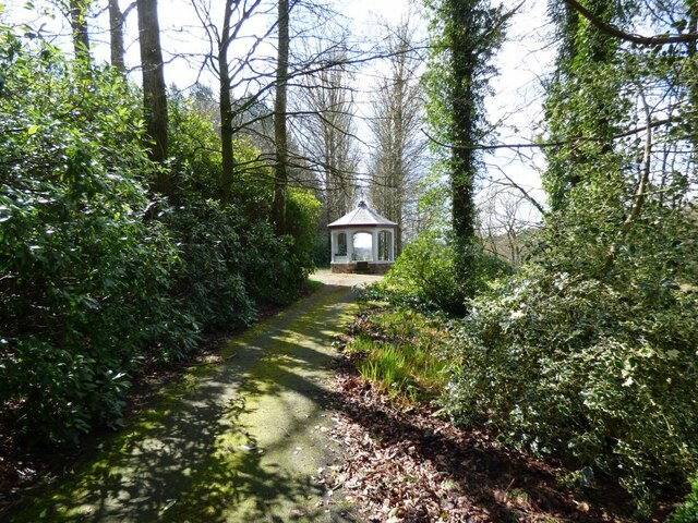
Photos Summer House at Consall Hall
‹ ›
Weather for this location Next 14 days Nearby places Useful places within 5 km
All Historic
Own or manage this place?
Claim this listing to keep details accurate, add photos, and highlight what makes it special — free.
Claim this page→ How useful was the information on this page?
id: 1727884b-e862-425f-93f7-f5ce10eab2c3
UK green spaces mapped from open public data — so anyone can find the woodland, trail, or nature reserve closest to them.
© 2026 Glade · Made with care for UK green spaces
Wildlife to spot
6,170 records · National Biodiversity Network
▾
Wildlife to spot 6,170 records · National Biodiversity Network 🐦 Birds 46 species
spring summer winter
2026 ▾
Carrion Crow · Mallard · Pheasant · Blue Tit · Woodpigeon +41
Carrion Crow Corvus corone2025 Mallard Anas platyrhynchos2025 Pheasant Phasianus colchicus2025 Blue Tit Cyanistes caeruleus2025 Woodpigeon Columba palumbus2025 Wren Troglodytes troglodytes2025 Magpie Pica pica2025 Blackbird Turdus merula2025 Jackdaw Coloeus monedula2025 Chaffinch Fringilla coelebs2025 Nuthatch Sitta europaea2025 Dunnock Prunella modularis2025 Coal Tit Periparus ater2025 Long-tailed Tit Aegithalos caudatus2025 Robin Erithacus rubecula2025 Song Thrush Turdus philomelos2025 Rook Corvus frugilegus2025 Great Tit Parus major2025 Starling Sturnus vulgaris2025 Goosander Mergus merganser2025 Raven Corvus corax2025 Goldcrest Regulus regulus2025 House Sparrow Passer domesticus2025 Chiffchaff Phylloscopus collybita2025 Blackcap Sylvia atricapilla2025 Great Spotted Woodpecker Dendrocopos major2025 Tufted Duck Aythya fuligula Treecreeper Certhia familiaris2025 Collared Dove Streptopelia decaocto2025 Herring Gull Larus argentatus2025 Black-headed Gull Chroicocephalus ridibundus2025 Pied Wagtail Motacilla alba yarrellii2025 Grey Wagtail Motacilla cinerea2025 Lesser Black-backed Gull Larus fuscus2025 House Martin Delichon urbicum2025 Goldfinch Carduelis carduelis2025 Red-legged Partridge Alectoris rufa2025 Barn Owl Tyto alba2025 Tawny Owl Strix aluco2025 Bullfinch Pyrrhula pyrrhula2025 Willow Tit Poecile montanus2025 Moorhen Gallinula chloropus2025 Garden Warbler Sylvia borin2025 Green Woodpecker Picus viridis2025 Dipper Cinclus cinclus2025 Swallow Hirundo rustica2025 🦌 Mammals 12 species
spring summer autumn
2026 ▾
Badger · Mole · Red Deer · Wood Mouse · Muntjac +7
Badger Meles meles Mole Talpa europaea Red Deer Cervus elaphus Wood Mouse Apodemus sylvaticus2025 Muntjac Muntiacus reevesi2025 Red Fox 🐸 Amphibians 1 species
spring summer
2026 ▾
Common Toad
Sericomyia superbiens · Marmalade Hoverfly · Harlequin Ladybird · 7-spot Ladybird · Dasysyrphus tricinctus +14
Sericomyia superbiens Sericomyia superbiens Marmalade Hoverfly Episyrphus balteatus Harlequin Ladybird Harmonia axyridis 7-spot Ladybird Coccinella septempunctata Dasysyrphus tricinctus Dasysyrphus tricinctus Helophilus pendulus Helophilus pendulus Himalayan Balsam · Skullcap · Upright Hedge-parsley · Western Red-cedar · Hart's-Tongue +16
Himalayan Balsam Impatiens glandulifera2025 Skullcap Scutellaria galericulata2025 Upright Hedge-parsley Torilis japonica2025 Western Red-cedar Thuja plicata Hart's-Tongue Asplenium scolopendrium Rock Stonecrop Petrosedum forsterianum Species observations from the last 10 years via NBN Atlas
Vulpes vulpes
Vulpes vulpes
Roe Deer Capreolus capreolus
Roe Deer Capreolus capreolus
Otter Lutra lutra2025
Otter Lutra lutra2025
Harvest Mouse Micromys minutus2025
Harvest Mouse Micromys minutus2025
Pygmy Shrew Sorex minutus2025
Pygmy Shrew Sorex minutus2025
Field Vole Microtus agrestis2025
Field Vole Microtus agrestis2025
Common Shrew Sorex araneus2025
Common Shrew Sorex araneus2025 Meliscaeva cinctella
Meliscaeva cinctella
Meliscaeva cinctella
Meliscaeva cinctella
Eupeodes latifasciatus Eupeodes latifasciatus
Eupeodes latifasciatus Eupeodes latifasciatus
Cuckoo-Spit Insect Philaenus spumarius
Cuckoo-Spit Insect Philaenus spumarius
Aquarius paludum Aquarius paludum
Aquarius paludum Aquarius paludum
Red-legged Shieldbug Pentatoma rufipes
Red-legged Shieldbug Pentatoma rufipes
Green Dock Beetle Gastrophysa viridula
Green Dock Beetle Gastrophysa viridula
Sericomyia silentis Sericomyia silentis
Sericomyia silentis Sericomyia silentis
Water Scorpion Nepa cinerea
Water Scorpion Nepa cinerea
Emperor Dragonfly Anax imperator
Emperor Dragonfly Anax imperator
Brown Hawker Aeshna grandis
Brown Hawker Aeshna grandis
Grypocoris (Lophyromiris) stysi Grypocoris (Lophyromiris) stysi
Grypocoris (Lophyromiris) stysi Grypocoris (Lophyromiris) stysi
Broad Centurion Chloromyia formosa
Broad Centurion Chloromyia formosa
Green Nettle Weevil Phyllobius pomaceus
Green Nettle Weevil Phyllobius pomaceus
Marsh Woundwort Stachys palustris2025
Marsh Woundwort Stachys palustris2025
Common Spotted-orchid Dactylorhiza fuchsii2025
Common Spotted-orchid Dactylorhiza fuchsii2025
Broad-leaved Helleborine Epipactis helleborine2025
Broad-leaved Helleborine Epipactis helleborine2025
Gypsywort Lycopus europaeus2025
Gypsywort Lycopus europaeus2025
Nipplewort Lapsana communis2025
Nipplewort Lapsana communis2025
Greater Bird's-foot-trefoil Lotus pedunculatus2025
Greater Bird's-foot-trefoil Lotus pedunculatus2025
Pendulous Sedge Carex pendula2025
Pendulous Sedge Carex pendula2025
Wild Angelica Angelica sylvestris2025
Wild Angelica Angelica sylvestris2025
Marsh Thistle Cirsium palustre2025
Marsh Thistle Cirsium palustre2025
Bittersweet Solanum dulcamara2025
Bittersweet Solanum dulcamara2025
Sitka Spruce Picea sitchensis2025
Sitka Spruce Picea sitchensis2025
Common Valerian Valeriana officinalis2025
Common Valerian Valeriana officinalis2025
Blackthorn Prunus spinosa2025
Blackthorn Prunus spinosa2025
Common Knapweed Centaurea nigra2025
Common Knapweed Centaurea nigra2025
Enchanter's-nightshade Circaea lutetiana2025
Enchanter's-nightshade Circaea lutetiana2025 Events & activities nearby Switch provider to compare local events, tours and bookable activities.
Bookable tours GetYourGuide Promote here