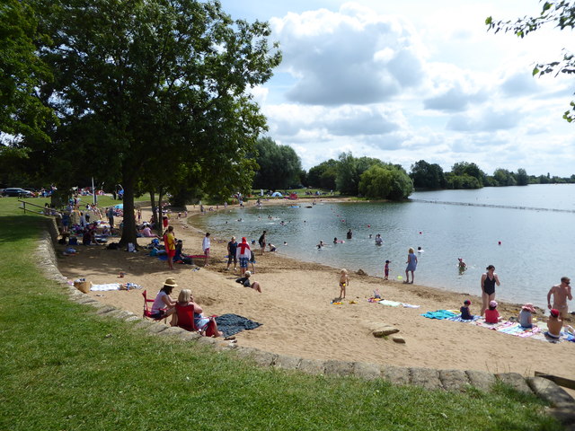
Cotswold Country Park and Beach
Getting here
51.65992, -1.96102
Visiting this summer
Seasonal nature notes and what to look for now
Visiting this summer
Seasonal nature notes and what to look for now
- 🐦63+ species recorded in this area — summer evenings are best for activity; watch for Coot and Grey Heron
- ☀️Summer family visits work well here — arrive early and plan for a longer stay
- 🛝Playground 207m away — built-in entertainment for younger visitors alongside the wider site
🌤️ Visiting this summer
- 🐦63+ species recorded in this area — summer evenings are best for activity; watch for Coot and Grey Heron
- ☀️Summer family visits work well here — arrive early and plan for a longer stay
- 🛝Playground 207m away — built-in entertainment for younger visitors alongside the wider site
Good to know
- £Free to visit — no entry charge
- 🐕Dogs welcome
Best for
Bird watching
Very strong match
Birds — Coot, Grey Heron, Cormorant +60 more · last seen 2026; Birds — Coot, Grey Heron, Cormorant +60 more · last seen 2026
Playgrounds
Strong match
playground, parking
Family friendly
Strong match
playground; Urban park — family destination
Wildlife
Strong match
Birds — Coot, Grey Heron, Cormorant +60 more · last seen 2026; Birds — Coot, Grey Heron, Cormorant +60 more · last seen 2026
Dog walks
Strong match
Dogs allowed with public access
Picnic day out
Good match
Urban park — open green space
Trails nearby
Within roughly 5 km🚶Walking
6 signed routes nearby · 19 public paths nearby
Signed route nearbyPublic paths
Walking
Monarch's WayWalking route990 km
approximate route of Charles II's escape
The Roman WayWalking route274.5 km
Wysis WayWalking route88.5 km
Long distance footpath forming a link between the Thames and the Wye
Thames PathWalking route296 km
Thames & Severn WayWalking route69.8 km
Linking the Severn to the Thames following the route of the Stroudwater Navigation and Thames & Severn Canal as closely as possible using public rights of way. As the canals are restored, it will be updated to use the reinstated towpath wherever possible.
🚴Cycling
28 signed routes nearby
Signed route nearby
Cycling
Mercian WayCycling route
Main RouteCycling route105 m
Main RouteCycling route592 m
Main RouteCycling route9.3 km
Main RouteCycling route96 m
Main RouteCycling route10 m
🐴Horse riding
1 public path nearby
Public paths
Horse riding
No named routes yet. Public paths are shown on the map.
Wildlife to spot
Photos
Weather for this location
Loading local forecast…
Nearby places
Useful places within 5 km
Own or manage this place?
Claim this listing to keep details accurate, add photos, and highlight what makes it special — free.
Claim this pageHow was your visit?
How useful was the information on this page?
id: 46ec9222-f6b8-4546-afe1-c41837db9623