Plan your visit
🦉 Wildlife🧺 Picnic🦅 Birds
Public access Free entry Dogs welcome 80 ha
Places › England › East Midlands › Newark and Sherwood Getting here
53.16775, -1.05745
Open directionsv Visiting this summer
Seasonal nature notes and what to look for now
▾ ☀️ June — canopy now fully closed, creating cool dappled shade even on warm days 🧺 Good picnic destination in summer — open space and facilities for a relaxed day out ☕ Starbucks — makes this an easy full-day family visit without needing to pack food 🌤️ Visiting this summer
☀️ June — canopy now fully closed, creating cool dappled shade even on warm days 🧺 Good picnic destination in summer — open space and facilities for a relaxed day out ☕ Starbucks — makes this an easy full-day family visit without needing to pack food £ Free to visit — no entry charge🐕 Dogs welcome🚲 Bike parking☕ Café🅿️ Parking· Free 🧺 Picnic spot🚻 Toilets
🦉 Wildlife
Very strong match
Multi-group wildlife — Amphibians, Birds, Mammals; Multi-group wildlife — Amphibians, Birds, Mammals
Free
🧺 Picnic day out
Very strong match
picnic area, café, toilets, car park
Free
🦅 Bird watching
Very strong match
Birds — Moorhen, Robin, Canada Goose +80 more · last seen 2026; Birds — Moorhen, Robin, Canada Goose +80 more · last seen 2026
Free
🛝 Family friendly
Strong match
café, toilets, picnic area
Free
Dogs allowed — public woodland
Free
🦋 Insect spotting
Strong match
Insects — Western Conifer Seed Bug, Cis bilamellatus, Cream-streaked Ladybird +21 more · last seen 2026; Insects — Western Conifer Seed Bug, Cis bilamellatus, Cream-streaked Ladybird +21 more · last seen 2026
Free
Trails nearby Within roughly 5 km 7 signed routes nearby · 1 public path nearby
Signed route nearby Public paths
Southwell Trail Walking route ▾
Named route Local walking route
Show on map Greenwood Trail Walking route ▾
Named route Local walking route
Show on map Dukeries Trail Walking route ▾
Major Oak Trail Walking route ▾
Named route Local walking route
Show on map Giants Trail Walking route ▾
Named route Local walking route
Show on map 45 signed routes nearby
Signed route nearby
Route 645 Cycling route ▾
Named route Ref 645 National Cycle Network
Show on map Route 645 Cycling route ▾
Named route Ref 645 National Cycle Network
Show on map Route 6 Cycling route ▾
Named route Ref 6 National Cycle Network
Show on map NCN National Route 648 Cycling route ▾
Named route Ref 648 National Cycle Network
Show on map National Byway (Southwell Loop) Cycling route ▾
Named route Ref NB Regional cycle route
Show on map Main Route Cycling route 376 m ▾
Named route Ref 6 Length 376 m National Cycle Network Traffic-free Surface unsealedfirm
Show on map 4 signed routes nearby
Signed route nearby
Family Cycle Route Mountain bike route ▾
Named route Ref Green Route
Show on map Outlaw Trail Mountain bike route ▾
Named route Ref Red Route
Show on map Viking Trail Mountain bike route ▾
Named route Ref Blue Route
Show on map Bike Park & Downhill Route Mountain bike route ▾
7 public paths nearby
Public paths
No named routes yet. Public paths are shown on the map.
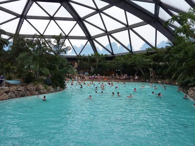
Photos Subtropical Swimming Paradise
‹ ›
Weather for this location Next 14 days Nearby places Useful places within 5 km
All Historic
How useful was the information on this page?
id: 39a57d90-3d42-417e-b1e2-2e7097f3e16e
UK green spaces mapped from open public data — so anyone can find the woodland, trail, or nature reserve closest to them.
© 2026 Glade · Made with care for UK green spaces
Events & activities nearby Switch provider to compare local events, tours and bookable activities.
Bookable tours Wildlife to spot
16,757 records · National Biodiversity Network
▾
Wildlife to spot 16,757 records · National Biodiversity Network 🐦 Birds 42 species
autumn winter
2026 ▾
Greylag Goose · Mallard · Moorhen · Coal Tit · Robin +37
Greylag Goose Anser anser Mallard Anas platyrhynchos Moorhen Gallinula chloropus Coal Tit Periparus ater2025 Robin Erithacus rubecula2025 Woodpigeon Columba palumbus Blackbird Turdus merula Canada Goose Branta canadensis Blue Tit Cyanistes caeruleus2025 Nuthatch Sitta europaea2025 Black-headed Gull Chroicocephalus ridibundus2025 Magpie Pica pica2025 Grey Heron Ardea cinerea2025 Chaffinch Fringilla coelebs2025 Coot Fulica atra Great Tit Parus major2025 Great Spotted Woodpecker Dendrocopos major2025 Starling Sturnus vulgaris2025 Mute Swan Cygnus olor2025 Carrion Crow Corvus corone2025 Long-tailed Tit Aegithalos caudatus2025 Tufted Duck Aythya fuligula2025 Goosander Mergus merganser2025 Goldcrest Regulus regulus2025 Crossbill Loxia curvirostra2025 Jay Garrulus glandarius2025 Goldfinch Carduelis carduelis2025 Grey Wagtail Motacilla cinerea2025 Kestrel Falco tinnunculus2025 Marsh Tit Poecile palustris2025 Little Egret Egretta garzetta2025 Dunnock Prunella modularis2025 Siskin Spinus spinus2025 Jackdaw Coloeus monedula2025 Gadwall Mareca strepera2025 Wren Troglodytes troglodytes2025 Kingfisher Alcedo atthis2025 Egyptian Goose Alopochen aegyptiaca2025 Herring Gull Larus argentatus2025 Brambling Fringilla montifringilla2025 Treecreeper Certhia familiaris2025 Green Woodpecker Picus viridis2025 Grey Squirrel · Noctule · Soprano Pipistrelle · Leisler's Bat
Grey Squirrel Sciurus carolinensis Noctule Nyctalus noctula Soprano Pipistrelle Pipistrellus pygmaeus Leisler's Bat Nyctalus leisleri 🐸 Amphibians 1 species
winter
2026 ▾
Common Toad
🐝 Insects 10 species
summer autumn
2026 ▾
Syrphus · Euophryum confine · Dark-edged Bee-fly · Cream-streaked Ladybird · 7-spot Ladybird +5
Syrphus Syrphus2025 Euophryum confine Euophryum confine2025 Dark-edged Bee-fly Bombylius major Cream-streaked Ladybird Harmonia quadripunctata2025 7-spot Ladybird Coccinella septempunctata2025 Mugwort · Fox-and-cubs · White Campion · Broad-leaved Dock · Sticky Mouse-ear +56
Mugwort Artemisia vulgaris Fox-and-cubs Pilosella aurantiaca White Campion Silene latifolia Broad-leaved Dock Rumex obtusifolius Sticky Mouse-ear Cerastium glomeratum Black Bent Agrostis gigantea Luzula multiflora subsp. congesta Species observations from the last 10 years via NBN Atlas
Harlequin Ladybird
Harlequin Ladybird
Harmonia axyridis2025
Harmonia axyridis2025
Green Shieldbug Palomena prasina2025
Green Shieldbug Palomena prasina2025
Western Conifer Seed Bug Leptoglossus occidentalis2025
Western Conifer Seed Bug Leptoglossus occidentalis2025
Strawberry-root Weevil Otiorhynchus ovatus2025
Strawberry-root Weevil Otiorhynchus ovatus2025
Orchesia undulata Orchesia undulata2025
Orchesia undulata Orchesia undulata2025 Luzula multiflora subsp. congesta
Luzula multiflora subsp. congesta
Black Horehound Ballota nigra
Black Horehound Ballota nigra
Thyme-leaved Speedwell Veronica serpyllifolia
Thyme-leaved Speedwell Veronica serpyllifolia
Bramble Rubus fruticosus
Bramble Rubus fruticosus
Dog-rose Rosa canina
Dog-rose Rosa canina
Ribwort Plantain Plantago lanceolata
Ribwort Plantain Plantago lanceolata
Smooth Hawk's-beard Crepis capillaris
Smooth Hawk's-beard Crepis capillaris
Butterfly-bush Buddleja davidii
Butterfly-bush Buddleja davidii
Hemlock Conium maculatum
Hemlock Conium maculatum
Spear Thistle Cirsium vulgare
Spear Thistle Cirsium vulgare
Yarrow Achillea millefolium
Yarrow Achillea millefolium
Broom Cytisus scoparius
Broom Cytisus scoparius
Red Clover Trifolium pratense
Red Clover Trifolium pratense
Tansy Tanacetum vulgare
Tansy Tanacetum vulgare
Hieracium sect. Sabauda Hieracium sect. Sabauda
Hieracium sect. Sabauda Hieracium sect. Sabauda
Hogweed Heracleum sphondylium
Hogweed Heracleum sphondylium
Hawthorn Crataegus monogyna
Hawthorn Crataegus monogyna
Squirreltail Fescue Vulpia bromoides
Squirreltail Fescue Vulpia bromoides
Dandelion Taraxacum
Dandelion Taraxacum
Velvet Bent Agrostis canina
Velvet Bent Agrostis canina
Creeping Bent Agrostis stolonifera
Creeping Bent Agrostis stolonifera
American Willowherb Epilobium ciliatum
American Willowherb Epilobium ciliatum
Silver Birch Betula pendula
Silver Birch Betula pendula
Common Centaury Centaurium erythraea
Common Centaury Centaurium erythraea
Common Bird's-foot-trefoil Lotus corniculatus
Common Bird's-foot-trefoil Lotus corniculatus
Bulrush Typha latifolia
Bulrush Typha latifolia
Common Nettle Urtica dioica
Common Nettle Urtica dioica
Lesser Burdock Arctium minus
Lesser Burdock Arctium minus
Common Sallow Salix cinerea
Common Sallow Salix cinerea
Hop Trefoil Trifolium campestre
Hop Trefoil Trifolium campestre
Pedunculate Oak Quercus robur
Pedunculate Oak Quercus robur
Corn Marigold Glebionis segetum
Corn Marigold Glebionis segetum
Cleavers Galium aparine
Cleavers Galium aparine
Long-headed Poppy Papaver dubium
Long-headed Poppy Papaver dubium
Perforate St John's-wort Hypericum perforatum
Perforate St John's-wort Hypericum perforatum
Wild Teasel Dipsacus fullonum
Wild Teasel Dipsacus fullonum
Sweet Chestnut Castanea sativa
Sweet Chestnut Castanea sativa
Yorkshire-fog Holcus lanatus
Yorkshire-fog Holcus lanatus
Soft-rush Juncus effusus
Soft-rush Juncus effusus
Mouse-ear-hawkweed Pilosella officinarum
Mouse-ear-hawkweed Pilosella officinarum
Sweet Vernal-grass Anthoxanthum odoratum
Sweet Vernal-grass Anthoxanthum odoratum
Smooth Cat's-ear Hypochaeris glabra
Smooth Cat's-ear Hypochaeris glabra
Reflexed Saltmarsh-Grass Puccinellia distans
Reflexed Saltmarsh-Grass Puccinellia distans
Common Amaranth Amaranthus retroflexus
Common Amaranth Amaranthus retroflexus
Common Mouse-ear Cerastium fontanum
Common Mouse-ear Cerastium fontanum
Black-bindweed Fallopia convolvulus
Black-bindweed Fallopia convolvulus
Cat's-ear Hypochaeris radicata
Cat's-ear Hypochaeris radicata
Gorse Ulex europaeus
Gorse Ulex europaeus
White Poplar Populus alba
White Poplar Populus alba
Common Bent Agrostis capillaris
Common Bent Agrostis capillaris
Prickly Lettuce Lactuca serriola
Prickly Lettuce Lactuca serriola
Lesser Hawkbit Leontodon saxatilis
Lesser Hawkbit Leontodon saxatilis
Downy Birch Betula pubescens
Downy Birch Betula pubescens
Canadian Fleabane Erigeron canadensis
Canadian Fleabane Erigeron canadensis
Aspen Populus tremula
Aspen Populus tremula