🦅Birds🦉Wildlife🦋Insects
Public accessDogs welcome
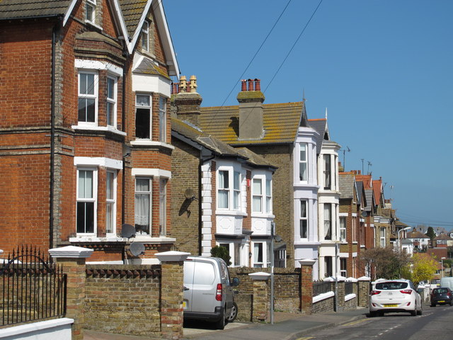
Getting here
51.36103, 1.43990
Open directionsv
Visiting this summer
Seasonal nature notes and what to look for now
- 🐦85+ species recorded in this area — summer evenings are best for activity; watch for Herring Gull and Carrion Crow
- ☀️Summer family visits work well here — arrive early and plan for a longer stay
- 🐕Dogs welcome — bring water in summer; the site has enough space to find shade on hot days
🌤️ Visiting this summer
- 🐦85+ species recorded in this area — summer evenings are best for activity; watch for Herring Gull and Carrion Crow
- ☀️Summer family visits work well here — arrive early and plan for a longer stay
- 🐕Dogs welcome — bring water in summer; the site has enough space to find shade on hot days
🚲Bike parking🅿️Parking· Paid🚻Toilets
🦅Bird watching
Very strong match
Birds — Herring Gull, Carrion Crow, Turnstone +82 more · last seen 2026; Birds — Herring Gull, Carrion Crow, Turnstone +82 more · last seen 2026
Free
🦉Wildlife
Very strong match
Multi-group wildlife — Birds, Mammals; Multi-group wildlife — Birds, Mammals
Free
🦋Insect spotting
Strong match
Insects — Small White, Holly Blue, Speckled Wood +77 more · last seen 2026; Insects — Small White, Holly Blue, Speckled Wood +77 more · last seen 2026
Free
🛝Family friendly
Strong match
toilets; Allotments
Free
Dogs allowed with public access
Free
Named hiking route nearby: King Charles III England Coast Path: Ramsgate to Whitstable
Free
Trails nearby
Within roughly 5 km4 signed routes nearby · 25 public paths nearby
Signed route nearbyPublic paths
Turner & Dickens WalkWalking route▾
Named routeRef T&DLocal walking route
Augustine CaminoWalking route▾
Named routeRegional walking route
King Charles III England Coast Path: Folkestone to RamsgateWalking route▾
Named routeRef ECPNational walking route
King Charles III England Coast Path: Ramsgate to WhitstableWalking route▾
Named routeRef ECPNational walking route
Nelson Placepublic footpath · 33 m▾
Public pathpublic footpathLength 33 mPath type: service
Dickens Walkpublic footpath · 38 m▾
Public pathpublic footpathLength 38 mSurface asphaltPath type: service
Cinder Pathpublic footpath · 75 m▾
Public pathpublic footpathLength 75 mSurface asphaltPath type: service
64 signed routes nearby
Signed route nearby
NCN Regional Route 15 (Kent)Cycling route▾
Named routeRef 15Regional cycle route
N/ACycling route170 m▾
Named routeRef 15Length 170 mNational Cycle NetworkTraffic-freeSurface asphalt
N/ACycling route131 m▾
Named routeRef 15Length 131 mNational Cycle NetworkTraffic-freeSurface asphalt
N/ACycling route112 m▾
Named routeRef 15Length 112 mNational Cycle NetworkOn-roadSurface asphalt
N/ACycling route92 m▾
Named routeRef 15Length 92 mNational Cycle NetworkOn-roadSurface asphalt
N/ACycling route292 m▾
Named routeRef 15Length 292 mNational Cycle NetworkOn-roadSurface asphalt
1 public path nearby
Public paths
Church Roadrestricted byway · 87 m▾
Public pathrestricted bywayLength 87 mSurface asphaltPath type: service
Weather for this location
Next 14 daysNearby places
Useful places within 5 km
Own or manage this place?
Claim this listing to keep details accurate, add photos, and highlight what makes it special — free.
Claim this page→How useful was the information on this page?
id: 2839dd36-71aa-4a07-a729-fcd170057bb8
Events & activities nearby
Switch provider to compare local events, tours and bookable activities.
Wildlife to spot
26,167 records · National Biodiversity Network
Wildlife to spot
26,167 records · National Biodiversity Network🐦Birds50 species
summerautumn
2026▾
Turnstone · Herring Gull · Rock Dove · Fulmar · Oystercatcher +45
- TurnstoneArenaria interpres
- Herring GullLarus argentatus2025
- Rock DoveColumba livia2025
- FulmarFulmarus glacialis
- OystercatcherHaematopus ostralegus
- RobinErithacus rubecula
- Great Black-backed GullLarus marinus2025
- Black-headed GullChroicocephalus ridibundus2025
- Pied WagtailMotacilla alba
- MagpiePica pica
- CormorantPhalacrocorax carbo2025
- Carrion CrowCorvus corone2025
- BlackbirdTurdus merula
- Great TitParus major
- Blue TitCyanistes caeruleus
- DunnockPrunella modularis
- Collared DoveStreptopelia decaocto
- Lesser Black-backed GullLarus fuscus2025
- WoodpigeonColumba palumbus2025
- JayGarrulus glandarius
- Common GullLarus canus2025
- KestrelFalco tinnunculus2025
- StonechatSaxicola rubicola2025
- GannetMorus bassanus2025
- JackdawColoeus monedula2025
- Rock PipitAnthus petrosus2025
- Purple SandpiperCalidris maritima2025
- StarlingSturnus vulgaris2025
- Little EgretEgretta garzetta2025
- WrenTroglodytes troglodytes2025
- House SparrowPasser domesticus2025
- SwiftApus apus2025
- Great Spotted WoodpeckerDendrocopos major
- Green WoodpeckerPicus viridis2025
- Cetti's WarblerCettia cetti2025
- Red-throated DiverGavia stellata2025
- GoldfinchCarduelis carduelis2025
- Grey HeronArdea cinerea2025
- Brent GooseBranta bernicla2025
- KittiwakeRissa tridactyla2025
- CurlewNumenius arquata2025
- Grey PloverPluvialis squatarola2025
- ShagGulosus aristotelis2025
- Pallid SwiftApus pallidus2025
- Meadow PipitAnthus pratensis2025
- Ringed PloverCharadrius hiaticula2025
- Yellow WagtailMotacilla flava2025
- SwallowHirundo rustica2025
- Yellow-browed WarblerPhylloscopus inornatus2025
- Radde's WarblerPhylloscopus schwarzi2025
🦌Mammals5 species
summerautumn
2026▾
Red Fox · Common Pipistrelle · Brown Rat · Hedgehog · Bats
- Red FoxVulpes vulpes2025
- Common PipistrellePipistrellus pipistrellus2025
- Brown RatRattus norvegicus
- HedgehogErinaceus europaeus2025
- BatsVespertilionidae2025
🐝Insects30 species
summerautumn
2026▾
Migrant Hawker · Red-legged Shieldbug · Limnephilus marmoratus · Common Darter · Birch Shieldbug +25
- Migrant HawkerAeshna mixta2025
- Red-legged ShieldbugPentatoma rufipes2025
- Limnephilus marmoratusLimnephilus marmoratus2025
- Common DarterSympetrum striolatum2025
- Birch ShieldbugElasmostethus interstinctus2025
Species observations from the last 10 years via NBN Atlas