Plan your visit
Getting here
52.53996, -2.96998
Visiting this summer
Seasonal nature notes and what to look for now
▾
Visiting this summer
Seasonal nature notes and what to look for now
- 🐦85+ species recorded in this area — summer evenings are best for activity; watch for Mallard and Moorhen
- 💜Bluebell walks is at its best in summer here
- 🐕Dogs welcome — bring water in summer; the site has enough space to find shade on hot days
🌤️ Visiting this summer
- 🐦85+ species recorded in this area — summer evenings are best for activity; watch for Mallard and Moorhen
- 💜Bluebell walks is at its best in summer here
- 🐕Dogs welcome — bring water in summer; the site has enough space to find shade on hot days
Best for
10 activitiesAncient woodland
Very strong match
Ancient woodland — continuous woodland since before 1600
Bird watching
Very strong match
Birds — Mallard, Moorhen, Mute Swan +82 more · last seen 2025; Ancient woodland — owls, woodpeckers, warblers
Bluebell walks
Very strong match
Ancient woodland — native bluebell habitat
Heritage
Very strong match
Grade I listed building: LINLEY HALL; Historic site with public access
Seasonal nature
Strong match
Ancient woodland — bluebells, fungi and autumn colour; Plants — Pignut, Moschatel, Common Blue-sow-thistle +1 more · last seen 2024
Wildlife
Strong match
Birds — Mallard, Moorhen, Mute Swan +82 more · last seen 2025; Deciduous woodland priority habitat
Trails nearby
Within roughly 5 km🚶Walking
▾4 signed routes nearby · 2 public paths nearby
Signed route nearbyPublic paths
Walking
Adstone WalkWalking route▾
The Stiperstones CircularWalking route▾
Shropshire Way - stage 02Walking route19.1 km▾
The Long Mynd and Ratlinghope Walk, Carding Mill ValleyWalking route16 km▾
A challenging walk with steep steps, slopes, water crossings, and rocky scrambles. Includes stiles and a farmyards. Wear sturdy footwear and weather-appropriate clothing. May not be suitable in winter and follow any warning signs.
🚴Cycling
▾6 signed routes nearby
Signed route nearby
Cycling
Route 44Cycling route▾
National Byway Church Stretton LoopCycling route▾
National Byway (Herefordshire)Cycling route▾
National Byway in Herefordshire
Main RouteCycling route4.5 km▾
Main RouteCycling route6.3 km▾
Main RouteCycling route1.7 km▾
🐴Horse riding
▾1 public path nearby
Public paths
Horse riding
No named routes yet. Public paths are shown on the map.
About this historic site
Grade II registered historic park and garden
Wildlife to spot
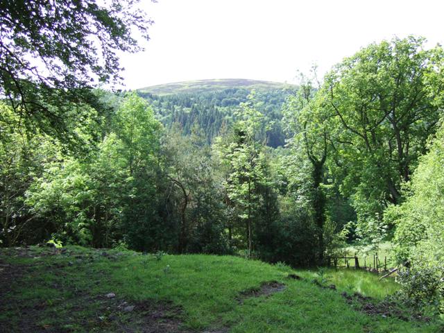
Photos
15 photos from nearby open sources
▾
Photos
15 photos from nearby open sources
Photos
Good to know
- 🐕Dogs welcome
Weather for this location
Next 14 daysLoading local forecast…
Nearby places
Useful places within 5 km