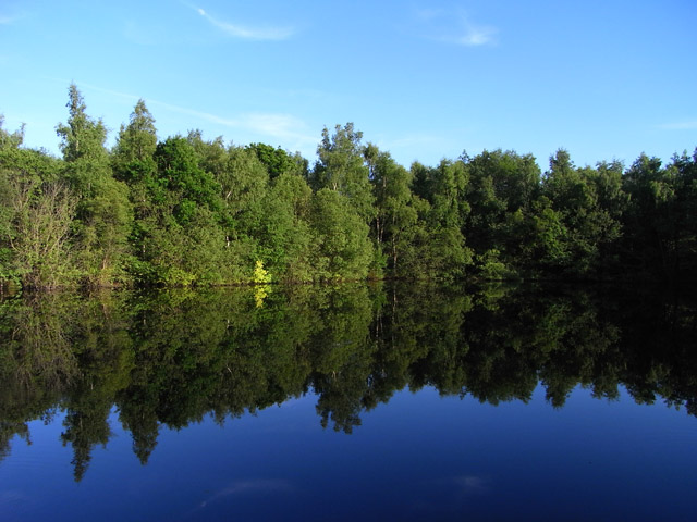
🐦73+ species recorded in this area — summer evenings are best for activity; watch for Blue Tit and Magpie
🐕Early mornings are best for dog walks in summer — visit before 9am to avoid the heat and find quieter trails
🅿️Parking 471m away
🌤️ Visiting this summer
🐦73+ species recorded in this area — summer evenings are best for activity; watch for Blue Tit and Magpie
🐕Early mornings are best for dog walks in summer — visit before 9am to avoid the heat and find quieter trails
🅿️Parking 471m away
Best for
7 activities
🦅
Bird watching
Very strong match
Free
Birds — Blue Tit, Magpie, Great Tit +70 more · last seen 2026; Deciduous woodland — woodpeckers, warblers and woodland birds
🦉
Wildlife
Strong match
Free
Birds — Blue Tit, Magpie, Great Tit +70 more · last seen 2026; Deciduous woodland priority habitat
🦋
Insect spotting
Strong match
Free
Insects — Large Yellow Underwing, Mottled Umber, November Moth agg. +110 more · last seen 2026; Semi-improved grassland — butterflies and wildflowers
🐶
Dog walks
Strong match
Free
Dogs allowed with public access
🌿
Foraging
Good match
Varies
Deciduous woodland — fungi, berries and wild garlic
🛝
Family friendly
Good match
Free
Urban park — family destination
Trails nearby
Within roughly 5 km
🚶
Walking
▾
6 signed routes nearby · 17 public paths nearby
Signed route nearbyPublic paths
red trailWalking route▾
Named routeLocal walking route
The Roman WayWalking route274.5 km▾
Named routeLength 274.5 kmRegional walking route
Wasing WayWalking route▾
Named routeLocal walking route
The Brenda Parker WayWalking route▾
Named routeRegional walking route
Kennet and Avon Canal TrailWalking route140 km▾
Rivers linked by a canal. The name refers to the entire navigable length. From Bristol the way is the Avon. The canal is from Bath to Newbury. From there to Reading the way is the Kennet. 53 locks to Summit Pound (150 m asl) and 54 down to Reading.
Named routeRef K&ALength 140 kmRegional walking route
Fisherman's Lanepublic footpath · 79 m▾
Public pathpublic footpathLength 79 mSurface gravelPath type: residential
Fisherman's Lanepublic footpath · 10 m▾
Public pathpublic footpathLength 10 mSurface asphaltPath type: residential
West Berkshire ALDE/9/1 (Part)public footpath · 2 km▾
Public pathpublic footpathLength 2 kmSurface unpavedPath type: footway
🚴
Cycling
▾
26 signed routes nearby
Signed route nearby
Route 4Cycling route▾
Named routeRef 4National Cycle Network
Round Berkshire Cycle RouteCycling route▾
Named routeRegional cycle route
Calleva TrailCycling route▾
Named routeRef Calleva TrailRegional cycle route
EuroVelo 2 - Capitals Route - part United Kingdom 4Cycling route▾
Named routeRef EV2International cycle route
Route 422Cycling route▾
Named routeRef 422National Cycle Network
Wasing WayCycling route▾
Named routeLocal cycle route
🚵
Mountain biking
▾
1 signed route nearby
Signed route nearby
Pamber Forest BridlewayMountain bike route▾
Named routeRef Blue Trail
🐴
Horse riding
▾
7 public paths nearby
Public paths
No named routes yet. Public paths are shown on the map.