Dewriding Plantation ✦ Ancient woodland 31 ha
Plan your visit
🦉 Wildlife🦅 Birds🍂 Seasonal
Public access Free entry Dogs welcome 31 ha
Places › England › South East › Reigate and Banstead Getting here
51.25936, -0.25590
Open directionsv Visiting this summer
Seasonal nature notes and what to look for now
▾ 🌞 Midsummer — early morning visits most comfortable; look for deer fawns in quieter clearings 🐕 Early mornings are best for dog walks in summer — visit before 9am to avoid the heat and find quieter trails 📍 Open access throughout summer — no booking required 🌤️ Visiting this summer
🌞 Midsummer — early morning visits most comfortable; look for deer fawns in quieter clearings 🐕 Early mornings are best for dog walks in summer — visit before 9am to avoid the heat and find quieter trails 📍 Open access throughout summer — no booking required £ Free to visit — no entry charge🐕 Dogs welcome🌿 Ancient woodland — rare wildlife habitat🦉 Wildlife
Very strong match
Multi-group wildlife — Amphibians, Birds, Mammals, Reptiles; Multi-group wildlife — Amphibians, Birds, Mammals, Reptiles
Free
🦅 Bird watching
Very strong match
Birds — Blue Tit, Woodpigeon, Robin +78 more · last seen 2026; Birds — Blue Tit, Woodpigeon, Robin +78 more · last seen 2026
Free
🍂 Seasonal nature
Strong match
Ancient woodland — bluebells, fungi and autumn colour; Plants — Trifid Bur-marigold, Lady's-mantle · last seen 2021
Free
🦋 Insect spotting
Strong match
Chalk and limestone grassland — chalkhill blue, adonis blue and rare moths; Insects — Stenophylax permistus, Marmalade Hoverfly, Southern Hawker +32 more · last seen 2026
Free
Dogs allowed — public woodland
Free
Named hiking route nearby: North Downs Way (Eastern)
Free
Trails nearby Within roughly 5 km 29 signed routes nearby · 13 public paths nearby
Signed route nearby Public paths
Mole Gap Trail Walking route ▾
Named route Local walking route
Show on map Box Hill Train To Stepping Stones Walk, Box Hill Walking route 4.8 km ▾
Named route Length 4.8 km Duration 02:00 Round trip Local walking route
Show on map The Box Hill Hike, Box Hill Walking route 12.8 km ▾
Circular walk, dog friendly, steep climbs and steps, paths may be slippery in winter, Please take care with your footing and wear suitable footwear for the conditions, Broadwood's Folly, Mickleham Gallops
Named route Length 12.8 km Duration 04:00;06:00 Round trip Local walking route
Show on map Banstead Countryside Walk Walking route ▾
Named route Ref BCW Local walking route
Show on map Thames Down Link Walking route ▾
Named route Ref TDL Regional walking route
Show on map 34 signed routes nearby
Signed route nearby
Leatherhead - Ashtead A24 Cycle track Cycling route ▾
Named route Local cycle route
Show on map Route 22 Cycling route ▾
Named route Ref 22 National Cycle Network
Show on map Surrey Cycleway Cycling route ▾
Epsom link
Named route Regional cycle route
Show on map Surrey Cycleway Cycling route ▾
Leigh link
Named route Regional cycle route
Show on map Surrey Cycleway Cycling route ▾
Cycle route consisting of main loop plus link routes
Named route Round trip Regional cycle route
Show on map Main Route Cycling route 48 m ▾
Named route Ref 22 Length 48 m National Cycle Network Traffic-free Surface asphalt
Show on map 21 public paths nearby
Public paths
Buckland Lane byway open to all traffic · 231 m ▾
Public path byway open to all traffic Length 231 m Path type: track
Show on map Rectory Lane bridleway · 74 m ▾
Public path bridleway Length 74 m Path type: track
Show on map Tye Lane bridleway · 298 m ▾
Public path bridleway Length 298 m Path type: bridleway
Show on map Buckland Lane byway open to all traffic · 417 m ▾
Public path byway open to all traffic Length 417 m Surface dirt Path type: bridleway
Show on map Tye Lane bridleway · 809 m ▾
Public path bridleway Length 809 m Path type: bridleway
Show on map ✦ Ancient woodland — continuously wooded since at least 1600 AD. A rare and irreplaceable habitat, rich in biodiversity and historical character.
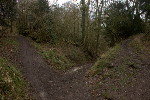
Photos Meeting of three paths near Dewriding Plantation
‹ ›
Weather for this location Next 14 days Nearby places Useful places within 5 km
All Historic
Own or manage this place?
Claim this listing to keep details accurate, add photos, and highlight what makes it special — free.
Claim this page→ How useful was the information on this page?
id: 76000b72-926f-42f9-8f8b-a92da55caa16
UK green spaces mapped from open public data — so anyone can find the woodland, trail, or nature reserve closest to them.
© 2026 Glade · Made with care for UK green spaces
Wildlife to spot
15,579 records · National Biodiversity Network
▾
Wildlife to spot 15,579 records · National Biodiversity Network Skylark · Blue Tit · Woodpigeon · Robin · Wren +37
Skylark Alauda arvensis2025 Blue Tit Cyanistes caeruleus2025 Woodpigeon Columba palumbus2025 Robin Erithacus rubecula Wren Troglodytes troglodytes2025 Great Tit Parus major2025 Chiffchaff Phylloscopus collybita2025 Magpie Pica pica2025 Carrion Crow Corvus corone2025 Blackbird Turdus merula2025 Whitethroat Curruca communis2025 Blackcap Sylvia atricapilla2025 Green Woodpecker Picus viridis2025 Song Thrush Turdus philomelos2025 Long-tailed Tit Aegithalos caudatus2025 Great Spotted Woodpecker Dendrocopos major2025 Jay Garrulus glandarius2025 Chaffinch Fringilla coelebs2025 Jackdaw Coloeus monedula2025 Coal Tit Periparus ater2025 Meadow Pipit Anthus pratensis2025 Linnet Linaria cannabina2025 Garden Warbler Sylvia borin2025 Goldfinch Carduelis carduelis2025 Goldcrest Regulus regulus2025 Marsh Tit Poecile palustris2025 Siskin Spinus spinus2025 Redwing Turdus iliacus2025 Kestrel Falco tinnunculus2025 Stonechat Saxicola rubicola2025 Pheasant Phasianus colchicus2025 Willow Warbler Phylloscopus trochilus2025 Yellowhammer Emberiza citrinella2025 Raven Corvus corax2025 Fieldfare Turdus pilaris2025 Starling Sturnus vulgaris2025 Red-legged Partridge Alectoris rufa2025 Bullfinch Pyrrhula pyrrhula2025 Lapwing Vanellus vanellus2025 Greenfinch Chloris chloris2025 Nuthatch Sitta europaea2025 Mallard Anas platyrhynchos2025 🦌 Mammals 2 species
spring summer autumn
2025 ▾
Hazel Dormouse · Badger
Hazel Dormouse Muscardinus avellanarius Badger Meles meles 🐝 Insects 15 species
spring summer
2026 ▾
Stenophylax permistus · Dark-edged Bee-fly · Lesser Stag Beetle · Juniper Shieldbug · Green Tiger Beetle +10
Stenophylax permistus Stenophylax permistus Dark-edged Bee-fly Bombylius major Lesser Stag Beetle Dorcus parallelipipedus Juniper Shieldbug Cyphostethus tristriatus2025 Green Tiger Beetle Cicindela campestris2025 Marmalade Hoverfly Species observations from the last 10 years via NBN Atlas
Episyrphus balteatus2025
Episyrphus balteatus2025
Meliscaeva cinctella Meliscaeva cinctella2025
Meliscaeva cinctella Meliscaeva cinctella2025
Green Shieldbug Palomena prasina2025
Green Shieldbug Palomena prasina2025
Hornet Vespa crabro2025
Hornet Vespa crabro2025
Red-legged Shieldbug Pentatoma rufipes2025
Red-legged Shieldbug Pentatoma rufipes2025
Common Red Soldier Beetle Rhagonycha fulva2025
Common Red Soldier Beetle Rhagonycha fulva2025
7-spot Ladybird Coccinella septempunctata2025
7-spot Ladybird Coccinella septempunctata2025
Cuckoo-Spit Insect Philaenus spumarius2025
Cuckoo-Spit Insect Philaenus spumarius2025
Melanostoma mellinum Melanostoma mellinum2025
Melanostoma mellinum Melanostoma mellinum2025
Meliscaeva auricollis Meliscaeva auricollis2025
Meliscaeva auricollis Meliscaeva auricollis2025 Events & activities nearby Switch provider to compare local events, tours and bookable activities.
Bookable tours GetYourGuide Promote here