Dingleden Wood ✦ Ancient woodland 2 ha
Plan your visit
🦉 Wildlife🦅 Birds🦋 Insects
Public access Free entry Dogs welcome 2 ha
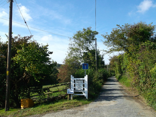
Places › England › South East › Folkestone and Hythe Getting here
51.12996, 1.06265
Open directionsv Visiting this summer
Seasonal nature notes and what to look for now
▾ 🌞 Midsummer — early morning visits most comfortable; look for deer fawns in quieter clearings 🐕 Early mornings are best for dog walks in summer — visit before 9am to avoid the heat and find quieter trails 🅿️ Parking 377m away — 2 car parks within reach 🌤️ Visiting this summer
🌞 Midsummer — early morning visits most comfortable; look for deer fawns in quieter clearings 🐕 Early mornings are best for dog walks in summer — visit before 9am to avoid the heat and find quieter trails 🅿️ Parking 377m away — 2 car parks within reach £ Free to visit — no entry charge🐕 Dogs welcome🌿 Ancient woodland — rare wildlife habitat🦉 Wildlife
Very strong match
Multi-group wildlife — Amphibians, Birds, Mammals, Reptiles; Multi-group wildlife — Amphibians, Birds, Mammals, Reptiles
Free
🦅 Bird watching
Very strong match
Birds — Blackbird, Great Tit, Wren +48 more · last seen 2026; Birds — Blackbird, Great Tit, Wren +48 more · last seen 2026
Free
🦋 Insect spotting
Strong match
Insects — Marmalade Hoverfly, Western Honey Bee, Ivy Bee +177 more · last seen 2026; Insects — Marmalade Hoverfly, Western Honey Bee, Ivy Bee +177 more · last seen 2026
Free
Dogs allowed — public woodland
Free
🍂 Seasonal nature
Strong match
Ancient woodland — bluebells, fungi and autumn colour; Plants — Sand-hill Screw-moss, Thickpoint Grimmia, Grey-cushioned Grimmia · last seen 2025
Free
Deciduous woodland — fungi, berries and wild garlic
Varies
Trails nearby Within roughly 5 km 6 signed routes nearby · 5 public paths nearby
Signed route nearby Public paths
Elham Valley Way Walking route ▾
Named route Listed length 40km Regional walking route
Show on map European walking route E9, Rye to Dover Walking route ▾
Named route Ref E9 International walking route
Show on map North Downs Way (Eastern) Walking route ▾
Named route National walking route
Show on map Saxon Shore Way Walking route 262 km ▾
Named route Length 262 km Regional walking route
Show on map Route HF33 Walking route ▾
Named route Ref HF33
Show on map 26 signed routes nearby
Signed route nearby
NCN Regional Route 17 (Kent) Cycling route ▾
Named route Ref 17 Regional cycle route
Show on map to the Eurotunnel Cycling route ▾
Named route Local cycle route
Show on map N/A Cycling route 1.1 km ▾
Named route Ref 17 Length 1.1 km National Cycle Network On-road Surface asphalt
Show on map N/A Cycling route 1.7 km ▾
Named route Ref 17 Length 1.7 km National Cycle Network On-road Surface asphalt
Show on map N/A Cycling route 269 m ▾
Named route Ref 17 Length 269 m National Cycle Network On-road Surface asphalt
Show on map N/A Cycling route 642 m ▾
Named route Ref 17 Length 642 m National Cycle Network On-road Surface asphalt
Show on map 4 public paths nearby
Public paths
Skeete Road bridleway · 628 m ▾
Public path bridleway Length 628 m Path type: service
Show on map ✦ Ancient woodland — continuously wooded since at least 1600 AD. A rare and irreplaceable habitat, rich in biodiversity and historical character.
Weather for this location Next 14 days Nearby places Useful places within 5 km
All Historic
Own or manage this place?
Claim this listing to keep details accurate, add photos, and highlight what makes it special — free.
Claim this page→ How useful was the information on this page?
id: 04f058d5-784f-4c23-9d51-89d8f5d482a5
UK green spaces mapped from open public data — so anyone can find the woodland, trail, or nature reserve closest to them.
© 2026 Glade · Made with care for UK green spaces
Events & activities nearby Switch provider to compare local events, tours and bookable activities.
Bookable tours GetYourGuide Promote here
Wildlife to spot
16,025 records · National Biodiversity Network
▾
Wildlife to spot 16,025 records · National Biodiversity Network Blackbird · Wren · Blue Tit · Jackdaw · Great Tit +32
Blackbird Turdus merula Wren Troglodytes troglodytes Blue Tit Cyanistes caeruleus Jackdaw Coloeus monedula Great Tit Parus major Robin Erithacus rubecula Magpie Pica pica2025 Goldfinch Carduelis carduelis Dunnock Prunella modularis Carrion Crow Corvus corone2025 Woodpigeon Columba palumbus2025 Chaffinch Fringilla coelebs Starling Sturnus vulgaris Pheasant Phasianus colchicus2025 Herring Gull Larus argentatus2025 Song Thrush Turdus philomelos2025 Stock Dove Columba oenas2025 House Sparrow Passer domesticus2025 Red-legged Partridge Alectoris rufa2025 Yellowhammer Emberiza citrinella2025 Jay Garrulus glandarius2025 Grey Wagtail Motacilla cinerea2025 Meadow Pipit Anthus pratensis2025 Black-headed Gull Chroicocephalus ridibundus2025 Collared Dove Streptopelia decaocto2025 Redwing Turdus iliacus2025 Mistle Thrush Turdus viscivorus2025 Tawny Owl Strix aluco2025 Swallow Hirundo rustica2025 Kestrel Falco tinnunculus2025 Whitethroat Curruca communis2025 Skylark Alauda arvensis2025 Linnet Linaria cannabina2025 Blackcap Sylvia atricapilla2025 Great Spotted Woodpecker Dendrocopos major2025 Greenfinch Chloris chloris2025 Chiffchaff Phylloscopus collybita2025 🦌 Mammals 8 species
winter spring summer autumn
2026 ▾
Badger · Eurasian Serotine · Polecat · Apodemus · Brown Hare +3
Badger Meles meles Eurasian Serotine Cnephaeus serotinus2025 Polecat Mustela putorius Apodemus Apodemus Brown Hare Lepus europaeus2025 🐸 Amphibians 1 species
winter
2026 ▾
Common Toad
Marmalade Hoverfly · Harlequin Ladybird · Box Bug · Scaeva pyrastri · Eristalis tenax +50
Marmalade Hoverfly Episyrphus balteatus2025 Harlequin Ladybird Harmonia axyridis2025 Box Bug Gonocerus acuteangulatus2025 Scaeva pyrastri Scaeva pyrastri2025 Eristalis tenax Eristalis tenax2025 Volucella inanis Sand-hill Screw-moss
Sand-hill Screw-moss Syntrichia ruraliformis Species observations from the last 10 years via NBN Atlas
Water Shrew Neomys fodiens2025
Water Shrew Neomys fodiens2025
Hedgehog Erinaceus europaeus2025
Hedgehog Erinaceus europaeus2025
Common Pipistrelle Pipistrellus pipistrellus2025
Common Pipistrelle Pipistrellus pipistrellus2025 Volucella inanis2025
Volucella inanis2025
Ferdinandea cuprea Ferdinandea cuprea2025
Ferdinandea cuprea Ferdinandea cuprea2025
Swollen-thighed Beetle Oedemera nobilis2025
Swollen-thighed Beetle Oedemera nobilis2025
Corizus hyoscyami Corizus hyoscyami2025
Corizus hyoscyami Corizus hyoscyami2025
Hairy Shieldbug Dolycoris baccarum2025
Hairy Shieldbug Dolycoris baccarum2025
Hornet Hoverfly Volucella zonaria2025
Hornet Hoverfly Volucella zonaria2025
Batman Hoverfly Myathropa florea2025
Batman Hoverfly Myathropa florea2025
Chrysotoxum bicinctum Chrysotoxum bicinctum2025
Chrysotoxum bicinctum Chrysotoxum bicinctum2025
Common Red Soldier Beetle Rhagonycha fulva2025
Common Red Soldier Beetle Rhagonycha fulva2025
Common Pollen Beetle Meligethes aeneus2025
Common Pollen Beetle Meligethes aeneus2025
Sphaerophoria scripta Sphaerophoria scripta2025
Sphaerophoria scripta Sphaerophoria scripta2025
Volucella pellucens Volucella pellucens2025
Volucella pellucens Volucella pellucens2025
Eupeodes Eupeodes2025
Eupeodes Eupeodes2025
Pea-leaf Weevil Sitona lineatus
Pea-leaf Weevil Sitona lineatus
Adonis' Ladybird Hippodamia variegata2025
Adonis' Ladybird Hippodamia variegata2025
Brown Marmorated Stink Bug Halyomorpha halys2025
Brown Marmorated Stink Bug Halyomorpha halys2025
Helophilus pendulus Helophilus pendulus2025
Helophilus pendulus Helophilus pendulus2025
Tipula pagana Tipula pagana2025
Tipula pagana Tipula pagana2025
Juniper Shieldbug Cyphostethus tristriatus2025
Juniper Shieldbug Cyphostethus tristriatus2025
Rhopalus (Rhopalus) subrufus Rhopalus (Rhopalus) subrufus2025
Rhopalus (Rhopalus) subrufus Rhopalus (Rhopalus) subrufus2025
Field Grasshopper Chorthippus brunneus2025
Field Grasshopper Chorthippus brunneus2025
Eristalis pertinax Eristalis pertinax2025
Eristalis pertinax Eristalis pertinax2025
7-spot Ladybird Coccinella septempunctata2025
7-spot Ladybird Coccinella septempunctata2025
Dark Bush-cricket Pholidoptera griseoaptera2025
Dark Bush-cricket Pholidoptera griseoaptera2025
Dor Beetle Geotrupes2025
Dor Beetle Geotrupes2025
Migrant Hawker Aeshna mixta2025
Migrant Hawker Aeshna mixta2025
Meliscaeva cinctella Meliscaeva cinctella2025
Meliscaeva cinctella Meliscaeva cinctella2025
Grypocoris (Lophyromiris) stysi Grypocoris (Lophyromiris) stysi2025
Grypocoris (Lophyromiris) stysi Grypocoris (Lophyromiris) stysi2025
Chrysogaster solstitialis Chrysogaster solstitialis2025
Chrysogaster solstitialis Chrysogaster solstitialis2025
Cheilosia Cheilosia2025
Cheilosia Cheilosia2025
Issus coleoptratus Issus coleoptratus2025
Issus coleoptratus Issus coleoptratus2025
Eupeodes corollae Eupeodes corollae2025
Eupeodes corollae Eupeodes corollae2025
Empis livida Empis livida2025
Empis livida Empis livida2025
Plagiognathus (Plagiognathus) arbustorum Plagiognathus (Plagiognathus) arbustorum2025
Plagiognathus (Plagiognathus) arbustorum Plagiognathus (Plagiognathus) arbustorum2025
Lagria hirta Lagria hirta2025
Lagria hirta Lagria hirta2025
Summer Chafer Amphimallon solstitiale2025
Summer Chafer Amphimallon solstitiale2025
10-spot Ladybird Adalia decempunctata2025
10-spot Ladybird Adalia decempunctata2025
Conopidae Conopidae2025
Conopidae Conopidae2025
Lesser Stag Beetle Dorcus parallelipipedus2025
Lesser Stag Beetle Dorcus parallelipipedus2025
Volucella bombylans Volucella bombylans2025
Volucella bombylans Volucella bombylans2025
Eupeodes luniger Eupeodes luniger2025
Eupeodes luniger Eupeodes luniger2025
Syrphus Syrphus2025
Syrphus Syrphus2025
Striped Slender Robberfly Leptogaster cylindrica2025
Striped Slender Robberfly Leptogaster cylindrica2025
Band-eyed Brown Horsefly Tabanus bromius2025
Band-eyed Brown Horsefly Tabanus bromius2025
Chrysotoxum cautum Chrysotoxum cautum2025
Chrysotoxum cautum Chrysotoxum cautum2025
Large Garden Bumblebee Bombus ruderatus2025
Large Garden Bumblebee Bombus ruderatus2025
Pipiza Pipiza2025
Pipiza Pipiza2025
Ledra aurita Ledra aurita2025
Ledra aurita Ledra aurita2025
Red-legged Shieldbug Pentatoma rufipes2025
Red-legged Shieldbug Pentatoma rufipes2025
Scaeva selenitica Scaeva selenitica2025
Scaeva selenitica Scaeva selenitica2025