Dobson Bottom ✦ Ancient woodland 244 ha
Plan your visit
🦅 Birds🦉 Wildlife🍂 Seasonal
Public access Free entry Dogs welcome 244 ha
Places › England › North West › Westmorland and Furness Getting here
54.57907, -2.70772
Open directionsv Visiting this summer
Seasonal nature notes and what to look for now
▾ 🐦 71+ species recorded in this area — summer evenings are best for activity; watch for Lapwing and Pheasant 🐕 Early mornings are best for dog walks in summer — visit before 9am to avoid the heat and find quieter trails 🅿️ Parking 80m away — 4 car parks within reach 🌤️ Visiting this summer
🐦 71+ species recorded in this area — summer evenings are best for activity; watch for Lapwing and Pheasant 🐕 Early mornings are best for dog walks in summer — visit before 9am to avoid the heat and find quieter trails 🅿️ Parking 80m away — 4 car parks within reach £ Free to visit — no entry charge🐕 Dogs welcome🌿 Ancient woodland — rare wildlife habitat🌳 Large woodland — room to roam🦅 Bird watching
Very strong match
Birds — Lapwing, Pheasant, Rook +68 more · last seen 2025; Birds — Lapwing, Pheasant, Rook +68 more · last seen 2025
Free
🦉 Wildlife
Very strong match
Multi-group wildlife — Birds, Mammals; Multi-group wildlife — Birds, Mammals
Free
🍂 Seasonal nature
Strong match
Ancient woodland — bluebells, fungi and autumn colour; Plants — Primrose · last seen 2025
Free
Dogs allowed — public woodland
Free
🦋 Insect spotting
Strong match
Insects — Small Tortoiseshell, Yellow Meadow Ant, Red Admiral +18 more · last seen 2026; Insects — Small Tortoiseshell, Yellow Meadow Ant, Red Admiral +18 more · last seen 2026
Free
Deciduous woodland — fungi, berries and wild garlic
Varies
Trails nearby Within roughly 5 km 3 signed routes nearby · 3 public paths nearby
Signed route nearby Public paths
Ullswater Way - Lowther Castle Loop Walking route ▾
Named route Round trip Local walking route
Show on map Lady Anne's Way Walking route 160 km ▾
The route was inspired by the indomitable Lady Anne Clifford, who owned vast estates in the old county of Westmorland during the seventeenth century. The route is in the area she traveled and highlights a several castles she renovated.
Named route Length 160 km Regional walking route
Show on map Coast to Coast Walk (St Bees to Shap) Walking route ▾
Named route Ref C2C National walking route
Show on map 4 signed routes nearby
Signed route nearby
Route 71 Cycling route ▾
Named route Ref 71 National Cycle Network
Show on map Main Route Cycling route 3.1 km ▾
Named route Ref 71 Length 3.1 km National Cycle Network On-road Surface asphalt
Show on map Main Route Cycling route 962 m ▾
Named route Ref 71 Length 962 m National Cycle Network On-road Surface asphalt
Show on map Main Route Cycling route 8.2 km ▾
Named route Ref 71 Length 8.2 km National Cycle Network On-road Surface asphalt
Show on map 19 public paths nearby
Public paths
No named routes yet. Public paths are shown on the map.
✦ Ancient woodland — continuously wooded since at least 1600 AD. A rare and irreplaceable habitat, rich in biodiversity and historical character.
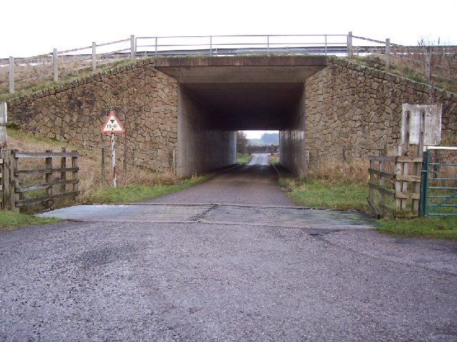
Photos Thrimby Cottages Underpass.
‹ ›
Weather for this location Next 14 days Nearby places Useful places within 5 km
All Historic
Own or manage this place?
Claim this listing to keep details accurate, add photos, and highlight what makes it special — free.
Claim this page→ How useful was the information on this page?
id: b2873d1c-9fb5-4d48-b85f-dd9fb5d919a6
UK green spaces mapped from open public data — so anyone can find the woodland, trail, or nature reserve closest to them.
© 2026 Glade · Made with care for UK green spaces
Events & activities nearby Switch provider to compare local events, tours and bookable activities.
Bookable tours GetYourGuide Promote here
Wildlife to spot
1,454 records · National Biodiversity Network
▾
Wildlife to spot 1,454 records · National Biodiversity Network 🐦 Birds 28 species
winter spring autumn
2025 ▾
Lapwing · Redstart · Pheasant · Rook · Raven +23
Lapwing Vanellus vanellus Redstart Phoenicurus phoenicurus2024 Pheasant Phasianus colchicus2019 Rook Corvus frugilegus Raven Corvus corax Mallard Anas platyrhynchos2024 Crossbill Loxia curvirostra2024 Swallow Hirundo rustica Robin Erithacus rubecula Siskin Spinus spinus Kestrel Falco tinnunculus Garden Warbler Sylvia borin Whitethroat Curruca communis Jackdaw Coloeus monedula Grey Heron Ardea cinerea2024 Blue Tit Cyanistes caeruleus2024 Pied Flycatcher Ficedula hypoleuca2024 Sedge Warbler Acrocephalus schoenobaenus2024 Grasshopper Warbler Locustella naevia2024 Wheatear Oenanthe oenanthe2024 Pink-footed Goose Anser brachyrhynchus2024 Tawny Owl Strix aluco2024 Meadow Pipit Anthus pratensis2024 Carrion Crow Corvus corone2024 Golden Plover Pluvialis apricaria2023 Redwing Turdus iliacus2023 Anas platyrhynchos x Anas platyrhynchos x2023 Barn Owl Tyto alba2023 🦌 Mammals 6 species
spring summer autumn
2024 ▾
Roe Deer · Red Fox · Red Squirrel · Hedgehog · Mole +1
Roe Deer Capreolus capreolus Red Fox Vulpes vulpes2023 Red Squirrel Sciurus vulgaris2023 Hedgehog Erinaceus europaeus2022 Mole Talpa europaea2021 🐝 Insects 6 species
winter spring summer autumn
2026 ▾
Yellow Meadow Ant · Violet Ground Beetle · Green Dock Beetle · Common Red Soldier Beetle · Carabus granulatus +1
Yellow Meadow Ant Lasius flavus Violet Ground Beetle Carabus violaceus2025 Green Dock Beetle Gastrophysa viridula2025 Common Red Soldier Beetle Rhagonycha fulva2025 Common Ragwort · Creeping Bent · Wall Speedwell · Festuca rubra · Greater Plantain +118
Common Ragwort Jacobaea vulgaris2019 Creeping Bent Agrostis stolonifera2019 Wall Speedwell Veronica arvensis2019 Festuca rubra Festuca rubra2019 Greater Plantain Plantago major2019 Yorkshire-fog Holcus lanatus Species observations from the last 10 years via NBN Atlas
Stoat
Stoat
Mustela erminea2019
Mustela erminea2019
Carabus granulatus
Carabus granulatus
Carabus granulatus2025
Carabus granulatus2025
Loricera pilicornis Loricera pilicornis2022
Loricera pilicornis Loricera pilicornis2022 2019
2019
Shepherd's-purse Capsella bursa-pastoris2019
Shepherd's-purse Capsella bursa-pastoris2019
Annual Meadow-grass Poa annua2019
Annual Meadow-grass Poa annua2019
Knotgrass Polygonum aviculare2019
Knotgrass Polygonum aviculare2019
Common Bent Agrostis capillaris2019
Common Bent Agrostis capillaris2019
Raspberry Rubus idaeus2019
Raspberry Rubus idaeus2019
Spear Thistle Cirsium vulgare2019
Spear Thistle Cirsium vulgare2019
Nipplewort Lapsana communis2019
Nipplewort Lapsana communis2019
Primrose Primula vulgaris
Primrose Primula vulgaris
Snowdrop Galanthus nivalis2024
Snowdrop Galanthus nivalis2024
Goldilocks Buttercup Ranunculus auricomus2020
Goldilocks Buttercup Ranunculus auricomus2020
Common Nettle Urtica dioica2019
Common Nettle Urtica dioica2019
Rosa canina Rosa canina2019
Rosa canina Rosa canina2019
Parsley Piert Aphanes arvensis2019
Parsley Piert Aphanes arvensis2019
Oxeye Daisy Leucanthemum vulgare2019
Oxeye Daisy Leucanthemum vulgare2019
Cow Parsley Anthriscus sylvestris2019
Cow Parsley Anthriscus sylvestris2019
Wood Dock Rumex sanguineus2019
Wood Dock Rumex sanguineus2019
Yellow Oat-grass Trisetum flavescens2019
Yellow Oat-grass Trisetum flavescens2019
Rosebay Willowherb Chamaenerion angustifolium2019
Rosebay Willowherb Chamaenerion angustifolium2019
Guelder-rose Viburnum opulus2019
Guelder-rose Viburnum opulus2019
Brooklime Veronica beccabunga2019
Brooklime Veronica beccabunga2019
Broad-leaved Dock Rumex obtusifolius2019
Broad-leaved Dock Rumex obtusifolius2019
Burdock Arctium2019
Burdock Arctium2019
Rowan Sorbus aucuparia2019
Rowan Sorbus aucuparia2019
Crested Dog's-tail Cynosurus cristatus2019
Crested Dog's-tail Cynosurus cristatus2019
False Oat-grass Arrhenatherum elatius2019
False Oat-grass Arrhenatherum elatius2019
Groundsel Senecio vulgaris2019
Groundsel Senecio vulgaris2019
Foxglove Digitalis purpurea2019
Foxglove Digitalis purpurea2019
Herb-Robert Geranium robertianum2019
Herb-Robert Geranium robertianum2019
Wych Elm Ulmus glabra2019
Wych Elm Ulmus glabra2019
Common Chickweed Stellaria media2019
Common Chickweed Stellaria media2019
Dandelion Taraxacum2019
Dandelion Taraxacum2019
Western Balsam-poplar Populus trichocarpa2019
Western Balsam-poplar Populus trichocarpa2019
Hornbeam Carpinus betulus2019
Hornbeam Carpinus betulus2019
Cleavers Galium aparine2019
Cleavers Galium aparine2019
Meadow Crane's-bill Geranium pratense2019
Meadow Crane's-bill Geranium pratense2019
Creeping Cinquefoil Potentilla reptans2019
Creeping Cinquefoil Potentilla reptans2019
Red Campion Silene dioica2019
Red Campion Silene dioica2019
Hairy St John's-wort Hypericum hirsutum2019
Hairy St John's-wort Hypericum hirsutum2019
Perennial Rye-grass Lolium perenne2019
Perennial Rye-grass Lolium perenne2019
Soft-brome Bromus hordeaceus2019
Soft-brome Bromus hordeaceus2019
Black Medick Medicago lupulina2019
Black Medick Medicago lupulina2019
Timothy Phleum pratense2019
Timothy Phleum pratense2019
Germander Speedwell Veronica chamaedrys2019
Germander Speedwell Veronica chamaedrys2019
Oak Quercus2019
Oak Quercus2019
Tufted Hair-grass Deschampsia cespitosa2019
Tufted Hair-grass Deschampsia cespitosa2019
Bottle Sedge Carex rostrata2019
Bottle Sedge Carex rostrata2019
Feverfew Tanacetum parthenium2019
Feverfew Tanacetum parthenium2019
Crab Apple Malus sylvestris2019
Crab Apple Malus sylvestris2019
Reed Canary-grass Phalaris arundinacea2019
Reed Canary-grass Phalaris arundinacea2019
Ash Fraxinus excelsior2019
Ash Fraxinus excelsior2019
Japanese Larch Larix kaempferi2019
Japanese Larch Larix kaempferi2019
Creeping Buttercup Ranunculus repens2019
Creeping Buttercup Ranunculus repens2019
Marsh Thistle Cirsium palustre2019
Marsh Thistle Cirsium palustre2019
Short-fruited Willowherb Epilobium obscurum2019
Short-fruited Willowherb Epilobium obscurum2019
Water Forget-me-not Myosotis scorpioides2019
Water Forget-me-not Myosotis scorpioides2019
Sweet Chestnut Castanea sativa2019
Sweet Chestnut Castanea sativa2019
Prickly Sow-thistle Sonchus asper2019
Prickly Sow-thistle Sonchus asper2019
Norway Spruce Picea abies2019
Norway Spruce Picea abies2019
Creeping Thistle Cirsium arvense2019
Creeping Thistle Cirsium arvense2019
Beech Fagus sylvatica2019
Beech Fagus sylvatica2019
Soft-rush Juncus effusus2019
Soft-rush Juncus effusus2019
Borage Borago officinalis2019
Borage Borago officinalis2019
Selfheal Prunella vulgaris2019
Selfheal Prunella vulgaris2019
Common Sallow Salix cinerea2019
Common Sallow Salix cinerea2019
Square-stalked St John's-wort Hypericum tetrapterum2019
Square-stalked St John's-wort Hypericum tetrapterum2019
Lesser Stitchwort Stellaria graminea2019
Lesser Stitchwort Stellaria graminea2019
White Clover Trifolium repens2019
White Clover Trifolium repens2019
Common Mouse-ear Cerastium fontanum2019
Common Mouse-ear Cerastium fontanum2019
Branched Bur-reed Sparganium erectum2019
Branched Bur-reed Sparganium erectum2019
Creeping Soft-grass Holcus mollis2019
Creeping Soft-grass Holcus mollis2019
Meadow Foxtail Alopecurus pratensis2019
Meadow Foxtail Alopecurus pratensis2019
Hogweed Heracleum sphondylium2019
Hogweed Heracleum sphondylium2019
Meadow Vetchling Lathyrus pratensis2019
Meadow Vetchling Lathyrus pratensis2019
Silverweed Potentilla anserina2019
Silverweed Potentilla anserina2019
Field Horsetail Equisetum arvense2019
Field Horsetail Equisetum arvense2019
Hazel Corylus avellana2019
Hazel Corylus avellana2019
Hawthorn Crataegus monogyna2019
Hawthorn Crataegus monogyna2019
Cock's-foot Dactylis glomerata2019
Cock's-foot Dactylis glomerata2019
Field Forget-me-not Myosotis arvensis2019
Field Forget-me-not Myosotis arvensis2019
Compact Rush Juncus conglomeratus2019
Compact Rush Juncus conglomeratus2019
Yarrow Achillea millefolium2019
Yarrow Achillea millefolium2019
Thyme-leaved Sandwort Arenaria serpyllifolia2019
Thyme-leaved Sandwort Arenaria serpyllifolia2019
Male-fern Dryopteris filix-mas2019
Male-fern Dryopteris filix-mas2019
Pineappleweed Matricaria discoidea2019
Pineappleweed Matricaria discoidea2019
Alder Alnus glutinosa2019
Alder Alnus glutinosa2019
Wild Cherry Prunus avium2019
Wild Cherry Prunus avium2019
Scentless Mayweed Tripleurospermum inodorum2019
Scentless Mayweed Tripleurospermum inodorum2019
Hedge Woundwort Stachys sylvatica2019
Hedge Woundwort Stachys sylvatica2019
Bush Vetch Vicia sepium2019
Bush Vetch Vicia sepium2019
Meadow Buttercup Ranunculus acris2019
Meadow Buttercup Ranunculus acris2019
Wood Avens Geum urbanum2019
Wood Avens Geum urbanum2019
Redshank Persicaria maculosa2019
Redshank Persicaria maculosa2019
Jointed Rush Juncus articulatus2019
Jointed Rush Juncus articulatus2019
Curled Dock Rumex crispus2019
Curled Dock Rumex crispus2019
Cuckooflower Cardamine pratensis2019
Cuckooflower Cardamine pratensis2019
Hairy Sedge Carex hirta2019
Hairy Sedge Carex hirta2019
Heath Speedwell Veronica officinalis2019
Heath Speedwell Veronica officinalis2019
Field Madder Sherardia arvensis2019
Field Madder Sherardia arvensis2019
Marsh Foxtail Alopecurus geniculatus2019
Marsh Foxtail Alopecurus geniculatus2019
Quaking-grass Briza media2019
Quaking-grass Briza media2019
Watercress Nasturtium officinale2019
Watercress Nasturtium officinale2019
Lesser Celandine Ficaria verna2019
Lesser Celandine Ficaria verna2019
Common Hemp-Nettle agg. Galeopsis tetrahit2019
Common Hemp-Nettle agg. Galeopsis tetrahit2019
Daisy Bellis perennis2019
Daisy Bellis perennis2019
Barren Strawberry Potentilla sterilis2019
Barren Strawberry Potentilla sterilis2019
Wild Thyme Thymus drucei2019
Wild Thyme Thymus drucei2019
Fool's Water-Cress Helosciadium nodiflorum2019
Fool's Water-Cress Helosciadium nodiflorum2019
Oval Sedge Carex leporina2019
Oval Sedge Carex leporina2019
Hybrid Larch Larix decidua x kaempferi = L. x marschlinsii2019
Hybrid Larch Larix decidua x kaempferi = L. x marschlinsii2019
Smooth Lady's-mantle Alchemilla glabra2019
Smooth Lady's-mantle Alchemilla glabra2019
False-brome Brachypodium sylvaticum2019
False-brome Brachypodium sylvaticum2019
Sticky Mouse-ear Cerastium glomeratum2019
Sticky Mouse-ear Cerastium glomeratum2019
Procumbent Pearlwort Sagina procumbens2019
Procumbent Pearlwort Sagina procumbens2019
Mouse-ear-hawkweed Pilosella officinarum2019
Mouse-ear-hawkweed Pilosella officinarum2019
Ground-ivy Glechoma hederacea2019
Ground-ivy Glechoma hederacea2019
American Willowherb Epilobium ciliatum2019
American Willowherb Epilobium ciliatum2019
Hairy Bitter-cress Cardamine hirsuta2019
Hairy Bitter-cress Cardamine hirsuta2019