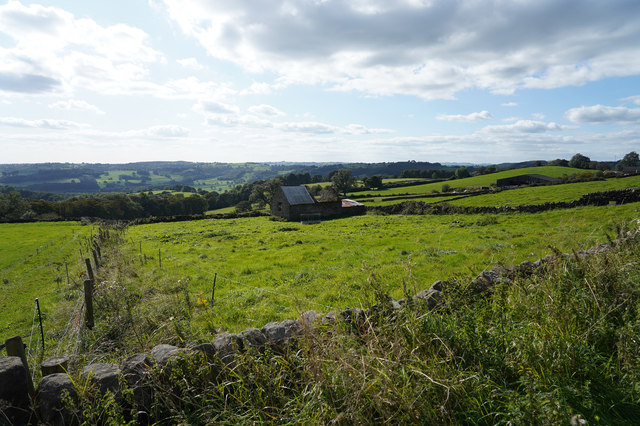
Doves Wood ✦ Ancient woodland 6 ha
Plan your visit
🦅 Birds🦉 Wildlife🌿 Foraging
Public access Free entry Dogs welcome 6 ha
Places › England › East Midlands › Derbyshire Dales Getting here
53.06940, -1.55807
Open directionsv Visiting this summer
Seasonal nature notes and what to look for now
▾ 🐦 82+ species recorded in this area — summer evenings are best for activity; watch for Robin and Blackbird 🌿 Foraging is at its best in summer here 🐕 Dogs welcome — bring water in summer; the site has enough space to find shade on hot days 🌤️ Visiting this summer
🐦 82+ species recorded in this area — summer evenings are best for activity; watch for Robin and Blackbird 🌿 Foraging is at its best in summer here 🐕 Dogs welcome — bring water in summer; the site has enough space to find shade on hot days £ Free to visit — no entry charge🐕 Dogs welcome🌿 Ancient woodland — rare wildlife habitat🦅 Bird watching
Very strong match
Birds — Robin, Blackbird, Blue Tit +79 more · last seen 2025; Birds — Robin, Blackbird, Blue Tit +79 more · last seen 2025
Free
🦉 Wildlife
Very strong match
Multi-group wildlife — Birds, Mammals; Multi-group wildlife — Birds, Mammals
Free
Plants — Common Nettle, Bramble, Hawthorn +10 more foraging species; Deciduous woodland — fungi, berries and wild garlic
Varies
🍂 Seasonal nature
Strong match
Ancient woodland — bluebells, fungi and autumn colour; Plants — Common Nettle, Herb-Robert, Ivy +98 more · last seen 2026
Free
🦋 Insect spotting
Strong match
Lowland meadows — marbled white, meadow brown and pollinating insects; Insects — Varied Carpet Beetle, Bombus lucorum, Western Honey Bee +8 more · last seen 2025
Free
Dogs allowed — public woodland
Free
Trails nearby Within roughly 5 km 14 signed routes nearby · 30 public paths nearby
Signed route nearby Public paths
Midshires Way Walking route 370 km ▾
Multi-use trail links the Ridgeway National Trail with the Trans Pennine Trail
Named route Length 370 km Regional walking route
Show on map Limestone Way Walking route 74 km ▾
Castleton to Rocester
Named route Length 74 km Point-to-point Regional walking route
Show on map High Peak Trail Walking route 27 km ▾
Named route Length 27 km Regional walking route
Show on map Derwent Valley Heritage Way Walking route 89 km ▾
Named route Length 89 km Regional walking route
Show on map Amber Valley Routeway Walk 14 Walking route ▾
Named route Local walking route
Show on map 16 signed routes nearby
Signed route nearby
Route 54 Cycling route ▾
Named route Ref 54 National Cycle Network
Show on map Route 547 Cycling route ▾
Named route Ref 547 National Cycle Network
Show on map Alternative Route Cycling route 286 m ▾
Named route Ref 547 Length 286 m National Cycle Network On-road Surface asphalt
Show on map Main Route Cycling route 194 m ▾
Named route Ref 547 Length 194 m National Cycle Network Traffic-free Surface unsealedfirm
Show on map Main Route Cycling route 3.5 km ▾
Named route Ref 54 Length 3.5 km National Cycle Network Traffic-free Surface unsealedfirm
Show on map Main Route Cycling route 97 m ▾
Named route Ref 54 Length 97 m National Cycle Network Traffic-free Surface unsealedfirm
Show on map 3 signed routes nearby
Signed route nearby
High Peak Trail Mountain bike route 27 km ▾
Named route Ref High Peak Trail Length 27 km Point-to-point Local cycle route
Show on map Carsington Water Cycle Route Mountain bike route ▾
Great North Trail (Peak District and South Pennines) Mountain bike route 130.4 km ▾
Named route Length 130.4 km National Cycle Network
Show on map 5 public paths nearby
Public paths
Pratthall Lane restricted byway · 8 m ▾
Public path restricted byway Length 8 m Surface gravel Path type: track
Show on map Pratthall Lane restricted byway · 285 m ▾
Public path restricted byway Length 285 m Surface gravel Path type: track
Show on map Pratthall Lane restricted byway · 4 m ▾
Public path restricted byway Length 4 m Surface gravel Path type: track
Show on map Pratthall Lane restricted byway · 177 m ▾
Public path restricted byway Length 177 m Surface gravel Path type: track
Show on map Pratthall Lane restricted byway · 380 m ▾
Public path restricted byway Length 380 m Surface gravel Path type: track
Show on map ✦ Ancient woodland — continuously wooded since at least 1600 AD. A rare and irreplaceable habitat, rich in biodiversity and historical character.
Weather for this location Next 14 days Nearby places Useful places within 5 km
All Historic
Own or manage this place?
Claim this listing to keep details accurate, add photos, and highlight what makes it special — free.
Claim this page→ How useful was the information on this page?
id: f5c718c2-e050-4d76-82b2-8f6d41c9c658
UK green spaces mapped from open public data — so anyone can find the woodland, trail, or nature reserve closest to them.
© 2026 Glade · Made with care for UK green spaces
Events & activities nearby Switch provider to compare local events, tours and bookable activities.
Bookable tours GetYourGuide Promote here
Wildlife to spot
8,223 records · National Biodiversity Network
▾
Wildlife to spot 8,223 records · National Biodiversity Network Pied Wagtail · Starling · Raven · Dunnock · Lapwing +20
Pied Wagtail Motacilla alba yarrellii Starling Sturnus vulgaris Raven Corvus corax Dunnock Prunella modularis Lapwing Vanellus vanellus Skylark Alauda arvensis Woodpigeon Columba palumbus Robin Erithacus rubecula Jackdaw Coloeus monedula Kestrel Falco tinnunculus Blackbird Turdus merula Linnet Linaria cannabina Carrion Crow Corvus corone Pheasant Phasianus colchicus Wren Troglodytes troglodytes Nuthatch Sitta europaea Goldfinch Carduelis carduelis Magpie Pica pica Lesser Black-backed Gull Larus fuscus Black-headed Gull Chroicocephalus ridibundus Meadow Pipit Anthus pratensis Chaffinch Fringilla coelebs Stonechat Saxicola rubicola Coal Tit Periparus ater Blue Tit Cyanistes caeruleus Pipistrelle Bat species
Pipistrelle Bat species Pipistrellus 🌿 Plants 115 species
spring summer
2026 ▾
Common Nettle · Sweet Vernal-grass · Green Alkanet · Ivy · Cow Parsley +110
Common Nettle Urtica dioica Sweet Vernal-grass Anthoxanthum odoratum2025 Green Alkanet Pentaglottis sempervirens Ivy Hedera helix Cow Parsley Anthriscus sylvestris Cleavers Galium aparine2025 Species observations from the last 10 years via NBN Atlas
Hawthorn Crataegus monogyna2025
Hawthorn Crataegus monogyna2025
Bramble Rubus fruticosus2025
Bramble Rubus fruticosus2025
Ribwort Plantain Plantago lanceolata2025
Ribwort Plantain Plantago lanceolata2025
Hogweed Heracleum sphondylium2025
Hogweed Heracleum sphondylium2025
Herb-Robert Geranium robertianum2025
Herb-Robert Geranium robertianum2025
Creeping Buttercup Ranunculus repens2025
Creeping Buttercup Ranunculus repens2025
Cock's-foot Dactylis glomerata2025
Cock's-foot Dactylis glomerata2025
Lords-and-Ladies Arum maculatum
Lords-and-Ladies Arum maculatum
Black Bryony Tamus communis2025
Black Bryony Tamus communis2025
Wood Avens Geum urbanum2025
Wood Avens Geum urbanum2025
Selfheal Prunella vulgaris2025
Selfheal Prunella vulgaris2025
False Oat-grass Arrhenatherum elatius2025
False Oat-grass Arrhenatherum elatius2025
Broad-leaved Dock Rumex obtusifolius2025
Broad-leaved Dock Rumex obtusifolius2025
Spear Thistle Cirsium vulgare2025
Spear Thistle Cirsium vulgare2025
Great Willowherb Epilobium hirsutum2025
Great Willowherb Epilobium hirsutum2025
Red Clover Trifolium pratense2025
Red Clover Trifolium pratense2025
Bush Vetch Vicia sepium2025
Bush Vetch Vicia sepium2025
Creeping Thistle Cirsium arvense2025
Creeping Thistle Cirsium arvense2025
Centaurea nigra Centaurea nigra2025
Centaurea nigra Centaurea nigra2025
Tufted Hair-grass Deschampsia cespitosa2025
Tufted Hair-grass Deschampsia cespitosa2025
Meadow Foxtail Alopecurus pratensis2025
Meadow Foxtail Alopecurus pratensis2025
Meadow Buttercup Ranunculus acris2025
Meadow Buttercup Ranunculus acris2025
Holly Ilex aquifolium2025
Holly Ilex aquifolium2025
Ash Fraxinus excelsior2025
Ash Fraxinus excelsior2025
Meadowsweet Filipendula ulmaria2025
Meadowsweet Filipendula ulmaria2025
Marsh Thistle Cirsium palustre2025
Marsh Thistle Cirsium palustre2025
Lesser Celandine Ficaria verna2025
Lesser Celandine Ficaria verna2025
Wood Dock Rumex sanguineus2025
Wood Dock Rumex sanguineus2025
Marsh Foxtail Alopecurus geniculatus2025
Marsh Foxtail Alopecurus geniculatus2025
Cuckooflower Cardamine pratensis2025
Cuckooflower Cardamine pratensis2025
Ivy-leaved Toadflax Cymbalaria muralis
Ivy-leaved Toadflax Cymbalaria muralis
Coltsfoot Tussilago farfara
Coltsfoot Tussilago farfara
Wall-rue Asplenium ruta-muraria
Wall-rue Asplenium ruta-muraria
Horse-chestnut Aesculus hippocastanum
Horse-chestnut Aesculus hippocastanum
Urtica membranacea Urtica membranacea
Urtica membranacea Urtica membranacea
White Clover Trifolium repens2025
White Clover Trifolium repens2025
Common Vetch Vicia sativa2025
Common Vetch Vicia sativa2025
Broad-leaved Willowherb Epilobium montanum2025
Broad-leaved Willowherb Epilobium montanum2025
Pine Pinus2025
Pine Pinus2025
Crested Dog's-tail Cynosurus cristatus2025
Crested Dog's-tail Cynosurus cristatus2025
Field Bindweed Convolvulus arvensis2025
Field Bindweed Convolvulus arvensis2025
Virginia-creeper Parthenocissus quinquefolia2025
Virginia-creeper Parthenocissus quinquefolia2025
Wych Elm Ulmus glabra2025
Wych Elm Ulmus glabra2025
White Dead-nettle Lamium album2025
White Dead-nettle Lamium album2025
Wild Teasel Dipsacus fullonum2025
Wild Teasel Dipsacus fullonum2025
Sycamore Acer pseudoplatanus2025
Sycamore Acer pseudoplatanus2025
Prickly Sow-thistle Sonchus asper2025
Prickly Sow-thistle Sonchus asper2025
Common Ragwort Jacobaea vulgaris2025
Common Ragwort Jacobaea vulgaris2025
Bugle Ajuga reptans2025
Bugle Ajuga reptans2025
Russian Comfrey Symphytum asperum x officinale = S. x uplandicum2025
Russian Comfrey Symphytum asperum x officinale = S. x uplandicum2025
Greater Plantain Plantago major2025
Greater Plantain Plantago major2025
Beech Fagus sylvatica2025
Beech Fagus sylvatica2025
Hazel Corylus avellana2025
Hazel Corylus avellana2025
Shining Crane's-bill Geranium lucidum2025
Shining Crane's-bill Geranium lucidum2025
Wild Angelica Angelica sylvestris2025
Wild Angelica Angelica sylvestris2025
Festuca rubra Festuca rubra2025
Festuca rubra Festuca rubra2025
Common Bent Agrostis capillaris2025
Common Bent Agrostis capillaris2025
Rosebay Willowherb Chamaenerion angustifolium2025
Rosebay Willowherb Chamaenerion angustifolium2025
Polygonum aviculare Polygonum aviculare2025
Polygonum aviculare Polygonum aviculare2025
Willow Salix2025
Willow Salix2025
Curled Dock Rumex crispus2025
Curled Dock Rumex crispus2025
Yorkshire-fog Holcus lanatus2025
Yorkshire-fog Holcus lanatus2025
Meadow Vetchling Lathyrus pratensis2025
Meadow Vetchling Lathyrus pratensis2025
Elder Sambucus nigra2025
Elder Sambucus nigra2025
Common Sorrel Rumex acetosa2025
Common Sorrel Rumex acetosa2025
Butterfly-bush Buddleja davidii2025
Butterfly-bush Buddleja davidii2025
Ground-elder Aegopodium podagraria2025
Ground-elder Aegopodium podagraria2025
Perennial Rye-grass Lolium perenne2025
Perennial Rye-grass Lolium perenne2025
Smooth Hawk's-beard Crepis capillaris2025
Smooth Hawk's-beard Crepis capillaris2025
Field Forget-me-not Myosotis arvensis2025
Field Forget-me-not Myosotis arvensis2025
Alder Alnus glutinosa2025
Alder Alnus glutinosa2025
Garden Solomon's-seal Polygonatum multiflorum x odoratum = P. x hybridum2025
Garden Solomon's-seal Polygonatum multiflorum x odoratum = P. x hybridum2025
Silver Birch Betula pendula2025
Silver Birch Betula pendula2025
Yarrow Achillea millefolium2025
Yarrow Achillea millefolium2025
Narrow Buckler-fern Dryopteris carthusiana2025
Narrow Buckler-fern Dryopteris carthusiana2025
Annual Meadow-grass Poa annua2025
Annual Meadow-grass Poa annua2025
Marsh-marigold Caltha palustris2025
Marsh-marigold Caltha palustris2025
Goat Willow Salix caprea2025
Goat Willow Salix caprea2025
Marsh-bedstraw Galium palustre2025
Marsh-bedstraw Galium palustre2025
Floating Sweet-grass Glyceria fluitans2025
Floating Sweet-grass Glyceria fluitans2025
Soft-rush Juncus effusus2025
Soft-rush Juncus effusus2025
Yellow Archangel Lamiastrum galeobdolon2025
Yellow Archangel Lamiastrum galeobdolon2025
Opposite-leaved Golden-saxifrage Chrysosplenium oppositifolium2025
Opposite-leaved Golden-saxifrage Chrysosplenium oppositifolium2025
Yellow Pimpernel Lysimachia nemorum2025
Yellow Pimpernel Lysimachia nemorum2025
Creeping Soft-grass Holcus mollis2025
Creeping Soft-grass Holcus mollis2025
Wavy Bitter-cress Cardamine flexuosa2025
Wavy Bitter-cress Cardamine flexuosa2025
Remote Sedge Carex remota2025
Remote Sedge Carex remota2025
Garlic Mustard Alliaria petiolata2025
Garlic Mustard Alliaria petiolata2025
Mexican Fleabane Erigeron karvinskianus2025
Mexican Fleabane Erigeron karvinskianus2025
Greater Periwinkle Vinca major2025
Greater Periwinkle Vinca major2025
Common Bird's-foot-trefoil Lotus corniculatus2025
Common Bird's-foot-trefoil Lotus corniculatus2025
Cowslip Primula veris2025
Cowslip Primula veris2025
Germander Speedwell Veronica chamaedrys2025
Germander Speedwell Veronica chamaedrys2025
Hairy-brome Bromopsis ramosa2025
Hairy-brome Bromopsis ramosa2025
Hedge Woundwort Stachys sylvatica2025
Hedge Woundwort Stachys sylvatica2025
Upright Hedge-parsley Torilis japonica2025
Upright Hedge-parsley Torilis japonica2025
Dog-rose Rosa canina2025
Dog-rose Rosa canina2025
Rough Meadow-grass Poa trivialis2025
Rough Meadow-grass Poa trivialis2025
Black Bent Agrostis gigantea2025
Black Bent Agrostis gigantea2025
Red Campion Silene dioica2025
Red Campion Silene dioica2025
Dog's Mercury Mercurialis perennis2025
Dog's Mercury Mercurialis perennis2025
Smooth Meadow-grass Poa pratensis2025
Smooth Meadow-grass Poa pratensis2025
Wood Forget-me-not Myosotis sylvatica2025
Wood Forget-me-not Myosotis sylvatica2025
Wood Anemone Anemone nemorosa2025
Wood Anemone Anemone nemorosa2025
Ivy-leaved Speedwell Veronica hederifolia2025
Ivy-leaved Speedwell Veronica hederifolia2025
Ground-ivy Glechoma hederacea2025
Ground-ivy Glechoma hederacea2025
Bluebell Hyacinthoides non-scripta2025
Bluebell Hyacinthoides non-scripta2025
Caper Spurge Euphorbia lathyris2025
Caper Spurge Euphorbia lathyris2025
Ramsons Allium ursinum2025
Ramsons Allium ursinum2025