🦅 Birds🦉 Wildlife🌿 Foraging
↑ Share
Free entry Dogs welcome 22 ha
Places › England › East Midlands › West Northamptonshire Getting here
52.27822, -1.16966
Open directionsv Visiting this summer
Seasonal nature notes and what to look for now
▾ 🐦 86+ species recorded in this area — summer evenings are best for activity; watch for Mute Swan and Mallard 🌿 Foraging is at its best in summer here 🛝 Playground 177m away — built-in entertainment for younger visitors alongside the wider site 🌤️ Visiting this summer
🐦 86+ species recorded in this area — summer evenings are best for activity; watch for Mute Swan and Mallard 🌿 Foraging is at its best in summer here 🛝 Playground 177m away — built-in entertainment for younger visitors alongside the wider site £ Free to visit — no entry charge🐕 Dogs welcome🦅 Bird watching
Very strong match
Birds — Mute Swan, Mallard, Coot +83 more · last seen 2026; Birds — Mute Swan, Mallard, Coot +83 more · last seen 2026
Free
🦉 Wildlife
Very strong match
Multi-group wildlife — Birds, Mammals; Multi-group wildlife — Birds, Mammals
Free
Deciduous woodland — fungi, berries and wild garlic; Plants — Hawthorn, Blackthorn, Pedunculate Oak
Varies
🍂 Seasonal nature
Good match
Plants — Cherry Plum, Snowdrop, Ivy-leaved Toadflax +11 more · last seen 2026; Plants — Cherry Plum, Snowdrop, Ivy-leaved Toadflax +11 more · last seen 2026
Free
🦋 Insect spotting
Good match
Insects — 7-spot Ladybird, Common Blue Damselfly, Southern Hawker +14 more · last seen 2026; Insects — 7-spot Ladybird, Common Blue Damselfly, Southern Hawker +14 more · last seen 2026
Free
Trails nearby Within roughly 5 km 4 signed routes nearby · 1 public path nearby
Signed route nearby Public paths
Oxford Canal Walk Walking route ▾
Named route Regional walking route
Show on map Nene Way Walking route 177 km ▾
Named route Length 177 km Regional walking route
Show on map Jurassic Way Walking route 142 km ▾
Named route Length 142 km Regional walking route
Show on map Grand Union Canal Walk Walking route ▾
Napton to Coy Carp section
Named route Regional walking route
Show on map 35 signed routes nearby
Signed route nearby
Route 50 Cycling route ▾
Named route Ref 50 National Cycle Network
Show on map Main Route Cycling route 373 m ▾
Named route Ref 50 Length 373 m National Cycle Network Traffic-free Surface asphalt
Show on map Main Route Cycling route 77 m ▾
Named route Ref 50 Length 77 m National Cycle Network On-road Surface asphalt
Show on map Main Route Cycling route 167 m ▾
Named route Ref 50 Length 167 m National Cycle Network Traffic-free Surface asphalt
Show on map Main Route Cycling route 170 m ▾
Named route Ref 50 Length 170 m National Cycle Network On-road Surface asphalt
Show on map Main Route Cycling route 1 km ▾
Named route Ref 50 Length 1 km National Cycle Network On-road Surface asphalt
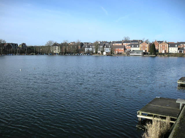
Show on map Photos Daventry-Drayton Reservoir
‹ ›
Weather for this location Next 14 days Nearby places Useful places within 5 km
All Historic
Own or manage this place?
Claim this listing to keep details accurate, add photos, and highlight what makes it special — free.
Claim this page→ Visitor access unverified. We don't yet have confirmed information about walking routes or public access at this reservoir. If you've visited, please help us improve this page.
How useful was the information on this page?
Something wrong on this page?
id: 4b686412-d340-4eb2-a076-9dc109b1bcd7
UK green spaces mapped from open public data — so anyone can find the woodland, trail, or nature reserve closest to them.
© 2026 Glade · Made with care for UK green spaces
Events & activities nearby Switch provider to compare local events, tours and bookable activities.
Bookable tours GetYourGuide Promote here
Wildlife to spot
36,860 records · National Biodiversity Network
▾
Wildlife to spot 36,860 records · National Biodiversity Network 🐦 Birds 54 species
autumn winter
2026 ▾
Moorhen · Magpie · Black-headed Gull · Blackbird · Blue Tit +49
Moorhen Gallinula chloropus2025 Magpie Pica pica Black-headed Gull Chroicocephalus ridibundus Blackbird Turdus merula2025 Blue Tit Cyanistes caeruleus Woodpigeon Columba palumbus2025 Jackdaw Coloeus monedula2025 Gadwall Mareca strepera2025 Wren Troglodytes troglodytes2025 Great Crested Grebe Podiceps cristatus2025 Great Tit Parus major2025 Teal Anas crecca2025 Mallard Anas platyrhynchos2025 Cormorant Phalacrocorax carbo2025 Coot Fulica atra2025 Robin Erithacus rubecula2025 Herring Gull Larus argentatus2025 Mute Swan Cygnus olor2025 Lesser Black-backed Gull Larus fuscus2025 Carrion Crow Corvus corone2025 Tufted Duck Aythya fuligula2025 Dunnock Prunella modularis2025 Canada Goose Branta canadensis2025 Grey Heron Ardea cinerea2025 Treecreeper Certhia familiaris2025 Long-tailed Tit Aegithalos caudatus2025 Water Rail Rallus aquaticus2025 Chiffchaff Phylloscopus collybita2025 Common Gull Larus canus2025 Grey Wagtail Motacilla cinerea2025 Greylag Goose Anser anser2025 Siskin Spinus spinus2025 Great Spotted Woodpecker Dendrocopos major2025 Redwing Turdus iliacus2025 Goldeneye Bucephala clangula2025 Goosander Mergus merganser2025 Goldfinch Carduelis carduelis2025 Goldcrest Regulus regulus2025 Song Thrush Turdus philomelos2025 Chaffinch Fringilla coelebs2025 Kingfisher Alcedo atthis2025 Fieldfare Turdus pilaris2025 Little Grebe Tachybaptus ruficollis2025 Little Egret Egretta garzetta2025 Linnet Linaria cannabina2025 Nuthatch Sitta europaea2025 Lapwing Vanellus vanellus2025 Meadow Pipit Anthus pratensis2025 Lesser Redpoll Acanthis flammea cabaret2025 Common Sandpiper Actitis hypoleucos2025 Blackcap Sylvia atricapilla2025 Green Sandpiper Tringa ochropus2025 Stock Dove Columba oenas2025 Greenshank Tringa nebularia2025 🦌 Mammals 2 species
autumn winter
2025 ▾
Grey Squirrel · Muntjac
Grey Squirrel Sciurus carolinensis Muntjac Muntiacus reevesi 7-spot Ladybird
7-spot Ladybird Coccinella septempunctata 🌿 Plants 7 species
winter autumn
2026 ▾
Snowdrop · Cherry Plum · Ivy-leaved Toadflax · Hawthorn · Chicory +2
Snowdrop Galanthus nivalis Cherry Plum Prunus cerasifera Ivy-leaved Toadflax Cymbalaria muralis Hawthorn Crataegus monogyna2025 Chicory Cichorium intybus2025 Mudwort Limosella aquatica Species observations from the last 10 years via NBN Atlas
2025
2025
Blackthorn Prunus spinosa2025
Blackthorn Prunus spinosa2025